

HURRICANE IRMA (2017)
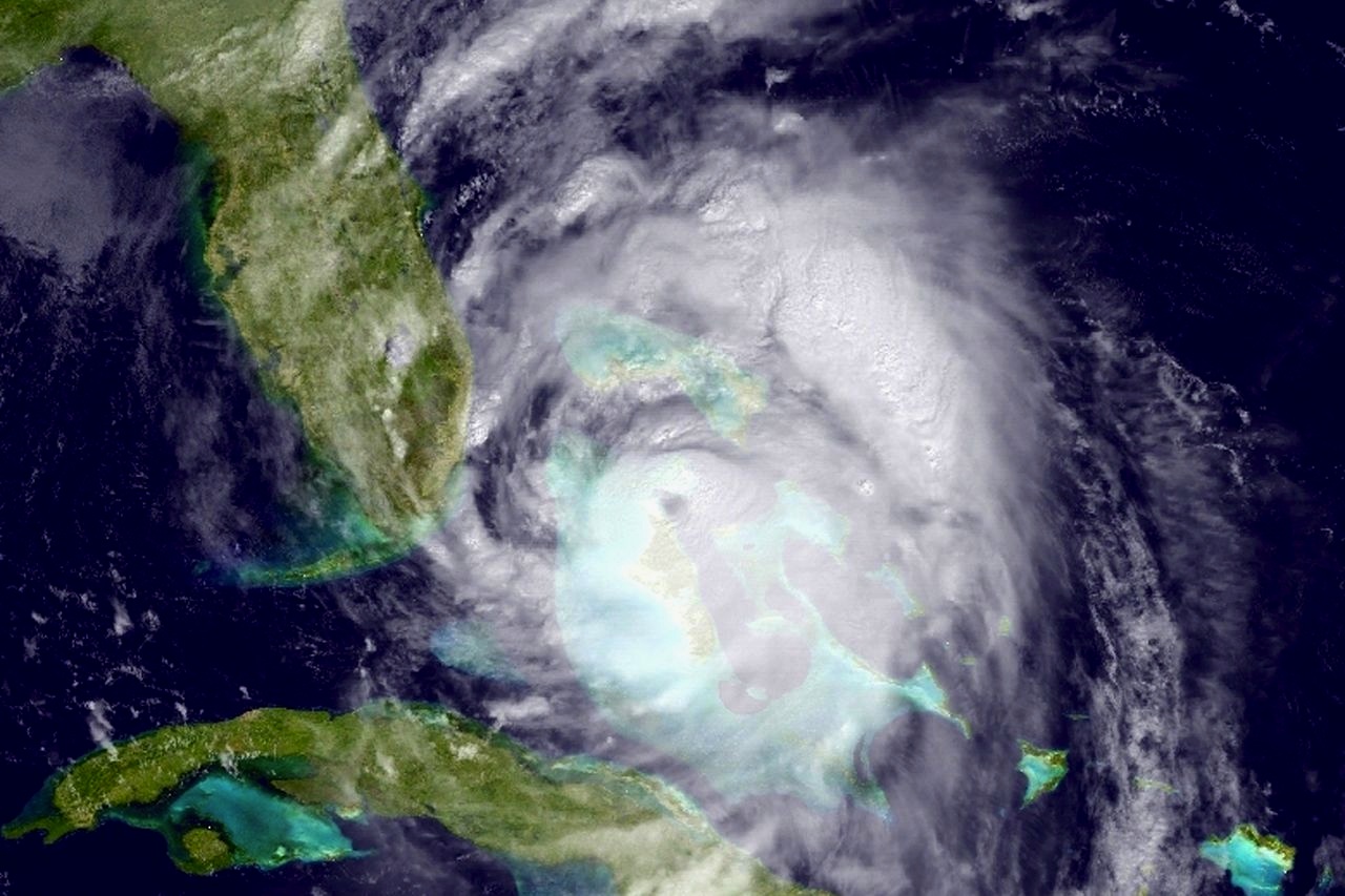
I’m writing this as Hurricane Irma – Cat 5 and the most powerful Atlantic storm yet – is wreaking havoc on its way through the northern Caribbean towards The Bahamas in general and Abaco in particular. The tracking path is changing daily, and it remains unclear whether Abaco may escape with a hefty side-swipe as the storm moves north through Florida. With 2 more storms already forming behind Irma, there’s no better time to post an excellent Live Tracker I have recently come across.
You get a small realtime live image of Irma; large scale modelling of the predicted path that adapts with the ever-changing situation; and frequent updates. Try it and see.
HURRICANE MATTHEW (6 October 2016)
![]()

As Hurricane Matthew swept its way north, leaving a trail of devastation and (in Haiti) deaths in its wake, the storm was inevitably going to hit the Bahamas badly. With 48 hours to go until it reached the northern Bahamas, Abaco was fairly and squarely in the very centre of the predicted path. Then, at the last moment, there was a slight veer to the west and it became clear that the brunt of Matthew’s progress was going to be borne by New Providence, followed by Grand Bahama.

As it turned out, Abaco experienced a very turbulent few hours of punishing wind and massive waves, but early reports suggest environmental damage only; even the usual power and comms outages were sorted out fairly rapidly. Nonetheless, this was the severest weather since Hurricane Sandy in October 2012.
ABACO DAYBREAK AT DELPHI


HURRICANE GONZALO OCT 2014
This one veered away from the Bahamas after an unpromising start! To see tracking and wind speed maps etc, along with other hurricane information CLICK HERE
HOW DOES A HURRICANE GET ITS NAME?
2014: Why Arthur is starting off a season that could end in Wilfred
CBC News Posted: Jul 03, 2014
What’s in a name? Plenty if you’re a hurricane. It defines you, it gives you a personality and if you’re bad enough, your name gets retired.
According to Environment Canada, hurricanes were named by the year in which they occurred followed by a letter (for example 1946a, 1946b) until 1950. After 1950, hurricanes started getting female names. Male names arrived in 1979. Using names proved to be a more efficient way to communicate storms both in writing and in broadcast, as it limited confusion.
An international committee of the World Meteorological Organization chooses the actual names under a strict procedure. Six different lists of names are used in rotation. The names chosen are short and reflect the languages prevalent in the Caribbean, and Central and North America. Namely: English, Spanish and French.
Each list has 21 names — one for each letter of the alphabet except Q, U, X, Y, and Z, since those letters start few names. These lists are recycled every six years and names are replaced when a hurricane name is retired. Retiring a hurricane name is done if the storm does significant damage or causes loss of life. The World Meteorological Organization will look at the request to retire a name and makes the decision.
Names are not really “retired”
“Retire” is not completely accurate since the name can be reused again — but not for at least 10 years to allow for legal actions and insurance claims to run their course. In 2004, Canada got Hurricane Juan retired. It was the first time Canada had asked for a name to be stricken from the list. Juan was a Category 2 hurricane described as the most powerful storm to hit Nova Scotia and Prince Edward Island in over a century. It caused millions of dollars in damage and claimed six lives (two directly) in Nova Scotia.
For 2014 the named storms begin with Arthur, and then come:
- Bertha
- Cristobal
- Dolly
- Edouard
- Fay
- Gustav
- Hanna
- Ike
- Josephine
- Kyle
- Laura
- Marco
- Nana
- Omar
- Paloma
- Rene
- Sally
- Teddy
- Vicky
- Wilfred
If a storm season blows through all 21 names, forecasters switch to the 24-letter Greek alphabet. This happened for the first time in 2005, which saw 28 named storms.
![]()
ALL TROPICAL CYCLONES THAT HAVE AFFECTED THE BAHAMAS THROUGH HISTORY
The link below to the Bahamas Meteorology Department will take you to a list of all tropical cyclones of hurricane and tropical storm force that have affected the Bahamas since 1739. Each weather event can be clicked for brief details of impact and area affected
![]() Click me!
Click me!
![]()
A NEW FOOLPROOF BAHAMIAN BAROMETER: THE ROPE
Pinched off FB from a Friend… whose name I didn’t note. Sorry…
![]()
2014 HURRICANE SEASON STARTS ON CUE WITH
![]()
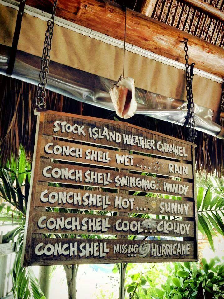
RELIABLE CONCH WEATHER FORECASTS AT FORT MYERS FL.
![]()
LATE SUMMER 2012 STORM & HURRICANE MAP (POST ISAAC)
LESLIE, KIRK, JOYCE, RAFAEL, PATTY

![]()
HURRICANE PATHS ON PLANET EARTH
Hurricanes. Extreme weather events that can strike anywhere in the world’s vulnerable zones. But where are these to be found? And in those zones, is there any historical evidence demonstrating that particular areas of the world are more vulnerable than others? A recent post on the very informative ABACO SCIENTIST website includes a comprehensive map of all hurricanes recorded since 1851. This map gives a clear picture of the hot-spots and danger areas.

- Delphi Club Abaco 25 Aug 2011 / Hurricane Irene: Looking south from the balcony

The source is NASA and the article may be found HERE. I reproduce the map and explanation, with acknowledgement to John Nelson and IDV Solutions. Each blue link in the explanation below will take you to a new source of hurricane information, so the article is a valuable resource as a gateway to further hurricane knowledge.
EXPLANATION AND WORLD MAP
“Should you be worried about hurricanes? To find out, it is useful to know where hurricanes have gone in the past. The Earth map shows the path of every hurricane reported since 1851, Although striking, a growing incompleteness exists in the data the further one looks back in time. The Earth map graphically indicates that hurricanes — sometimes called cyclones or typhoons depending on where they form — usually occur over water, which makes sense since evaporating warm water gives them energy. The map also shows that hurricanes never cross — or even occur very near — the Earth’s equator, since the Coriolis effect goes to zero there, and hurricanes need the Coriolis force to circulate. The Coriolis force also causes hurricane paths to arc away from the equator. Although incompleteness fogs long term trends and the prevalence of hurricanes remains a topic of research, evidence is accumulating that hurricanes are, on the average, more common and more powerful in the North Atlantic Ocean over the past 20 years.”
 Image Credit & Copyright: John Nelson, IDV Solutions
The image below (posted previously) was shared on Facebook, but I don’t have the originator’s name. I’m sorry not to be able to identify the inventor of this ingenious hurricane warning. Every home should have one… 
![]()
TROPICAL STORM ISAAC UPDATES AUGUST 2012
For updates, tracking maps & live online clips CLICK===>>> HERE
![]()
UNIVERSAL WEATHER FORECASTING IMPLEMENT
")
This useful and inexpensive universal weather forecasting implement flashed through on my Facebook page, unattributed. Since this gadget will hold true for any place for all time, it deserves a wider audience. Kudos to the originator, and I hope (s)he has patented the idea and will become wealthy and huge in meteorology (if not already).
![]()
SEA SURFACE TEMPERATURES ON NOVEMBER 14 2011
This map comes from The Weather Channel App on my phone. The App has been upgraded. I’ve only just discovered the map possibilities. It’s an interesting overview of the differences from the tropics through the temperate zones to the frankly chilly. In September I swam in a pool in Italy that was 15C / 59F (fed from mountain springs). I decided that’s my personal lower limit these days…
![]()
THE SAFFIR-SIMPSON HURRICANE SCALE

![]()
HURRICANE IRENE – AUGUST 2011
Daily Posts on HOME PAGE between 23 Aug and 31 Aug 2011, during which I stopped adding to this page. In due course all that material will be moved to its own sub-page here as an archive.

Updated 25 Aug 09.30 GMT Hurricane Irene at Abaco Click me!
25 AUGUST 2011: PLEASE CLICK===>>> MAIN UPDATED POST I shall no longer be separately updating this individual page report
======================
HURRICANE IRENE ABACO UPDATE 25 AUG 03.00 GMT
Check out the progress of Irene using STORMPULSE
STOP PRESS – CURRENT WEATHER AT ROLLING HARBOUR, ABACO, AUG 24 p.m. AS HURRICANE IRENE APPROACHES
This photograph was taken this afternoon, 24 August, at Rolling Harbour on the east coast of Abaco about 25 miles south of Marsh Harbour, down towards Crossing Rocks. Irene is about 300 miles away. Caroline Stahala, who took the photo, reports “serious wind and sea surges”. Thanks ,Caroline, for giving us an idea of what is on its way…

- HURRICANE IRENE APPROACHES ABACO 24 AUG P.M.

WEATHER NEWS FLASH
HURRICANE IRENE is en route to Abaco, expected there on Thursday 25 August (based on Marsh Harbour Hurricane Irene tracking predictions) To check out a wide variety of trackers, forecasts, radar maps and so forth, all on one convenient page (thanks, Wunderground) CLICK===>>> IRENE To view the dedicated tracking map CLICK===>>> Hurricane Irene : Tracking Map : Weather Underground and scroll down to the large map To view the storm-centered satellite image CLICK===>>> Hurricane Irene : Storm-Centered Satellite Image : Weather Underground Finally, for more technical stuff and other tracking maps, check out the ever-reliable and all-knowing Abaco weather information phenomenon that is BAROMETER BOB

Hurricane Irene at Abaco – projected path Aug 25 a.m. (Google Info) – Click Me!
WE ARE THINKING OF YOU…
![]() TROPICAL STORM TRACKER – CLICK LINK for current details
TROPICAL STORM TRACKER – CLICK LINK for current details
Tropical Storm Don : Tracking Map : Weather Underground
(thanks to Weather Underground for this and Marsh Harbour temperature / time widget in Sidebar)
![]()
HURRICANES AFFECTING ABACO – TIMELINES 1920-2009 & detail 2000-09
Click timeline to enlarge ![]() Abaco Hurricane History 1871 – 2010
Abaco Hurricane History 1871 – 2010 Years of hurricanes within 60 miles 77 times in 139 years to end of 2010 Names of some hurricanes Able, Judith, Betsy, Daisy, Janice, Betsy, Floyd, Andrew, Fran, Bertha, Dennis, Michelle, Frances, Jeanne, Franklin, Noel, Hanna, Bonnie How often the area gets affected? Brushed or hit every 1.81 years Average years between direct hurricane hits Once every 3.76 years Average MPH of hurricane hits. (based on sustained winds not gusts) 110mph Last affected 2010 July 23rd Tropical Storm Bonnie hit while moving WNW with 40mph winds. (Thanks to HurricaneCity.com for the stats)
![]()
ABACO AVERAGE TEMPERATURES & RAINFALL
| Month | Average High Temp | Average Low Temp | Water Temp | Rainfall |
|---|---|---|---|---|
| January | 77°F | 66°F | 70°F | 2″ |
| February | 77°F | 65°F | 71°F | 1.6″ |
| March | 78°F | 67°F | 74°F | 1.4″ |
| April | 81°F | 69°F | 76°F | 1.6″ |
| May | 82°F | 70°F | 79°F | 4.3″ |
| June | 82°F | 70°F | 80°F | 4.3″ |
| July | 87°F | 75°F | 85°F | 3.8″ |
| August | 88°F | 76°F | 86°F | 4.4″ |
| September | 88°F | 75°F | 85°F | 6.2″ |
| October | 84°F | 74°F | 82°F | 7.4″ |
| November | 81°F | 71°F | 79°F | 2.6″ |
| December | 79°F | 67°F | 74°F | 2.2″ |
(Acknowledegement to http://www.abacos.net/weather.html)
