")
TROPICAL STORM CHANTAL HEADS FOR BAHAMAS & ABACO…
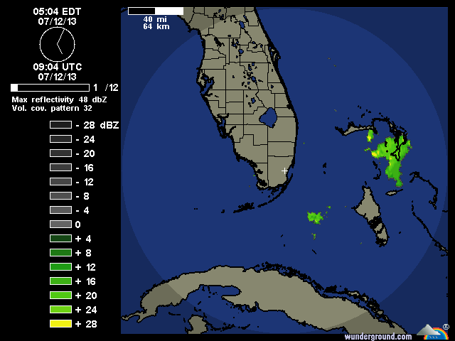
EX-CHANTAL ACTIVE AFTER-EFFECTS FOR BAHAMAS JULY 12
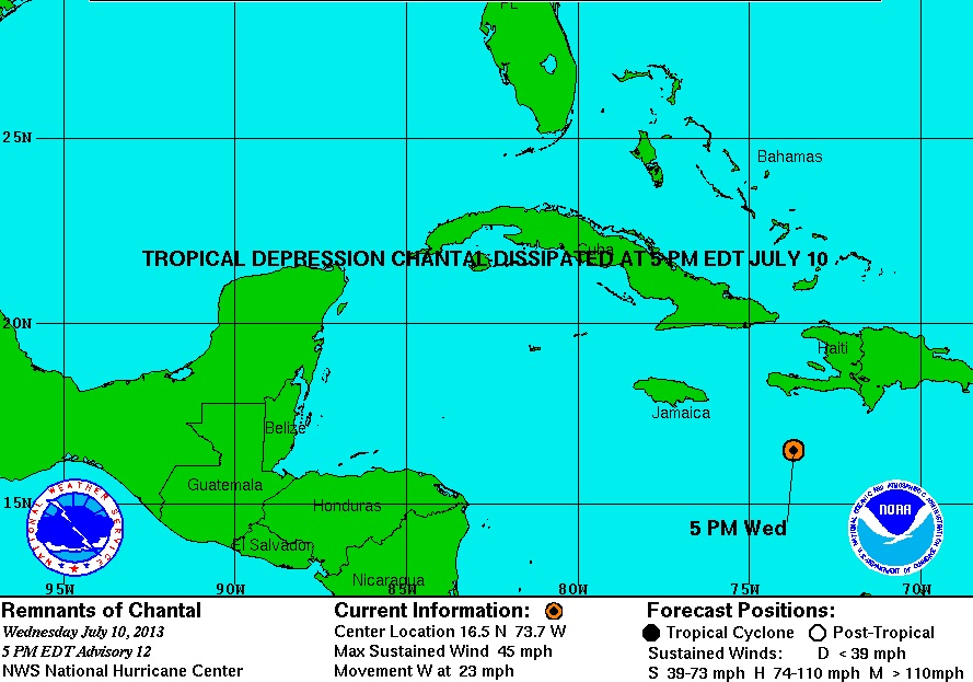
… AND DISSIPATES AS AT 17.00 EDT July 10
UPDATE NOAA 11.00 EDT July 10
The storm path seems to be drifting gradually westwards. Abaco is now clear of the currently predicted path, rather than slap bang in the middle…

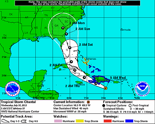
UPDATE NOAA 6.00 EDT July 10

UPDATE INTELLICAST 17.00 July 9 
ORIGINAL POST
The 9th July, the season of storms starts to loom, and Chantal is first off the meteorological starting blocks. The reason I am posting this now is because the present 5-day predictions (see NOAA charts below) has Chantal heading directly for the Bahamas in general, and Abaco in particular. So this may be one to keep a weather eye on over the next few days…
")
")
")

You must be logged in to post a comment.