‘BURNS NIGHT’ – CONTAINING FOREST FIRES ON ABACO


Abaco Forest Fire 4

‘BURNS NIGHT’ – CONTAINING FOREST FIRES ON ABACO

Every year Abaco has a number of forest fires, especially in the south of the island. The timing is variable –  sometimes it’s March, right now it’s… right now. The fires are good in some respects for the forest, and regeneration is remarkably rapid. Links to previous posts on the topic are shown below. Many, or most, are (allegedly) started by hunters clearing scrub and undergrowth so that the dogs can chase the hogs. The rights and the wrongs are debatable, but what is beyond doubt is that a change of wind can cause fires set in forest on the unpopulated west side to jump the Highway across to the east side. There are farms and settlements there, and these are regularly put in peril. The Delphi Club has had a couple of close calls when the thick coppice between the house and the pinewoods failed adequately to deter the flames (in theory, it should!); Crossing Rocks had some nights last year when the whole community united to protect the settlement. Now it’s the turn of Bahama Palm Shores, where the fire service and volunteers have spent the last few days – and nights – trying to prevent fire reaching the houses. So far, so good. Abaco is a wonderful place, but the fires can be powerful and scary, spreading rapidly in the wind.

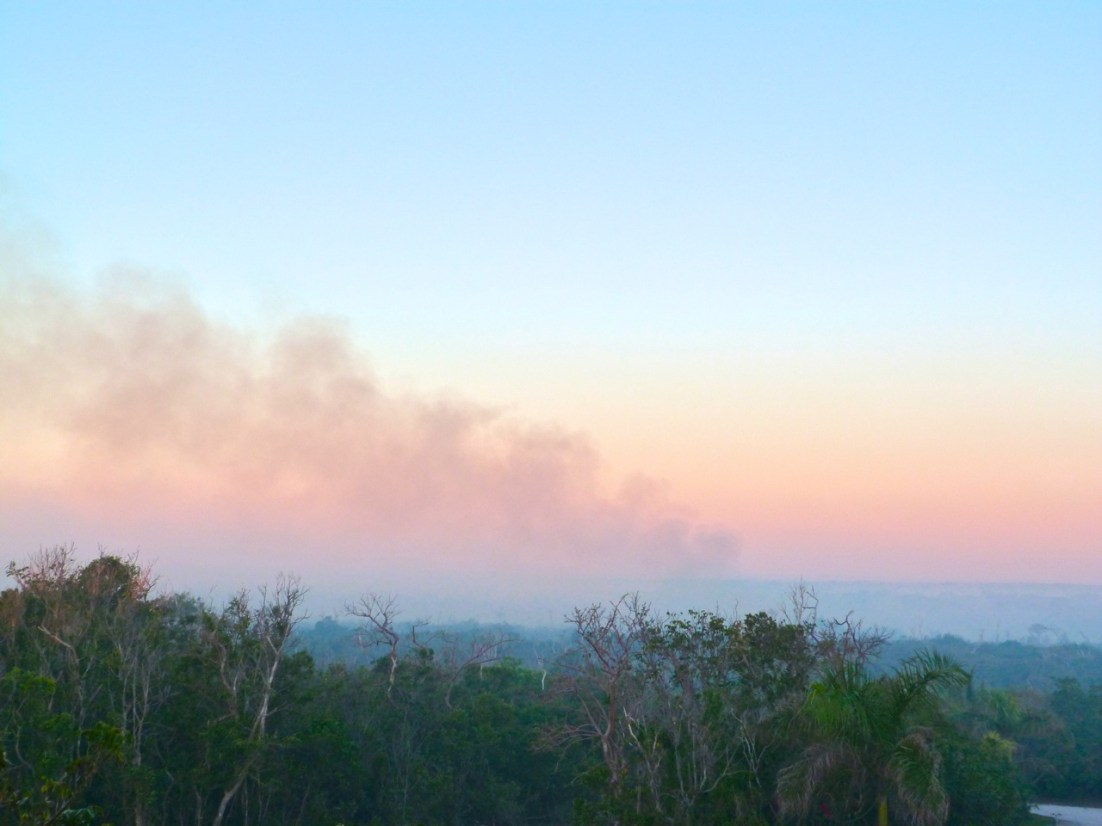
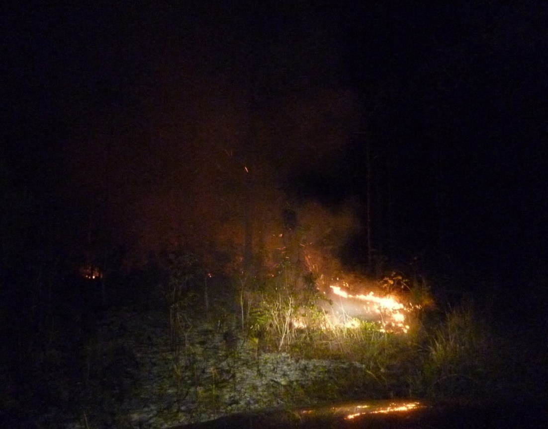
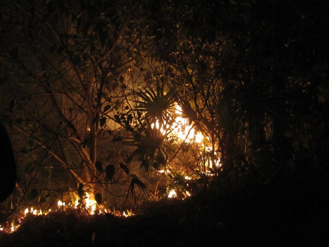
Luc Lavallee is one of the volunteers, and hasn’t had a lot of sleep recently. He has posted regular bulletins during the night on the BPS Facebook Page to keep everyone informed of the situation and the work in progress – for example creating firebreaks. Here are some of his photos over the last few days; the aerial shot is by photographer David Rees, who takes wonderful ‘drone’ photos.

Forest fire, BPS, Abaco (David Rees) Forest Fire, BPS, Abaco (Luc Lavallee) Forest Fire, BPS, Abaco (Luc Lavallee) Forest Fire, BPS, Abaco (Luc Lavallee)

This photo captures the fire raging in the middle of the night, making an almost abstract imageForest Fire, BPS, Abaco (Luc Lavallee)

FOREST FIRES –  BURNING SENSATIONS

FOREST FIRES – TOO CLOSE TO DELPHI

FOREST FIRES – REGENERATION

INDUSTRIAL ARCHAEOLOGY AT SAWMILL SINK REVEALED BY FIRE

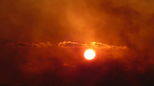
Finally, here is a shot I took last year from the Delphi balcony looking west to the sunset. The fires had burned for several days, and the suns rays in daytime had to penetrate clouds of smoke and ash. The effect was striking.

Forest Fires, Delphi Abaco 2013


 Credits: Header & last pic- RH at Delphi 2013; aerial shot – David Rees; other images – Luc Lavallee


BURNING SENSATIONS: FOREST FIRES ON ABACO


Forest Fires, Abaco 11

BURNING SENSATIONS: FOREST FIRES ON ABACO 

My last post was about SAWMILL SINK – not the famous Blue Hole itself, but the detritus of past logging activity in that part of the Abaco pine forests revealed by last month’s forest fires. I mentioned that this destructive burning of the shrubby understorey is (allegedly) the work of  hunters making it easier for their dogs to pursue the hog denizens of the forest. The evidence suggests that nature alone could not cause so many separate seats of fire to appear in a matter of days over such a wide area – and in springtime at that.

This year, the fires came uncomfortably close to several small communities and outlying residences – and to the Delphi Club itself. Many people spent nights hosing down undergrowth and building on the edge of settlements, with neighbours all joining in. Electricity poles are vulnerable, with obvious consequences for the supply should they burn through at the bottom, as often happens. One pole a short way south of Delphi on the highway has the burnt remains of 3 utility posts beside the current (ha!) one. At Delphi itself, the vegetation from around all the poles along the mile of drive had to be cleared.

This iPhone photo was taken from the Delphi balcony. The fire is in fact on the far side of the highway, with the pall of smoke – and therefore the fire’s direction – heading south. The question is, when and where will it jump the highway, and what will be the wind direction then…Forest Fires, Abaco 12

This picture shows the extraordinary effect of the smoke-laden atmosphere on the sunset. The header picture is another example. The fire is now into the pine woods between the Club and the highway, and the theory that the damp coppice nearer the Club will act as a barrier to prevent its spread is about to be put to the test overnight…Forest Fires, Abaco 9

It soon became clear that the fires were not going to be discouraged by the coppice.  Sandy is always eager to find volunteers to go out in a truck to feel the heat, so to speak. He is apt to dismiss concerns that one is sitting on top of a large tank of inflammable liquid by pointing out that diesel is less combustible than petrol. This is invariably comforting to all occupants of the vehicle. So with the fire burning bright, and with tree-tops suddenly bursting into flame like torches, off we go…Forest Fires, Abaco 3Forest Fires, Abaco 5Forest Fires, Abaco 7Forest Fires, Abaco 1Forest Fires, Abaco 2

In the morning, a smokey mist lies over the trees and the bay to the northForest Fires, Abaco 14

An uncomfortably short distance along the guest drive, it is clear that the coppice has burnt quite easily, though not devastatingly. In fact there are still flames to be seen…Forest Fires Abaco 19Forest Fires Abaco 18

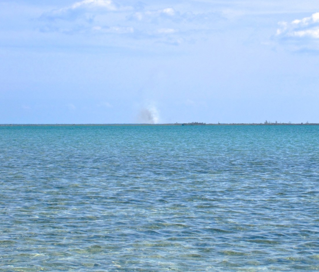
Later, out on the Marls, a plume of smoke is visible, with several more in either directionForest Fires, Abaco 4

Despite the widespread damage caused by the fires, the capacity for regeneration is amazing. New growth is visible very quickly, and within the year the burnt-out areas are mostly back to normal. I’ll end on that optimistic note, and with another dramatic sunset above the haze of smoke over the tree canopy.Forest Fires, Abaco 8

SAWMILL SINK, ABACO: INDUSTRIAL ARCHAEOLOGY IN A POST-APOCALYPTIC LANDSCAPE


Sawmill Sink (adventureactivist youtube)

SAWMILL SINK, ABACO: INDUSTRIAL ARCHAEOLOGY IN A POST-APOCALYPTIC LANDSCAPE

1. BLUE HOLES

The Blue Holes of Abaco are geological wonders about which much has been written – much of it in the NATIONAL GEOGRAPHIC MAGAZINE. Sawmill Sink is one of the best-known inland ones; and there are other holes in the shallow seas on both sides of the island. They are deep chasms in the limestone rock, many leading to extensive and complex cave systems under the island. Divers exploring Sawmill Sink have found many prehistoric fossils, including those of an extinct giant tortoise, and land crocodiles. Most conveniently, this fascinating blue hole is close to Delphi, hidden deep in the pine forest and accessible only by historic logging tracks.

LOGGING TRACK TO SAWMILL SINKSawmill Sink Abaco 19

AERIAL VIEW OF SAWMILL SINK DEEP IN THE PINE FORESTSawmill Sink Map copy

This article is not about Blues Holes in general, nor Sawmill Sink  specifically. I have such a post planned, but for the moment I’ll put some relevant links at the end of this one. Feel free to scroll straight there if the cumbersome heading has already put you off… but in an effort to hold your interest, here’s an image of the Sink to give you an idea of what it looks like. There are wooden steps down and a platform to enable you to swim in it (there are no crocodiles these days. So they say…).

SAWMILL SINK, ABACOSawmill Sink Abaco 8

2. A LOGGING HISTORY

South Abaco – defined loosely as the area south of Marsh Harbour – is dominated by pine forest. There are a few settlements and individual residences, all by the coast. The forested swathes are criss-crossed by an extensive system of logging tracks, many now all but impassable. They are reminders of Abaco’s historic importance as a source of wood deriving from the ubiquitous tall, slim pines. One use to which they were put was as mine pit props in the collieries of Wales.
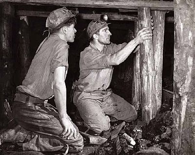
 1996.2039.db

Last June when we went to Sawmill Sink, we saw a rusty rail sticking up from the undergrowth. We were with Ricky Johnson, the man who could invariably answer any question about Abaco; he explained that there had at one time been a light railway through the forest to carry the felled timber to the highway, where it was transported to the coast for loading onto ships.Sawmill Sink Abaco 17

Last month we returned to Sawmill Sink. The south part of the island was enduring the annual outbreak of forest fires, most (if not all) believed to be set by hunters wanting to clear to undergrowth to make hog-hunting easier. While the occasional natural fire is actually good for the forest (cf burning moorland), the set fires do great damage over a vast area. On some days there were 6 or more separate seats of fire appearing in one day – highly unlikely to be the work of nature. Thick palls of smoke drifted across the island, and out to sea. Even far out on the Marls, the fires were visible, with the smell of burning carried on the wind. This year, the fires came uncomfortably close to some of the settlements. Night-long community action was needed in some places to protect property. At Delphi, the fires came within 300 feet or so before finally fizzling out in the coppice… Two years ago, they  came nearly as close. For a post-fire wander round the Delphi drive circuit click FOREST FIRES (it was one of the first, tentative posts on this blog – and boy, does it show… it needs a rethink)

DELPHI GUEST DRIVE: A WARM WELCOMEForest Fire, Delphi, Abaco

The photos that follow show the track to Sawmill Sink immediately after a fire had swept through the area. Trees were still smouldering and in places the ground was still hot to the touch. Along the way the evidence of the former usage had been laid bare. Some images show the paved path that leads from the logging track to the Sink. I have no idea if these are the first images of so many visible remains of the logging trade, revealed by the burnt-off undergrowth. I haven’t tracked down any others at all so far. I write as a non-resident of the island, so if anyone can add any information, please do so via the COMMENT box. Sawmill Sink Abaco 1 Sawmill Sink Abaco 2 Sawmill Sink Abaco 3 Sawmill Sink Abaco 5 Sawmill Sink Abaco 6 Sawmill Sink Abaco 7 Sawmill Sink Abaco 9 Sawmill Sink Abaco 10 Sawmill Sink Abaco 11 Sawmill Sink Abaco 12 Sawmill Sink Abaco 13 Sawmill Sink Abaco 14

Finally, we found this rock close to the Sink. Are those plant fossils? Bearing in mind that sea probably covered this area entirely (the highest point on Abaco is a mere 134 feet ASL), might these be anemones or sponge fossils of some sort? Comments from fossilologists welcome.

STOP PRESS thanks to FOSSIL LADY (aka Kathi) for the following: “Those don’t look like plant fossils to me, they remind me of stromatolites, a sponge like creature that first dominated the earth billions of years ago. Some varieties still survive today. It would be worth it to have a geologist have a look see. ps the sinkhole is awesome!”Sawmill Sink Abaco 15

SOME BLUE HOLE LINKS TO EXPLORE 

BAHAMAS CAVES RESEARCH FOUNDATION

FRIENDS OF THE ENVIRONMENT, ABACO

NATIONAL GEOGRAPHIC

ADVANCED DIVER MAGAZINE ARTICLE

As a reward for having waded through the smoke and ash above, here’s a short video of what you can see if you dive in a blue hole. It’s worth saying (1) that you need to check you are allowed dive – some holes are subject to ongoing research and (2) blue hole diving and caving is an inherently unsafe activity unless you have the right equipment and know exactly (by which I don’t mean “hey, I can wing it”) what you are doing… 

[vimeo http://vimeo.com/37838009]

Photo credits: all RH except header (adventureactivist, youTube); pit props (Scottish Mining Museum); aerial view (Gmaps)

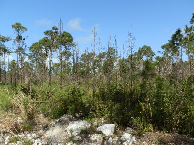
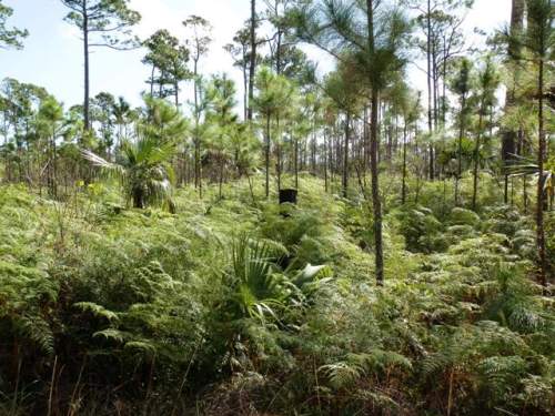
PINE FOREST REGENERATION AFTER FIRES ON ABACO IN 2011


Abaco Forest Fire 13

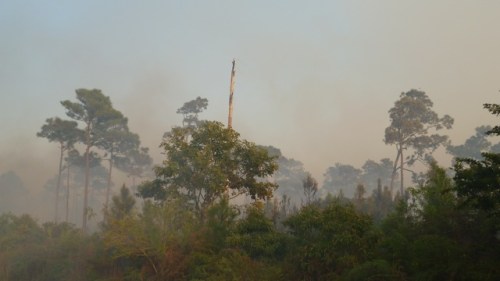
MARCH 2011 Fires swept through large areas of South Abaco, spreading rapidly and jumping the firebreak of the Highway in several places. At any one time, there were several ‘non-natural’ seats of fire. For 3 days the flames were uncomfortably close to the Delphi Club, halted only by the natural boundary between the flammable pine forest and the damper less combustible coppice. The smoke caused some amazing visual effects, especially at sunset. The first image was taken looking east from the Club verandah one evening as the fire got nearer

The vegetation alongside and between the drives was dense and lushly green before the fires. Here is a photo as fire began to take hold near the top of the drives towards the road, having jumped the Highway in the night…

As the fire rapidly spreads, this tall dead tree is actually flaming from the top

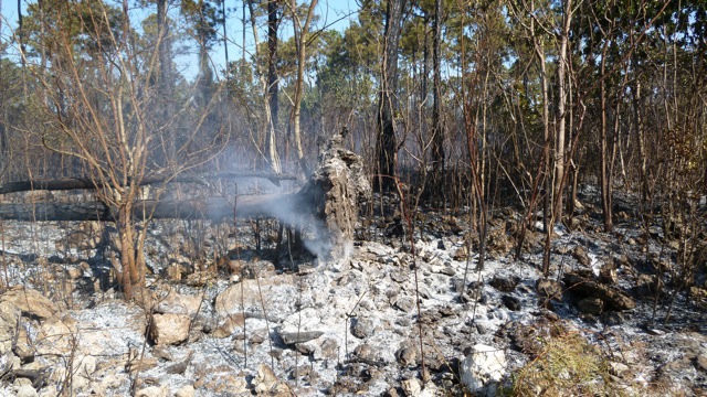
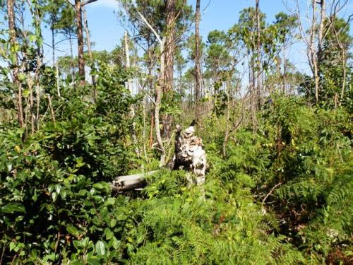
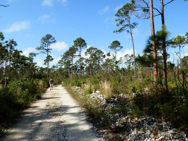
During the next couple of days, we took photographs along the drives of the apocalyptic scenes where there had so recently been impenetrable vegetation. Nearly a year later, indispensable beachcomber and photographer Kasia has taken some pictures of the drives as they are now. First, two ‘then and now’ views of the same scenes to illustrate the extent of forest regeneration

2011

2012

2011

2012

2011 The burnt-out forest between the drives

2012 A wander round the drive circuit

In some places the undergrowth has returned but trees have not recovered

Elsewhere, blackened stumps are visible in amongst the vigorous regrowth