
HURRICANE JOAQUIN: LATEST TRACKING UPDATE OCTOBER 2
There’s a great deal of information about Hurricane Joaquin flying around the internet right now, which is completely understandable. How quickly things have progressed since Irene in 2011 in the very early days of this blog, when there was little public information and an almost complete absence of information on social media. I posted daily (or more) updates as the hurricane swept up over the Bahamas. In 4 days, and despite communications being largely blanked, I had over 15,000 hits and a mass of questions along the lines ‘Any news of Treasure Cay’; ‘Can you find out how my boat is – Saucy Sue in Little Harbour’; and ‘Hi I’m on Elbow Cay, can you tell my mom in Maine that I’m ok’ [+ email]…
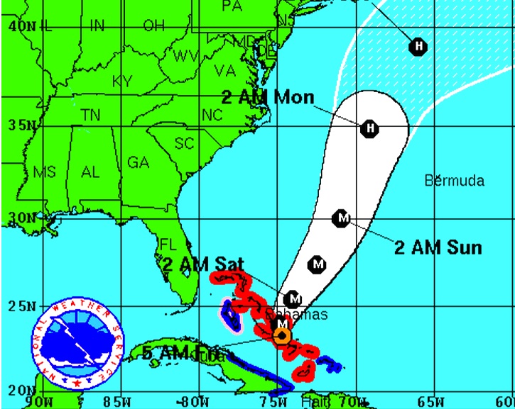
Here is the position today, at 05.00 EDT, according to the various resources that people turn to. Central Bahamas has taken – is taking – a battering and we have the people there very much in mind. But for the northern Bahamas the picture has improved, with the veer of Joaquin’s predicted path to the northeast increasing overnight. This does not mean an absence of strong winds and big waves – these are already being felt. But the most serious area of this Cat 4 hurricane is not expected to pass over Abaco – the direct concern of most readers of this blog. How different from Irene which wrought its havoc right over the island; and Sandy, which took much the same route.
USEFUL DIRECT LINKS FOR HURRICANE JOAQUIN INFORMATION
and for local Bahamas news
Anyway, all the best to everyone affected by this fierce storm directly or indirectly, and good luck.


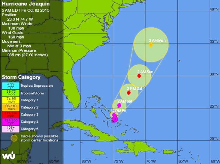


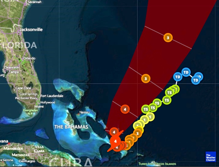
 Sources: NASA, NOAA, Wunderground, Weather Channel, NYT, Accuweather

Thanks for the update! We were wondering about Delphi.
LikeLike
Hi Lynn, all ok at HQ. The waves aren’t a problem with that 50′ cliff; and the winds have not been excessive. The storm has now turned 90º to the northeast so all should be well… RH
LikeLike