

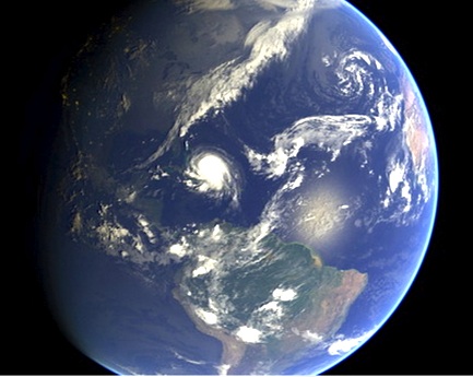
Hurricane Joaquin at dawn from International Space Station, Oct 2 (Scott Kelly / ISS / NASA)
SEEING THE BACK OF HURRICANE JOAQUIN: LATEST UPDATE OCT 3
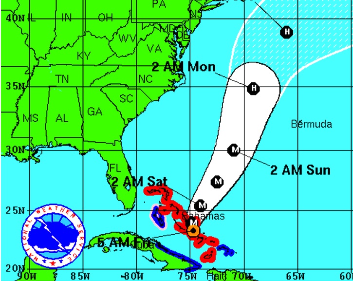
Since my post yesterday HERE confirming evidence that Joaquin was hooking out into the Atlantic and away from northern Bahamas, the storm has picked up speed as it now heads for Bermuda. It is also on a direct route to Ireland and the UK, but is already weakening. With the storm now reduced to a Cat. 3, a continuing lessening of intensity is predicted.
In this second – and, I hope, final – post of the hurricane season, the images below show the current state of play early today. I’ll repeat the weather watch links at the end.
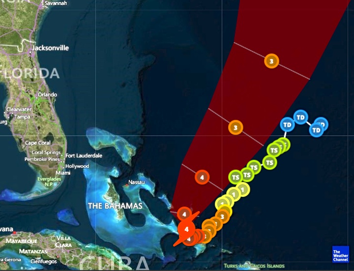
Joaquin clears the Bahamas & heads out into the Atlantic towards Bermuda as a Cat. 3 storm
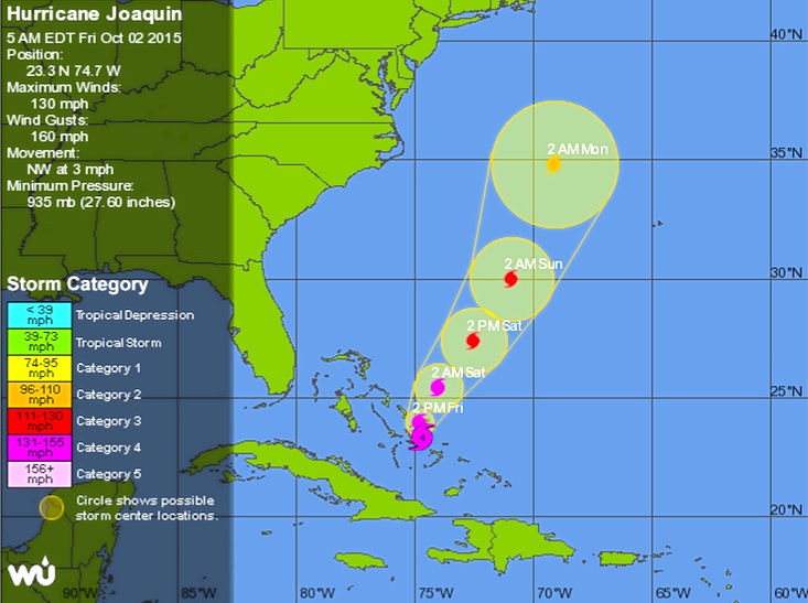
Forecast eye-path early on Oct 3
The remarkable storm path, hooking round over Central Bahamas & going back on itseslf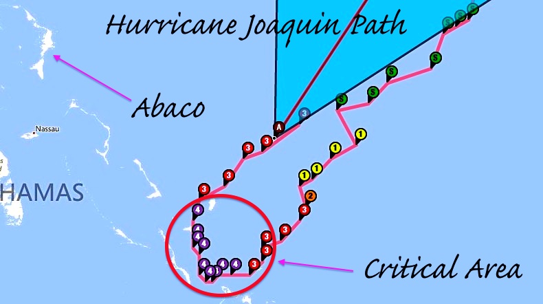
The strange beauty of a hurricane captured from space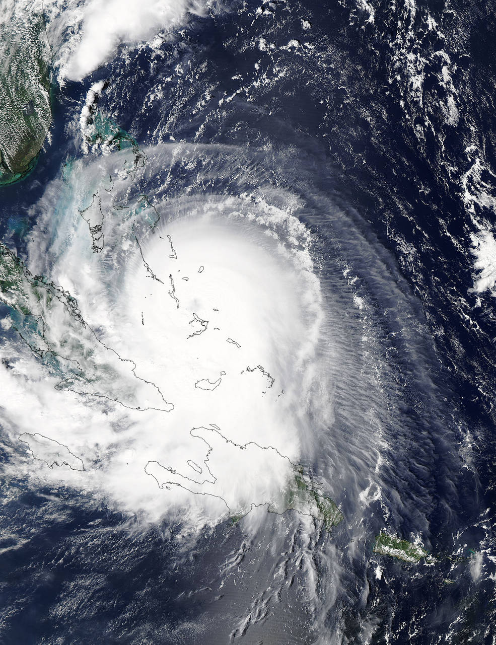
USEFUL DIRECT LINKS FOR HURRICANE INFORMATION
and for local Bahamas news

Sources: NASA, NOAA, ISS / Scott Kelly, Wunderground, Accuweather


You must be logged in to post a comment.