

АБАKО: SOVIET RUSSIAN MILITARY MAP OF ABACO
I had been toying with a plan to write something fishy today. Lifting the lid on the secrets of the creole wrasse, maybe. Then something arrived in my inbox overnight that changed my course entirely. I was struck by an idea harder than a torrent of mixed metaphors speeding towards a bullseye in the motherlode. A map! A map of Abaco!! All in Russian!!! From the Soviet Russian Military Survey!!!! Irresistible. An occasion for multiple exclamation marks.![]()
‘Russian Soviet Military Topographic Maps’
Map sheet G-18-1 GREAT ABACO ISLAND ed. 1979 – scale 1:500 000, map size 66 cm x 55 cm

![]()
My blog is stuffed full of maps. They are scattered everywhere, like cartographical confetti. There’s even a page for some of them HERE. Want a map of Abaco’s HIGHEST POINT (134m, if you have the energy). Need to see what Abaco looked like 300 years ago? Try HERE. Need a history of Hole-in-the-Wall in maps? Try THIS. And so on.
![]()
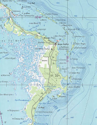
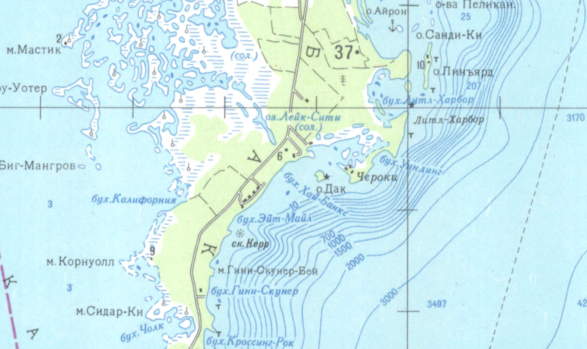
The header map is a merely the bottom-left corner of the much larger map immediately above. As a crop of the much larger area, it’s illegible. Which is next to useless, because the best thing about this map is that it is all in Russian. And I really wanted to see how they had mapped Marsh Harbour. Treasure Cay. Man-o-War. And the rest. I looked around online and reached this one. Even with some work on the image, you can only get a blurry glimpse – just a few tempting hints of Cyrillic. But it’s impossible to locate Марш Харьор, Трежер Ки, or Ман-оф-Уор Ки…
![]()
So, back to the interweb thing. And eventually, something usable turned up. Here, with props to Clicpic, is Abaco in the late Soviet era. Check out where you live – in Russian. Got friends on Грейт Гуапна Кй? Sadly, the northern end of Abaco and the whole southern end from Crossing Rocks down to Hole-in-the-Wall and right round to Sandy Point is absent. That area is of course the perfect place for missile silos**. Except now it’s a National Park, so that wouldn’t be possible… would it?
![]()
I’ve split the map into 3 sections to make it as big as possible. The maps overlap to keep the proportions equal on-screen. Double click to zoom in. Hope you enjoy travelling around it…


** Vladdy, mate, if you or your agents have picked up on this, (1) only joking, right? and (2) you’ve anyway got better things to worry about these days…
