

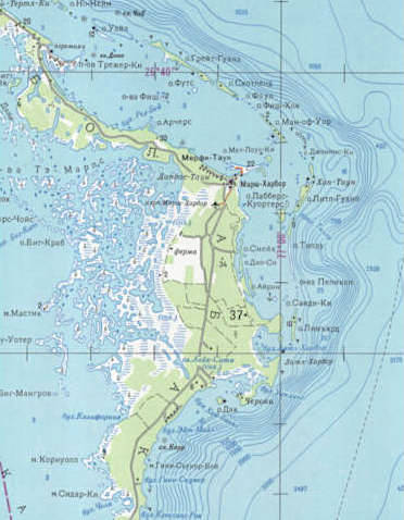
АБАKО: SOVIET RUSSIAN MILITARY MAP OF ABACO
I had been toying with a plan to write something fishy today. Lifting the lid on the secrets of the creole wrasse, maybe. Then something arrived in my inbox overnight that changed my course entirely. I was struck by an idea harder than a torrent of mixed metaphors speeding towards a bullseye in the motherlode. A map! A map of Abaco!! All in Russian!!! From the Soviet Russian Military Survey!!!! Irresistible. An occasion for multiple exclamation marks.![]()
‘Russian Soviet Military Topographic Maps’
Map sheet G-18-1 GREAT ABACO ISLAND ed. 1979 – scale 1:500 000, map size 66 cm x 55 cm

![]()
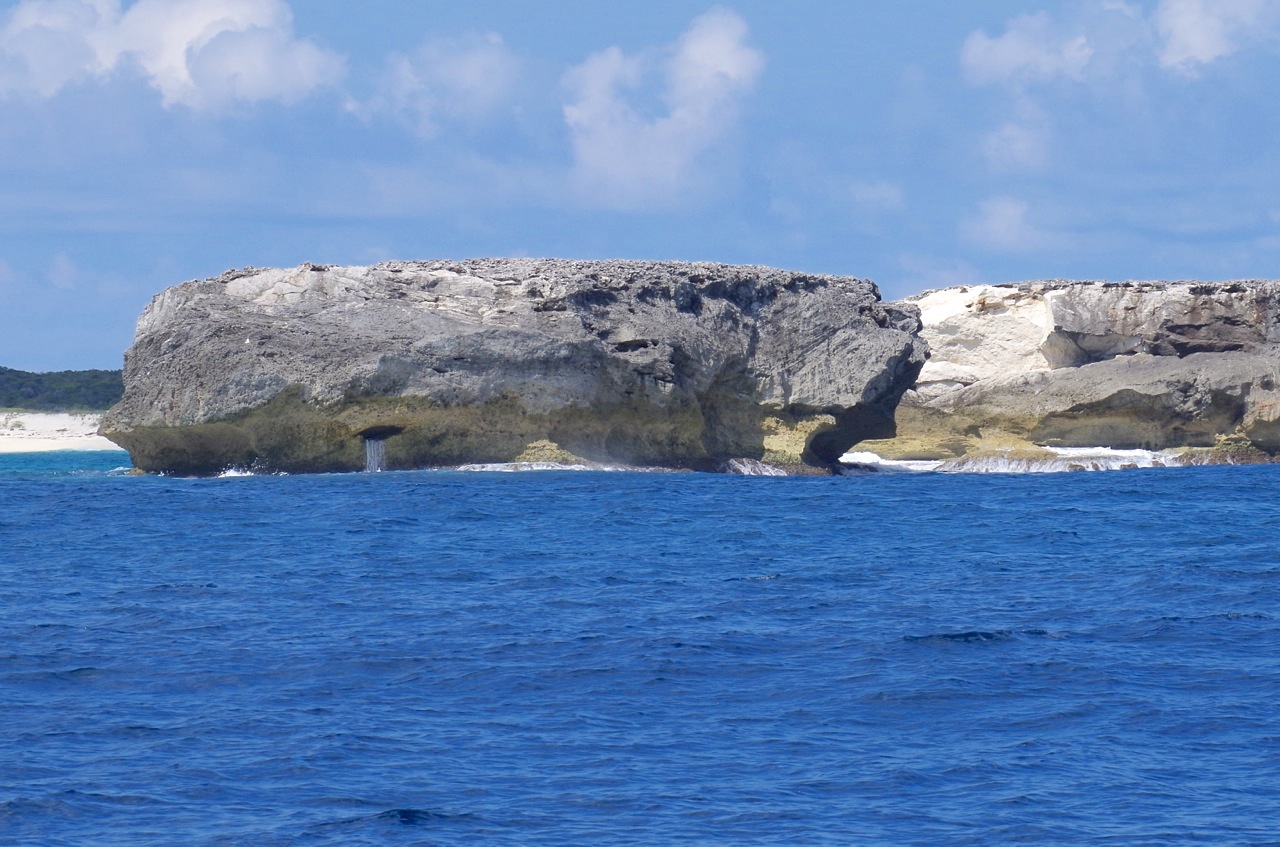
My blog is stuffed full of maps. They are scattered everywhere, like cartographical confetti. There’s even a page for some of them HERE. Want a map of Abaco’s HIGHEST POINT (134m, if you have the energy). Need to see what Abaco looked like 300 years ago? Try HERE. Need a history of Hole-in-the-Wall in maps? Try THIS. And so on.
![]()
The header map is a merely the bottom-left corner of the much larger map immediately above. As a crop of the much larger area, it’s illegible. Which is next to useless, because the best thing about this map is that it is all in Russian. And I really wanted to see how they had mapped Marsh Harbour. Treasure Cay. Man-o-War. And the rest. I looked around online and reached this one. Even with some work on the image, you can only get a blurry glimpse – just a few tempting hints of Cyrillic. But it’s impossible to locate Марш Харьор, Трежер Ки, or Ман-оф-Уор Ки…
![]()
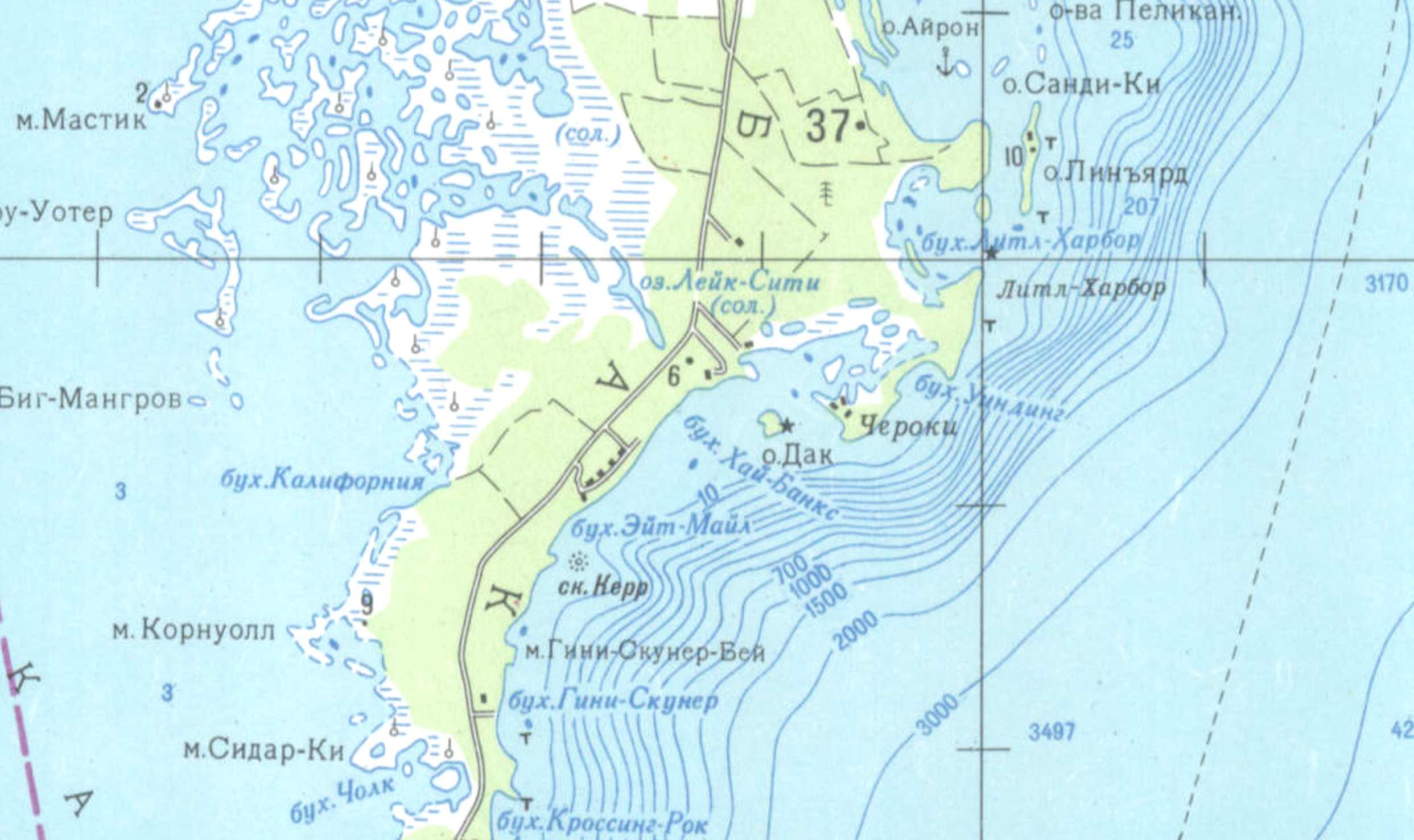
So, back to the interweb thing. And eventually, something usable turned up. Here, with props to Clicpic, is Abaco in the late Soviet era. Check out where you live – in Russian. Got friends on Грейт Гуапна Кй? Sadly, the northern end of Abaco and the whole southern end from Crossing Rocks down to Hole-in-the-Wall and right round to Sandy Point is absent. That area is of course the perfect place for missile silos**. Except now it’s a National Park, so that wouldn’t be possible… would it?
![]()
I’ve split the map into 3 sections to make it as big as possible. The maps overlap to keep the proportions equal on-screen. Double click to zoom in. Hope you enjoy travelling around it…


** Vladdy, mate, if you or your agents have picked up on this, (1) only joking, right? and (2) you’ve anyway got better things to worry about these days…


")


You must be logged in to post a comment.