BREADFRUIT: NATURE’S BOUNTY (WITH ADDED MUTINY)


Artocarpus altilis - breadfruit (Hans Hillewaert)

BREADFRUIT: NATURE’S BOUNTY (WITH ADDED MUTINY)

Capt. William Bligh achieved fame for all the wrong reasons. Despite a distinguished and wide-ranging seafaring career he is widely remembered for just two things: (1) The Bounty and (2) Mutiny On. In 1787, he was dispatched to Tahiti to collect specimens of BREADFRUIT (a fruit of the Pacific islands, in particular Polynesia) to help provide food for the British colonies in the West Indies. To be clear, the breadfruit was intended to be a basic and cheap staple food not just for settlers but also for the indigenous population. I think we can all guess the status of the latter at that time.

Breadfruit 2

‘BLIGH’S BLIGHT’ – MUTINY!

Capt. Bligh’s Bounty crew unfortunately mutinied – possibly to do with the amount of water the breadfruit required in transit, compared to their own meagre rations. So they threw overboard the hundreds of breadfruit plants that were in transit. Then they set Bligh with his loyal officers and crew adrift… He was later court-martialled but cleared of culpability for provoking a mutiny by his conduct (from a strictly legal viewpoint and on the bare facts, not a surprising ruling you might think).

Mutiny on the HMS Bounty (Robert Dodd)

This isn’t the place for a disquisition on the Mutiny. You can read all about it HERE. Or better still, watch one of the rollicking all-star-cast films based loosely on the episode for a careful and accurate historical record of the events that will buckle your swash…

Mutiny_on_the_Bounty_Poster (1935) 220px-Poster_for_Mutiny_on_the_Bounty BLIGH’S SECOND CHANCE

Following that skirmish, and indeed blemish, on his record, in 1793 Capt. Bligh was yet again charged with the task of shipping breadfruit trees from their origin to the Caribbean. His heart must have sunk at the prospect, yet finally he succeeded. However, he completed his journey only for those on the consumption end to express considerable distaste for such a bland, starchy fruit. It took a long time to catch on, and even longer for its culinary versatility to become appreciated. Breadfruit image (Pacific site)

The most famous breadfruit tree in all Abaco is to be found in Hope Town, on Elbow Cay. I can do no better than display the notice that proudly proclaims the historic significance of the tree and its eponymous fruit.

Breadfruit Tree Notice, Hope Town Abaco (Dp PatersonBreadfruit Tree, Hope Town Abaco (Dp Paterson)

Unusually for a fruit plant, a true breadfruit Artocarpus altilis does not produce seeds. It is propagated by removing the suckers that grow at at the base of the tree.

For those unfamiliar with the fruit and its interior, here it is in both slice and cross-sectionBreadfruit sliced (US Pacific Basin Agricultural Research Center)

BREADFRUIT IN ART

Breadfruit has (somewhat surprisingly?) received some artistic recognition over the years. Here are a few examples. The first, very jolly, includes early representations of the Polydamus Swallowtail butterfly; the second is quite dull; the third is instructional (oddly equating breadfruit with tea, coffee and chocolate); and the fourth is not at all appetising to look at… nor, in the days of adhesive stamps, to lick.

Breadfruit with butterflies (Royal Botanic Garden, Kew)Breadfruit (Royal Botanic Gardens, Kew)

                                 Breadfruit (John Frederick Miller)                                  Breadfruit drawing John Frederick Miller

      Breadfruit & related plants used as food (William Rhind (1841)     Breadfruit etc William Rhind (1841)

Breadfruit - Bahamas Stamp

SO WHERE DOES BREADFRUIT GROW NOW?

Breadfruit will flourish only within a certain latitude range where the rainfall and temperature suit it, as this map shows. I include this information in case you ever find yourself in the awkward position of being socially stranded with someone whose conversation has become soporific. Be armed with some useful worldwide breadfruit stats for just such an occasion – the fact that Madagascar is a suitable yet not a very good location, for example (not enough rainfall). You will soon find yourself alone…

Breadfruit - the world propagation range

A CULINARY TREAT

Breadfruit is sometimes thought to be a dull and un-tasty, at least compared with many other fruits. I thought I’d include a recipe or two that rather appealed to me – the second because even I could do that… it’s within my shamefully limited culinary skill-set.

Breadfruit Recipe (myrecipefriends.com)

BAKED BREADFRUIT

Large, ripe breadfruit 1 cup water Butter 1 lime or lemon

Heat oven to 350 degrees F. Put the water in a shallow pan and place the whole breadfruit in the water. Bake in oven for three hours. Remove from oven, allow to cool slightly, peel, removing the large core and stem. Cut the fruit into sections and place in a serving dish. Cover with butter and a squeeze of lime or lemon juice.

A PERFECT HOPE TOWN BREADFRUIT
Breadfruit, Hope Town Abaco (Dp Paterson)

BLIGH’S END

Capt. Bligh managed to put his breadfruit adventures and the mutiny behind him. He continued a distinguished naval career with successive command of an impressive number of  ships. He ended up as a Vice-Admiral, and (on his death in 1817) in a grave in Lambeth, London.

V-A William Bligh (1814)

Grave of William Bligh, Lambeth, London (Geograph, Commons Media

This post was originally published a while back, inspired by an article on breadfruit and the Hope Town tree by local historian Deb ‘DP’ Patterson, known to many for her committed involvement with the Wyannie Malone Historical Museum in Hope Town. I’m grateful to her for permission to use her idea and indeed some of her material, in particular her photos of the tree and its notice.

Wyannie Malone Museum Crest, Hope Town, Abaco

HMS BOUNTY II (Full Sails). A 1960 reconstruction (Dan Kasberger)HMS_BOUNTY_II_Full_Sails 1960 reconsrtuction (Dan Kasberger)

Credits: First and foremost, Deb Patterson; Magpie Pickings including Hans Hillewaert, US Pacific Basin Agricultural Research Center, Royal Botanic Garden Kew, myrecipefriends, M Kwek, whatsonbahamas, Wyannie Malone Historical Museum, ‘Geograph’, Dan Kasberger, and Wiki; and anyone else I have omitted…

ECHINODERMS, DOLLAR DOVES & PETRIFIED BISCUITS


Sand Dollar, Abaco Bahamas (Keith Salvesen / Rolling Harbour)

ECHINODERMS, DOLLAR DOVES & PETRIFIED BISCUITS

Echinoderms (Gr. ‘Hedgehog Skin’) comprise a large variety of sea creatures characterised (mostly) by radial symmetry. In a nutshell a creature with radial (as opposed to bilateral) symmetry can be divided into equal portions from the centre, like a cake. It has no left or right side and no definable front or back.  It is multidirectional from the centre, where the mouth is located. It obviously has a distinct upper side and an underside, but that has no bearing on this form of symmetry. 

Ten dollar Sand Dollar coin, Bahamas

Within the family of radially symmetrical animals, echinoderms (starfish, sand dollars and sea urchins) are unique in having five-point radial symmetry. These are the creatures you are most likely to come across in Abaco. There are two particular aspects of dollars and biscuits that merit a closer look (made more difficult by me stupidly taking photos of white things on a white background).

Sand Dollar Doves, Abaco Bahamas (Keith Salvesen / Rolling Harbour)

DOLLAR DOVES

I’m sure all Bahamians know or are aware of at least one version of the famous ‘Sand Dollar’ poem, in which the various characteristics of the test (the skeleton of the creature) are given religious significance. One verse of the poem may be puzzling: “Now break the centre open And here you will release The five white doves awaiting To spread good will and peace”.

The Sand Dollar Legend

A few years back, Senior Granddaughter was looking at some Abaco sand dollars I’d given her for her growing collection of shells. She picked one up, shook it and it rattled. She said a friend at school had told her that a rattling sand dollar has ‘doves’ inside it, and asked if we could break it open and see. I’ve learnt that it is useless to argue with her – she has the tenacity of a trial lawyer – so we did. This is what we found.

Sand Dollar with a spiky interior like a white cave with stalagmites and stalagtitesSand Dollar Doves, Abaco Bahamas (Keith Salvesen / Rolling Harbour)

Five white doves (in fact, the separated parts of the creature’s feeding apparatus)Sand Dollar Doves, Abaco Bahamas (Keith Salvesen / Rolling Harbour)

Two broken pieces showing where the doves are centrally locatedSand Dollar Doves, Abaco Bahamas (Keith Salvesen / Rolling Harbour)

A regrettably poor photo of a single doveSand Dollar Doves, Abaco Bahamas (Keith Salvesen / Rolling Harbour)

The image below, from Pinterest, shows the ‘mouth’ with its dove-parts intact, in an arrangement called ‘Aristotle’s Lantern‘, a five-sided globular structure that supports the mouth and jaws of an echinoderm.

Sand Dollar : Aristotle's Lantern : Doves (Pinterest)

PETRIFIED BISCUITS

In common parlance ‘petrified’ is an extreme version of ‘terrified’. Literally, it means ‘turned to stone’ (L. petrus, a rock). It is descriptive of a state of fossilisation, where an animal skeleton or dead wood or plant matter turns over aeons into stone. Senior GD (a most inquisitive girl) followed up on the doves research after discovering a box containing random stones and fossils. She found these two items:

Fossilised sea biscuitsPetrified / Fossilised Sea Biscuit (Keith Salvesen)

A closer look at the pair of rocksPetrified / Fossilised Sea Biscuit (Keith Salvesen)

The undersides of the fossils above – looking like stones but with some tell-tale small holesPetrified / Fossilised Sea Biscuit (Keith Salvesen) Petrified / Fossilised Sea Biscuit (Keith Salvesen)

A close-up of the pale biscuitPetrified / Fossilised Sea Biscuit (Keith Salvesen)

Sea biscuits on the beach at Delphi – familiar white skeletons (‘tests’) but not yet fossilsSea Biscuits, Abaco Bahamas (Keith Salvesen / Rolling Harbour)

A ‘modern’ non-Jurassic Abaco sea biscuit in close-upSea Biscuit, Abaco Bahamas (Rhonda Pearce)

FUN FACT

Florida has an unofficial but proposed State Fossil, the ‘Sea Biscuit (Eocene Age)’. I didn’t know it before, but it turns out that more than 40 US States have State Fossils. Whatever next? State Bacteria? State Viruses?

Sea biscuit from Madagascar (OS)

SO HOW OLD MIGHT A PETRIFIED BISCUIT BE?

The fossil biscuits I have looked at, from Florida to Madagascar (see small image above), are said to come from three specific historic epochs – from the oldest, Jurassic (145m – 201m years ago), to Eocene (34m – 56m) and Pleistocene (0.01m – 2.6m). 

HOW DOES THAT HELP ANYBODY? BE MORE PRECISE

By all means. Here is an excellent Geochart that gives an idea of the time span. A Jurassic sea biscuit would be more than 145m years old. This chart also helpfully helps avoid confusion with the Eon Era Period Epoch ordering.

geotimescale

You will find more echinoderm entertainment using this link to my fellow-blogger ‘Dear Kitty’ https://dearkitty1.wordpress.com/2007/01/01/big-hedgehog-small-sand-dollars-diving-schools/

All photos ‘in-house’ except the Delphi biscuits, Clare Latimer; & the single biscuit Rhonda Pearce; Sand Dollar poem on Postcard, Dexter Press; the Geochart was in my ‘useful chart photos’ folder but I can’t now find the source. I did try.


BREADFRUIT: NATURE’S BOUNTY (WITH ADDED MUTINY)


Artocarpus altilis - breadfruit (Hans Hillewaert)

BREADFRUIT: NATURE’S BOUNTY (WITH ADDED MUTINY)

Capt. William Bligh achieved fame for all the wrong reasons. Despite a distinguished and wide-ranging seafaring career he is widely remembered for just two things: (1) The Bounty and (2) Mutiny On. In 1787, he was dispatched to Tahiti to collect specimens of BREADFRUIT (a fruit of the Pacific islands, in particular Polynesia) to help provide food for the British colonies in the West Indies. To be clear, the breadfruit was intended to be a basic and cheap staple food not just for settlers but also for the indigenous population. I think we can all guess the status of the latter at that time.

Breadfruit 2

‘BLIGH’S BLIGHT’ – MUTINY!

Capt. Bligh’s Bounty crew unfortunately mutinied – possibly to do with the amount of water the breadfruit required in transit, compared to their own meagre rations. So they threw overboard the hundreds of breadfruit plants that were in transit. Then they set Bligh with his loyal officers and crew adrift… He was later court-martialled but cleared of culpability for provoking a mutiny by his conduct. 

Mutiny on the HMS Bounty (Robert Dodd)

This isn’t the place for a disquisition on the Mutiny. You can read all about it HERE. Or better still, watch one of the rollicking all-star-cast films based loosely on the episode for a careful and accurate historical record of the events that will buckle your swash…

Mutiny_on_the_Bounty_Poster (1935) 220px-Poster_for_Mutiny_on_the_Bounty

BLIGH’S SECOND CHANCE

Following that skirmish, and indeed blemish, on his record, in 1793 Capt. Bligh was yet again charged with the task of shipping breadfruit trees from their origin to the Caribbean. His heart must have sunk, yet finally he succeeded, only for those on the eating end to express considerable distaste for such a bland, starchy fruit. It took a long time to catch on, and its culinary versatility was only discovered many decades later. By which time slavery had thankfully been abolished anyway.

 Breadfruit image (Pacific site)

The most famous breadfruit tree in all Abaco is to be found in Hope Town, on Elbow Cay. I can do no better than display the notice that proudly proclaims the historic significance of the tree and its eponymous fruit.

Breadfruit Tree Notice, Hope Town Abaco (Dp PatersonBreadfruit Tree, Hope Town Abaco (Dp Paterson)

Unusually for a fruit plant, a true breadfruit Artocarpus altilis does not produce seeds. It is propagated by removing the suckers that grow at at the base of the tree.

For those unfamiliar with the fruit and its interior, here it is in both slice and cross-sectionBreadfruit sliced (US Pacific Basin Agricultural Research Center)

BREADFRUIT IN ART

Breadfruit has (somewhat surprisingly?) received some artistic recognition over the years. Here are a few examples. The first, very jolly, includes early representations of the Polydamus Swallowtail butterfly; the second is quite dull; the third is instructional (oddly equating breadfruit with tea, coffee and chocolate); and the fourth, frankly not at all appetising to look at…

Breadfruit with butterflies (Royal Botanic Garden, Kew)Breadfruit (Royal Botanic Gardens, Kew)

                                 Breadfruit (John Frederick Miller)                                  Breadfruit drawing John Frederick Miller

      Breadfruit & related plants used as food (William Rhind (1841)     Breadfruit etc William Rhind (1841)

Breadfruit - Bahamas Stamp

SO WHERE DOES BREADFRUIT GROW NOW?

Breadfruit will flourish only within a certain latitude range where the rainfall and temperature suit it, as this map shows. I include this information in case you ever find yourself in the awkward position of being socially stranded with someone whose conversation has become soporific. Be armed with some useful worldwide breadfruit stats for just such an occasion – the fact that Madagascar is a suitable yet not a very good location, for example (not enough rainfall). You will soon find yourself alone…

Breadfruit - the world propagation range

A CULINARY TREAT

Breadfruit is sometimes thought to be a dull and untasty, at least compared with many other fruits. I thought I’d include a recipe or two that rather appealed to me – the second because even I could do that… it’s within my shamefully limited culinary skill-set.

Breadfruit Recipe (myrecipefriends.com)

BAKED BREADFRUIT

Large, ripe breadfruit 1 cup water Butter 1 lime or lemon

Heat oven to 350 degrees F. Put the water in a shallow pan and place the whole breadfruit in the water. Bake in oven for three hours. Remove from oven, allow to cool slightly, peel, removing the large core and stem. Cut the fruit into sections and place in a serving dish. Cover with butter and a squeeze of lime or lemon juice.

A PERFECT HOPE TOWN BREADFRUIT
Breadfruit, Hope Town Abaco (Dp Paterson)

This post was inspired by an article on breadfruit and the Hope Town tree by local historian Deb ‘DP’ Patterson, who will be known to many for her committed involvement with the Wyannie Malone Historical Museum in Hope Town. I’m grateful to her for permission to use her idea and indeed some of her material, in particular her photos of the tree and its notice. I originally posted this about 4 years ago, and have dusted it off for the benefit of new (thank you!) followers who might also have breadfruitphilia.

If you do visit this delightful little town, the museum is a treasure house of Abaconian history that deserves a visit. You can check out its website HERE and the FB page HERE.

Wyannie Malone Museum Crest, Hope Town, Abaco

BLIGH’S END

Capt. Bligh managed to put his breadfruit adventures and the mutiny behind him. He continued a distinguished naval career with successive command of an impressive number of  ships. He ended up a Vice-Admiral, and (on his death in 1817) in a grave in Lambeth, London.

V-A William Bligh (1814)

Grave of William Bligh, Lambeth, London (Geograph, Commons Media

HMS BOUNTY II (Full Sails). A 1960 reconstruction (Dan Kasberger)HMS_BOUNTY_II_Full_Sails 1960 reconsrtuction (Dan Kasberger)

Credits: First and foremost, Deb Patterson; Magpie Pickings including Hans Hillewaert, US Pacific Basin Agricultural Research Center, Royal Botanic Garden Kew, myrecipefriends, M Kwek, whatsonbahamas, Wyannie Malone Historical Museum, ‘Geograph’, Dan Kasberger, and Wiki; and anyone else I have omitted…

MAPPING ABACO: ON THE MAP IN 1702


Map of the Bahama Islands - Samuel Thornton - c1702

MAPPING ABACO: ON THE MAP IN 1702

In the Old World, 1702 was a turbulent year politically, royally, and militarily. Treaties made were broken; new treaties were made. Queen Anne succeeded to the throne after William III died of complications after falling off his horse. Anne went on to have 17 children, any one of whom would have secured the succession, but the extraordinary and sad fact is that none survived beyond childhood. In the New World, English troops were abroad, attacking St Augustine in (then-Spanish) Florida.

Map of the Bahama Islands - Samuel Thornton - c1702

Meanwhile in the world of cartography, the development of mapping continued apace with the Dutch retaining their pre-eminence, and the French and British making important contributions. Which brings me to Samuel Thornton, hydrographer, and his mapping ways. He was the son of the more famous cartographer, John Thornton, considered the principal English chart-maker of the late c17. As his father aged, a degree of uncertainty seems to have crept in over the authorship of Thornton maps. It is clear that after John’s death in 1708, Samuel took over the business and reissued maps under his own name, sometimes with little alteration other than the name in the cartouche. However there was possibly a ‘grey area’ for a few years before, when the same practice applied. 

Map of the Bahama Islands - Samuel Thornton - c1702

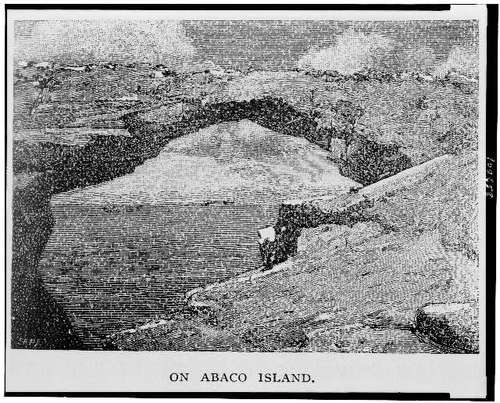
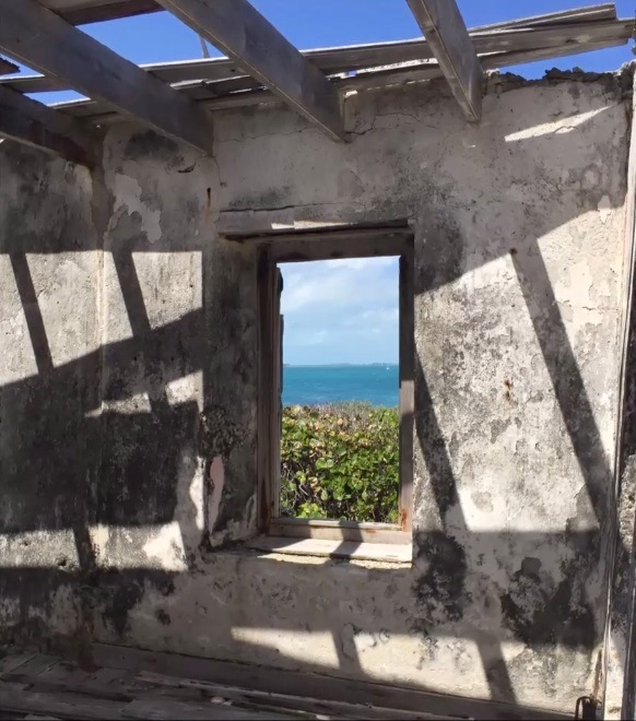
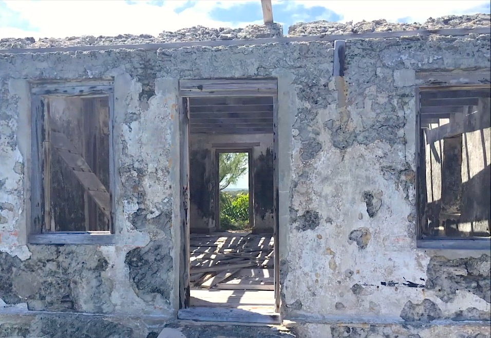
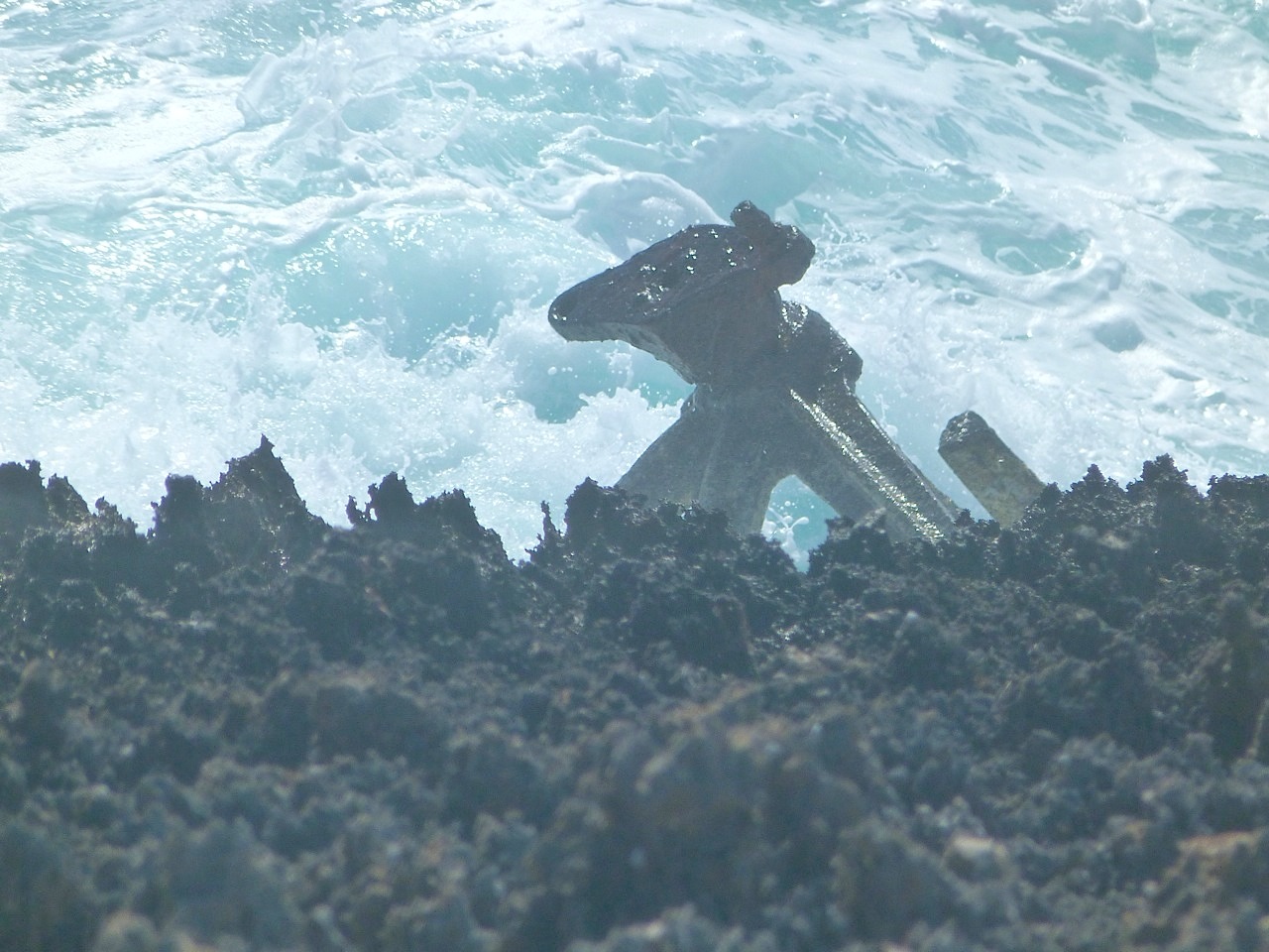
Samuel Thornton’s ‘…New Chart of the Bahama Islands and the Windward Pafsage (sic)’ is thought originally to date from c1702, when presumably the enjoyably colourful Cartouche (above) in fact bore his father’s name. The map covers an extensive geographical area besides the Bahamas, with the Florida coastline revealed as remarkably unpopulated. Zeroing in on the northern Bahamas (and as is usual with historic maps), certain features stand out, not least with spelling. Andros was written Androfs (sic). The Bahama Banck (sic) is shown to extend quite a long way north of Abbaco (sic) and Grand Bahama (shown as Bahama I). And as noted in earlier posts relating to Abaco’s history (see links below), ‘Hole in the Rock’ (ie Wall) is the only mainland location marked. This was not because there was any sizeable settlement there, but because for at least a century beforehand, Abaco’s most notable topographic feature was a significant and instantly recognisable navigation marker for shipping at the southern end of the island.

Map of the Bahama Islands - Samuel Thornton - c1702

One problem with Samuel Thornton’s reissues of his father’s maps was that flaws an original map from which a reproduction was derived went uncorrected. For example if you look at the header image of the full map, there’s a dark band right down the centre of the map, which persisted in later versions. More importantly, there was probably little or no correction of errors that new expeditions in the area might have revealed. Be that as it may, the Thornton map plays a significant role in the mapping of the Bahama Islands and beyond, and marks the start of an increasing sophistication as the new century progressed.

RELATED POSTS

MAPPING ABACO Bahamas and Florida in the c17

MAPPING ABACO Bellin’s Map 1764

MAPPING ABACO A journey back to c18

A HISTORY OF HOLE-IN-THE-WALL IN MAPS

Map of the Bahama Islands - Samuel Thornton - c1702

A LIGHT EXTINGUISHED: LITTLE HARBOUR LIGHTHOUSE REVISITED


Little Harbour Lighthouse, Abaco Bahamas (Keith Salvesen)

A LIGHT EXTINGUISHED: LITTLE HARBOUR LIGHTHOUSE REVISITED

The words ‘Abaco Lighthouse’ are near-synonymous with the splendid striped edifice in Hope Town, Elbow Cay. This beloved building is truly iconic, in the modern sense of the word (see HERE). But it would not do to forget the other principal lighthouse of Abaco at Hole-in-the-Wall, also with its original Fresnel lenses (see HERE for a post written ages ago).

Little Harbour Lighthouse, Abaco Bahamas (Keith Salvesen)

However, there’s a third lighthouse on Abaco. The small light at Little Harbour is, by contrast with the other two beacons, relatively unknown, unvisited, and unloved. Derelict, in fact, and a sad  relic on its lonely promontory. Recently we prised ourselves away from the delights of Pete’s Pub and found the start of the overgrown track to the light. There’s a wooden sign that helps to locate the path. 

Little Harbour Lighthouse, Abaco Bahamas (Keith Salvesen)

This small lighthouse station – “The Old Lighthouse” – was established in 1889 close to the entrance to Little Harbour. Originally, it was manned, with the first lighthouse keeper and his wife being the only inhabitants of that part of Little Harbour. The light presumably served to guide shipping to the channel leading to the secluded and safe harbour.

Little Harbour Lighthouse, Abaco Bahamas (Keith Salvesen)Little Harbour Lighthouse, Abaco Bahamas (Keith Salvesen) Little Harbour Lighthouse, Abaco Bahamas (Keith Salvesen)

In due course the living quarters fell into dereliction and the existing beacon (type unknown?) on a small tower was converted to a solar-powered light. This arrangement did not survive the devastation of Hurricane Floyd in 1999. The replacement was a modern steel framework tower that carried an active light until eventually it was blown over by Hurricane Sandy in October 2012. Sandy was also the hurricane that destroyed forever the rock ‘hole’ – an important navigation mark for centuries – that gave Hole-in-the-Wall its distinctive name (see HERE and links).

Little Harbour Lighthouse, Abaco Bahamas (Keith Salvesen)Little Harbour Lighthouse, Abaco Bahamas (Keith Salvesen) Little Harbour Lighthouse, Abaco Bahamas (Keith Salvesen)

The views from the elevated position of the ruin are spectacular, both from the outside and from inside. In good weather, anyway… It remains to be seen whether the lonely light is now considered completely redundant, or whether another automatic light will in the end be positioned here when funds or willpower permit. I’m not aware of any groundswell of opinion suggesting that, in the absence of a beacon at Little Harbour, there is a potential safety issue. 

The view north from the light to the tip of the promontoryLittle Harbour Lighthouse, Abaco Bahamas (Keith Salvesen)

The view roughly south past the fallen tower towards CherokeeLittle Harbour Lighthouse, Abaco Bahamas (Keith Salvesen)

Over time, I have been contacted by people with family associations to previous keepers; and with personal experiences of life there. One or two Americans have wanted to track newly discovered family connections to the light, and even possible relatives. I have the makings of ‘Lighthouse Family’ tree. When I last wrote about the light, Chuck Rickey contacted me with his story, which gives a wonderful insight into the history of the light and its hardy occupants: 

“My grandmother’s first cousin, Curtis Lowe, was lighthouse keeper here for many years and along with his wife, Bessie, raised children Hartley, Maitland, Lois and Robert, obtaining staples buy walking a tract road or sailing to Cherokee Sound. Later on, they were able to motor to Snake Cay, to get provisions from Owens Illinois’ company store aboard the “Robert Fulton”, an old side-wheel steamer, permanently moored there. I was fortunate to spend much fun time there during school vacations growing up”.

WHEREABOUTS IN LITTLE HARBOUR IS WAS THE LIGHTHOUSE

Little Harbour Lighthouse 1 jpg copyLittle Harbour Lighthouse 4 jpg

RELATED POSTS

ELBOW REEF LIGHTHOUSE: A BEACON ICON

HOLE-IN-THE-WALL LIGHTHOUSE

HOLE-IN-THE-WALL: HISTORY, SHIPS AND MAPS

Little Harbour Lighthouse, Abaco Bahamas (Darlene Chisholm)

Credits: all photos Keith Salvesen except the last, Darlene Chisholm. Also, with thanks to Sandy Estabrook. 

Logo of the World Lighthouse Society

Logo of the World Lighthouse Society

A HISTORIC MONUMENT TO MARITIME HISTORY: CHEROKEE, ABACO


Tribute Monument to the Sailing Smacks of Cherokee Abaco (Keith Salvesen)

A HISTORIC MONUMENT TO MARITIME HISTORY: CHEROKEE, ABACO

The small and – until quite recently – remote settlement of Cherokee is said to have been founded by one Colonel Thomas Brown with his cohort of Loyalists from the Carolinas. The origin of the name has given rise to various theories, one of which stems from Col. Brown’s supposed link to Cherokee Indians.

The early settlers established themselves at this natural harbour, and life there was largely dependent on the sea. Fishing provided food, wrecking provided goods and presumably the wherewithal for trade or barter. In due course, boat building became an important part of the community, as with other places on Abaco (e.g. Man-o-War Cay). Later still, smack fishing with the locally made boats brought stability and no doubt a degree of prosperity to the community.

The monument, and in the background right, the comms tower & the new SHELL MUSEUMTribute Monument to the Sailing Smacks of Cherokee Abaco (Keith Salvesen)

The fishing smacks of Cherokee were designed to carry 5 sails rather than the usual 7 sails. Not being a sailor, I can’t tell if this was just a local stylistic choice, or for simplicity, or perhaps for a specific sea-going reason in that particular area. As a tribute to this honourable industry, in October 1988 the community of Cherokee Sound erected a fine monument near the famous LONG DOCK dedicated to the Cherokee fishermen and their smacks, and naming many of the vessels involved over many decades.

Tribute Monument to the Sailing Smacks of Cherokee Abaco (Keith Salvesen)

The monument also sets out the long history of smack fishing dating from the early c19 until the 1960s, by which time the advent of the diesel engine had begun to make setting the sails for fishing redundant. The moving tribute speaks to the great pride of the community in its history and its forbears.

The short poem, with the authorship shown as Anon, is in fact based on a sea-song written by a non-seafaring Scotsman called Allan Cunningham (1784- 1842), A Wet sheet and a flowing sea – said to be his best known song. The full version is given at the end, and you’ll see that the second verse (with some minor changes) is the part chosen to form the shorter tribute.

Tribute Monument to the Sailing Smacks of Cherokee Abaco

The monument also includes a panel dedicated to the fishermen of the community who lost their lives in plying their trade from 1890 onwards. It is notable that every one of them bears a family name familiar to this day on Abaco in the succeeding generations.

Tribute Monument to the Sailing Smacks of Cherokee Abaco

A Wet Sheet and a Flowing Sea by Alan Cunningham (1784- 1842)

A Wet sheet and a flowing sea, 
    A wind that follows fast 
And fills the white and rustling sail 
    And bends the gallant mast; 
And bends the gallant mast, my boys, 
    While like the eagle free – 
Away the good ship flies, and leaves 
    Old England on the lee.

“O for a soft and gentle wind!” 
    I heard a fair one cry: 
But give to me the snoring breeze 
    And white waves heaving high; 
And white waves heaving high, my lads, 
    The good ship tight and free – 
The world of waters is our home, 
    And merry men are we.

There’s tempest in yon hornèd moon, 
    And lightning in yon cloud: 
But hark the music, mariners! 
    The wind is piping loud; 
The wind is piping loud, my boys, 
    The lightning flashes free – 
While the hollow oak our palace is, 
    Our heritage the sea.

Credits & research: Keith Salvesen, Kaderin Mills / BNT, Bahamas.com, National Geographic, Bahamas Ministry of Tourism

LITTLE HARBOUR ABACO (1): JOHNSTON FOUNDRY & GALLERY


Pete's Pub & Gallery / The Johnston Foundry Little Harbour Abaco (Keith Salvesen)

LITTLE HARBOUR ABACO (1): JOHNSTON FOUNDRY & GALLERY

Pete’s Pub in Little Harbour needs no introduction. The place is an integral part of Abaco life, in much the same way as the Elbow Reef Lighthouse. Everyone knows that one runs effortlessly on beer and rum; the other on kerosene and a bed of mercury (just don’t mix up which is which, and best not to drink the mercury). Some visitors may happily while away an hour or three at Pete’s, not knowing of the amazing sculpture gallery almost next door, where works from the historic Johnston Foundry are displayed. Here is a taste of what you will find there.

Pete's Pub & Gallery / The Johnston Foundry Little Harbour Abaco (Keith Salvesen)

In the 1950s Randolph Johnston built a bronze casting foundry at Little Harbour that is still very much in use today. Much of the wonderful work produced by members of the Johnston family over 3 generations can be found on display in the Gallery. Here you will find genuinely locally produced sculptural works of art ranging from the simple to the incredibly complex. Some large outdoor pieces can also be found dotted around the settlement – here, a huge ray; over there, a pair of leaping dolphins.

Pete's Pub & Gallery / The Johnston Foundry Little Harbour Abaco (Keith Salvesen)Pete's Pub & Gallery / The Johnston Foundry Little Harbour Abaco (Keith Salvesen)Pete's Pub & Gallery / The Johnston Foundry Little Harbour Abaco (Keith Salvesen)Pete's Pub & Gallery / The Johnston Foundry Little Harbour Abaco (Keith Salvesen)

Unsurprisingly, the sculptures on display mostly relate to the sea, which laps the shoreline only a few yards in front of the gallery. These are works of art, and of skill refined over decades. They do not come cheap. There are however smaller and less expensive items to tempt the visitor who may have a baggage allowance to live down to. Here is a snapshot of some of these.

Pete's Pub & Gallery / The Johnston Foundry Little Harbour Abaco (Keith Salvesen)Pete's Pub & Gallery / The Johnston Foundry Little Harbour Abaco (Keith Salvesen)Pete's Pub & Gallery / The Johnston Foundry Little Harbour Abaco (Keith Salvesen) Pete's Pub & Gallery / The Johnston Foundry Little Harbour Abaco (Keith Salvesen)Pete's Pub & Gallery / The Johnston Foundry Little Harbour Abaco (Keith Salvesen)

You might be entertained by this short video, which will give you an idea of Pete’s set-up at this unique off-grid settlement. And if you do visit, coincide with a mealtime – the freshly caught fish is outstanding.

All photos: Keith Salvesen, with thanks for permission to photograph some of the artworks on display. Video by Pete’s! [PS I have not been paid for my writing, not even a beer…]

“GIFTS FROM THE SEA”: THE CHEROKEE SHELL MUSEUM


Cherokee Shell Museum, Abaco Bahamas (Keith Salvesen)

“GIFTS FROM THE SEA”: THE CHEROKEE SHELL MUSEUM

In the shadow of a tall pylon in the secluded settlement of Cherokee stands Abaco’s smallest museum. Make that one of the world’s smallest museums. As I mentioned after it opened last year, other contenders for the title include the MmuseumM in New York, housed in an elevator shaft (look through glass window + audio guide); a converted red telephone kiosk in Warley, Yorkshire UK dedicated to local history (one visitor at a time); and a tiny shed of 134 sq ft in Arizona featuring what might broadly be called ‘ephemera’, including a Beatles poster…

Cherokee Shell Museum, Abaco Bahamas (Keith Salvesen)

This tiny museum is dedicated to the shells of Abaco. It is almost certainly the smallest shell museum anywhere in the world (except maybe the one you kept in a small box under your bed when you were 10). 

Cherokee Shell Museum, Abaco Bahamas / Gifts from the Sea / Cinder Pinder

“Gifts from the Sea” is housed in the former 1950s telegraph office that ceased to operate in 1987 and had fallen into disrepair. Leased from BTC for a nominal rent, the little building was restored, and given a smart new roof and a complete makeover. It’s the perfect space for displaying a selection of the wonderful shells and corals to be found in Abaco waters.

Cherokee Shell Museum, Abaco Bahamas / Gifts from the Sea / Cinder Pinder

This community project is the vision and creation of Curator Lee Pinder. Derek Weatherford fitted cabinets for the exhibits, and artist Jo-Ann Bradley painted a interior Cherokee-themed mural as a fitting backdrop to the displays.

Cherokee Shell Museum, Abaco Bahamas / Gifts from the Sea / Cinder Pinder

The exhibition shows more than 200 shells, each catalogued with its Latin and common name, and clearly labelled in the display. Most were found locally; a few are from further afield. Some specimens are very rare. The collection will expand as people make shell donations to the museum. 

Cherokee Shell Museum, Abaco Bahamas / Gifts from the Sea / Abaconian

The building has a door at each end to give natural light and provide a ‘walk-through’ arrangement, which makes viewing in the confined space easier. Entry is free but there’s a glass jar for donations towards the upkeep of the museum. I’m guessing here, but I reckon donations made ‘outside the jar’ (so to speak) are very welcome too…

Museum Curator Lee PinderCherokee Shell Museum, Abaco Bahamas / Gifts from the Sea / Cinder Pinder

The opening ceremony took place on Easter Saturday 2017, when Cherokee resident Rev. Bateman Sands performed the official ribbon cutting ceremony preceded by a prayer at precisely 12 noon. As Jennifer Hudson in an Abaconian article pointed out, he was the ideal person for the task, having been “the first telegraph operator in Cherokee Sound, working in the little building using Morse code and in charge of the one and only telephone in the settlement until 1987 when the new BTC building was opened”.

Cherokee Shell Museum, Abaco Bahamas / Gifts from the Sea / Cinder Pinder

The shell museum is not left open all the time, but visitors are welcomed on weekend afternoons, and private tours can be arranged by calling either number shown below on the notice attached to the door.

Cherokee Shell Museum, Abaco Bahamas (Keith Salvesen)

To see a selection of the many types of Abaco shells, check out my shell page HERE

Sources and Photo Credits: Bradley Albury / Jennifer Hudson / Abaconian; Cindy James Pinder (shells, interior 2017); Keith Salvesen (exterior, 2018)

Cherokee Shell Museum, Abaco Bahamas (Keith Salvesen)

CHEROKEE SHELL MUSEUM, ABACO: “GIFTS FROM THE SEA”


Cherokee Shell Museum, Abaco Bahamas / Gifts from the Sea / Cinder Pinder

CHEROKEE SHELL MUSEUM, ABACO: “GIFTS FROM THE SEA”

One of the smallest museums in the world has just opened on April 15 in the picturesque settlement of Cherokee on Abaco, Bahamas. Other contenders for the title include the MmuseumM in New York, housed in an elevator shaft (look through glass window + audio guide); a converted red telephone kiosk in Warley, Yorkshire UK dedicated to local history (one visitor at a time); and a tiny shed of 134 sq ft in Arizona featuring what might broadly be called ‘ephemera’, including a Beatles poster…

Cherokee Shell Museum, Abaco Bahamas / Gifts from the Sea / Abaconian

Whatever the size comparisons, the new shell museum is beyond doubt the very best one in the Bahamas, not least because it is the only one. “Gifts from the Sea” is housed in the former 1950s telegraph office that ceased to operate in 1987 and had fallen into disrepair. Leased from BTC for a nominal rent, the little building was restored, and given a smart new roof and a complete makeover. The new museum provides the perfect space for displaying a selection of the wonderful shells to be found in Abaco waters.

Cherokee Shell Museum, Abaco Bahamas / Gifts from the Sea / Cinder Pinder

The whole community has got behind this project, which is the vision and creation of Curator Lee Pinder. Derek Weatherford fitted cabinets for the exhibits, and artist Jo-Ann Bradley has painted a fabulous interior Cherokee-themed mural as a fitting backdrop to the displays.

Cherokee Shell Museum, Abaco Bahamas / Gifts from the Sea / Cinder Pinder

The exhibition shows more than 200 shells, each catalogued with its Latin and common name, and clearly labelled in the display. Most were found locally; a few are from further afield. Some specimens are very rare. It is hoped to expand the collection as people make shell donations to the museum. 

Cherokee Shell Museum, Abaco Bahamas / Gifts from the Sea / Abaconian

The building has a door at each end to give natural light and provide a ‘walk-through’ arrangement, which will make viewing in the confined space easier. Entry is free but there’s a glass jar for donations towards the upkeep of the museum. I’m guessing here, but I reckon donations that are made ‘outside the jar’ (so to speak) are very welcome too…

Museum Curator Lee PinderCherokee Shell Museum, Abaco Bahamas / Gifts from the Sea / Cinder Pinder

The opening ceremony took place on Easter Saturday, when Cherokee resident Rev. Bateman Sands performed the official ribbon cutting ceremony preceded by a prayer at precisely 12 noon. As Jennifer Hudson in an Abaconian article points out, he was the ideal person for the task, having been “the first telegraph operator in Cherokee Sound, working in the little building using Morse code and in charge of the one and only telephone in the settlement until 1987 when the new BTC building was opened”.

Cherokee Shell Museum, Abaco Bahamas / Gifts from the Sea / Cinder Pinder

The shell museum is not left open all the time, but visitors are welcomed and private tours can be arranged by calling 475-7868.

Cherokee Shell Museum, Abaco Bahamas / Gifts from the Sea / Cinder Pinder

To see a selection of the many types of Abaco shells, check out my shell page HERE

Sources and Credits: Bradley Albury / Jennifer Hudson / Abaconian; Cindy James Pinder for her great photos

Sand dollar, Abaco (Rolling Harbour)

АБАKО: SOVIET RUSSIAN MILITARY MAP OF ABACO


Soviet Russian Military Map of Abaco 1979

АБАKО: SOVIET RUSSIAN MILITARY MAP OF ABACO

I had been toying with a plan to write something fishy today. Lifting the lid on the secrets of the creole wrasse, maybe. Then something arrived in my inbox overnight that changed my course entirely. I was struck  by an idea  harder than a torrent of mixed metaphors speeding towards a bullseye in the motherlode. A map! A map of Abaco!! All in Russian!!! From the Soviet Russian Military Survey!!!! Irresistible. An occasion for multiple exclamation marks.509px-hammer_and_sickle_black_large_on_transparent-svg

‘Russian Soviet Military Topographic Maps’

Map sheet G-18-1 GREAT ABACO ISLAND ed. 1979 – scale 1:500 000, map size 66 cm x 55 cm

Soviet Russian Military Map of Abaco 1979

509px-hammer_and_sickle_black_large_on_transparent-svg

My blog is stuffed full of maps. They are scattered everywhere, like cartographical confetti. There’s even a page for some of them HERE. Want a map of Abaco’s HIGHEST POINT (134m, if you have the energy).  Need to see what Abaco looked like 300 years ago? Try HERE. Need a history of Hole-in-the-Wall in maps? Try THIS. And so on.
509px-hammer_and_sickle_black_large_on_transparent-svg

The header map is a merely the bottom-left corner of the much larger map immediately above. As a crop of the much larger area, it’s illegible. Which is next to useless, because the best thing about this map is that it is all in Russian. And I really wanted to see how they had mapped Marsh Harbour. Treasure Cay. Man-o-War. And the rest. I looked around online and reached this one. Even with some work on the image, you can only get a blurry glimpse – just a few tempting hints of Cyrillic. But it’s impossible to locate Марш Харьор, Трежер Ки, or Ман-оф-Уор Ки…

Soviet Russian Military Map of Abaco 1979

509px-hammer_and_sickle_black_large_on_transparent-svg

So, back to the interweb thing. And eventually, something usable turned up. Here, with props to Clicpic, is Abaco in the late Soviet era. Check out where you live – in Russian. Got friends on Грейт Гуапна Кй? Sadly, the northern end of Abaco and the whole southern end from Crossing Rocks down to Hole-in-the-Wall and right round to Sandy Point is absent. That area is of course the perfect place for missile silos**. Except now it’s a National Park, so that wouldn’t be possible… would it?

509px-hammer_and_sickle_black_large_on_transparent-svg

I’ve split the map into 3 sections to make it as big as possible. The maps overlap to keep the proportions equal on-screen. Double click to zoom in. Hope you enjoy travelling around it…

Soviet Russian Military Map of Abaco 1979 Detail 1 Soviet Russian Military Map of Abaco 1979 Detail 2 Soviet Russian Military Map of Abaco 1979 Detail 3

** Vladdy, mate, if you or your agents have picked up on this, (1) only joking, right? and (2) you’ve  anyway got better things to worry about these days…

STARK’S “HISTORY OF & GUIDE TO THE BAHAMAS”


047-copy

STARK’S “HISTORY OF & GUIDE TO THE BAHAMAS”

James H. Stark appears to have been, for his time, a veritable Rough Guide for the Caribbean. In 1891 he produced an entrancing tome, the commendably grammatically correctly-titled “Stark’s History of and Guide to the Bahama Islands Containing a Description of Everything on or About the Bahama Islands of Which the Visitor or Resident May Desire Information, Including Their History, Inhabitants, Climate, Agriculture, Geology, Government and Resources”. More of his other magna opera below.

Stark's History of & Guide to the Bahamas     Stark's History of & Guide to the Bahamas

 The jaunty and classic late c19 cover depicts the landing of Columbus, lest the unwary reader should be so ill-informed as the be unaware of the location of the great explorer’s landfall. And gives the date of the event, for the sake of completeness. The title page is most informative of the contents, and manages to namecheck the author three times (or thrice, as he might have put it). The illustrations and in particular the maps are wonderful, and call for a small gallery for your enjoyment. The “Coast Chart” is compiled from “the latest… surveys.” The map of Nassau is most interesting to compare with a map of 125 years later. And the engraved map is set at an unusual angle to say the least. [I’ve tried to clip the Abaco part to check the place names, but I can’t yet get a clear enough image to read].

Stark's History of & Guide to the Bahamas - Bahamas Map

Stark's History of & Guide to the Bahamas - Nassau map

Stark's History of & Guide to the Bahamas - Bahama Islands Map

An historic map from 100 years earlier: note the place names, eg ‘Alabaster’ (Eleuthera)129

The ‘History of & Guide to’ has detailed sections on all the islands. I have lifted the relevant pages – only a few – concerning Abaco. See what a difference 125 years makes…

145146147

I enjoyed reading the ‘opinions of the press’. How unlike our own dear Amazon reviews…Stark's History of & Guide to the Bahamas    Stark's History of & Guide to the Bahamas

005

RAISING A CONTROVERSY…

This is a topic I have touched on before. It concerns the authentic location of the ‘Glass Window’ of Winslow Homer’s famous painting. Is it Eleuthera (as claimed) or Abaco (as contended). The argument is lodged with the Brooklyn Museum, custodian of the Homer painting. In Stark’s book of 1891 is a fine photograph of a – or the? – ‘glass window’, assigned to Eleuthera. Below is an earlier engraving entitled ‘On Abaco Island’. It is the work of Homer, named by him, and seemingly a preliminary study for the painting. The same view? Or different? The jury is still listening to the arguments… 

136aHole-in-the-Wall Picture

Winslow Homer G W Original Brooklyn

Other books by James H. Stark that you may enjoy:

Stark’s History and Guide to Barbados and the Caribee Islands, Containing a Description of Everything on or About These Islands of Which the Visitor or Resident May Desire Information – Including Their History, Inhabitants, Climate, Agriculture, Geology (1893)

A ditto for Trinidad.

A ditto for ‘Boston and its Suburbs’

A ditto to the County of Ohio

md14322205683

HOLE-IN-THE-WALL for more about Hole-in-the-Wall, Abaco and Winslow Homer

Credits: my primary source is the University of Florida Digital Collection, to which thanks. However there are plenty of mainstream online sites that offer this book to view; and you can download it or even get your own POD (‘print on demand’). 

ABACO HISTORY: GREEN TURTLE CAY & THOSE WHO STAYED


Black Sound, GTC, Abaco (Amanda Diedrick)

‘THOSE WHO STAYED’

I am very pleased to feature Amanda Diedrick’s wonderful new book about the the history of Abaco generally and Green Turtle Cay specifically. Publication is imminent. Without more ado I will leave you with Amanda’s own description of her book, which is illustrated with paintings by illustrious Abaco & GTC artist Alton Lowe. It also contains unique historic photographs that record Abaco’s rich heritage. The book details are shown below, and there’s even a handy Paypal link if – as I hope – you cannot be restrained from the temptation to buy a copy. Or maybe two. And you can follow Amanda’s fascinating and rewarding blog at LITTLE HOUSE BY THE FERRY

greenturtlesignnew

“Visitors often describe New Plymouth on Green Turtle Cay as a charming fishing village, its narrow streets, clapboard homes and colourful flowers reminiscent of a New England town.

cover-with-shadow-2

But beneath this sweet façade is a past of piracy, poverty and privilege.

Hints of New Plymouth’s history are all around. A rusted anchor at Settlement Point. Two cannon standing guard on the public dock. Broken tombstones on the beach.  An old jail with stairs that lead nowhere.

For more than a thousand years, settlers have come here, drawn by the safety of the land and the bounty of the sea. And as the waves contour the shore, so have these migrants shaped this tiny cay.

By fate and occasionally by force, most were carried away.  A resilient few remained.

This is their story.”

ABOUT THOSE WHO STAYED

  • Print length: 185 pages
  • Book size: 8.5” x 11”
  • Full colour
  • Hard cover
  • Publication date: November 20, 2016
  • Images: 200+, including many never-before published historic photographs, and original oil paintings by world-renowned artist and Green Turtle Cay native, Alton Lowe
  • Price: $79.00

Buy Now Button

Books will ship at the end of November. All orders received by November 25 will be delivered before Christmas.

ABOUT THE AUTHORamanda-profile-pic-for-web

A writer for more than 25 years, Amanda Diedrick is a ninth-generation Bahamian who counts Loyalist settlers Wyannie Malone and Nathan Key and pirate Matthew Lowe among her ancestors.

In 2012, she and her husband Tom Walters purchased the tiny cottage on Green Turtle Cay that her great-grandparents, Herman and May Curry, built after the 1932 hurricane destroyed their grand home.

Amanda documents the ongoing restoration of her ancestral home and writes about Green Turtle Cay and its history on her blog, Little House by the Ferry [link above. RH]

Tom, Amanda and their dog, Wrigley, divide their time between Green Turtle Cay and Los Angeles.

ABOUT THE ARTIST

As with so many Bahamians, it wasn’t until Alton Lowe left home at 16 to become an artist that he truly realized the uniqueness and beauty of his home country.

alton-lowe

In the decades since, he has devoted himself to capturing the people, scenes and history of the Bahamas in original oil paintings.

Lowe’s colourful works hang in public and private collections worldwide, including those of HRH Queen Elizabeth and Prince Philip, as well as Prince Charles and the late Princess Diana. He has staged 38 one-man shows to date, and more than 100 of his works have been commissioned by the Bahamian government for use as postage stamps.

Reflecting his commitment to preserving Bahamian history, Lowe founded Green Turtle Cay’s Albert Lowe Museum and was instrumental in the creation of the island’s Loyalist Memorial Sculpture Garden and Island Roots Heritage Festival.

Through his body of work, he hopes to convey the magnificence of the Bahamas and to inspire his fellow Bahamians to appreciate, enhance and protect their remarkable history for future generations.

cover-with-shadow-2

Text and images Amanda Diedrick except welcome sign (GTC Rentals) and the photo below (socmed / open source)

Abaco map by Thompson (1812): note the strange geography, place names and spellings

For more historic Abaco maps click HEREabaco-historic-map-thompson-1815-crop-copy

The opening of the Albert Lowe Museum, Green Turtle Cay, AbacoAlbert Lowe Museum GTC Opening Nov 1976

LITTLE HARBOUR LIGHTHOUSE: A DERELICT MARITIME LANDMARK


Little Harbour lighthouse Abaco - Darlene Chisholm

LITTLE HARBOUR LIGHTHOUSE: A DERELICT MARITIME LANDMARK

The words ‘Abaco Lighthouse’ are near-synonymous with the splendid striped edifice on Elbow Cay. This beloved building is truly iconic, in the modern sense of the word. But it would not do to forget the other principal lighthouse of Abaco at Hole-in-the-Wall, also with its original Fresnel lenses. The small light at Little Harbour is by contrast relatively unknown, unvisited and unloved. And derelict. Maybe that explains it. You can read in detail about this neglected relic of Abaco’s maritime history HERE

little-harbour-lighthouse-abaco-1-bob-rusby

Last Spring,  friends and fellow Delphi Club members Bob & Annie Rusby and their children stayed for a while in Little Harbour. Among their adventures was a walk to the lighthouse, which is situated quite remotely on a promontory, and a decent stagger from Pete’s Pub. They took some up-to-date photos (the ones shown are in fact video stills) which supersede the ones I have previously posted. 

little-harbour-lighthouse-abaco-3-bob-rusby

This small lighthouse station – “The Old Lighthouse” – was established in 1889 at the entrance to Little Harbour. Originally, it was manned, with the lighthouse keeper and his wife being (according to Sandy Estabrook) the only inhabitants of that part of Little Harbour. The light presumably served more to locate the channel to the secluded and safe harbour than to warn of reef dangers.

little-harbour-lighthouse-abaco-4-bob-rusby

In due course the living quarters fell into dereliction and the existing beacon (type unknown?) on a small tower was converted to a solar-powered light. This arrangement did not survive the devastation of Hurricane Floyd in 1999. The replacement was a modern steel framework tower that carried an active light until it was blown over by Hurricane Sandy in October 2012. The header image shows the tumbled structure, which has never been replaced. Even the steel tower seems now (4 years later) to have gone. 

little-harbour-lighthouse-abaco-2-bob-rusby

Little Harbour Lighthouse 1 jpg copyLittle Harbour Lighthouse 4 jpg

The views from the elevated position of the ruin are spectacular, both from inside the ruin (lucky keeper!) and from outside. In good weather, anyway… It remains to be seen whether light is now considered completely redundant, or whether another automatic light will in the end be positioned here when funds or willpower permit. I’m not aware of any groundswell of opinion suggesting that, in the absence of a beacon at Little Harbour, there is a potential safety issue. I’d be interested to hear any views.

little-harbour-lighthouse-abaco-6-bob-rusby

STOP PRESS Chuck Rickey has left a wonderful comment in response to this post, full of personal and historical interest. Any other reminiscences would be most welcome.

“My grandmother’s first cousin, Curtis Lowe, was lighthouse keeper here for many years and along with his wife, Bessie, raised children Hartley, Maitland, Lois and Robert, obtaining staples buy walking a tract road or sailing to Cherokee Sound. Later on, they were able to motor to Snake Cay, to get provisions from Owens Illinois’ company store aboard the “Robert Fulton”, an old side-wheel steamer, permanently moored there. I was fortunate to spend much fun time there during school vacations growing up”.

little-harbour-lighthouse-abaco-5-bob-rusby

RELATED POSTS

ELBOW REEF LIGHTHOUSE: A BEACON ICON

HOLE-IN-THE-WALL LIGHTHOUSE

LITTLE HARBOUR LIGHTHOUSE

Lighthouse ruins, Little Harbour Abaco - Patrick Shyu

Credits: Darlene Chisholm (header image); Bob Rusby (all main images); Patrick Shyu (last photo); Sandy Estabrook (special thanks for info re earlier post)

Logo of the World Lighthouse Society

Logo of the World Lighthouse Society

MAPPING ABACO: A JOURNEY BACK TO THE c18


acaco-map-1778-crop

MAPPING ABACO: A JOURNEY BACK TO THE c18

From time to time I come across historic maps of the Bahamas in general and Abaco in particular. Many were included in a post I wrote some time ago about the maritime and geographic importance of Hole-in-the-Wall, HERE. Almost all pre-c20 maps of the Bahamas contain insights into the maritime and geo-political history of the islands that are worth investigating. One that recently caught my eye is a map dated 1778 from Italy, published in Venice, with the excellent title “Il Paese de’ Selvaggi Outauacesi, e Kilistinesi Intorno al Lago Superiore”, attributed to Antonio Zatta, John Mitchell and G T Raynal.  “The title translated, might read, “The Country of the Savage Ottowas and Christineaux on the shores of Lake Superior.” Except for Ile Royale, the large islands in the lake are fictitious. The somewhat distorted outline of southern Florida in the inset is in keeping with general lack of British knowledge about this area” Portinaro & Knirsch 

Zatta was a Venetian cartographer who produced some important maps in the 1770s and 1780s, including a 4-volume atlas of the world. Mitchell was a geographer and botanist, best known for the first comprehensive map of eastern North America (1755); Guillaume Thomas Raynal was a French writer and journalist most famous for his treatise on the ‘philosophical and political history of the establishment of commerce by Europeans in the the two Indies’, a work that was considered controversial (it was banned in France, and copies burned). 

THE COMPLETE MAP

Lake Superior, with the ‘Supplemento alla Florida Orientale’ inset – a strange juxtaposition…abaco-map-zatta-1778-sm

FOCUS ON FLORIDA

The ‘eastern Florida’ inset conveniently happens to include the northern Bahamas. Staying with Fl. for a moment, of note is the inclusion of C. Canaveral, spelled then as now. Key Biscayne is also shown. I wondered about the place marked Tartarughe Secche – ‘Dry Turtles’. It is now Dry Tortugas National Park. “Mostly water, this remote park features abundant marine & bird life plus a 19th-century fort. It comprises 7 islands, plus protected coral reefs. Garden Key is home to beaches and the 19th-century Fort Jefferson. Loggerhead Key has a lighthouse and sea turtles. On nearby Loggerhead Reef, the Windjammer Wreck, the remains of an 1875 ship, is a popular dive site. Bush Key is a nesting site for seabirds like sooty terns.”** I suspect that these coral reef islets were marked on maps in days before lighthouses because of the hazards they posed to navigation at sea; and because, like Hole-in-the-Wall on Abaco, they were useful navigation aids.

abaco-map-inset-italian-c18

ABACO & NORTHERN BAHAMAS

Unacknowledged in both the map and the inset titles, are the northern Bahamas islands. We can pass by Bimini, Andros and (Grand) Bahama which, apart from distinct oddities of scale, shape, and location are more or less as one might expect for the period. Let’s look at some details of the depiction of Abaco. 

acaco-map-1778-crop

  • ABACO(A) The first geographical jolt comes not from the well-known fact that historically, present-day Abaco was originally called Lucaya (or variations), but that (New) Providence was called Abacoa. Adding to the confusion, some early maps also show certain cays as ‘Abaco’, ‘Abacoa’, or in the case of Tilloo Cay in 1815, ‘Aboca’, possibly through errors or misunderstandings. This map is one of the few I have seen that shows both the mapped transition of Lucaya (or its variants) to Abaco; and of Abaco(a) to Providence. If anyone has any idea why this came about, I’d be pleased to know!
  • HITW? The next surprise is that Hole-in-the-Wall, an established and mapped nautical landmark for some decades, is not marked. Shown on maps since at least 1738, this is the first map I have found – other than the most basic – that does not feature HITW (in whatever language) or ‘Lighthouse Point’. An odd omission.
  • PORTO PICCOLO’s inclusion is interesting because it continues a tendency – eg 1738, Couvens & Mortier – to show Little Harbour as the only named settlement, though by 1778 there must have been others. LH was clearly a place of some significance, and this presumably had a nautical explantation: the harbour is perfectly placed to offer protection and a safe refuge in stormy weather.
  • CANAL DELA BALENA refers to what, by the early c20, was called ‘Whale Cay Channels’ (below), by which time it was more accurately mapped. Other c18 maps also show ‘Chenal Whale’ and ‘Whale Channel’, but considerably north of the actual location. But in those days, even the outline of Abaco and the location of the cays was usually endearingly wonky.whale-cay-abaco-map-crop
  • BARRA DI DUCHTWRECK I haven’t been able to find out much about this location, or the wreck that gave it its name. A map by Thompson (1815) calls it ‘Dutch Wreck Bar’, and I can only assume that at some time in the early c18 – or even the c17 – a Dutch vessel came to grief on the reef. I need to look into this more. Someday. Oddly, the modern Italian for a reef is barriera not barra. Maybe the word has changed over time, or the usage barra then was colloquial; or perhaps in mapping terms it was a generally accepted abbreviation.
  • I MIMBRES This reef or shoal area of is usually mapped as Matanilla Reef, Maternillo Bank or Reef, or variants. In 1656 this area – presumably dangerous for shipping – was the scene of a dramatic tragedy involving a treasure ship, the flagship of a fleet. I dug up reports of the events in Portugese which baffled ‘Google Translator. I was bailed out by an article about treasure hunter Robert Marx and his findings:

shipwreck-ac-marxshipwreck-ac-marx-copy-2bahamabank-1

If you have got this far at all, or even with the assistance of 2 or 3 Kaliks, thanks for bearing with me. The old Abaco maps are fascinating, and of course once one begins to dig, so more stuff emerges… and so on.

Credits: David Rumsey Historical Map Collection, http://www.davidrumsey.com / Cartography Associates – in particular for licensing non-commercial use of material via a Creative Commons License; magpie pickings from multiple open-source sites.

**Dry Tortugas National Park review comments are eclectic and include “Crystal clear water, lots of wildlife, nice people and such a cool fort”; “The Dry Tortugas area first gained significance after the War of 1812” and “Constant nice breeze and comfortable night time temperatures for sleeping.”

ABACO’S WRECKS INVESTIGATED: SS HESLEYSIDE


SS Hesleyside (wreck), Schooner Bay Abaco (Keith Salvesen) O4

ABACO’S WRECKS INVESTIGATED: SS HESLEYSIDE 

Abaco, like many of the islands of the Bahamas, has its fair share of wrecks around its shores – both ancient and modern. I reference some of these under my RANDOM menu, with some maps, links, and general information. One that I didn’t include is the SS Hesleyside, a wreck that lies broken and wave-tossed on the rocks at Schooner Bay. To reach it, you will have to arrange at the entrance for a golf-cart to take you down to the shore. The price for your transport may be an invitation to take a tour of the community there, an ambitious enterprise that was started about 10 years ago.

charlton_steamship_co_charlton_mcallum_co_ltd_charlton_w_cflag

From where the Hesleyside lies, you get a long view across to Delphi, some 3 miles to the north. Delphi Club from Schooner Bay

For the energetic, you can walk the beach of Guinea Schooner Bay all the way to Delphi. However, the unpopulated strand is covered in seaweed (good for wildlife, though) and horrendous quantities of plastic, from micro off-cuts to macro bollards, oil containers and so forth. Frankly rather off-putting.

Guinea Schooner Bay, Abaco Beach Debris, Abaco

We visited Schooner Bay on a bright day with a strong wind that whipped up the waves all along the shoreline, with clouds of spray rather detracting from the photographic possibilities. The tide was high, and the remains of the wreck were at times barely visible. 

The bow, part of the central section towards the stern, and some sort of boiler (?) at the sternSS Hesleyside (wreck), Schooner Bay Abaco (Keith Salvesen) O1 copy

charlton_steamship_co_charlton_mcallum_co_ltd_charlton_w_cflag

SS Hesleyside was a British cargo ship built in 1900 in Sunderland, England for the Charlton Steamship Co. (Charlton, McAllum). Steam-powered, the 2600 ton vessel was more than 300 foot long.  In 1908 she was was sailing from the Azores to Key West when bad weather struck, and on 1st October high winds – described in contemporary reports as a hurricane –  drove her aground where her remains now lie, a part of the coastline known as the ‘Iron Shore’. Fortunately the crew were able to escape, and there was no loss of life.

SS Hesleyside (wreck), Schooner Bay Abaco (Keith Salvesen) O7SS Hesleyside (wreck), Schooner Bay Abaco (Keith Salvesen) O3SS Hesleyside (wreck), Schooner Bay Abaco (Keith Salvesen) O5

A dramatic account of the shipwreck was published in the New York Times. The hero of the crisis was fireman Jack Thompson, who with notable courage volunteered to swim ashore with a line, by which the rest of the crew were able to make their way to safety.

Report from the New York TimesSS Hesleyside NYT report (Coconut Telegraph) jpg

charlton_steamship_co_charlton_mcallum_co_ltd_charlton_w_cflag

In accordance with standard practice, a Court of Inquiry was held in Nassau two weeks after the event to investigate the circumstances. The Master was exonerated of blame, having “tried every means of getting the ship under control without effect”.  SS Hesleyside 5 Report (Abaco Palms)

One interesting nautical and topographical note  is that the site of the wreck is described as “about 18 miles north of Hole in the Wall”. The navigational importance of HITW as a landmark was known from as early as the c17, and it was the first location to be named in the earliest maps of Abaco. For a detailed history of HITW in maps, click HERE

Nautical Map, 1856, showing the seas around ‘Le Trou dans le Mur’, and the lighthouseNautical Map 1857
Hesleyside details wrecksite.euSS Hesleyside details (wrecksite.eu / Tony Allen) [the date is wrong]

charlton_steamship_co_charlton_mcallum_co_ltd_charlton_w_cflag

WHO, WHAT OR WHERE IS HESLEYSIDE?

It’s a place in Northumberland, UK – inland, but not very from where the ship was built. Many of the Charlton ships began with an H and ended in …side. It was – and is – a common practice to have a naming theme for vessels. 

Hiram; SS 'Hesleyside'; Sunderland Museum & Winter Gardens; http://www.artuk.org/artworks/ss-hesleyside-35255

THE WRONG SORT OF HESLEYSIDE

I got quite excited when I thought I had tracked down a painting in the Sunderland Museum of the SS Hesleyside. After all, there could hardly be two steam ships with the same name, could there? Wrong. There were in fact 3 ‘Charlton’ Hesleysides in all. There is some coincidence (but not necessarily ‘irony’, Alanis Morissette) that all 3 were wrecked.

Hesleyside (1) 

86089 


1882 

688 

Ex-Turgenief, 1882 purchased from Baxter & Co, Sunderland r/n Hesleyside, 24.7.1893 wrecked at Sosnowetz.

Hesleyside (2) 

110353 


1900 

2631 

4.10.1908 wrecked at Abaco, Bahamas.

Hesleyside (3) 

133508 


1912 

3994 

1933 sold to P. Hadoulis, Andros, 1935 sold to M. Sitinas, Andros, 24.5.1940 torpedoed and sunk in 48.30N 09.30W by U.37

The rather glamourised painting shown above shows Hesleyside Mark 3 her glory days. She was built in 1912 but was sold in 1933 to a Greek company and renamed SS Kymas. Under that name she was torpedoed by a U-boat in May 1940, and 7 of her crew of 30 were killed.  The photo below (which took me a long time to decide was the same Helseyside) shows a much more steamery, freightery looking vessel… 

hesleyside_40

Sources of information: plimsoll.org; NY Times; http://wrecksite.eu / Tony Allen; coconuttelegraph.net; http://www.abacopalms.com; Wiki; Sunderland Museum http://www.artuk.org/artworks/ss-hesleyside-35255; magpie pickings from all over the place.

ECHINODERMS, DOLLAR DOVES & PETRIFIED BISCUITS


Sand Dollar Doves (Keith Salvesen) 6

Sand Dollar from Abaco containing 5 miniature white doves…

ECHINODERMS, DOLLAR DOVES & PETRIFIED BISCUITS

Echinoderms (Gr. ‘Hedgehog Skin’) comprise a large variety of sea creatures characterised (mostly) by radial symmetry, often five-way. For Abaconians, the most frequently encountered are starfish, sea urchins, sand dollars and sea biscuits. I am going to look at two particular aspects of dollars and biscuits, conscious that my illustrative photos of white objects were stupidly taken against a white background.

DOLLAR DOVES

I’m sure all Bahamians know or are aware of at least one version of the famous ‘Sand Dollar’ poem, in which the various characteristics of the test (the skeleton of the creature) are given religious significance. One verse of the poem may be puzzling: “Now break the centre open And here you will release The five white doves awaiting To spread good will and peace”.

Recently, Senior Granddaughter (10 this week) was looking at some Abaco sand dollars in her unfeasibly huge collection of shells. She picked one up, shook it and it rattled. She said a friend at school had told her that a rattling sand dollar has ‘doves’ inside it, and asked if we could break it open and see. I’ve learnt that it is useless to argue with her – she has the tenacity of a trial lawyer – so we did. This is what we found.

Sand Dollar with a spiky interior like a white cave with stalagmites and stalagtitesSand Dollar Doves (Keith Salvesen) 4

Five white doves (in fact, the separated parts of the creature’s feeding apparatus)Sand Dollar Doves (Keith Salvesen) 1

Two broken pieces showing where the doves are centrally locatedSand Dollar Doves (Keith Salvesen) 5

A single dove (best viewed the other way up for full-on doveliness)Sand Dollar Doves (Keith Salvesen) 3

The photo below, from Pinterest, shows the ‘mouth’ with its 5 dove-parts intact, an arrangement called ‘Aristotle’s Lantern’.

Sand Dollar : Aristotle's Lantern : Doves (Pinterest)

PETRIFIED BISCUITS

In common parlance ‘petrified’ is an extreme version of ‘terrified’. Literally, it means ‘turned to stone’ (L. Petrus, a rock). It is descriptive of a state of fossilisation, where an animal skeleton or dead wood or plant matter turns over aeons into stone. Undaunted by her Doves discovery, SG (a most inquisitive girl) also discovered a box containing random stones and fossils. She found these two items:

Fossilised sea biscuitsPetrified Sea Biscuit (Keith Salvesen) 1

A closer look at the pair of rocksPetrified Sea Biscuit (Keith Salvesen) 5 Petrified Sea Biscuit (Keith Salvesen) 4

The undersides of the fossils above – looking like stones but with some tell-tale small holesPetrified Sea Biscuit (Keith Salvesen) 2 Petrified Sea Biscuit (Keith Salvesen) 3

A close-up of the pale biscuitPetrified Sea Biscuit (Keith Salvesen) 6

Sea biscuits as everyone knows them, on the beach at Delphi – skeletons but not yet fossilsSea Biscuits, Delphi, Abaco (Clare Latimer) copy

A ‘modern’ sea biscuit in close-upSea Biscuit, Abaco (Rhonda Pearce) copy

FUN FACT

Florida has an unofficial but proposed State Fossil, the ‘Sea Biscuit (Eocene Age)’. I didn’t know it before, but it turns out that around 40 States have State Fossils. Whatever next? State Bacteria?

SO HOW OLD MIGHT A PETRIFIED BISCUIT BE?

The fossil biscuits I have looked at, from Florida to Madagascar, are said to come from three specific historic epochs – from the oldest, Jurassic (145m – 201m years ago),  to Eocene (34m – 56m) and Pleistocene (0.01m – 2.6m). 

HOW DOES THAT HELP ANYBODY? BE MORE PRECISE

By all means. Here is an excellent Geochart that gives an idea of the time span. A Jurassic sea biscuit would be more than 145m years old. So maybe the next plan should be to take the 2 petrified sea biscuits plus SG to a museum to see if we can get an idea of their age…geotimescale

All photos ‘in-house’ except the Delphi biscuits, Clare Latimer & the single biscuit Rhonda Pearce; Geochart to be credited asap, mislaid the source…

CHEROKEE LONG DOCK: ABACO LANDMARKS (1)


Cherokee Long Dock Aerial (David Rees)

CHEROKEE LONG DOCK: ABACO LANDMARKS (1)

Cherokee Long Dock has a significant claim to prominence on an Island that has, with its Cays, a good few docks to admire. The impressive 770 foot wooden dock is the longest wooden dock in the Commonwealth of the Bahamas, as its plaque proudly proclaims. The waters of Cherokee Sound are very shallow in places, and as the tides retreat, so sandbanks appear and the rest is barely covered by the sea. Hence the need arose for a very long dock to serve the very small community of Cherokee.

Cherokee Long Dock, Abaco, Bahamas (Larry Towning 1)Cherokee Long Dock, Abaco, Bahamas (Larry Towning 2)

Before the roads were built – in relatively recent memory – Cherokee was an isolated settlement. There was a shortcut connection by boat to a now-abandoned dock at the nearest community, Casuarina, across the Sound. However, non-tide-dependent access from the open sea was vital for supply boats and mail boats. Access to the sea was needed by the fishermen.

Cherokee Long Dock 4 (Amanda Diedrick) Cherokee Long Dock 2a (Amanda Diedrick) Cherokee Long Dock 1 (Amanda Diedrieck) jpg

The plaque documents the history of the dock, the damage inflicted by hurricanes, and the ‘countless hours of labour’ by local people- ‘men, women and children’ – to preserve the dock.Cherokee Long Dock: the plaque (Amanda Diedrick)

Royal terns and other seabirds use the dock to rest; and as a safe place from which to fishCherokee Long Dock (Velma Knowles)

long-dock-cherokee-abaco-karen-eldonCherokee Long Dock 3 (Amanda Diedrieck)IMG_3013

Photo credits: David Rees and his wonderful drone (header); Larry Towning (2, 3); Amanda Diedrick (4, 5, 6, 7, 9); Karen Eldon, Velma Knowles (8); last image from a FB friend with thanks and many apologies – I’ve lost my note of who took it…  to be added if possible; short vid from Youtube.

BREADFRUIT: NATURE’S BOUNTY (WITH ADDED MUTINY)


Artocarpus altilis - breadfruit (Hans Hillewaert)

BREADFRUIT: NATURE’S BOUNTY (WITH ADDED MUTINY)

Capt. William Bligh achieved fame for all the wrong reasons. Despite a distinguished and wide-ranging seafaring career he is widely remembered for just two things: (1) The Bounty and (2) Mutiny On. In 1787, he was dispatched to Tahiti to collect specimens of breadfruit (a fruit of the Pacific islands, in particular Polynesia) to help provide food for the British colonies in the West Indies. To be clear, the breadfruit was intended to be a basic and cheap staple food not just for settlers but also for the indigenous population.Breadfruit 2

Capt. Bligh’s Bounty crew unfortunately mutinied – possibly to do with the amount of water the breadfruit required compared to their own meagre rations – and threw overboard the hundreds of breadfruit plants that were in transit. Then they set Bligh with his loyal officers and crew adrift… He was later court-martialled but cleared of culpability for the mutiny. 

Mutiny on the HMS Bounty (Robert Dodd)

This isn’t the place for a disquisition on the Mutiny. You can read all about it HERE. Or better still, watch one of the rollicking all-star-cast films based loosely on the episode for a careful and accurate historical record of the events that will buckle your swash…

Mutiny_on_the_Bounty_Poster (1935)     220px-Poster_for_Mutiny_on_the_Bounty

Following that skirmish, and indeed blemish on his record, in 1793 Capt. Bligh was yet again charged with the task of shipping breadfruit trees from their origin to the Caribbean. His heart must have sunk, yet finally he succeeded, only for those on the eating end to express considerable distaste for such a bland, starchy fruit. It took a long time to catch on, and its culinary versatility was only discovered many decades later. By which time slavery had thankfully been abolished anyway.Breadfruit image (Pacific site)

The most famous breadfruit tree in all Abaco is to be found in Hope Town (Elbow Cay). I can do no better than display the notice that proudly proclaims the historic significance of the tree; and of course the tree itself.

Breadfruit Tree Notice, Hope Town Abaco (Dp PatersonBreadfruit Tree, Hope Town Abaco (Dp Paterson)

Unusually for a fruit plant, a true breadfruit Artocarpus altilis does not produce seeds. It is propagated by removing the suckers that grow at at the base of the tree.

For those unfamiliar with the fruit and its interior, here it is in both slice and cross-sectionBreadfruit sliced (US Pacific Basin Agricultural Research Center)

BREADFRUIT IN ART

Breadfruit has received artistic recognition over the years. Here are some examples – the first, very jolly (and an early representation of the Polydamus Swallowtail butterfly, I think); the second, quite dull; the third, instructional (oddly equating breadfruit with tea, coffee and chocolate); and the fourth, frankly not at all appetising to look at…

Breadfruit with butterflies (Royal Botanic Garden, Kew)Breadfruit (Royal Botanic Gardens, Kew)

                                 Breadfruit (John Frederick Miller)                                  Breadfruit drawing  John Frederick Miller

      Breadfruit & related plants used as food (William Rhind (1841)     Breadfruit etc William Rhind (1841)

Breadfruit - Bahamas Stamp

WORLD DISTRIBUTION OF BREADFRUIT

Breadfruit will flourish only within a certain latitude range where the rainfall and temperature suit it, as this map shows. I include this information in case you ever find yourself in the awkward position of being socially stranded with someone whose conversation has become soporific. Be armed with some useful worldwide breadfruit stats for just such an occasion – you will soon find yourself alone…Breadfruit - the world propagation range

A CULINARY TREAT

Breadfruit is sometimes thought to be a dull and untasty, at least compared with many other fruits. I thought I’d include a recipe or two that rather appealed to me – the second because even I could do that…

Breadfruit Recipe  (myrecipefriends.com)

BAKED BREADFRUIT

Large, ripe breadfruit 1 cup water Butter 1 lime or lemon

Heat oven to 33 degrees F. Put the water in a shallow pan and place the whole breadfruit in the water. Bake in oven for three hours. Remove from oven, allow to cool slightly, peel, removing the large core and stem. Cut the fruit into sections and place in a serving dish. Cover with butter and a squeeze of lime or lemon juice.

A PERFECT HOPE TOWN BREADFRUIT
Breadfruit, Hope Town Abaco (Dp Paterson)

This post was inspired by an article on breadfruit and the Hope Town tree by local historian Deb ‘DP’ Patterson, who will be known to many for her committed involvement with the Wyannie Malone Historical Museum in Hope Town. I’m grateful to her for permission to use her idea and indeed some of her material, in particular her photos of the tree and its notice. If you do visit this delightful little town, the museum is a treasure house of Abaconian history that deserves a visit. You can check out its website HERE and the FB page HERE.

Wyannie Malone Museum Crest, Hope Town, Abaco

Capt. Bligh managed to put his breadfruit adventures and the mutiny behind him, and continued a distinguished naval career with successive command of an impressive number of  ships. He ended up a Vice-Admiral, and (on his death in 1817) in a grave in Lambeth, London.

V-A William Bligh (1814)Grave of William Bligh, Lambeth, London (Geograph, Commons Media

HMS BOUNTY II (Full Sails). A 1960 reconstruction (Dan Kasberger)HMS_BOUNTY_II_Full_Sails 1960 reconsrtuction (Dan Kasberger)

Credits: First and foremost, Deb Patterson; Magpie Pickings including Hans Hillewaert, US Pacific Basin Agricultural Research Center, Royal Botanic Garden Kew, myrecipefriends, M Kwek, whatsonbahamas, Wyannie Malone Historical Museum, ‘Geograph’, Dan Kasberger, and Wiki; and anyone else I have omitted…

ELBOW REEF LIGHTHOUSE, ABACO: THE OLD LADY’S BIG DAY


Hope Town Lighthouse, Elbow Cay, Abaco

ELBOW REEF LIGHTHOUSE, ABACO: THE OLD LADY’S BIG DAY

There are various overwrought ‘describing’ words that have become devalued and tired through overuse. Unique. Unsurpassed. Unparalleled. Iconic. However the famous and much-loved Elbow Cay Lighthouse could plausibly lay claim to any one of those adjectives. Let’s make that ‘all’. Earlier this year, following a meticulous survey, repairs and refurbishments were made to this stately 89 foot high, 101 step light that came into operation in 1863 during the height of the American Civil War. 

You can read more about the lighthouse, its importance and its machinery in various earlier posts (use the search box), and there is other material including details of the recent repair program HERE. This post is simply to advertise the forthcoming 2nd Lighthouse Festival that takes place in Tuesday June 23rd. The flyer below tells you all you need to know about the day.

11165251_902234616503783_3983866159670923203_n

For this event, the students of Hope Town Primary School, in conjunction with the invaluable ELBOW REEF LIGHTHOUSE SOCIETY , have produced a wonderful book celebrating the lighthouse, with proceeds of sale benefitting the school’s volunteer programs and the Society’s ongoing projects. I am sure will be a best seller – make it happen!

10986656_10153399883840815_3126863414253161396_n11140378_10153399883870815_873890178916274603_n

As last year, the events will include an auction. Among the wide variety of items to be auctioned will be a 15″ x 15″ print on canvas of my photo of a Western Spindalis, taken on the drive of the Delphi Club and included in “THE BIRDS OF ABACO” (a copy of which was auctioned last year). 

Western Spindalis, Abaco (Keith Salvesen)

Maybe a few more pics of such an interesting building are called for…. And a reminder of some key words to scatter liberally into your conversation at the event. Or anywhere, really: “Fresnel Lenses”, “Mercury Bed”, “Clockwork Mechanism”, “Trinity House, London”.Hope Town Lighthouse, Elbow Cay Abaco

Hope Town Lighthouse, Elbow Cay, Abaco (Lamp, Fresnel Lens) hoplit22 Hope Town Lighthouse, Elbow Cay, Abaco hoplit20 Hope Town Lighthouse, Elbow Cay, Abaco hoplit19 Hope Town Lighthouse, Elbow Cay, Abaco hoplit18 Hope Town Lighthouse, Elbow Cay, Abaco hoplit17 Hope Town Lighthouse, Elbow Cay, Abaco (Fresnel Lens) hoplit6 Hope Town Lighthouse, Elbow Cay, Abaco hoplit4 Hope Town Lighthouse, Elbow Cay, Abaco hoplit2 Hope Town Lighthouse, Elbow Cay, Abaco hoplit3

And finally a wonderful photo of Hope Town centred on the Lighthouse complex. Enjoy June 23rd.Elbow Reef Lighthouse Society

Logo of the World Lighthouse Society

Logo of the World Lighthouse Society

Credits: Lighthouse exteriors and Spindalis RH; all interiors Mrs RH; props to Elbow Reef Lighthouse Society (and ?David Rees for the aerial view…); Annie Potts for her inspiring book “Last Lights” about the intriguing lighthouses of the Bahamas

HOLE-IN-THE-WALL, ABACO: A UNIQUE PERSPECTIVE (2) PRESENT & FUTURE


Winslow Homer G W Original Brooklyn

HOLE-IN-THE-WALL, ABACO: A UNIQUE PERSPECTIVE (2) PRESENT & FUTURE

Following on from my post last month HOLE-IN-THE WALL: THE PAST, it’s time to take a closer look at the ‘Gap-in-the-Wall’ as it is today, viewed from the sea. I’ve called this a ‘unique perspective’, but I’m sure many people have taken photos of HITW from the sea. It just that apart from a few kayaking ones from before the collapse of the arch, I haven’t found them. So I took some, thanks to the BMMRO and their research RHIB. 

Hole-in-the-Wall Abaco (2015-2) 01 Location photo map

The view above is taken from some way to the west of HITW, and I have marked the main features that will be shown in this post. As one approaches the promontory, the lighthouse and its outbuildings are the only sign of human intervention to be seen in the landscape. Historically there were small settlements in this remote place, and some traces of these remain.

Hole-in-the-Wall Lighthouse Abaco (sea view)

Closing in on the former ‘Hole’, fresh damage from Hurricane Sandy’s destruction of the arch is still visible. It is more conspicuous on the other side.Hole-in-the-Wall Abaco (2015-2) 03 Collapsed arch (Hurricane Sandy)

In this photo, you can follow the features from the lighthouse to the foreshortened promontory, the new gap, the small islet that now exists, and finally a small eroded outcrop of rock – the remains of an extension of the mainland, and probably evidencing the southern tip of another arch that collapsed centuries ago.Hole-in-the-Wall Abaco (2015-2) 04 Light, hole and outcrop

Passing the outcrop and round to the east side of the promontory, further evidence of fresh damage can be seen, with the main shear being on the north side of the arch.Hole-in-the-Wall Abaco (2015-2) 05 Hole-in-the-Wall Abaco (2015-2) 09Hole-in-the-Wall Abaco (2015-2) 07Hole-in-the-Wall Abaco (2015-2) 10

There’s a fine view of the lighthouse from the east Hole-in-the-Wall Abaco (2015-2) 11

As we started the return journey to Sandy Point via groups of whales and dolphins, we went close to the outcrop, land’s end (next stop, Nassau). Even on a calm day, it is still thrashed by waves, as the second photo shows: no wonder it has eroded so quickly…  See how it looked in the 1803 aquatint below, from which one can see how there must have once been an even larger ‘hole in the wall’ way back in history and long since collapsed even by then. Hole-in-the-Wall Abaco (2015-2) 12 Hole-in-the-Wall Abaco (2015-2) 13Hole in the Wall Print 1803

Then it was time to move on, having been fortunate enough to see the location from an entirely new angleHole-in-the-Wall Abaco (2015-2) 14Hole-in-the-Wall Abaco (2015-2) 15

THE FUTURE

The geological future of the Hole-in the-Wall landscape is presumably that erosion and rising sea levels will sink the outcrop below the waves; the islet left after the collapse of the arch will similarly erode over the centuries, as in time will the whole promontory. Maybe as it gets thinner, another hole will be worn through by the waves. The restoration of the lighthouse, long promised, may perhaps take place. The nautical importance of the area suggests that the historic need for a light as both landmark and warning will continue. And who knows: even now, plans for wholesale redevelopment of the area could be on a drawing board somewhere…

Hole-in-the-Wall Lighthouse Abaco (Notice) hitw9

WINSLOW HOMER

The header image is the well-known watercolour by Winslow Homer (1836 – 1910), the original of which is in the Brooklyn Museum. It was painted in 1885 and is entitled ‘Glass Windows’. This is commonly claimed to be the famous ‘Glass Window’ feature on Eleuthera. However my own theory is that it in fact depicts Hole-in-the-Wall, Abaco. There are a number of good reasons for this, but the most immediately striking is the title Homer himself gave to an engraving of the identical view, published in The Century magazine (Feb 1887). This engraving pre-dates, and was clearly the template for, the watercolour. The rock structure and even the cloud formations are identical. And the title “On Abaco Island” seems conclusive of the location.

Hole-in-the-Wall Picture

Credits: All photos, RH; Winslow Homer painting, Brooklyn Museum online archive