HURRICANE IRMA UPDATE (2): ABACO, BAHAMAS 9/9


Hurricane Irma NASA

HURRICANE IRMA UPDATE (2): ABACO, BAHAMAS 9/9

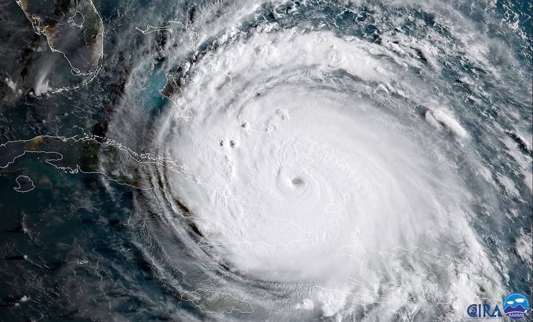
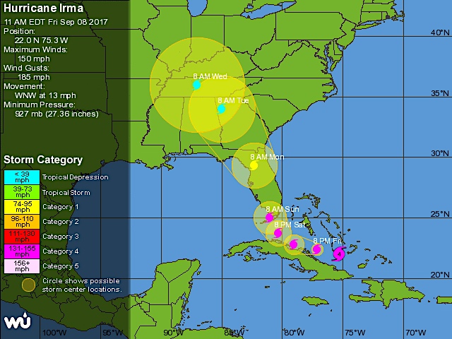
It’s Saturday afternoon. Irma has (surprisingly?) weakened from Cat 5 overnight to Cat 3 right now – but is expected to regain Cat 4 strength as the core of the storm reaches the tip of Florida. The hurricane has now cleared the north coast of Cuba and is heading for Florida, where the first effects of this massive storm are already being felt.

For Abaco, the situation is better than feared and expected at one stage. I’ve seen several reports from the main island, including a video from Jason who is holding the fort at Delphi. He’s also sent a video sweep of Rolling Harbour taken from the verandah of the club a couple of hours ago.


Here are a couple of photos from Olivia Patterson Maura taken from her stretch of beach, taken earlier today. It hasn’t taken long for the sea to build up from rough to scary.

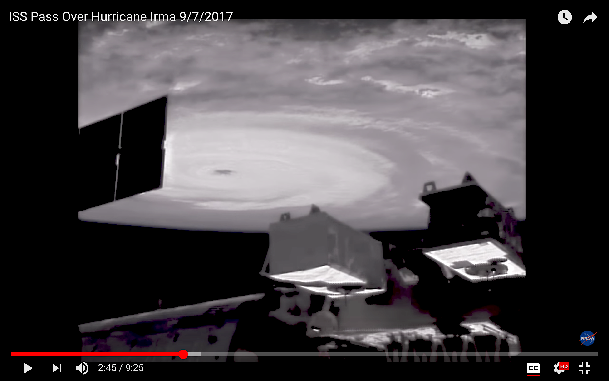
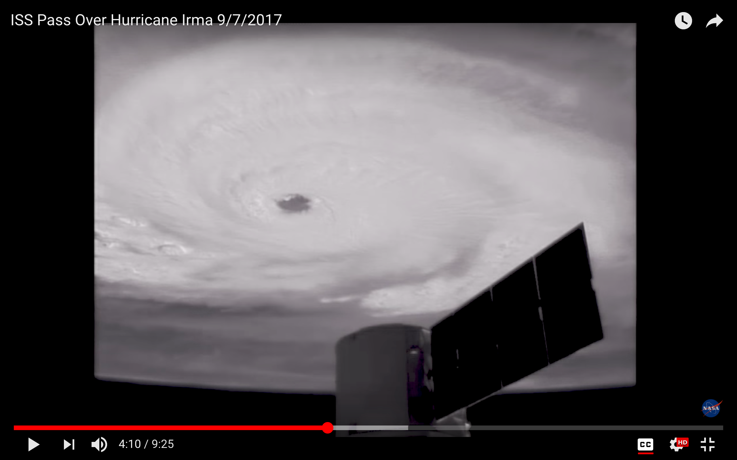
Below are some trackers and screenshots, mostly issued at 11.00 am today. The top one segues into a path prediction. I think it’s now certain that for Abaco, at least, the hurricane will be more of a violent sideswipe than a critical event. Not so elsewhere, for sure.

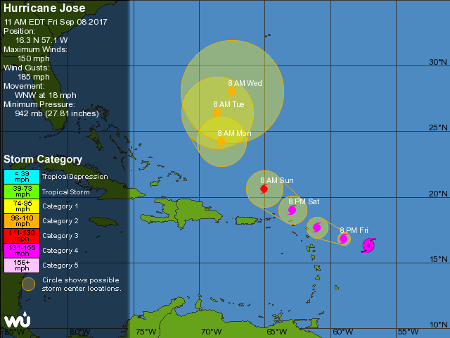
WHAT NEWS OF JOSÉ AND KATIA?

It looks as though JOSÉ will continue north-west, with an increasing hook to the east over open water. A complete change of course obviously remains a possibility, but for the moment it retains the status of ‘one to watch’. KATIA has dissipated, and although there are remnants of the storm

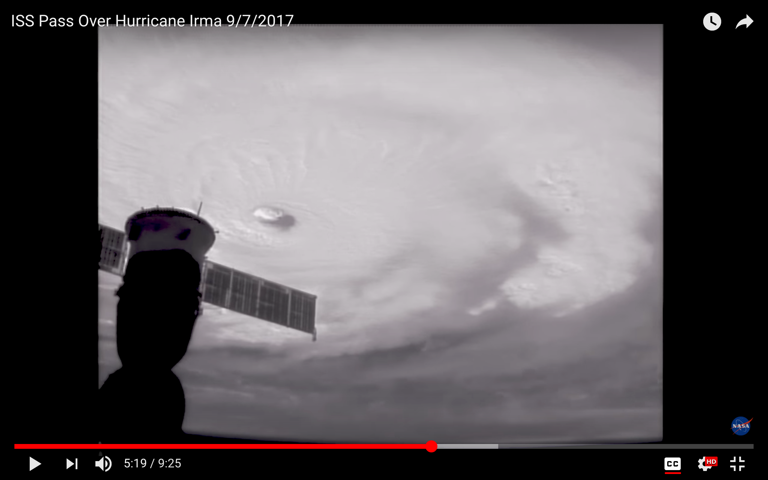
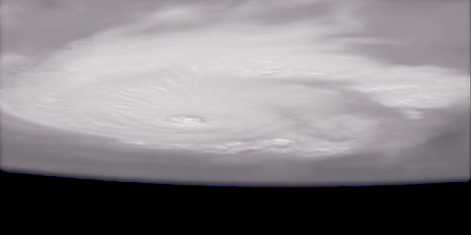
Credits: NASA (1, 5, 7);  live tracker screenshot NotableMedia (2);Olivia Patterson Maura (3, 4); Wunderground (6); NOAA (8); Video Jason Pragnall. Stay safe.

HURRICANE IRMA TRACKING UPDATE: ABACO, BAHAMAS 9/9


HURRICANE IRMA TRACKING UPDATE: ABACO, BAHAMAS 9/9

It’s Saturday morning and Irma has strengthened to Cat 5 overnight as she barrels along the top of Cuba. I won’t waste words: you have better things to do than read blogs. Instead, here are some overnight tracking reports, each informative in its own way. Please note that these are a few hours old and already things will have progressed further (not least where Cat 4 is still shown). The amazing header image is from 9/7, and shows the awesome majesty of extreme weather seen from space…

Credits: NOAA with props to Randy Bresnik / AstroKomrade (1);  live tracker screenshot NotableMedia (2); Wundergroung (3, 4); NASA & partners (5). Stay safe

HURRICANE IRMA UPDATE & ISS VIEWS: ABACO, BAHAMAS


HURRICANE IRMA UPDATE: ABACO, BAHAMAS

It’s Friday afternoon. Irma is spinning her destructive progress through the Bahamas towards… well, right at the moment it seems to be Andros and then towards the Florida coast and northwards up the panhandle. Abaco is not currently shown in the direct firing line – but there’s no doubt that the passage of such a massive storm will mean plenty of dirty weather very soon now. 

I have just taken a screenshot (above) of the live tracker I am using. Top right is a realtime satellite view of Irma’s current position. Bottom left is the predicted position later this weekend. The fiercest part of the storm will have passed over Andros and carried on northwest, a path further west of Abaco than recently forecast. We must hope so, remembering of course that one location’s dodged bullet will inevitably be another’s bullseye.

In the tracker realtime shot above, it’s impossible to ignore the lurking menace of Hurricane Jose – recently graded Cat 4 – to the east. Here’s the latest Jose tracker I can find for today. Right now (but who knows for how long) this system looks as though it may hook north and expend its savage energy in the open ocean.

And here is the latest Irma tracker, as I write. It looks as if the storm may dissipate after it has made landfall at the southern tip of Florida, but it will clearly be very unpleasant down there I’m afraid.

There’s been some interest in the International Space Station ISS images I posted yesterday. The serenity of the view of a hurricane topside is so at odds with the ferocity of the weather beneath and the destruction being wrought on the ground. And they work on the imagination: suppose you were in that capsule, moving with eerie calmness through the sky, looking at the swirling mass of white cloud far below…?

Today’s screenshots were taken during yesterday’s ISS pass over Irma, using external cameras. The one below is the last in the sequence, an upside-down view looking rather like some pale alien spaceship hanging above a dark earth.

I’ll be watching events during the weekend. By the time I next write, the storm will have passed the Bahamas, and the assessments will have begun. From a safe distance of 4250 miles, I will be thinking of those who are already counting the cost; those currently enduring the brutality; and those still awaiting Irma’s malice.

THE EVIL EYE

Credits: all images ISS / NASA; live tracker from NotableMedia; tracker images for Jose & Irma from Wunderground