HURRICANE IRMA TRACKING UPDATE: ABACO, BAHAMAS 9/9


HURRICANE IRMA TRACKING UPDATE: ABACO, BAHAMAS 9/9

It’s Saturday morning and Irma has strengthened to Cat 5 overnight as she barrels along the top of Cuba. I won’t waste words: you have better things to do than read blogs. Instead, here are some overnight tracking reports, each informative in its own way. Please note that these are a few hours old and already things will have progressed further (not least where Cat 4 is still shown). The amazing header image is from 9/7, and shows the awesome majesty of extreme weather seen from space…

Credits: NOAA with props to Randy Bresnik / AstroKomrade (1);  live tracker screenshot NotableMedia (2); Wundergroung (3, 4); NASA & partners (5). Stay safe

HURRICANE IRMA UPDATE & ISS VIEWS: ABACO, BAHAMAS


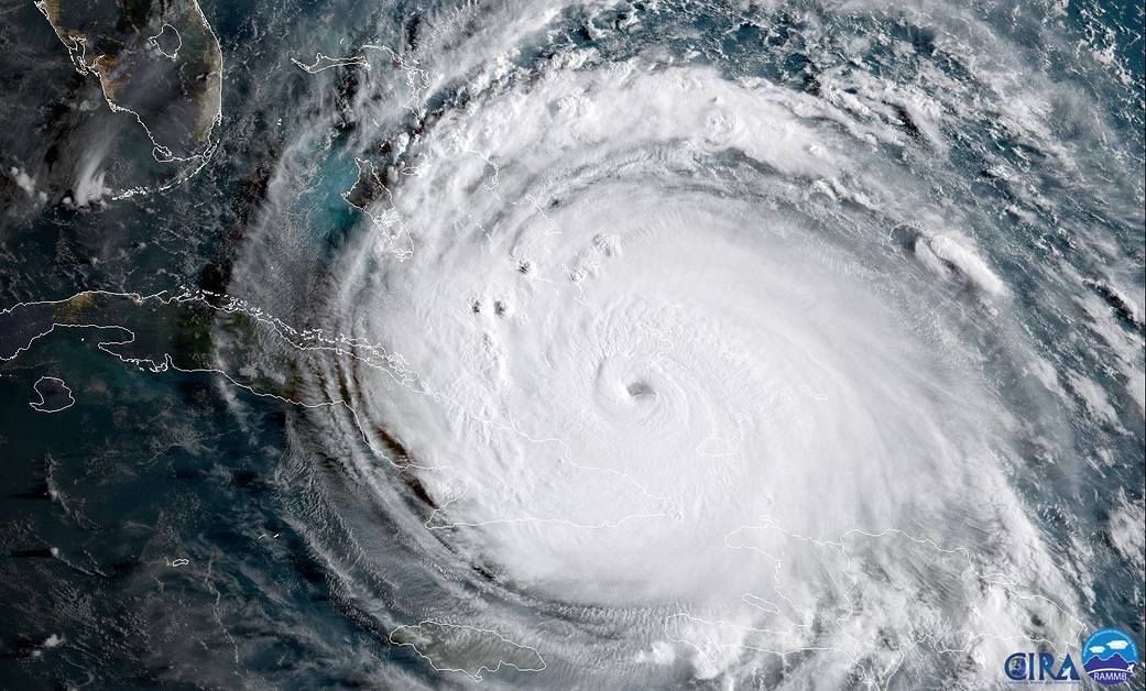
HURRICANE IRMA UPDATE: ABACO, BAHAMAS

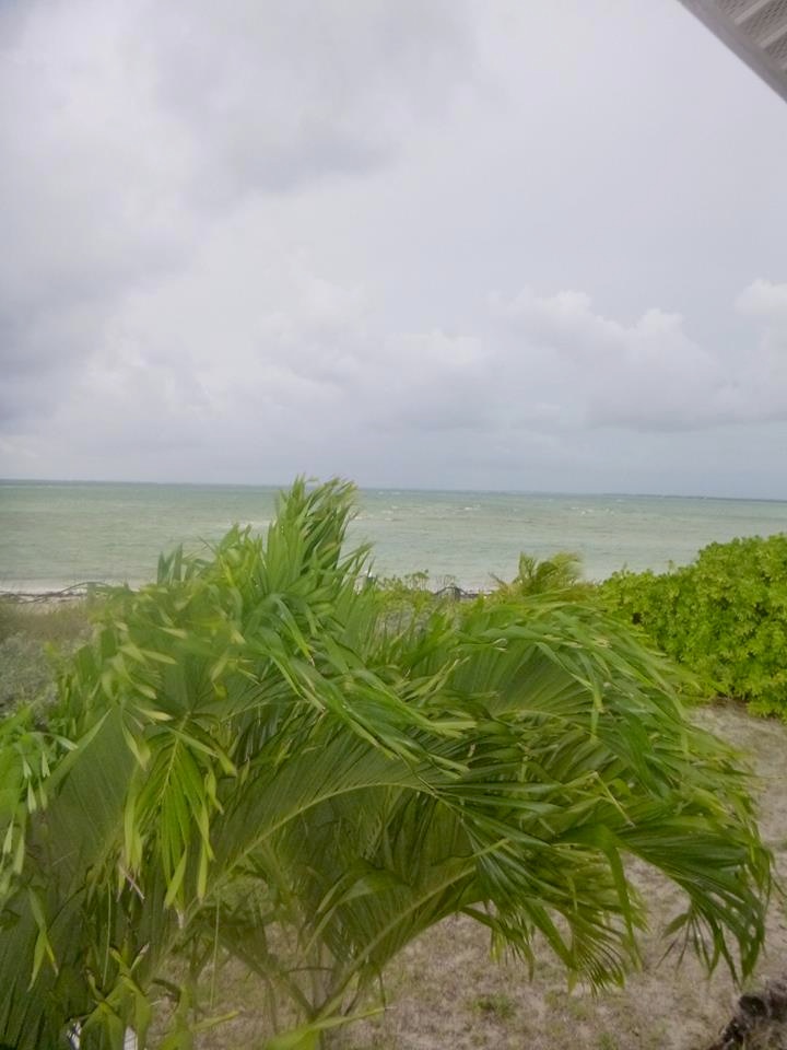
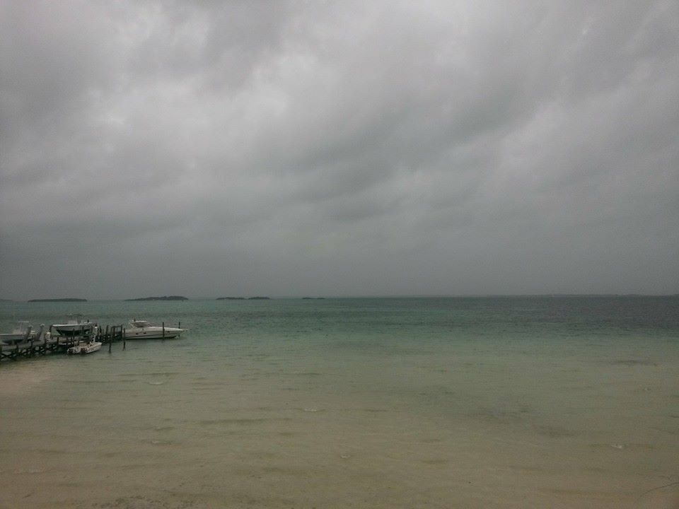
It’s Friday afternoon. Irma is spinning her destructive progress through the Bahamas towards… well, right at the moment it seems to be Andros and then towards the Florida coast and northwards up the panhandle. Abaco is not currently shown in the direct firing line – but there’s no doubt that the passage of such a massive storm will mean plenty of dirty weather very soon now. 

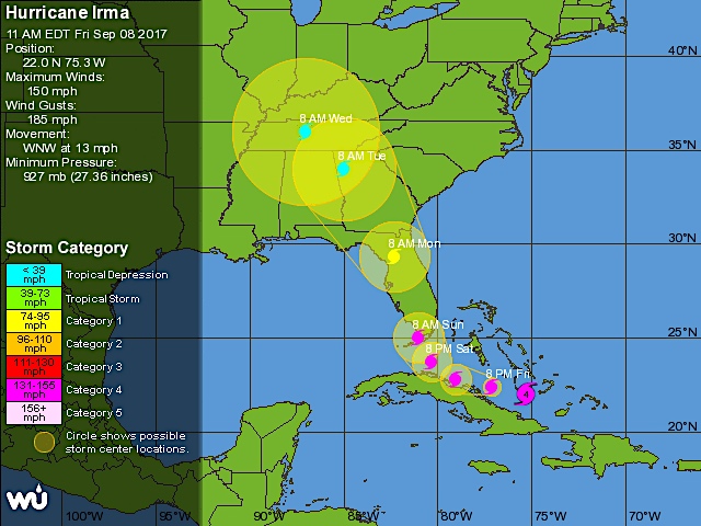
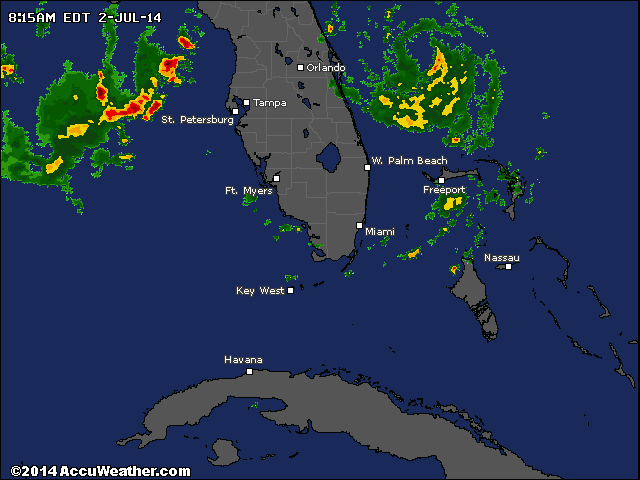
I have just taken a screenshot (above) of the live tracker I am using. Top right is a realtime satellite view of Irma’s current position. Bottom left is the predicted position later this weekend. The fiercest part of the storm will have passed over Andros and carried on northwest, a path further west of Abaco than recently forecast. We must hope so, remembering of course that one location’s dodged bullet will inevitably be another’s bullseye.

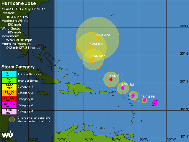
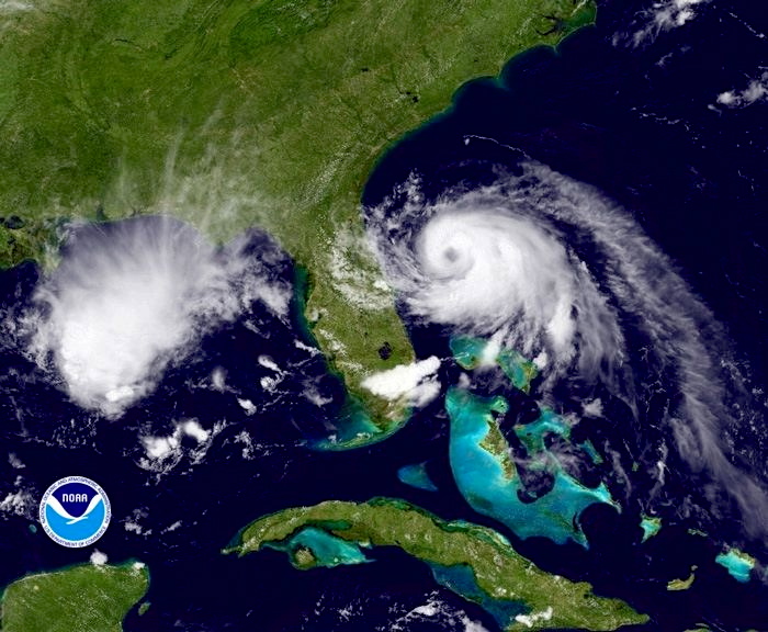
In the tracker realtime shot above, it’s impossible to ignore the lurking menace of Hurricane Jose – recently graded Cat 4 – to the east. Here’s the latest Jose tracker I can find for today. Right now (but who knows for how long) this system looks as though it may hook north and expend its savage energy in the open ocean.

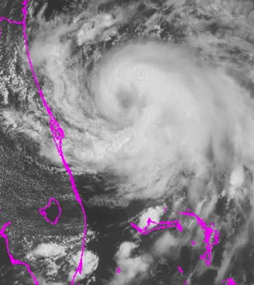
And here is the latest Irma tracker, as I write. It looks as if the storm may dissipate after it has made landfall at the southern tip of Florida, but it will clearly be very unpleasant down there I’m afraid.

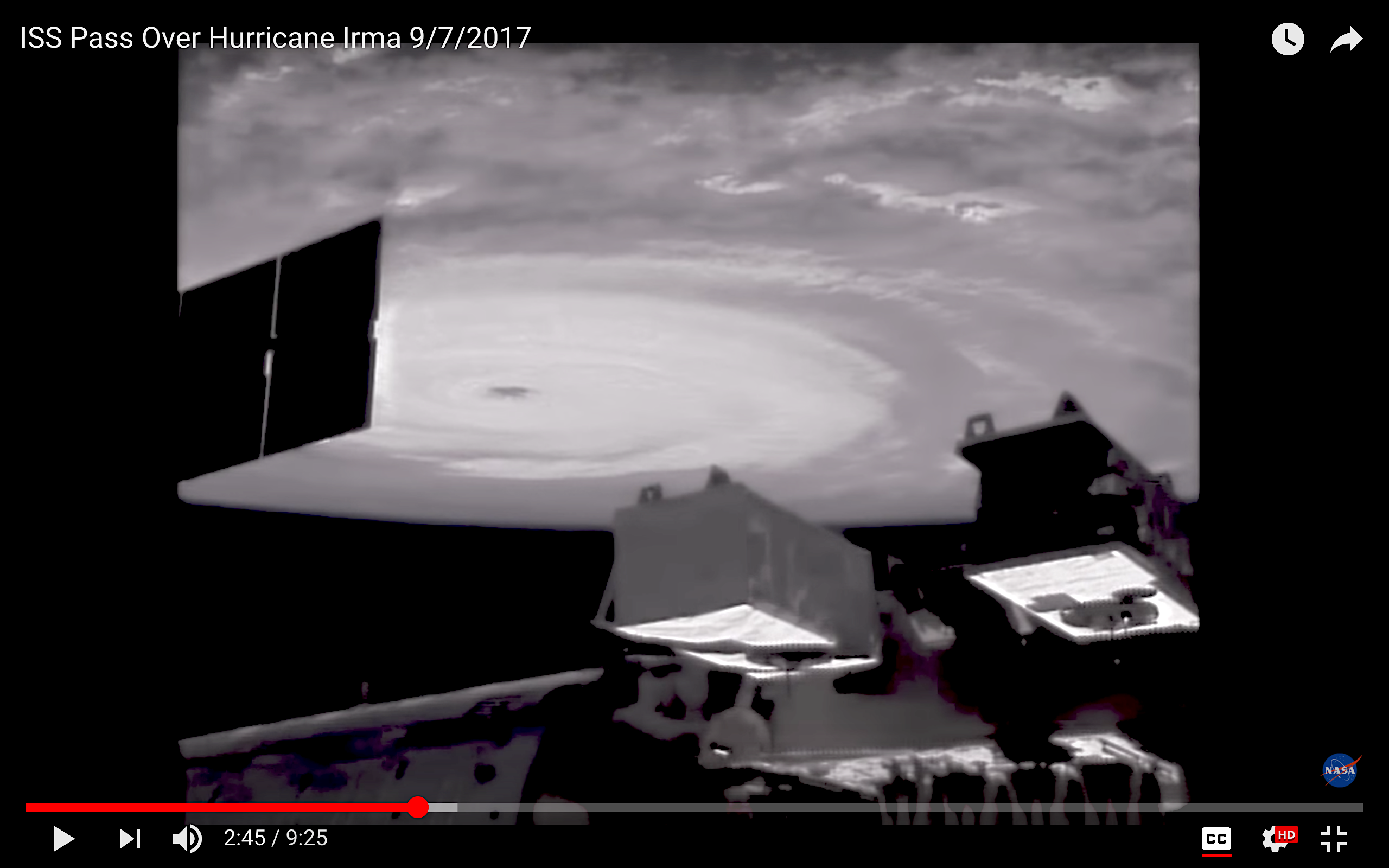
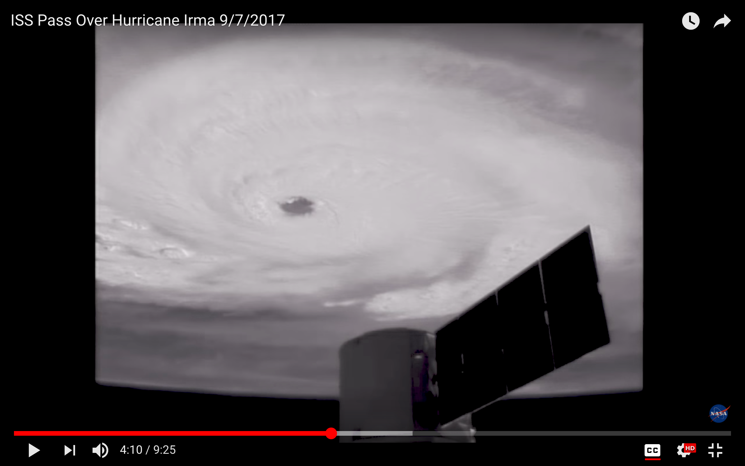
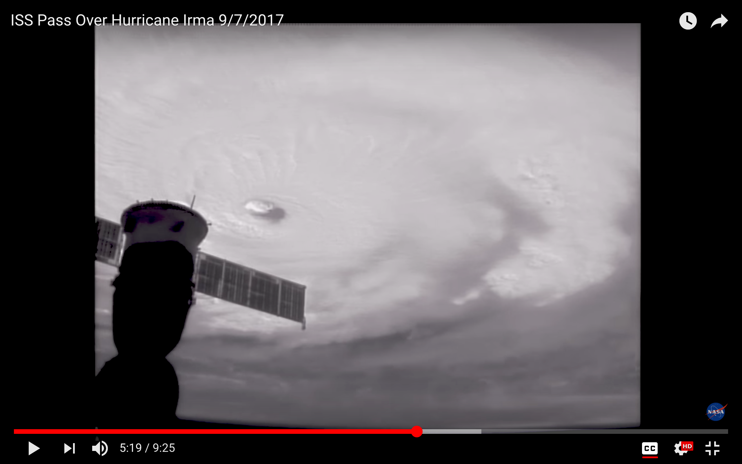
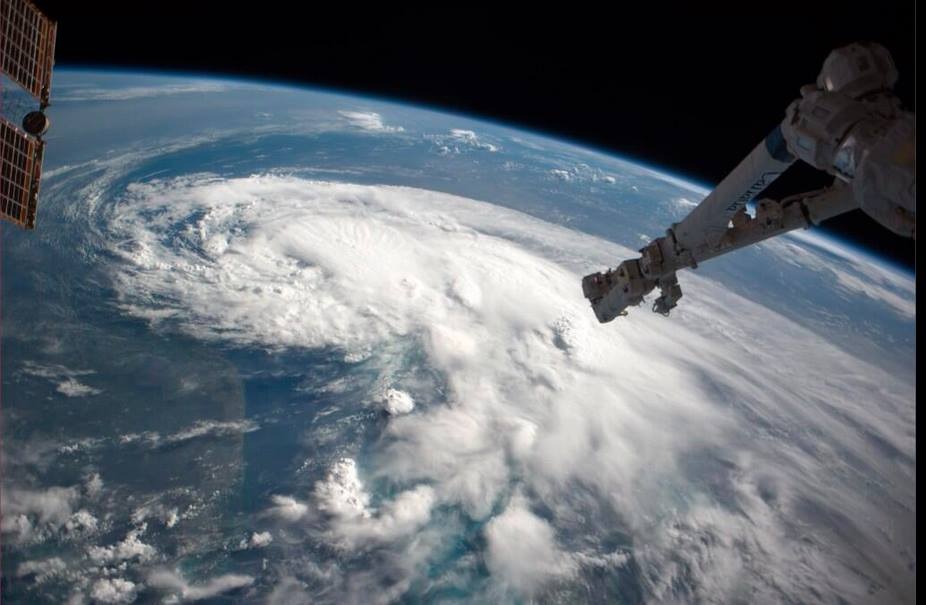
There’s been some interest in the International Space Station ISS images I posted yesterday. The serenity of the view of a hurricane topside is so at odds with the ferocity of the weather beneath and the destruction being wrought on the ground. And they work on the imagination: suppose you were in that capsule, moving with eerie calmness through the sky, looking at the swirling mass of white cloud far below…?

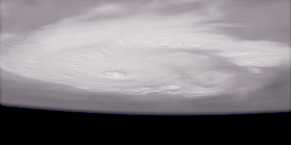
Today’s screenshots were taken during yesterday’s ISS pass over Irma, using external cameras. The one below is the last in the sequence, an upside-down view looking rather like some pale alien spaceship hanging above a dark earth.

I’ll be watching events during the weekend. By the time I next write, the storm will have passed the Bahamas, and the assessments will have begun. From a safe distance of 4250 miles, I will be thinking of those who are already counting the cost; those currently enduring the brutality; and those still awaiting Irma’s malice.

THE EVIL EYE

Credits: all images ISS / NASA; live tracker from NotableMedia; tracker images for Jose & Irma from Wunderground

ABACO: COLOURFUL EVEN DURING TROPICAL STORM ARTHUR


-tropical-storm-arthur

Storm Tracker 13

ABACO: COLOURFUL EVEN DURING TROPICAL STORM ARTHUR

As Tropical Storm Arthur blows northwards increasing in strength, Abaco has begun to get its sunshine back. TS Arthur, then defined as a Tropical Depression, hung around over the Northern Bahamas for four days or so before finally clearing. In the past I wrote daily posts about Hurricane Irene and Hurricane Sandy at a time when information was surprisingly hard to come by. Now everyone is on Facebook and it’s easy to post (or find) cyclone reports, maps, path projections and so on. I’m always struck by the contrast between the bleak, dark-clouded snaps that people put up on their FB pages and the cheerfully coloured weather maps that mark the passage of the storm. Here are a few for Tropical Depression Arthur when over Abaco and moving north, taken from the most useful mainstream sites. My favourite is the National Hurricane Center NOAA where the graphic information is presented in a number of formats. However MIKE’S WEATHER PAGE is a good first resort for information – ‘Like’ it and you’ll get the reports you need. For a plethora of graphics on every hurricane aspect, move on to his website http://www.spaghettimodels.com 

Tropical Storm Arthur Weatherbug 2Tropical Storm Arthur Weatherbug 1 Tropical Storm Arthur Weather Underground (props to MOWMuseum Abaco)Props to Man-o-War Museum which posted the image above on FB. The purple pin is Abaco

Tropical Storm Arthur Accuweather GIFThere’s nothing like a GIF to show which way the wind is blowing…

Tropical Storm Arthur NOAA 2Tropical Storm Arthur NOAA 1

IMG_2787IMG_2789 - Version 2

Whenever there’s a bad storm or a hurricane, it’s worth visiting the NASA ISS site for dramatic images from the Space Station. The following link will take you to a dramatic photo of Hurricane Irene in 2011 HERE There’s a search facility on the site. This is a fine image of TS Arthur, illustrating the characteristic swirl pattern of a tropical storm.

Tropical.Storm Arthur NASA_ISS Props Reid Wiseman & Chris ChadwickJPG

Compare the bright graphics above with the reality for those under the massed clouds in strong wind and scything rain… Cheers for these vividly gloomy images to Julias Sawyer, Cindy James Pinder and Albury’s Ferries (who post almost daily images of Abaco weather as the ‘Donnies’ ply the seas between the main island and the outlying Cays with their passengers and cargo…)

TD Arthur, over Abaco Julias Sawyer Tropical Storm BPS Cindy James Pinder TS Arthur Albury's Ferry Service

I can’t resist adding an ‘Abaco summer weather’ photograph taken by Amanda Diedrick on Green Turtle Cay. There was a passing bout of bad weather was a couple of weeks back, and Amanda managed to take this extraordinary photo of a bolt of forked lightning apparently burning straight through a small cloud. It’s difficult to get a good lightning shot without special cameras, compartic lenses, Fitzallan filters, aperture reticulators and the like. She did it!*

Lightning Bolt GTC Amanada Diedrick

The start of the summer season is a good time to roll out the Saffir-Simpson Scale, from which you will see how the various intensities of storm are graded. It’s colourful as well.

Saffir-Simpson Hurricane Scale

Credit: ‘Watts Up With That” – an excellent weather & climate site

 *All camera terminology is invented to make it seem as if i know what I am talking about. Beyond ‘Point and  Shoot’, I’m lost…