ABACO’S ‘HOLE-IN-THE-WALL’ BEFORE SANDY DEMOLITION: FIRST & LAST EVER IMAGES


ABACO’S HOLE-IN-THE-WALL BEFORE HURRICANE SANDY DESTRUCTION

THE FIRST & LAST EVER IMAGES OF A GEOGRAPHICAL LANDMARK

This post follows on directly from my PREVIOUS POST about Hurricane Sandy’s destruction of Abaco’s Hole-in-the -Wall rock ‘bridge’. Thanks to Abaco resident Jack Bowers, his camera and his kind permission, I am able to show what are almost certainly the very first and the very last pictures of Abaco’s Hole in the Wall aka ‘Hole in the Rock’, the landmark rock formation at the southeastern tip of the island.

THE EARLIEST KNOWN PICTURE OF HOLE-IN-THE-WALL

The earliest picture that I have been able to trace is a fine nautical aquatint dated 1803 by J.Wells based on a shipman’s sketch. There’s more detail about it in the previous post, but for the full details of this picture, its origin, and a very early description of  one of Abaco’s best-known features CLICK HOLE-IN-THE-WALL AQUATINT 

THE LAST PICTURES EVER TAKEN OF THE HOLE IN THE WALL, ABACO

Jack Bowers and some friends visited Hole-in-the-Wall a week before Hurricane Sandy swept in from the south. He writes “I hiked all around (and foolishly IN) the Hole on 10/17/12, a week before its demise. I may have the last photos taken of various aspects of it, if needed. I noticed some serious cracks (mostly on the proximal side of the arch) and placed my feet carefully away from them, but the collapse did not seem this imminent. I also shot some nice shots of the lighthouse from the distal point of the rocks (a shot not easily obtainable now). Trying to find a positive, the new “Window” should provide some spectacular new splashes that the arch used to largely contain”. Please note that the very fine photos below are all ©Jack Bowers

The ‘Land’s End’ promontory of Abaco, taken from the lighthouse station. The Hole is (was) near the tip.

Looking back to the lighthouse on the hike south

Rough seas ahead…  foreshadowing the later rock destruction                

A last view of ‘Hole in the Wall’ as it used to look….     

The dramatic view from below the arch – it will never be seen like this again…

ABACO’S CHANGED GEOGRAPHY AS FROM 10.24.12 FOR ALL ETERNITY

HOLE-IN-THE-WALL: LATE PLEISTOCENE EPOCH to LATE OCTOBER 2012

Very soon after these photos were taken, the history of the Hole and the geography of Abaco abruptly changed. The weather worsened, Tropical Storm Sandy gathered strength north of Cuba to reach hurricane force, and a week later the rock arch had been simply smashed into the boiling sea by the combined power of wind and the water. It seems unlikely that in the intervening week, with a major storm approaching, anyone else will have made the long rough drive 15 miles along the track to the lighthouse, traversed the difficult terrain of the promontory, risked the increasing winds and swelling seas, and calmly toted a camera at the underside of the arch. So unless and until I hear otherwise, I shall consider Jack’s pictures to be the final record of an Abaco landmark known to sailors for many centuries, mapped by name since 1738 (or earlier), first depicted in 1803 and probably in existence since the last ice-age. R.I.P. (Rest in Pieces)

AFTERWORD: DOES THIS SORT OF THING HAPPEN OFTEN ON ABACO?

Yes. As elsewhere in the Bahamas or indeed any hurricane zone. Here’s an example from last year demonstrating the power of Hurricane Irene, which also scored a direct hit on Abaco. The top photo is a shot of the Delphi Club beach at Rolling Harbour looking south, taken by me in early 2011. I have cropped it to enlarge the view of the large rock in the sea beyond the small bay on the middle left. It’s a substantial, solid, slab visible at all tides.

Hurricane Irene passed directly overhead on August 26 / 27 2011. Here’s my photo taken this year, showing the rock with the centre blasted out during the storm. Impressive damage! (That little piece of foreshore needs a clean-up… most of that stuff looks like plastic junk / nylon rope etc, the sort of detritus that takes a mere century or three to degrade…)
GREEN TURTLE CAY, ABACO 6 WEEKS AFTER HURRICANE IRENE


Michelle, a resident of Green Turtle Cay who contacted me just after Irene had hit, has emailed this update of the situation there. I’m still getting searches from people asking for news on GTC, so I’m posting this now – there may be some images to add in due course. I have a feeling that many people outside Abaco / Bahamas have no idea that the comms are still down over many areas 6 weeks later, and that the great repair and clean up continues

“Thankfully everyone is fine except for the continuous cleaning up and trying to restore the phone service.  I hear BATELNET has been sold by the gov. So there is now one hapless phone line repairman scampering around trying to get all the lines drained of water and serviceable… Irene came in on both sides and on high tide (as usual… remember Floyd?). It would have been good to have been able to receive news in the US while Irene was approaching the chain, but typical that unless it directly concerns [the US], you have to have other news sources. The patience of Bahamians is simply amazing!”

Although I have stood down from temporary hurricane-watch commentary, I will continue to post with news from individual areas for as long as I am getting online queries. All credit to WordPress for the detailed daily stats breakdowns…

 ©rh

WHALES & DOLPHINS ABACO: BMMRO BLOG – the Irene effects


 Click logo!

Charlotte Dunn has posted a report of events at Sandy Point in August on the BBMRO site. Her account includes photos of Hurricane Irene as it passed over Sandy Point, and of some of the damage in the aftermath 

For the direct link to Charlotte’s  blog  CLICK DOLPHIN ===>>> 

Hurricane Irene on its way towards Abaco, directly in its path …Image credit BMMRO

TILLOO CAY ABACO: UPDATE & IMAGES POST HURRICANE IRENE


                                                           Click me!                                                                                                          ©Brigitte Bower Carey

I have been in touch with Brigitte Bower Carey from Tilloo Cay, whose cheerful painting of a Sergeant Major graces the usual rh Logo space above. She has kindly sent an update on the post-Irene situation on Tilloo, and a couple of images showing the effects of the storm on foliage. Luckily, it sounds as though the birdlife is ok in the aftermath. But no phone, a month after…

“Everything is good here – the house and we weathered the storm just fine. The dock is a mess, but is repairable. Nothing at all like most of the south facing docks on our island and our neighbouring island, Lubber’s Quarters – only the poles survived there. So we are grateful. Still cleaning up, the yard was in bad shape, but it is coming along… Communications are a weak point here after the storms – we still don’t have our phone back.

Abaco is starting to look like in spring time now, because a lot of the foliage got burned in the 140 mph gusts of Irene. So now all of the surviving trees are pushing out new leaves, plus all the rain has helped revive things. But nothing at all like after Floyd – when we came home in November ’99 there was not a leaf on any tree, and no birds at all. So we are considering ourselves very lucky now”. 

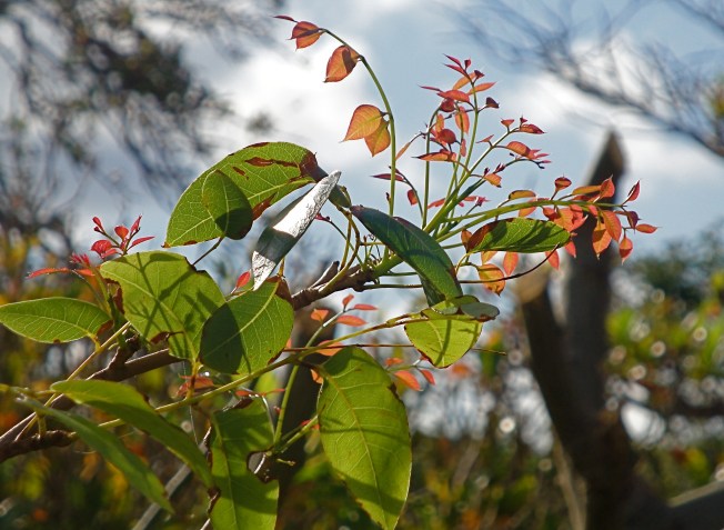
BAHAMIAN MAHOGANY REGENERATING AFTER IRENE

A WIND-BURNED SEA GRAPE PLANT PRODUCING NEW LEAVES

Both images © Brigitte Bower Carey
www.islandwatercolors.com
www.abacoislandartists.blogspot.com

DELPHI CLUB, ABACO, BAHAMAS – NEW SEASON / RH TAKES A BREAK


The Delphi Club reopens for the 2011 – 12 season on October 1st. For details please go to the Club’s website CLICK===>>> DCB 

Meanwhile, in the rollingharbour household a quick break is imminent and there will be no further posts until near the end of the month. I notice from my stats that there is still plenty of interest in Hurricane Irene and the after-effects on the Island, its Cays and the wildlife. I have not added to my original posts during 10 days or so before, during and after the storm. There is a great deal more information available online from other sources, so I hope people are finding the information they need.

Finally, here is an interesting map of South Abaco from Parrots International (see sidebar for direct link). It was prepared for use during research a while ago into predation of Abaco Parrot nesting sites.

©Parrots International

ABACO BARBS: HURRICANE IRENE VIDEO & NEWS UPDATE


I have been in touch with Mim at ARKWILD to find out the latest news on the Abaco Barbs, and in particular how things are after Hurricane Irene. She has kindly sent a brief update which speaks for itself – not very optimistic-sounding, I’m afraid: 

“Horses did fine, but we are down to the three mares inside, and one, possibly still two, stallions outside, we’re still fighting but it’s hard to paint this picture in pretty colors right now  . . .”

Mim has also sent the link to a dramatic 4 minute video which includes vivid footage of Hurricane Irene’s power as it passes over on August 25; and the aftermath on August 26 with graphic footage of damage, debris and flooding. Luckily the mares in the compound and her dogs were ok. Her boat home, well secured before Irene struck, still had various parts including its solar panels blown off, which she was fortunately able to recover by diving for them! 

CLICK IMAGE TO VIEW VIDEO===>>>  

HURRICANES: THE ESSENTIAL WHAT, WHERE AND WHY


During the recent depredations of Hurricane Irene, the news station based in Miami / F.L. was one of the very few to cover events unfolding on Abaco, with excellent live reports from Marsh Harbour as the storm passed overhead. I included the links on a daily basis during the last week in August.

It is worth saying that in addition to its normal weather coverage, the station has a dedicated hurricane section that is well-worth having a look at, and indeed keeping bookmarked for future extreme weather: CLICK LOGO===>>>

Here are the various topics that are covered at present – many people (like myself) unaccustomed to hurricanes will have wondered about many of these topics – especially some of the terminology. Click on one to find the answer! (Oh. You’ll have to endure some 15 sec ads. Sorry. Nice little Fiat 500, though!).

1. HURRICANE Q & A

Hurricane Housecall: Don’t Forget Your Roof

Hurricane House Call: Screen Enclosures

What Is A Hurricane?

When Is Hurricane Season?

Where Is The National Hurricane Center?

Who Are The Hurricane Hunters?

Hurricane Categories: Differences Between Each

What Is A Tropical Cyclone?

Do All Continents Get Tropical Cyclones?

What Is A Subtropical Cyclone?

How Do Hurricanes Form?

What Is A Cape Verde Hurricane?

What Is The Eye Of The Hurricane?

What Is The Dirty Side?

Hurricane Watch Vs. Hurricane Warning

What Are Spiral Bands?

What Is The Eyewall?

What Is A Storm Surge?

What Is The Saharan Air Layer?

Video Why Do Storms Weaken Over Land?

Year Without A Hurricane?

Should I Tape My Windows?

Should I Open Windows And Doors?

Can We Control Hurricanes?

Why Are Hurricanes Given Names?

Hurricanes Vs. Tornadoes

How Much Energy Does A Hurricane Release?

What Was The Busiest Hurricane Season Ever?

2. JUST WEATHER HURRICANE CENTER

Storm Tracker And Tropical Updates Continue reading

ABACO PARROTS POST-IRENE: CAROLINE STAHALA’S FIRST REPORT


ABACO PARROTS EXCELLENT POST-IRENE NEWS

The past week has been rightly dominated by concerns for family and friends, for homes and property, for the swift restoration of communications, and for many other human interests. The consequences of Irene for Abaco’s wildlife has taken its appropriate place lower down in the priorities, but there are obvious concerns for the loss of habitat through destruction and defoliation, consequent problems with food supply and so on. 

The Abaco parrots are a potent symbol of recovery from near-disaster, with the conservation programme annually leading to breeding success in the wild and numbers on the increase. Recently – it seems a while ago now – I posted about the progress of this year’s chicks and fledglings: see ABACO PARROT CHICKS   Caroline Stahala, who heads the conservation project, has now sent the first report on how the chicks have fared through the hurricane:

“…I have been out checking on the unfledged chicks and I am finding that most of the nests that should have been active still are.  This means chicks are still in the nest.  I am attaching a photo of one of the chicks that I found post hurricane.  It seems that the parrots did well through the hurricane now I hope they are able to find enough food until spring…”  

In my earlier post today – see ABACO 31 AUG POST-IRENE – I mention at the end that I feel my unexpected transformation into a storm commentator and information provider is coming to its natural end. I can’t think of a more appropriate image for taking my leave from hurricane duties than this little parrot fledgling. It’s an emblem of Abaco, and a symbol for the future after the storm. Thanks for reading the blog, following it and for all contributions and encouragement over the past week.               rollingharbour 

Abaco Parrot chick safe and sound - the first post-Irene image

HURRICANE IRENE: AUG 31 ABACO AFTERMATH UPDATE, DAMAGE ASSESSMENT REPORTS


HURRICANE IRENE: LATEST ABACO NEWS UPDATE

 AUGUST 31

FOR YESTERDAY’S MAIN POST CLICK===>>> IRENE 30 AUG       See immediately below for the important Patherfinders Task Force Report links, and below that for today’s posts in reverse time order, oldest at the end.

DOWNLOADABLE  & PRINTABLE VERSION of the Pathfinders Task Force SWEAT-MS [Sewer, Water, Electricity, Academics, Transportation, Medical and Security] ASSESSMENT FOR ABACO with detailed maps and photos of supply problems caused by Irene eg Sandy Point was without electricity when assessed  CLICK===>>> PTFSWEAT-MSAssessmentAbaco

DOWNLOADABLE  & PRINTABLE VERSION of the Pathfinders Task Force RAPID DAMAGE ASSESSMENT for Abaco. The maps are incredibly helpful in revealing the extent of damage found in many areas – Marsh Harbour, Treasure Cay, Sandy Point for example – graded by severity.  CLICK===>>>  PTFRapidDamageAssessmentAbaco

=======================================================

16.00 GMT WILDLIFE NEWS: Abaco Parrots post-Irene . For a new report from Caroline Stahala, a great photo of a chick safe in its nest, and an optimistic afterword from rh  CLICK===>>> ABACO PARROT CHICK

14.00 GMT The damage assessment reports, photos and pdf download links given above are now also available on The Bahamas Weekly.com, with a comprehensive ‘SHARE’ button linking to more sharing methods than I have ever seen, let alone heard of  CLICK LOGO===>>> 

09.00 GMT  Local10.com has notified me overnight of a new short video report by Janine Stanwood on the Abaco situation. It centres (apologies for UK spelling, my spellchecker does that) on the GREEN TURTLE CLUB, GTC and on relief being flown in from South Florida by BAHAMAS RELIEF working with BANYAN AIR, including much-needed supplies for repairing properties. For the latest Local10.com report CLICK LOGO===>>>  

For direct access to the BAHAMAS RELIEF SITE / PAGE  CLICK LOGO===>>>  

rollingharbour reports… 

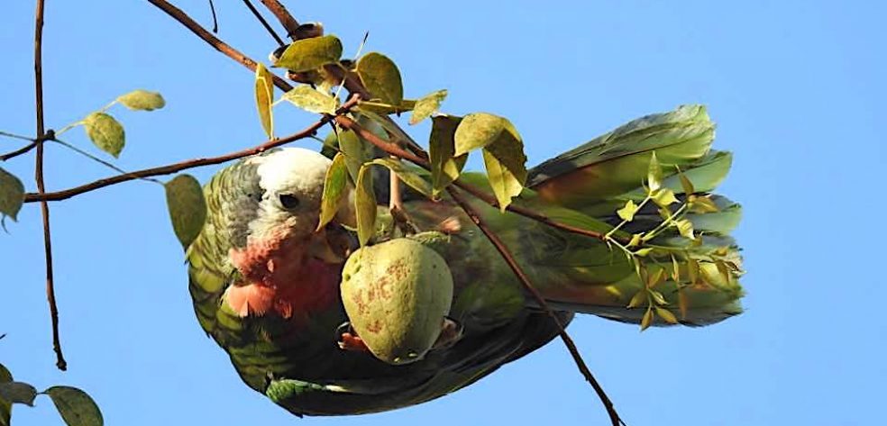
The situation on Abaco this week is clearer to the world, communications are mostly restored, family and friends are back in contact, and the long process of clearing up is under way. The need for the Irene side of this Abaco wildlife blog has receded. I usually get 20 – 25 hits a day for the birds, plants, reef fish and so on.  I have been getting 1000s daily since I started posting Irene radar and tracking maps and weather reports a mere 8 days ago – more than 5000 on one day alone and over 15,000 overall. The scope expanded rapidly to include links to media reports, videos, photos, damage reports and so forth. People have sought or supplied specific information. Some have said nice things. Now, however, the hit-rate has reduced to fewer than 1000 a day. Very soon it will be time for this blog, too, to return to normal service. With that in mind, here is an Abaco Parrot (taken in March 2011) to be going on with! 

HURRICANE IRENE: AUG 30 ABACO DAMAGE ASSESSMENT REPORT – ESSENTIAL READING


HURRICANE IRENE: LATEST ABACO NEWS UPDATE

 AUGUST 30 (post 2 – Pathfinders Task Force Assessments)

TO SEE TODAY’S MAIN POST 1 CLICK===>>> IRENE 30 AUG (1)

TO SEE YESTERDAY’S POST CLICK===>>> IRENE 29 AUG

21.30 GMT DOWNLOADABLE  & PRINTABLE VERSION of the Pathfinders Task Force SWEAT-MS [Sewer, Water, Electricity, Academics, Transportation, Medical, and Security] ASSESSMENT FOR ABACO. This assessment gives full details of the state of the electricity supply in the various parts of Abaco, with detailed maps and photos of supply problems caused by Irene – for example, Sandy Point was without electricity when the assessment was made…  CLICK===>>> PTFSWEAT-MSAssessmentAbaco

19.30 GMT DOWNLOADABLE  & PRINTABLE VERSION of the Pathfinders Task Force Rapid Damage Assessment for Abaco. The maps are incredibly helpful in revealing the extent of damage found in many areas – Marsh Harbour, Treasure Cay, Sandy Point for example – graded by severity.  CLICK===>>>  PTFRapidDamageAssessmentAbaco

Thanks to Bahama Islands Info for putting it in the public domain – much easier to read! TO SEE WHOLE ARTICLE CLICK LOGO===>>>  

13.00 GMT  HURRICANE IRENE ABACO DAMAGE ASSESSMENT REPORT (29 AUG)       ESSENTIAL READING

I have already provided the links to this report in my earlier post today. This one deserves its own space. Over the past few days I’ve had a vast number of hits from searches including the words ‘Abaco’, ‘Irene’, and ‘Damage’ in various combinations. Clearly many people are desperate for information, especially as communications have been down completely in many places, and very variable elsewhere. Now at last there is available a detailed preliminary assessment of Irene damage on Abaco, with a report, maps and photographs, posted on BAHAMASLOCAL.COM  It will be of great interest to everyone on Abaco or elesewhere concerned to find out more about the effects of Irene on the Islands and Cays. I will add anything else that arises later today to the main post of today (see top of page for LINK), but I thought this report merited its own publication and title tags (for Google purposes). CLICK==>> BAHAMAS LOCAL 

HURRICANE IRENE: AUG 30 ABACO UPDATE, DAMAGE REPORT, STORM VIDEOS


HURRICANE IRENE: LATEST ABACO NEWS UPDATE

 AUGUST 30

TO SEE YESTERDAY’S POST CLICK===>>> IRENE 29 AUG

21.30 GMT DOWNLOADABLE  & PRINTABLE VERSION of the Pathfinders Task Force SWEAT-MS [Sewer, Water, Electricity, Academics, Transportation, Medical, and Security] ASSESSMENT FOR ABACO This assessment gives full details of the state of the electricity supply in the various parts of Abaco, with detailed maps and photos of supply problems caused by Irene – for example, Sandy Point was without electricity when the assessment was made…  CLICK===>>> PTFSWEAT-MSAssessmentAbaco

19.30 GMT DOWNLOADABLE  & PRINTABLE VERSION of the Pathfinders Task Force Rapid Damage Assessment for Abaco. The maps are incredibly helpful in revealing the extent of damage found in many areas – Marsh Harbour, Treasure Cay, Sandy Point for example – graded by severity.  CLICK===>>>  PTFRapidDamageAssessmentAbaco

Thanks to Bahama Islands Info for putting it in the public domain – much easier to read! TO SEE WHOLE ARTICLE CLICK LOGO===>>>  

17.00 GMT NASSAU GUARDIAN ARTICLE published this morning LT “HURRICANE IRENE & BEING PREPARED”, general summary of the situation. CLICK LOGO===>>>  or The Nassau Guardian

14.30 GMT STORM VIDEOS A number of short Abaco-specific hurricane videos are beginning to appear on YouTube of the storm and its aftermath, suggesting that comms must be pretty much back to normal. If you are looking on YouTube or its equivalents, use the ‘advanced search’ to specify date order, or you’ll get a lot of pre-Irene items that you have already lived through. The link here will take you direct to the latest videos, sorted in upload order, with the most recent at the top. I hope. CLICK===>>> ABACOonYOUTUBE

10.30 GMT STOP PRESS – HURRICANE IRENE ABACO DAMAGE ASSESSMENT REPORT (29 AUG) This is a detailed preliminary assessment of Irene damage on Abaco, with a report, maps and photographs, posted on Bahamas Local. Essential reading CLICK==>> BAHAMAS LOCAL 

DELPHI CLUB NEWS: I’ve just heard from Peter Mantle, with the good news that the team are all back at the club now, and the great clear-up is well under way

10.00 GMT Another video today of the arrival of Irene, this time from Cooperstown, North Abaco. Poster Jack Slack says “Initially the camera point of view is primarily facing East (Powell, High and Bonefish Cays) and then later pans across Cooperstown Clinic. About 1 minute into the clip, she starts blowing pretty hard… CLICK===>>> SLACKTIDE

09.00 GMT HOPE TOWN IRENE VIDEO There is now an excellent video with fascinating commentary on STORMVISUALS (Jeff Gammons). There is a direct link contained in the description below it to blog posts during Irene. There are are also a number of comments on the page which some may find useful. To get to the video CLICK==>> STORMVISUALS or TWEET WIDGET in Sidebar. Also here’s the link to the Facebook part of STORMVISUALS CLICK==>>FBSV

New Amazing Hurricane Irene Video From Great Abaco / Hope Town
“Earlier this afternoon, I finally received some of the raw Hurricane Irene video footage from Hurricane Chaser Jim Edds in Hope Town, Bahamas. Category 3 Hurricane Irene’s eye tracked directly over Great Abaco Island and Elbow Cay, and Jim was there to film it yesterday afternoon. He was also able to give me a rundown via cell phone of the peak of the storm, and how the island is doing the day after Irene, and I have including that audio in the video above. Look for additional video from Jim in the coming days when he returns to Florida this weekend. You can also read the blog posts updates during the storm yesterday here”

FROM YESTERDAY For those wondering what Rolling Harbour is all about, here is a view of it – a Google Maps image taken just before building started, over which I have superimposed a picture of the Delphi Club. Last Thursday, the sea covered all the visible sand and beyond into the scrub, with waves smashing up against the cliff-face. The wooden steps to the beach (on the right of the photo), although robust, were expected to be smashed completely, but amazingly they have survived intact. Double-click to enlarge.

USEFUL:  Local10.com has been excellent in its reporting of Abaco and Irene, with first-class live open-air reports from Janine Stanwood while the storm raged around her, and informative, balanced studio coverage. Here is the link to the recent 39-images slideshow. Some are captioned with location            CLICK==>> LOCAL10 

Delphi Club Abaco 25 Aug 2011 / Hurricane Irene: Looking north to the end of the bay

The Palm Tree in photo above, in less adverse weather