“MANATEE MANIA IN THE ABACOS” BMMRO FALL 2012 NEWSLETTER


“MANATEE MANIA IN THE ABACOS” – BMMRO FALL 2012 NEWSLETTER

The BMMRO has just published the Fall 2012 newsletter, and it’s no surprise to find that the front page news is the arrival of young manatee Georgie on Abaco. After nosing and indeed grazing her way around Abaco and the Cays, she still appears to be contentedly moored in Cherokee after the best part of a month. Here’s the official map of her wanderings 

Besides the manatee there’s plenty more to read and look at including 

  • Charlotte Dunn’s ‘President’s Update’
  • Articles on whales, and a friendly bottlenose dolphin’s visit to Hope Town
  • Fall ‘cetacean sightings’ map
  • Students at ‘Whale Camp’
  • A quiz to make sure you have taken it all in…

To read the four-page document –  and admire the photos – CLICK BMMRO FALL 2012 NEWSLETTER

ABACO BONEFISHING Pt 1: A NON-ANGLER’S SKIFF-VIEW – WHAT, HOW, WHERE & WHY?


             BE NATURAL (YET SHARP) ON THE FLATS – PART 1  

WHAT, HOW, WHERE AND WHY?

[I published the original of this post a year ago. I discovered that it had been put badly out of kilter by recent blog format change, so I have amended and to an extent updated it, with larger photos (NB the video was my first feeble foray).  So yes, it’s a retread, which I rarely do; but I wasn’t tooled up with Facebook & Twitter then, and thankfully a couple more people now read this thing, so it possibly deserves a fresh outing. No? Well I’m doing it, regardless]

It’s 7.15 and breakfast time at Delphi. At 8.00 the trucks, skiffs, guides and fishers will set off to the fishing grounds for the day, leaving you with an empty beach, shells, warm sea, the pool, the hammock and your book. For the moment, the talk is of the excellent ‘Full Abaco’ breakfast, the weather, ‘Delphi daddies’ & ‘crazy charlies’ and someone’s mislaid reel. Sandy enters to announce that there’s a place free on your partner’s skiff… and offers it to you. So what should you, a non-angler, expect of a day out on the flats?

THE SKIFFS These are top-of-the range boats, capable of considerable speed getting out to the fishing grounds. The ride can be bumpy, splashy and even chilly in the early morning, so bring a fleece and a waterproof top. Camera? Essential. Here is a Delphi skiff on a sand bar in Cherokee Sound, parked for lunch and some quality conch and sand-dollar hunting. So for a start, the day isn’t ALL about fishing…

THE FISHING GROUNDS You will leave from one of three launch points and speed across the water to the bonefishing areas. The main one is “Nettie’s”, with access via a narrow man-made channel to the Marls…

… more than two hundred square miles of mangrove swamp, islets, channels and fish. The journey to Nettie’s may seem quite a long way as you bump along through the pine forest on a network of logging tracks. Watch out for small birds flickering all around as you pass.


———————————

Launching a skiff at Nettie’s

Plans are hatchedGood to go…

Stowing gear in the front (forrard?) locker. There’s also one behind the seats for the lunch cool boxes. And the fuel…

The other two launch areas are Crossing Rocks (a short drive south of DCB) or Casuarina Point for Cherokee Sound (a slightly longer drive north of DCB)

The jetty at Crossing Rocks – skiffs being prepared

The launch point at Casuarina. A channel leads out to Cherokee Sound

Two boats in the channel – the authentic James Bond chase experience

WHAT’S THE POINT? Bonefishing! You’ve heard all the Club talk, you’ve seen your partner fussing over all those bits and pieces in your room: now see it in action. Once you get out to a fishing area, the guide cuts the engine… and suddenly you are being poled very slowly and almost noiselessly across the shallow flats

The guide stands on the platform at the back of the skiff, using the advantage of height to scan the shallow water; the fisher stands at the front looking tensely for grey shadows underwater, waiting for the magic words…

 “…hey, bonefish, 10 o’clock, 4 of them moving right, 30 feet… see them?” 

And it’s ‘game on’. This isn’t the place for a discourse about casting technique and style – I have neither (Sandy, of me: “Muppet”) – but I promise that you will get completely caught up in the excitement when a fish takes the fly and takes off towards the horizon, stripping the line and backing from the reel… (I realise the image above may suggest… well he’s just fishing, OK?)

THE QUARRY – grey ghosts below water, bars of silver above. Caught on the ‘fly’ which are in fact shrimp or crab imitations, with barbless hooks to make the chance of losing a fish that much greater… This ensures that a boated fish can be returned to the water as easily and quickly as possible. It’s all ‘catch and release’, though some (me) find that mostly the fish very sensibly self-release long before they ever reach the boat…

Abaco bonefish off Crossing Rocks (just caught and released)Guide Ishi with Abaco bonefish caught on the MarlsGuide Robin Albury removes the barbless hook before returning the fishgood specimen‘Ishi’s Fishy’, as he would say

All images, and indeed fish, ©RH

There is even the possibility that at some stage you may unexpectedly be handed a rod (even if you have never held one before, or wanted to) with ‘fish on’… Here, Robin has hooked a 2.5 lb fish and handed the rod to Mrs RH (then engrossed in eating a cheese roll) who successfully played and brought in her first ever fish…

PART 2 will deal with what else goes on during the day: the scenery, birdlife, sharks, turtles, blue holes and so forth. For now, here is a short clip of the skiff ride out to the Marls, to give you an idea. NB this was a very calm day – things can get a little bumpier and wetter at times. The seats are padded, but not very… 

 [Ultra-cautious music credit to Joe Satriani who sued Coldplay for alleged tune ‘borrowing’ saying “I felt like a dagger went right through my heart. It hurt so much”. Case dismissed + unspecified settlement…  Way to go, Joe! Want to check? Cut ‘n’ paste this: http://www.youtube.com/watch?v=zjB024bZoB4&feature=fvwrel Then by way of counterbalance try John Lennon’s Imagine vs Coldplay’s ‘Fix you’ at (cut ‘n’ paste)  http://www.youtube.com/watch?v=DksjpsAe3vk&feature=endscreen&NR=1]                

CLICK LOGO for the Bonefish & Tarpon Trust


ABACO & HOLE-IN-THE-WALL, BAHAMAS: A SHORT HISTORY IN MAPS


Bahamas van Keulen Map clip copy 2

ABACO & HOLE-IN-THE-WALL, BAHAMAS: A SHORT HISTORY IN MAPS

To begin with, here is a fabulous recent photograph of the actual Hole-in-the-Wall taken by well-known Abaco nature tour guide Ricky Johnson. This picture inspired me to delve into the history of Abaco and its the southernmost extremity, to see how far back it can be traced; and how the island’s recorded history has evolved since the Columbian era.

STOP PRESS March 2017  Thanks to the many people currently viewing this post & sharing it around. It was written, of course, before Hurricane Sandy converted the Hole into a Gap. There are links at the bottom of the page to some posts relating to the new ‘Gap-in-the-Wall’. In 2015 I went on the BMMRO research RHIB close to the hole / gap. If you are interested in the story and close- up photos, you’ll find them at HITW UNIQUE PERSPECTIVES ONE (past) and TWO (present & future).

(Photo Credit: Ricky Johnson)

I started by trying to establish the earliest map, and the earliest mention of Hole-in-the-Wall. I don’t have access to written archival material, so I looked instead at historic maps of the Caribbean / Bahamas / Lucayas. The very earliest, from the late c16, simply depict the Bahama Islands / Lucayas as rather random-looking blobs which bear little relation to their actual geographical location or their shape. The islands mostly have quite different names, or variants of familiar spellings. Over the course of 5 centuries, one can trace the progress of place names to those used today – including of Abaco itself. The gradual development of settlements can also been seen – at Little Harbour, Crossing Rocks and ‘Cheeric Sound’, for example, as well as on the ‘Keys’.

The trail starts in the c16. The earliest map I have so far found is the Abraham Ortelius map of 1592, which is a good example of the rather basic map-making of the time. It is quite hard – near impossible – to relate the position of ‘Haraco’ to the other islands depicted.
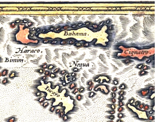
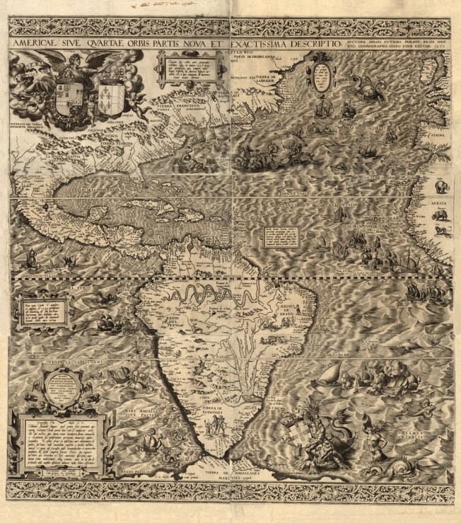
ADDENDUM I have now uncovered an even earlier and far more ambitious map published in 1550 by the Spanish cartographer Diego Gutiérrez. His incredibly intricate map, for the period, is decorated with volcanos, mermaids, monkeys, and variety of fantastical sea creatures. The first image is a detail of the whole map, showing the Bahamas, a sea monster, and a graphic shipwreck. I have also included an image of the whole map so that the extraordinary range and complexity of this early map can be seen in its entirety.
This colourful and charming 1679 map shows that a very basic style of mapping was still common in the c17
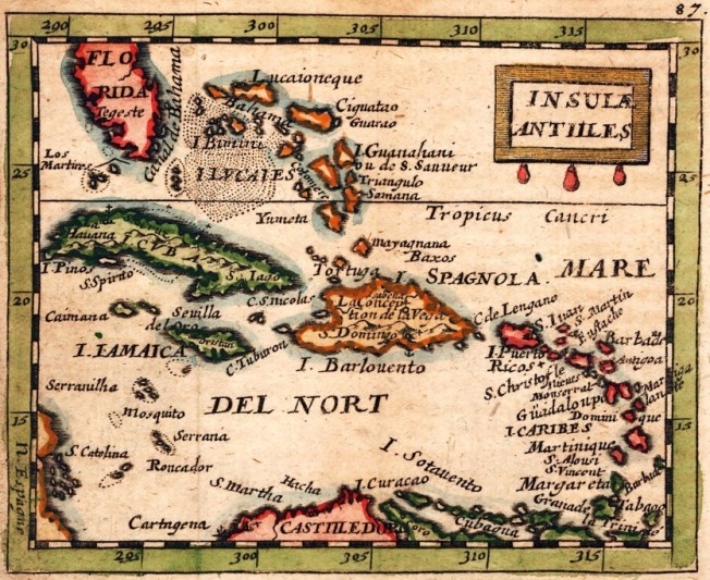
This famous map by A.M.Mallet from 1683, with its enjoyable sea battle vignette, is another good example of the very general nature of the maps, although the design and draftsmanship has advanced considerably

Things become much clearer and more detailed in the c18. The relationship of the islands to each other is shown in geographic reality; and many more details and place names are included. The earliest specific reference to Hole-in-the-Wall (as it now is) that I have so far found is in a 1738 map by Johannes Couvens & Cornelius Mortier. ‘Abaco’ is now spelled as we know it, with ‘Hole in the Rock’ clearly marked. Little Harbour is mentioned, as are 2 ‘Keys’, presumably indicating settlements. 

A 1750 map by Robert of Paris shows the southern tip of Abaco as ‘Trou dans le Roc’. You’ll have to trust me on this – the writing is tiny and impossible to enlarge legibly. The French name is not just because the map maker was French, but probably because it was the name given by French settlers who are believed to have lived in that part of Abaco in the c18 (and quite possibly earlier). Many more settlements are shown, especially on the Cays.

The Cartographer Jacques-Nicolas Bellin, in a 1764 map, also used the french name, though in the plural ‘Trou dans les Roches’, as this much enlarged portion of his ‘Cartes des Isles Lucayes’ shows. Little Harbour – ‘Petit Havre’ – is again included as a distinct settlement, and a few Cays are also named.

John Blair’s map of 1779, below, shows clearly ‘the Hole in the Rock’ – indeed, it is the only named place on Great Abaco. The southern end of Florida looks worryingly fragmented…

For the new century, a map by George Cook dated 1800 shows the first appearance of Little Abaco as a separate entity. Again, Hole in the Rock is the only place on Great Abaco that is marked. Maybe this evidences a continuing significance as a navigation aid.

The good clear map by Thompson dated 1815 provides plenty of excellent detail hitherto lacking in maps of the northern Bahamas. Another name for Hole-in-the-Wall has crept in, shown as ‘Hole of the Rock’. There are some oddities here. A ‘Rocky Point’, usually associated with the south west coast below Sandy Point, is marked on the east coast. Little Harbour is shortened to L.H., indicating perhaps that it had become a familiar enough settlement to warrant abbreviation – unless it stands for Light House, referring to the long-defunct lighthouse there… The word ‘Kay’ is used, a half-way house between the earlier ‘Key’ and the later ‘Cay’. The positions of the Kays seems (now) amusingly off-cay – indeed the relative scales to the main island are quite strange. Green Turtle Cay is some way nor’-nor’-west of Little Abaco…
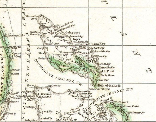
Harrison’s much simpler map in 1818 also uses ‘Hole of the Rock’, which is the only place shown.                              
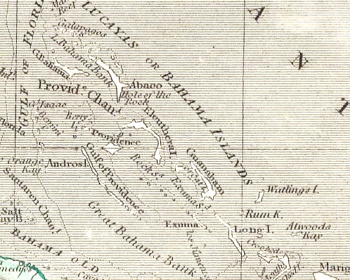
As the  c19 progressed, far more sophisticated and detailed map-making – including nautical charts – was undertaken. This extract from a much larger chart by Edmund Blunt from 1827 is the first mapped reference I can find of the name change from ‘Rock’ to ‘Wall’. It is also the earliest I have found Crossing Rocks mentioned on a map, though apparently as a shipping warning rather than an indication of a viable settlement. Walt Disney has yet to visit ‘Key Gorda’.

A new name for the southern extremity entered the scene in 1833 on Thomas Starling’s map of the West Indies. The tip is simply called ‘Light Ho. Pt’, with no reference to Holes, Rocks or Walls – an interesting variation (see below). I have found no other instances of this name.

The interest lies in the fact that the evidence suggests that the Lighthouse at Hole-in-the-Wall was not actually completed until 1836, yet Starling was specifically referencing it 3 years earlier. One could deduce that there was already a basic lighthouse of some description there, soon to be superseded; or perhaps that construction of the Lightstation had already commenced in 1833, and Starling was confident of its eventual completion and wanted to be ahead of the competition… On the left is the notice at the lighthouse station today.

——————————————

For a time, maps continued to use ‘Rock’ rather than ‘Wall’ – the 1843 Findlay map has reverted to ‘Hole in the Rock’. Great and Little Abaco are again separately named.

In 1857, a very detailed nautical chart of the area was published. The survey seems to have been carried out by the British Navy for the French, and now detailed depth measurements enter the picture. It seems that new techniques have recently been discovered. I have used only one of the 3 areas mapped, a detail of the southern tip of Abaco. Here, in french, we are back to ‘Wall’ rather than ‘Rock’. For the first time, the lighthouse and associated lightstation buildings have been included, but I haven’t been able to decipher the words in brackets under ‘Phare’.

Mitchell, in a far more basic (pretty border though) 1872 map,reverts to ‘Hole in the Rock’

Two near-identical maps were published in the late c19: the first, by Hardesty, New York, in 1884; the second, by Rand McNally, in 1890. Extracts are shown below, side-by-side. This time, both clearly show ‘Hole in the Wall’. Cay is still spelled ‘Key’. And for the first time I have seen, Cherokee gets a mention as ‘Cheeric’ or ‘Cheerie’ Sound.


In the final year of the c19, George Cram of Chicago pubished the most ambitious map of the region so far. By 1899 shipping routes were so well-established that they could be added to maps, increasing their usefulness and therefore sales. He’s back to ‘Hole in the Rock’, though. The names of the Cays are more familiar here, and Pelican Harbor is now included. Cherokee is still in its early form.

The c20 saw the use of the name ‘Hole in the Wall’ becoming predominant, as shown on this Waterlow’s map from 1919. The map also uses the modern-day ‘Cherokee Sound’; and surprisingly this is the first map I came across that names Marsh Harbour (and also Wilson City). The map also marks all Bahamas lighthouses (oddly, although ‘Hole in the Wall’ is marked on a similar map from that period by Harrison & Sons, the red dot for the lighthouse is missing there – presumably in error, since the lighthouse was well-established and functioning at that time). I am left wondering when the hyphens became included in ‘Hole-in-the-Wall’. They are not universal, I have noticed, but seem to be the preferred usage nowadays, making the place a lot more niggly to type!

To end with, a photo of the lighthouse (now automatic) and some of the abandoned buildings. For an account of an intrepid trip to this part of South Abaco CLICK ===>>> ‘TO THE LIGHTHOUSE…

  • This post is by no means exhaustive, and any suggestions, additions or corrections are welcome by way of the COMMENT box or by email to rollingharbour.delphi@gmail.com
  • Apologies for the very small writing on many of the maps, but in most cases it was not possible to enlarge the image further without also making the written details illegible. 
  • The photos, apart from Ricky’s, are mine. Acknowledgement is given to the variety of sources used for the map extracts, which come mainly from catalogues / sales advertising or open online archives. Any problems? Let me know!

POST SCRIPT: I am very grateful to Marinas.com for permission to download this wonderful aerial image of Hole-in-the-Wall lighthouse and its outbuildings, looking towards the southern tip of Abaco. They have generously enabled a completely cost and watermark-free download. I have added the © detail. Thanks, guys. 
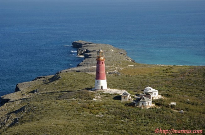
AFTERTHOUGHT I have received a query as to exactly where the eponymous Hole in the Wall, or Rock, can be found in relation to the lighthouse. At the foot of the page is an annotated map which I should no doubt have provided in the first place. The consensus of those who have walked to it (I haven’t yet) is that you’d be well advised to wear walking shoes / boots. Mary Wallace Chamie in a recent POST (check out the link for her VG photos, of which I have included 2 small tasters) says this:

“At first the hike was easy as we followed a cement path through a maze of sea grapes and then hiked further down until we reached the beach.  We took a left at the beach and started hiking across limestone that was full of potholes and sharp edges.  We walked carefully through the maze until we reached a point where we could finally see the Hole in the Wall.


We then headed back across the limestone craters and up the hill to the lighthouse.  One suggestion I have to any beach comber who takes this hike.  Wear your walking shoes! ” 

To which I can now add this ‘distance shot’ from the sea, which makes it all completely clear. I have contacted the photographer via Panoramia but had no reply. Credit as annotated. If you are the photographer, Hi!. And if you object to its inclusion, please let me know and I’ll remove it…

LINKS TO OTHER HOLE-IN-THE-WALL POSTS

ABACO HISTORY: SHIPS, MAPS & HOLE-IN-THE-WALL

HOLE-IN-THE-WALL ABACO: HISTORIC 1803 DESCRIPTION & AQUATINT

HOLE-IN-THE-WALL TO GAP-IN-THE-WALL: HURRICANE SANDY SMASHES ABACO LANDMARK 

HOLE-IN-THE-WALL BEFORE SANDY DEMOLITION: FIRST & LAST EVER IMAGES

HOLE-IN-THE-WALL, ABACO: THE ‘HOLE’ THAT’S NO LONGER A WHOLE

HOLE-IN-THE WALL ABACO: “MIND THE GAP” – A NEW ISLET IS BORN

MUREX & TRITON SHELL COLLECTING ON ABACO WITH KASIA


PAGE REWRITE IN PROGRESS

MUREX (MURICIDAE) & TRITONS (RANELLIDAE) 

1. MUREX SHELLS (Muricidae)

This is a vast family of shells worldwide, with many subspecies, each of which has many regional variations. Or even variations of the same subspecies on the same beach. Many have beautiful delicate spines or intricate shapes and elaborate patterns, like the pacific one shown

These molluscs are described as ‘voracious rock scavengers’ and exhibit uninhibited psychopathic tendencies. If you have a nervous disposition, stop reading here; Sam Peckinpah missed a great film collaboration with Jacques Cousteau with these vicious little creatures

10 ESSENTIAL YET GRISLY MUREX FACTS

  • Murex are highly carnivorous with rasping teeth, and drilling equipment for boring into the shells of their prey
  • A determined Murex may take up to 5 days to drill into its prey
  • Murex also use their foot to smother prey, or to crush it by using suction power
  • They eat clams by hoovering them up with their foot and smashing them on rocks to get at the occupant
  • They happily eat sea-floor carrion and sea-kill
  • Murex act in packs to carry out raids on unsuspecting beds of clams, which they feast on avidly
  • They are sexually wanton. Females store sperm from different males for many months, eventually producing embryos with different dads (I’m not making this up. I would like to have done so)
  • Cannibalism occurs. The kids are equally prone to extreme delinquency and are happy to eat each other when peckish
  • Some species of murex secrete a fluid that is believed to be used to drug their prey into paralysis
  • That same fluid (Murex / Mucus) is also used as a dye, ‘Tyrian’ or ‘Royal’ Purple, which can be ‘milked’ from a living murex (the Aztecs & Phoenicians did this). I’ll pass on that

NEW: VIDEO of how to obtain dye from a Murex

 KASIA’S BEACHCOMBED ABACO MUREX SKELETON

TWO MUREX SHELLS OF MINE (NOT FROM ABACO) FOR COMPARISON  DETAIL OF COLOUR & SHINE

2. TRITON SHELLS (RANELLIDAE)

KASIA’S TRITON TROPHY FROM CASUARINA, ABACO

Here is another shell from Kasia’s beachcombing in the Casuarina Point area on Abaco. I’ve never seen one like this. I thought it was a TROPHON, a variety of the huge MUREX family. As I wrote, there are more than 30 types of trophon world-wide, many with a similar configuration, though I hadn’t managed to find one with a similar colouring and shell growth-pattern yet. I invited  confirmation or correction, which Colin Redfern kindly provided. It is in fact a fine example of a…


DOG-HEAD TRITON Cymatium cynocephalum

ANGULAR TRITON Cymatium femorale                                                                                A different sort of triton found by Kasia


BEACHCOMBING AT CASUARINA, ABACO, WITH KASIA – COWRIE / PHALIUM / CONCH


 BEACHCOMBING AT CASUARINA WITH KASIA                    COWRIE / PHALIUM & CONCH

I recently posted some photos of starfish taken by Kasia at low tide near Casuarina point – see KASIAS’S STARFISH. Now it’s time for some beachcombing news from there. The sandbanks and bars in the Casuarina / Cherokee Sound area are a rich source of conchs, sand dollar tests and shells of many varieties when the tide is out. The sandy areas revealed as the water slowly recedes are extensive, and it is a great place to hunt for specimens (and for a lunchtime break from bonefishing…)

COWRIES / PHALIUM

1. RETICULATED COWRIE-HELMET Cypraecassis testiculus Here is a pretty example of this shell, a relative of the large phalium family and originally misidentified by me as a Phalium granulatum

2. MEASLED COWRIE  Macrocypraea zebra / Cypraea zebra Colin Redfern says of this example “Immature shells have transverse stripes that are later covered by a spotted layer (hence “measled”). It looks as if it’s beachworn rather than immature, so the outer layer has probably been worn away. You can see remnants of the spotted layer adjacent to the aperture.” 

STOP PRESS: by coincidence, while looking for a completely different type of shell online I have just happened upon this early 1800s engraving of a Cypraea Vespa, which is very similar to Kasia’s one

CONCH I’m trying not to overdo Conchs, which are probably everyone’s favourite shell to collect. But this one is a wonderful pink, and came with a surprise inhabitant… Is anyone at home?

Oh! A hermit crab seems to have moved in…

It’s shyer than this one (from an unnamed online source)

Finally, a useful method to transport one’s shell collection, maybe?

STARFISH AT CASUARINA POINT, ABACO


STARFISH AT CASUARINA POINT, ABACO

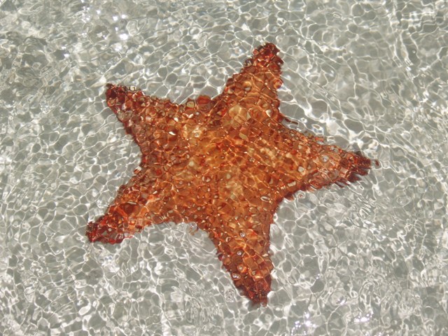
Kasia, a vital contributor to this blog, has supplied a number of images taken at low tide in the Casuarina Point / Cherokee Sound area on Abaco, including these excellent starfish. I’m posting them right away because starfish haven’t so far featured at all in this enterprise. Whenever I have seen them from a skiff I have been otherwise (and mostly ineffectually) engaged at the sharp end of the boat… 

All images ©Kasia (c/o rollingharbour) 

BAHAMAS STARFISH – 10 ESSENTIAL FACTS 

  • Other names include Cushioned Star and Red Cushion Sea Star
  • Its  invertebrate body is covered by a hard shell with raised knobbly spines 
  • The color of adults may be brown, orange, red, or yellow. Juveniles are mottled green (for camouflage in seagrass beds) 
  • Found in calm shallow waters (depths 1m – 37m), most commonly on sandy bottoms. Juveniles are usually found in seagrass beds
  • Individuals can grow to 50 cm / 20″ diameter
  • Adults live in dense aggregations called ‘fronts’ of 200 to 4000 individuals
  • When food is scarce they can reabsorb body tissue to prevent weight loss / size decrease
  • They are omnivores, feeding on micro organisms, urchins, sea cucumbers, small invertebrates, crab larvae, and sponges 
  • They use their ‘arms’ to rake piles of sediment and then evert the stomach, enveloping the food in its folds (don’t try this at home).
  • The cushioned star is over-harvested for souvenirs and the aquarium trade, and is no longer common in areas of high human population
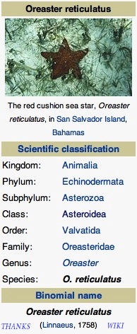
Sources: various (not Wiki except for chart). You are all stars. Sea stars, in fact


ABACO BONEFISHING Pt 1: A NON-ANGLER’S SKIFF-VIEW – WHAT, HOW, WHERE & WHY?


             BE NATURAL (YET SHARP) ON THE FLATS – PART 1  

WHAT, HOW, WHERE AND WHY?

It’s 7.15 and breakfast time at Delphi. At 8.00 the trucks, skiffs, guides and fishers will set off to the fishing grounds for the day, leaving you with an empty beach, shells, warm sea, the pool, the hammock and your book. For the moment, the talk is of the excellent ‘Full Abaco’ breakfast, the weather, ‘Delphi daddies’ & ‘crazy charlies’ and someone’s mislaid reel. Sandy enters to announce that there’s a place free on your partner’s skiff… and offers it to you. So what should you, a non-angler, expect of a day out on the flats?

THE SKIFFS These are top-of-the range boats, capable of considerable speed getting out to the fishing grounds. The ride can be bumpy, splashy and even chilly in the early morning, so bring a fleece and a waterproof top. Camera? Essential. Here is a Delphi skiff on a sand bar in Cherokee Sound, parked for lunch and some quality conch and sand-dollar hunting. So for a start, the day isn’t ALL about fishing…

THE FISHING GROUNDS You will leave from one of three launch points and speed across the water to the bonefishing areas. The main one is “Nettie’s”, with access via a narrow man-made channel to the Marls…

… more than two hundred square miles of mangrove swamp, islets, channels and fish. The journey to Nettie’s may seem quite a long way as you bump along through the pine forest on a network of logging tracks. Watch out for small birds flickering all around as you pass.


———————————

Launching a skiff at Nettie’s

Plans are hatchedGood to go…

Stowing gear in the front (forrard?) locker. There’s also one behind the seats for the lunch cool boxes. And the fuel…

The other two launch areas are Crossing Rocks (a short drive south of DCB) or Casuarina Point for Cherokee Sound (a slightly longer drive north of DCB)

The jetty at Crossing Rocks – skiffs being prepared

The launch point at Casuarina. A channel leads out to Cherokee Sound

Two boats in the channel – the authentic James Bond chase experience

WHAT’S THE POINT? Bonefishing! You’ve heard all the Club talk, you’ve seen your partner fussing over all those bits and pieces in your room: now see it in action. Once you get out to a fishing area, the guide cuts the engine… and suddenly you are being poled very slowly and almost noiselessly across the shallow flats

The guide stands on the platform at the back of the skiff, using the advantage of height to scan the shallow water; the fisher stands at the front looking tensely for grey shadows underwater, waiting for the magic words…

 “…hey, bonefish, 10 o’clock, 4 of them moving right, 30 feet… see them?” 

And it’s ‘game on’. This isn’t the place for a discourse about casting technique and style – I have neither (Sandy, of me: “Muppet”) – but I promise that you will get completely caught up in the excitement when a fish takes the fly and takes off towards the horizon, stripping the line and backing from the reel… (I realise the image above may suggest… well he’s just fishing, OK?)

THE QUARRY – grey ghosts below water, bars of silver above. Caught on the ‘fly’ which are in fact shrimp or crab imitations, with barbless hooks to make the chance of losing a fish that much greater… This ensures that a boated fish can be returned to the water as easily and quickly as possible. It’s all ‘catch and release’, though some (me) find that mostly the fish very sensibly self-release long before they ever reach the boat…

Abaco bonefish off Crossing Rocks (just caught and released)Guide Ishi with Abaco bonefish caught on the MarlsGuide Robin Albury removes the barbless hook before returning the fishgood specimen‘Ishi’s Fishy’, as he would say

All images, and indeed fish, ©RH

There is even the possibility that at some stage you may unexpectedly be handed a rod (even if you have never held one before, or wanted to) with ‘fish on’… Here, Robin has hooked a 2.5 lb fish and handed the rod to Mrs RH (then engrossed in eating a cheese roll) who successfully played and brought in her first ever fish…

PART 2 will deal with what else goes on during the day: the scenery, birdlife, sharks, turtles, blue holes and so forth. For now, here is a short clip of the skiff ride out to the Marls, to give you an idea. NB this was a very calm day – things can get a little bumpier and wetter at times. The seats are padded, but not very… 

 [Ultra-cautious music credit to Joe Satriani who sued Coldplay for alleged tune ‘borrowing’ saying “I felt like a dagger went right through my heart. It hurt so much”. Case dismissed + unspecified settlement…  Way to go, Joe! Want to check? Cut ‘n’ paste this: http://www.youtube.com/watch?v=zjB024bZoB4&feature=fvwrel Then by way of counterbalance try John Lennon’s Imagine vs Coldplay’s ‘Fix you’ at (cut ‘n’ paste)  http://www.youtube.com/watch?v=DksjpsAe3vk&feature=endscreen&NR=1]                

CLICK LOGO for the Bonefish & Tarpon Trust


HURRICANE IRENE: AUG 30 ABACO DAMAGE ASSESSMENT REPORT – ESSENTIAL READING


HURRICANE IRENE: LATEST ABACO NEWS UPDATE

 AUGUST 30 (post 2 – Pathfinders Task Force Assessments)

TO SEE TODAY’S MAIN POST 1 CLICK===>>> IRENE 30 AUG (1)

TO SEE YESTERDAY’S POST CLICK===>>> IRENE 29 AUG

21.30 GMT DOWNLOADABLE  & PRINTABLE VERSION of the Pathfinders Task Force SWEAT-MS [Sewer, Water, Electricity, Academics, Transportation, Medical, and Security] ASSESSMENT FOR ABACO. This assessment gives full details of the state of the electricity supply in the various parts of Abaco, with detailed maps and photos of supply problems caused by Irene – for example, Sandy Point was without electricity when the assessment was made…  CLICK===>>> PTFSWEAT-MSAssessmentAbaco

19.30 GMT DOWNLOADABLE  & PRINTABLE VERSION of the Pathfinders Task Force Rapid Damage Assessment for Abaco. The maps are incredibly helpful in revealing the extent of damage found in many areas – Marsh Harbour, Treasure Cay, Sandy Point for example – graded by severity.  CLICK===>>>  PTFRapidDamageAssessmentAbaco

Thanks to Bahama Islands Info for putting it in the public domain – much easier to read! TO SEE WHOLE ARTICLE CLICK LOGO===>>>  

13.00 GMT  HURRICANE IRENE ABACO DAMAGE ASSESSMENT REPORT (29 AUG)       ESSENTIAL READING

I have already provided the links to this report in my earlier post today. This one deserves its own space. Over the past few days I’ve had a vast number of hits from searches including the words ‘Abaco’, ‘Irene’, and ‘Damage’ in various combinations. Clearly many people are desperate for information, especially as communications have been down completely in many places, and very variable elsewhere. Now at last there is available a detailed preliminary assessment of Irene damage on Abaco, with a report, maps and photographs, posted on BAHAMASLOCAL.COM  It will be of great interest to everyone on Abaco or elesewhere concerned to find out more about the effects of Irene on the Islands and Cays. I will add anything else that arises later today to the main post of today (see top of page for LINK), but I thought this report merited its own publication and title tags (for Google purposes). CLICK==>> BAHAMAS LOCAL 

HURRICANE IRENE, ABACO & A ‘DIRECT HIT’ ON THE DELPHI CLUB


HURRICANE IRENE ABACO: A DIRECT HIT ON THE DELPHI CLUB

NB FOR LATEST ABACO / IRENE INFORMATION SCROLL UP TO TOP POST OR SEE TOP OF THE ‘RECENT POSTS’ IN SIDEBAR

Peter Mantle has just sent me the latest news blog entry from the Delphi Club, Rolling Harbour (down the east coast between Cherokee and Crossing Rocks, or more specifically Bahama Palm Shores and Serenity Point). It includes an awesome image courtesy of McIDAS. The news there is, overall, quite encouraging.

Delphi Club News/Blog

DIRECT HIT BY HURRICANE IRENE

26 August 2011

The eye of Hurricane Irene passed over the Club at about 5pm GMTyesterday. Irene, a Category 3 hurricane, is one of the biggest storms to hit the Bahamas for many years. With constant wind speeds of 115mph, gusting to a reported 143mph, and with associated storm surges of up to 11 feet, Irene posed a very serious threat to property and life on low-lying Abaco.

We eagerly await news from the island. Initial reports from the Club (remarkably, there were still limited telephone links as the eye passed over) indicated that damage to the gardens and landscaping was extensive but the buildings appear to have largely held up – some external lights blown off, fences down etc but nothing too serious.

The beach steps were still standing at that point, but that would only have been half way through the ordeal and we doubt they will withstand the pummelling by what are still very angry seas. Waves were breaking on the cliff face fully 36 hours before the hurricane actually arrived.

Communications with the entire island have now been lost. We hope the “second half” was OK too and that the rest of the island has escaped so lightly. More news as it emerges….

See also the Rolling Harbour blog site https://rollingharbour.wordpress.com for fuller details [rh note – if you are reading this, you are here already…]

A DAY AT CHEROKEE SOUND (ABACO) by TRISH FINDLATER


A MEMORY OF A DAY BONEFISHING ON CHEROKEE SOUND

First I thought it best to look up in the dictionary the meaning of the word ‘Sound’ in relation to ‘Cherokee Sound’ – it has such a poetic name. Sound: a long arm of the sea forming a channel between the mainland and an island or islands; or connecting two larger bodies of water.

“No one knows for sure where ‘the place’ got its name but one theory is that it was named after a local wild cherry tree and according to some old-English sailing charts was identified as ‘Cherry Cay’ (cay pronounced ‘key’ locally). Another story about the first settler being an old Indian woman who was supposed to have come from the Cherokee Nation in North Carolina during the American Revolution, and she named the settlement after her ancestors.”          By Lee Pinder, Cherokee Sound, Abaco.

About 40 kilometres or 25 miles south of Marsh Harbour, capital of Abaco, is the seaside settlement of Cherokee Sound. It is only fifteen minutes from the superb Delphi Fishing Club at Rolling Harbour where we were based. We set off for a day’s fishing at Cherokee, the home to fewer than 150 families, where most make their living fishing for crawfish, bonefish guiding and taking parties out deep sea fishing. Some of the finest bonefish guides live at Cherokee and none better than young Dana Lowe, daughter of Delphi’s senior guide Donnie Lowe. She has learnt since childhood from her experienced father and knows every inch of the complex waters, and where best to fish under various tide and cloud conditions (perish the thought, it is almost always gloriously sunny).

Dana has developed her own relaxed approach to guiding, and takes a missed opportunity in her stride, seldom getting upset by a client’s failure to engage with the incredibly spooky fish in the Sound. She calls clearly to the fisherman on the bow from her poling platform high above the 40 horse-power Yamaha at the stern of the 14 ft skiff: Fish 40 yards off, prepare to cast (and a minute later) give me 40 (feet) at 11 (o’clock, the bow is always 12). The angler has sufficient line stripped from the reel and with one false cast and a slight single haul lands the fly in the fish’s path.

After a momentary pause she quietly asks (with reference to the line): ‘strip, strip, stop, strip, raise the tip, GOT IT’ as the fish yields to the temptation of the inviting fly – and in a moment, like a bat-out-of-hell is 100/120 yards off, heading for the horizon! Then it pauses and turns which is the start of a real good angling experience until it gives up and is released from the barbless hook to rejoin its pals and recount the experience, often being honoured with leadership of the shoal. Such is the order of nature!

Dana is at one with her surroundings and encourages her guests to take in all that Cherokee has to offer. At low tide she loves to have her guests wade in bare feet on the silvery golden flats, sand as far as the eye can see, and cast to the occasional meandering fish or even a shoal of them. Easy to visualise the silvery sand, the blue green of the water, and the royal blue sky off set by soft fluffiness of the pure white clouds and almost uninterrupted sunshine. I love the lunch stops on a little mangrove island under the limited shade of a coconut tree, and the opportunity to collect a few shells for my nieces. I particularly like the sand dollars that have the appearance of engraved roman coinage, but are transparent porcelain white. And the various shades of pink of the conch shells are much liked by our local jeweller for engraving most appealing cameos. From the boat again she can show you, in season, the Ospreys nesting in their very square constructions of straw and wattle, green turtles snorting, and a plentiful number of ray, shark and barracuda cruising sinisterly around and with no evil intent to the peaceful anglers! As the evening draws in we call it a day and say our goodbyes to Cherokee Sound. Dana brings us back to the little jetty where our jeep from Delphi is awaiting us and we wave our fond farewell for another year and watch as Dana punts quietly out into the bay to her lovely home further along the shore line. The slow-paced tranquil daily life here feels as if it has not changed for many years and we hope, if that is fair to the residents, that it remains so for years to come.

Trish Findlater June 2011

AND FINALLY… unknown to Trish, rh was on the other skiff with a camera. For an independent view of what was going on in this idyllic place CLICK HERE