I’ve just put this on my iTimewaster, and first impressions are that this is a seriously useful app from the Smithsonian, certainly from a layman’s point of view. Be warned that it is extremely comprehensive and therefore takes up 0.5 gb of space, so on an iPhone you may have to remove Angry Birds completely to make space, plus your most recent impulsive and misguided music downloads.
The first option is to browse fish by species or family. Either will take you to first-class photos (some drawings) that really look like what you see underwater (not every app is so good). You are offered a helpful ‘similar fish’ option; there’s a notebook to enter your data; a glossary;and the IUCN status for each fish. The descriptions are clear, as are the range maps for particular species.
There’s also a very good search feature for when someone tells you to look out for the ‘Lucifer’s Gonadfish’ at Fowl Cay and you have no idea what one looks like. (If they exist. Which they don’t). This is subdivided into name / location/ shape/ colour pattern and colours options to help pinpoint the fish. Later you can even recall ‘recently visited species’.
I have only had a quick flick around on my phone. I guess it will be more impressive still on an iPad. It’s hard to believe that this is free, when similar ID apps cost several dollars. I’ll play with it a bit more, and use it for a couple of IDs I am struggling with. NB There is a risk that I might find myself upgrading the rating to the rare and coveted Rolling Harbour 5*****
HOLE-IN-THE WALL ABACO: “MIND THE GAP” – A NEW ISLET IS BORN
17th October 2012
Jack Bowers and friends visited Hole-in-the-Wall and took what are probably the last photos of Hole-in-the-Wall before Hurricane Sandy struck, and the central arch was smashed into the sea – this one below, and others HERE
6th November 2012
Less than 3 weeks later, John Haestad made the same trip towards the end of the promontory. This time, it was different. The arch was gone. Beyond the breach, a new islet, separated from the mainland by a foaming channel. John has kindly given use permission, and you are now looking at what may be the first image of Abaco’s new geography. A feature that had appeared on maps since at least the early c18, been a landmark for marine navigation for centuries, and lent its name to the lighthouse station, has gone forever. A very small island at the southeastern tip of Abaco has been born…
HOLE-IN-THE-WALL PROMONTORY, ABACO (Since posting this, Jack Bowers has come up with ‘Holy Isle’, which has a certain ring to it…)
ADDITION I have now found a photo by Jennifer Arrington (to whom thanks for use permission) which shows from a helpful angle both the intact Hole and the small tip of land beyond, now an island. Many photographers are understandably drawn to the Hole itself by the time they have trekked across the sharp uneven rocks to get to it. This is one of the few I have found that gives a wider perspective.
HOLE-IN-THE-WALL: THE ‘ISLAND’ BEFORE IT BECAME ONE…
AFTERWORD FROM ROLLING HARBOUR
For an interesting philosophical and metaphysical discussion on whether the collapse of the arch made any sound if there was no one (and / or no living creature) there to hear it, check out IF A TREE FALLS IN A FOREST… but please don’t if that sort of arcane and /or pointless argument drives you mad with irritation
FLAMINGO TONGUE SNAILS & SHELLS: COLOURFUL GASTROPODS OF THE CARIBBEAN
AN UPDATED VERSION OF THIS POST WITH NEW IMAGES AND MATERIAL (AS WELL AS A RETREAD OF SOME OF THIS POST) WAS POSTED IN NOVEMBER 2014 AND CAN BE FOUNDHERE
The FLAMINGO TONGUE SNAIL Cyphoma gibbosum is a small sea snail (marine gastropod mollusc), related to cowries. The live animal is brightly coloured and strikingly patterned, but that colour is only in the ‘live’ parts – the shell itself is pale and characterised by a thick ridge round the middle. These snails live in the tropical waters of the Caribbean and wider western Atlantic. Whether alive or dead, they are easy to identify.
This snail on the left (thanks, Wiki) is snacking on a coral stem, leaving a feeding track behind it. The structural shell ridge is clearly visible beneath the distinctively marked live tissue.
The flamingo tongue feeds by browsing on soft corals. Adult females attach eggs to coral which they have recently fed upon. About 10 days later, the larvae hatch. They eventually settle onto other gorgonian corals such as Sea Fans. Juveniles tend to live on the underside of coral branches, while adults are far more visible and mobile. Where the snail leaves a feeding scar, the corals can regrow the polyps, and therefore predation by C. gibbosum is generally not harmful to the coral.
The principal purpose of the mantle of tissue over the shell is as the creature’s breathing apparatus. The tissue absorbs oxygen and releases carbon dioxide. As I have seen it described (unkindly?) “it’s basically their lungs, stretched out over their rather boring-looking shell”.
This species was once common but is becoming rarer. One significant threat comes from snorkelers and divers who mistakenly think that the colour is the shell of the animal, collect up a whole bunch, and in due course are left with… (see photos below)
These photos are of flamingo tongue shells from the Delphi Club Collection. Until I read the ‘boring-looking shell’ comment, I thought everyone thought they were rather lovely… you decide!
Finally, a couple of videos. The first is rather charmingly titled ‘FLAMINGO TONGUES DOING…. SOMETHING’. Any (printable but amusing) suggestions via the Comment box are welcome (Hi Trish!). The second punchily summarises this post. Maybe that’s all that was needed!
ABACO’S HOLE-IN-THE-WALL BEFORE HURRICANE SANDY DESTRUCTION
THE FIRST & LAST EVER IMAGES OF A GEOGRAPHICAL LANDMARK
This post follows on directly from my PREVIOUS POSTabout Hurricane Sandy’s destruction of Abaco’s Hole-in-the -Wall rock ‘bridge’. Thanks to Abaco resident Jack Bowers, his camera and his kind permission, I am able to show what are almost certainly the very first and the very last pictures of Abaco’s Hole in the Wall aka ‘Hole in the Rock’, the landmark rock formation at the southeastern tip of the island.
THE EARLIEST KNOWN PICTURE OF HOLE-IN-THE-WALL
The earliest picture that I have been able to trace is a fine nautical aquatint dated 1803 by J.Wells based on a shipman’s sketch. There’s more detail about it in the previous post, but for the full details of this picture, its origin, and a very early description of one of Abaco’s best-known features CLICKHOLE-IN-THE-WALL AQUATINT
THE LAST PICTURES EVER TAKEN OF THE HOLE IN THE WALL, ABACO
The ‘Land’s End’ promontory of Abaco, taken from the lighthouse station. The Hole is (was) near the tip.
Looking back to the lighthouse on the hike south
Rough seas ahead… foreshadowing the later rock destruction
A last view of ‘Hole in the Wall’ as it used to look….
The dramatic view from below the arch – it will never be seen like this again…
ABACO’S CHANGED GEOGRAPHY AS FROM 10.24.12 FOR ALL ETERNITY
HOLE-IN-THE-WALL: LATE PLEISTOCENE EPOCH to LATE OCTOBER 2012
Very soon after these photos were taken, the history of the Hole and the geography of Abaco abruptly changed. The weather worsened, Tropical Storm Sandy gathered strength north of Cuba to reach hurricane force, and a week later the rock arch had been simply smashed into the boiling sea by the combined power of wind and the water. It seems unlikely that in the intervening week, with a major storm approaching, anyone else will have made the long rough drive 15 miles along the track to the lighthouse, traversed the difficult terrain of the promontory, risked the increasing winds and swelling seas, and calmly toted a camera at the underside of the arch. So unless and until I hear otherwise, I shall consider Jack’s pictures to be the final record of an Abaco landmark known to sailors for many centuries, mapped by name since 1738 (or earlier), first depicted in 1803 and probably in existence since the last ice-age. R.I.P. (Rest in Pieces)
AFTERWORD: DOES THIS SORT OF THING HAPPEN OFTEN ON ABACO?
Yes. As elsewhere in the Bahamas or indeed any hurricane zone. Here’s an example from last year demonstrating the power of Hurricane Irene, which also scored a direct hit on Abaco. The top photo is a shot of the Delphi Club beach at Rolling Harbour looking south, taken by me in early 2011. I have cropped it to enlarge the view of the large rock in the sea beyond the small bay on the middle left. It’s a substantial, solid, slab visible at all tides.
Hurricane Irene passed directly overhead on August 26 / 27 2011. Here’s my photo taken this year, showing the rock with the centre blasted out during the storm. Impressive damage! (That little piece of foreshore needs a clean-up… most of that stuff looks like plastic junk / nylon rope etc, the sort of detritus that takes a mere century or three to degrade…)
“MANATEE MANIA IN THE ABACOS” – BMMRO FALL 2012 NEWSLETTER
The BMMRO has just published the Fall 2012 newsletter, and it’s no surprise to find that the front page news is the arrival of young manatee Georgie on Abaco. After nosing and indeed grazing her way around Abaco and the Cays, she still appears to be contentedly moored in Cherokee after the best part of a month. Here’s the official map of her wanderings
Besides the manatee there’s plenty more to read and look at including
Charlotte Dunn’s ‘President’s Update’
Articles on whales, and a friendly bottlenose dolphin’s visit to Hope Town
GEORGIE THE ABACO MANATEE – CHEROKEE’S SIRENIAN VISITOR STAYS ON…
There must be something special about Cherokee on Abaco. Georgie the Manatee, having travelled over from the Berry Is. early last month, spent 4 weeks or so on the move. She was tracked on the west side of Abaco in the Marls, moving north and rounding Little Abaco, then travelling south visiting various Cays along the way, ending up in Hope Town harbour. After a few days she moved across from Elbow Cay to the Little Harbour area, before settling down in Cherokee. That was nearly 3 weeks ago. She’s still there, by far the longest she has stayed in one place
Maybe the sea grass is especially good there. Or maybe she has found a tasty freshwater spring. Or it could be that she is enjoying the company there, and the welcome from the community – though she of course has been a very popular visitor in all her ports of call. Whatever the reason, she seems to be happy and in good health. Kendria Ferguson (BMMRO) has just sent me 3 photos from her visit to Cherokee today. Georgie has managed to shed her tag – again – but since everyone knows where she is, it doesn’t matter for now…
The image below is also posted on the BMMRO’s FACEBOOK PAGE and maybe gives a clue to why Georgie is so content – calm, friendly interest and attention. The next one is of a young boy inspecting Georgie, also in Cherokee. Equally peaceful.
Let’s compare and contrast those serene pictures with another taken recently – the woman below who was detained in Florida for her ‘manatee riding’ antics…
As a companion-piece to the previous post about Abaco bonefishing, I’ve made a short movie of the final stage of the skiff trip after a day out on the Marls back to Nettie’s Point and the skiff launching / landing ground there. It’s always a interesting ride, and I took the footage just for the fun of it. At very high tide, the channel can (must?) be taken at speed, and end with an 007 flourish. When the tide is low, however, it can be slow progress with the propeller precariously close to the rock for much of the channel’s length… Small crabs scuttle for cover in limestone holes as you pass, and you can see clearly what a huge amount of rock had to be cleared out.
Approaching the mouth of the channel at high tide, with rock spoil on both sides
Then I got to thinking about the originator of this canal cut through rock from the firm ground of the pine forest through to the open sea. ‘Nettie’s’ is named after Nettica Symonette, Eleutheran-born owner of ‘Different of Abaco’, the now defunct bonefishing lodge on the road off the main highway to Casuarina. She was clearly a striking figure – tall, strong-minded, and a passionate promoter of out-island tourism. She must have had plenty of insight into the importance of the natural resources that might make Abaco attractive to visitors, for she was not just a bonefishing pioneer, but also a wildlife enthusiast.
Flamingos and chicks on Inagua, 2012 (photo credit: Melissa Maura)
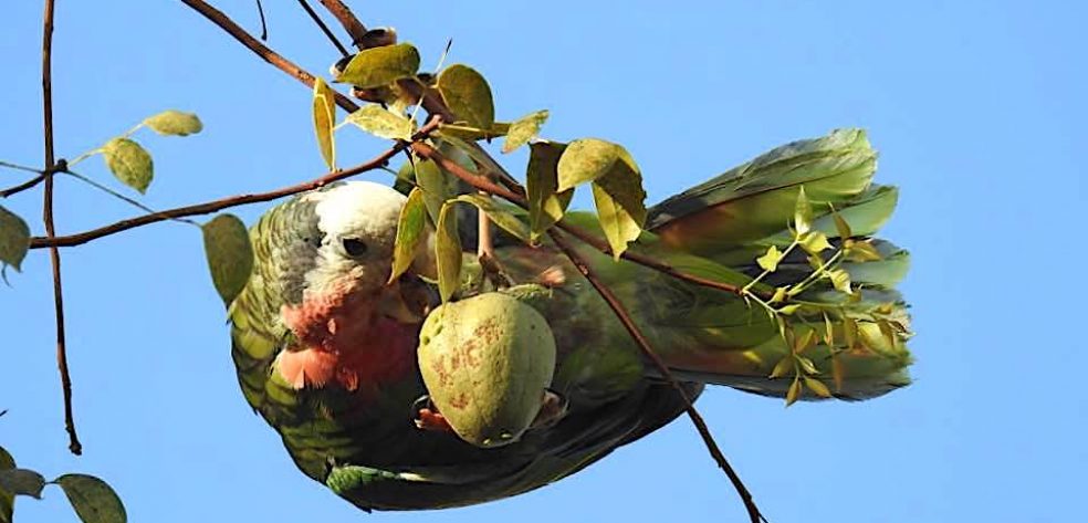
Nettie attempted to reintroduce flamingos to Abaco as breeding birds (there had been none breeding on Abaco for some 50 years). That involved the relocation of a number of juvenile birds from the National Park on Inagua (see FLAMINGO POST). They were flown to Abaco and resettled in the Casuarina area with their wings clipped. This was 15 – 20 years ago, and I don’t know if there was any successful breeding. I believe further birds were brought over, but for some reason the hoped-for breeding colony did not become established. It’s possible that there were problems with predation, as with the Abaco parrots.
Unhitching a skiff into the boat basin at high tide
Nettie’s lasting legacy is the construction of the canal cut through to the mangrove swamps and the ocean, and the ‘boat basin’ that allows safe launch and return for skiffs. This made possible what must have been very difficult given the geology of the terrain – easy boat access to the prolific fishing grounds over the vast area of mangroves and the labyrinthine water channels that is the Marls. It’s worth the comment that the whole project is entirely natural – it involves no man-made materials of any description. Contrast this with what might have been: concrete, iron, steel, wood – maybe a bit of plastic trim to round it off…
The first skiff sets off for the day…
I don’t know (perhaps someone can help via the comment box or email me) when and how this was done or how long it took, But when you watch the video as it follows the channel’s full length, you will see the rock spoil and appreciate the feat – and the vision – involved. And in places you can also see the shelving rock below the waterline that makes steering a steady central course advisable…
Aha! More arcane music from the Rolling Harbour archive, I hear you say. The music is Preston Reed’s ‘Along the Perimeter’ from ‘Handwritten Notes’ – an astonishing guitarist with a two-handed playing technique that also involves hitting and slapping various areas of the guitar (saves the cost of a drummer). He uses experimental open tunings that are found in no ‘How to play guitar nicely’ manuals. And if you like this, try Erik Mongrain who is simply astounding. Almost a trick guitarist. But I digress…
[I published the original of this post a year ago. I discovered that it had been put badly out of kilter by recent blog format change, so I have amended and to an extent updated it, with larger photos (NB the video was my first feeble foray). So yes, it’s a retread, which I rarely do; but I wasn’t tooled up with Facebook & Twitter then, and thankfully a couple more people now read this thing, so it possibly deserves a fresh outing. No? Well I’m doing it, regardless]
It’s 7.15 and breakfast time at Delphi. At 8.00 the trucks, skiffs, guides and fishers will set off to the fishing grounds for the day, leaving you with an empty beach, shells, warm sea, the pool, the hammock and your book. For the moment, the talk is of the excellent ‘Full Abaco’ breakfast, the weather, ‘Delphi daddies’ & ‘crazy charlies’ and someone’s mislaid reel. Sandy enters to announce that there’s a place free on your partner’s skiff… and offers it to you. So what should you, a non-angler, expect of a day out on the flats?
THE SKIFFS These are top-of-the range boats, capable of considerable speed getting out to the fishing grounds. The ride can be bumpy, splashy and even chilly in the early morning, so bring a fleece and a waterproof top. Camera? Essential. Here is a Delphi skiff on a sand bar in Cherokee Sound, parked for lunch and some quality conch and sand-dollar hunting. So for a start, the day isn’t ALL about fishing…
THE FISHING GROUNDS You will leave from one of three launch points and speed across the water to the bonefishing areas. The main one is “Nettie’s”, with access via a narrow man-made channel to the Marls…
… more than two hundred square miles of mangrove swamp, islets, channels and fish. The journey to Nettie’s may seem quite a long way as you bump along through the pine forest on a network of logging tracks. Watch out for small birds flickering all around as you pass.
———————————
Launching a skiff at Nettie’s
Plans are hatchedGood to go…
Stowing gear in the front (forrard?) locker. There’s also one behind the seats for the lunch cool boxes. And the fuel…
The other two launch areas are Crossing Rocks (a short drive south of DCB) or Casuarina Point for Cherokee Sound (a slightly longer drive north of DCB)
The jetty at Crossing Rocks – skiffs being prepared
The launch point at Casuarina. A channel leads out to Cherokee Sound
Two boats in the channel – the authentic James Bond chase experience
WHAT’S THE POINT? Bonefishing! You’ve heard all the Club talk, you’ve seen your partner fussing over all those bits and pieces in your room: now see it in action. Once you get out to a fishing area, the guide cuts the engine… and suddenly you are being poled very slowly and almost noiselessly across the shallow flats
The guide stands on the platform at the back of the skiff, using the advantage of height to scan the shallow water; the fisher stands at the front looking tensely for grey shadows underwater, waiting for the magic words…
“…hey, bonefish, 10 o’clock, 4 of them moving right, 30 feet… see them?”
And it’s ‘game on’. This isn’t the place for a discourse about casting technique and style – I have neither (Sandy, of me: “Muppet”) – but I promise that you will get completely caught up in the excitement when a fish takes the fly and takes off towards the horizon, stripping the line and backing from the reel… (I realise the image above may suggest… well he’s just fishing, OK?)
THE QUARRY – grey ghosts below water, bars of silver above. Caught on the ‘fly’ which are in fact shrimp or crab imitations, with barbless hooks to make the chance of losing a fish that much greater… This ensures that a boated fish can be returned to the water as easily and quickly as possible. It’s all ‘catch and release’, though some (me) find that mostly the fish very sensibly self-release long before they ever reach the boat…
Abaco bonefish off Crossing Rocks (just caught and released)Guide Ishi with Abaco bonefish caught on the MarlsGuide Robin Albury removes the barbless hook before returning the fishA good specimen‘Ishi’s Fishy’, as he would say
There is even the possibility that at some stage you may unexpectedly be handed a rod (even if you have never held one before, or wanted to) with ‘fish on’… Here, Robin has hooked a 2.5 lb fish and handed the rod to Mrs RH (then engrossed in eating a cheese roll) who successfully played and brought in her first ever fish…
PART 2 will deal with what else goes on during the day: the scenery, birdlife, sharks, turtles, blue holes and so forth. For now, here is a short clip of the skiff ride out to the Marls, to give you an idea. NB this was a very calm day – things can get a little bumpier and wetter at times. The seats are padded, but not very…
[Ultra-cautious music credit to Joe Satriani who sued Coldplay for alleged tune ‘borrowing’ saying “I felt like a dagger went right through my heart. It hurt so much”. Case dismissed + unspecified settlement… Way to go, Joe! Want to check? Cut ‘n’ paste this: http://www.youtube.com/watch?v=zjB024bZoB4&feature=fvwrel Then by way of counterbalance try John Lennon’s Imagine vs Coldplay’s ‘Fix you’ at (cut ‘n’ paste) http://www.youtube.com/watch?v=DksjpsAe3vk&feature=endscreen&NR=1]
UPDATE 17 OCTI gather that Georgie is so pleased with her new home at Cherokee, she’s still there. Not sure if she is with or without her tag, but I suppose if she has decided to stay put in one area, tracking her is not a priority. Maybe the sea grass there is a particularly good kind – or perhaps she has found natural springs to her liking. Maybe it’s the folk who live there… yes, I think it must be that. I’m hoping to get some more specific news soon, and some more photos.
UPDATE 7 OCTKendria says that Georgie has managed to lose her tag yet again. She’s still at Cherokee, but if she decides to make a move, she can now be tracked only from reported sightings. Maybe she just doesn’t like to accessorise…
UPDATE 6 OCTGeorgie has taken to life in Cherokee. She is still there – the longest she has stayed on one place during her epic journey. She’s a very popular guest, of course, and has generated a lot of local interest and affection. Here’s a BMMRO photo taken yesterday of Georgie enjoying some quality algae browsing on the pilings in the dock
“GEORGIE” THE MANATEE MOVIE: ON LOCATION AT CHEROKEE, ABACO
The story of Georgie, the young female manatee currently undertaking a round trip of Abaco, has further raised the profile of these unusual and fascinating creatures in the northern Bahamas. Like many others who have been enthused by this important conservation and research project, I’ve been following her story since her release with her mother Rita in the Berry Is. earlier this year. In June she was weaned. In September she decided to set off to sea grass pastures new – seeGEORGIEfor details
Yesterday she was still in the Cherokee area, but had lost her tag. The task was to locate her, find the tag and reattach it, and check her wellbeing. All were accomplished in the course of the day and the BMMRO posted:“Today was another day in Georgie’s ‘world according to Georgie’!!! A special BMMRO thank you and Manatee high five to Andrew Lowe, Cindy & Buddy, and the community of Cherokee! Georgie is lucky to have such caring people around! She is still parked at Cherokee and BMMRO will do their best to continue to monitor her health and habitat use in the area!”
Things have moved on a bit since then, and I am really grateful to Kendria Ferguson for finding the time to email me; and to Cindy James Pinder for permission to use her excellent photographic material from her time spent with Georgie. Her latest news is that Georgie is moving south towards Casuarina. There are blue holes in the area where she can find fresh water. Cindy adds“She may show up in the canal in Casuarina today. If you see her please offer her fresh water from a hose.”
It’s time to showcase a short video taken by Cindy at Cherokee yesterday. In order to post it here I have had to make a derivative movie from the original. It’s like an uncontentious bootleg, i.e. made with the artist’s approval (for which many thanks!). The quality isn’t as good of course, but you will clearly see what is endearing about these inquisitive, gentle and trusting creatures – and why this makes them so vulnerable and in need of protection. Only today, a woman has been detained in Florida for riding a manatee – a strictly unlawful act that has been strongly condemned.
Here are some stills also taken by Cindy yesterday, who says“…in case you are wondering . . . a manatee feels like leather!”. They depend on having some fresh water, and these great pictures show various methods of supplying it. The top one is my favourite.
HELP NEEDED If you would like to support manatee research and conservation in The Bahamas, please email info@bahamaswhales.org or rollingharbour.delphi@gmail.com
This is the perfect place and time to post the BMMRO September 2012 Whale, Dolphin and Manatee sightings map. Last month the cetacean count was very low – no whales at all, a solitary dolphin. However, manatees are starting to feature much more, and the Abaco sightings – presumably of Georgie as she progresses round the Islands – are the first ones recorded there (I think) since manatee sightings began to be included towards the end of last year. A cause for breaking out the fresh water to celebrate.
* * * * * * *
MUSICAL AFTERNOTES The video music is Rizraklaru by Ralph McTell (before he arguably spoilt it all with the mawkish ‘Streets of London’) from ‘Spiral Staircase’ (credit / plug for RM). He wrote it in 1967 while living in an old caravan in deepest Cornwall. He and his mates had only mother nature’s ‘Rural Karzi’ to use, and the song title is an anagram. It’s a long story that ends, in RM’s words, “After he’d stopped laughing, Henry and I explained the title’s origin [to him] and he suggested an anagram, so we put the first letter last and spelt the whole thing backwards, and there you have it ! RIZRAKLARU !”
ABACO SHELLS: 3 MORE FROM THE DELPHI CLUB COLLECTION
I have recently featured some of the shells from the collection amassed at Delphi – see SHELLS 1 and SHELLS 2. They are kept in vases or bowls for display and examination. They may not all come from the immediate vicinity, but they are all, for sure, from South Abaco. It’s time for some more.
PINK TRIVIA SHELL
LETTERED OLIVE SHELL
COMMON SPIRULA
For further details about Spirula(e), please see the comment box where Capt Rick Guest gives a lot of fascinating info about them and related marine cast-offs. You’ll also find out which are the real prize ones to look out for…
A vignette of RH examining shells on the balcony at Delphi
ABACO’S MANATEE, GEORGIE, SWIMS FROM HOPE TOWN VIA LITTLE HARBOUR TO CHEROKEE
GEORGIE UPDATE 2 OCTCindy James Pinder has posted on Facebook“Oh no, Georgie the manatee has lost her tracking device. Be on the look out for it in the Cherokee area. We are going to go out and look for her tomorrow with BMMRO. We are hoping that she goes back to the dock area looking for fresh water.”
BMMRO UPDATE 1 OCT I’ve just heard from Diane Claridge and Kendria Ferguson. They have kindly clarified the details of Georgie’s route, which makes her journey longer than my guesstimate (see below). Georgie has continued on her way, and after some resting and some quality sea grass munching, Kendria says (yesterday ) “…right now she is in CHEROKEE!”. I’m not sure where the fresh water springs are along the east coast, but I am beginning to think that Georgie may be on her way to check out Rolling Harbour and the Delphi Club, drawn by telepathic and symbiotic forces as yet unexplained, projected from the blogosphere…
BMMRO FACEBOOK “Georgie the manatee is creating quit a stir in Cherokee! Thank you for the sighting reports! (get some photos please!) To everyone there please don’t feed her lettuce. Manatees become very dependent on humans-their fast learners! It also teaches them to come into marinas which is where their number one predator lives – BOATS!! We want to ensure Georgie’s safety whiles she is here! We are unfamiliar with the area-so if anyone knows of any natural freshwater resources (shallow water seepage/blueholes) please do share that info! It is ok to give her a hose, mainly because we are not sure if she’s getting adequate freshwater in the area. Please remember she is a toddler and her belly is never full so have a cut off limit! See you tomorrow Cherokee!! Take care of Georgie!”
Georgie’s next stop?
BMMRO report 30 SEPGeorgie the manatee continues to travel around the Abaco’s! Fitted with a new satellite tag, she is currently exploring LITTLE HARBOUR. Yesterday, scientists caught up with her by CORNISH CAY where she was taking a quick nap and feeding on seagrass. We will continue to update the public on her whereabouts. Thank you to everyone for all their assistance in locating Georgie and ensuring her safety whiles she takes a much needed vacation from the Berry Islands.
A short time ago I wondered (in print) when a manatee would next be seen in Abaco waters – the nearest candidates being the small Berry Is. population. The answer was quick. Now! Georgie – the recently weaned calf of Rita – had swum across from the Berrys to Abaco, explored the Marls, headed north to Little Abaco, then travelled south on the eastern side of Abaco. She was spotted at Green Turtle Cay, but it had become clear that her satellite tag was malfunctioning, so locating Georgie and monitoring her progress depended on reported sightings.
The BMMRO reported yesterday “Georgie the manatee was sighted at the Sailing Club dock in Hope Town Harbour just after 2pm today! We’d appreciate any further sighting reports as to her whereabouts! Please drive carefully in and around Hope Town Harbour.” Hope Town resident Stafford Patterson was able to get 2 fine photos of Georgie. I contacted him about using them, and he has replied “Permission granted!! And we were happy to host Georgie yesterday.” So here is Abaco’s sole resident manatee (as far as I am aware) enjoying her visit to Elbow Cay.
A team was able to fit a new satellite tag to Georgie (see below), so following her adventures will now be much easier. But where will she go next? What this space or, better still, check out the BMMRO FACEBOOK page
STOP PRESS I’ve been wondering about the distance Georgie has travelled (remembering always that she was weaned only recently). So with the the help of an online map measuring thingy (Free! Cool!), here’s a calculation based loosely on more assumptions than you will find on ASSUMPTION ISLAND. For a start, I don’t know where in the Berry Is. Georgie officially set off from; nor where she was seen on the Marls; nor how she negotiated Little Abaco and the Cays along the east coast of Abaco; nor how many times she circled round exploring as she went. However, taking the ‘as the manatee swims’ direct line approach and assuming no significant deviations, the gizmo reckons the journey was a minimum of 150 miles. With any luck the recovered defective tag will have recorded her exact route, and amply demonstrate that I have wasted 1/2 an hour on this. Still, I wanted to know…
And for anyone wondering about Assumption Island, it does indeed exist, located in the Indian Ocean north of Madagascar. And the spooky thing is… it is shaped remarkably like a manatee! Well, quite like one, anyway.
Assumption Island (geographically correct) Assumption Island (manatee rotation) Awww…Cute!!!
MANATEES: CONSERVATION, AWARENESS PROGRAMS & DISTRIBUTION MAP
The “SAVE THE MANATEE CLUB”is a very active organisation that I have mentioned in previous manatee posts. These gentle creatures are in need of protection, and much effective conservation work is in progress. The BMMRO‘s wonderful work for the MANATEES OF THE BERRY ISLES is featured in this blog because of the proximity to Abaco (might those manatees visit one day?) – and of course because BMMRO HQ is at Sandy Point.
[ADDED 25 SEPT]…and lo, just as I pressed the ‘publish’ button, the BMMRO posted this news:
Georgie is currently exploring the Abacos. Help us monitor her movement patterns by reporting sightings!!
“Earlier this year we tagged & released 2 West Indian manatees in Great Harbour Cay, Berry Islands. These were the same manatees from Spanish Wells that were captured after they swam to Nassau when hurricane Irene passed in late August 2011. After release at Great Harbour Cay in May 2012, they explored most of the Berry Islands but centered their use around Great Harbour. In September one of these manatees, a young female named Georgie, swam from the Berrys to Abaco, has traveled within The Marls, north towards Little Abaco & is now traveling south on the eastern side of Abaco. We received a sighting of her on 23 September at the Green Turtle Cay Ferry landing, just north of Treasure Cay. We anticipate she will continue to travel south and may venture into marinas and harbours along the way. We would like to make the public aware of her presence in the area. Although we believe she is in good health and is exploring new areas, the tag is not functioning properly now so sightings from the public will help us locate and monitor her progress. If possible, please share with anyone in the Abaco area or make an announcement encouraging people that see her to report any sightings”
[ORIGINAL POST CONTINUES] The SMC is a Florida-based organisation and it recently posted a new cheerful cover picture by Natalie Prayor on itsFACEBOOK PAGE. I have recently noticed some searches on the blog such as ‘Manatees facts for Kids’, so this post might be helpful. You could even (I can’t believe I even thought of checking this out!) knit one… Want a pattern? Click HEREIn fact, I might even…
To see more of Natalie’s artwork, just search ‘Natalie Prayor in Facebook. She can be contacted at dracodawnstar@gmail.com
The SMC also posts Manatee facts and advice, from which I have selected the examples shown below
This map shows the world distribution of the 4 extant sirenian branches as well as the extinct STELLER’S SEA COW of the north Pacific. It is a melancholy fact that by 1768, a mere 27 years after its discovery by Europeans, this slow-moving, tame and easily-captured sea cow was hunted to extinction. 250 years on, the world’s sirenian population remains vulnerable and, as with whales and dolphins, in need of active monitoring and protection measures
Finally, I liked this manatee cartoon from Rachel Arnow, with its incongruous and enjoyably unfeasible suggestion of manatees in Loch Ness. Rachel has a great sirenian-centric website http://mvsm.omnomzom.com/ featuring her excellent and charming cartoon series “MAN VERSUS MANATEE”.
Caribbean coral reefs are in danger of disappearing, depriving the world of one of its most beautiful and productive ecosystems
Guardian: Monday 10 September 2012 03.00 BST
• INTERACTIVE GUIDE: CORAL REEFS AROUND THE WORLD
• WHAT DOES A CORAL REEF SOUND LIKE?
A pair of French angelfish enjoy the coral reef in the Caribbean Sea. Photograph: Marcus Mays for the Guardian
Caribbeancoralreefs – which make up one of the world’s most colourful, vivid and productive ecosystems – are on the verge of collapse, with less than 10% of the reef area showing live coral cover.
With so little growth left, the reefs are in danger of utter devastation unless urgent action is taken, conservationists warned. They said the drastic loss was the result of severe environmental problems, including over exploitation,pollutionfrom agricultural run-off and other sources, andclimate change.
The decline of the reefs has been rapid: in the 1970s, more than 50% showed live coral cover, compared with 8% in the newly completed survey. The scientists who carried it out warned there was no sign of the rate of coral death slowing.
Coral reefs are a particularly valuable part of the marine ecosystem because they act as nurseries for younger fish, providing food sources and protection from predators until the fish have grown large enough to fend better for themselves. They are also a source of revenue from tourism and leisure.
Carl Gustaf Lundin, director of the global marine and polar programme at the International Union for Conservation of Nature (IUCN), which published the research, said: “The major causes of coral decline are well known and include overfishing, pollution, disease and bleaching caused by rising temperatures resulting from the burning of fossil fuels. Looking forward, there is an urgent need to immediately and drastically reduce all human impacts [in the area] if coral reefs and the vitally important fisheries that depend on them are to survive in the decades to come.”
Warnings over the poor state of the world’s coral reefs have become more frequent in the past decades as pollution, increasing pressure on fish stocks, and the effects of global warming on the marine environment – in the form of higher sea temperatures and slightly elevated levels of acidity in the ocean – have taken their toll.
This decline is likely to have severe impacts on coastal villages, particularly in developing countries, where many people depend on the reefs for fishing and tourism. Globally, about 275 million people live within 19 miles of a reef.
IUCN, which is holding its quadrennial World Conservation Congress on Jeju island in South Korea this week, said swift action was vital. The organisation called for catch quotas to limit fishing, more marine-protected areas where fishing would be banned, and measures that would halt the run-off of fertilisers from farmland around the coast. To save reefs around the world, moves to stave off global warming would also be needed, the group said.
On a few of the more remote Caribbean reefs, the situation is less dire. In the Netherlands Antilles, Cayman Islands and a few other places, the die-off has been slower, with up to 30% coverage of live coral still remaining. The scientists noted that these reefs were in areas less exposed to human impact from fishing and pollution, as well as to natural disasters such as hurricanes.
GLIMPSES OF LIFE ALONG A CORAL REEF by F. H. HERRICK
This post is aimed at those with a particular interest in the flora and fauna – especially avifauna – of Abaco and its Cays. It is a naturalist’s account from 1886 of an expedition to Abaco, interspersed with a few line drawings. It’s an easy read if you are interested in Abaco, its history, and the state of natural life on the islands 125 years ago. Those who have come to this site for the photos and / or even the occasional jest are warned to expect neither. However, to tempt waverers I’ll highlight below (by way of a quiz) some intriguing aspects of the 9-page article. I have had to edit it to correct the many ‘literals’ in the open-source material; however the c19 spellings are retained. I’ve also added coloured subject-matter codes as follows:PLACE NAMES; BIRDS; PLANTS; FISH; CREATURES
In 1886, Herrick visited Abaco with a party of naturalists. This trip predated by 3 years the publication of Charles Cory’s groundbreaking ‘Birds of the West Indies‘. There would have been scant readily-available published material about the natural history of the Bahamas, let alone of Abaco itself. Herrick and a friend left the main party and went on their own wider explorations of Abaco with two local guides. Herrick recorded their findings, which were subsequently published in ‘Popular Science Monthly‘ in 1888. In Herrick’s wide-ranging account of the adventure you will find the answers to the following 15 questions. If any one of them whets your appetite to read this historic account, press the link below the quiz!
What fruit might you have found growing in fields on Abaco in 1886?
What was the local name for the perforated rock at Hole-in-the-Wall?
What is an “egg-bird”?
What was causing “the gradual extermination” of flamingos?
What were “shanks” and “strikers”?
To what human use were Wilson’s Terns put?
How many eggs does a tropic-bird lay?
What law prevented the shooting of tropic-birds, and indeed any other bird, by naturalists?
What sort of creature is a “sennet”?
Which was rated the better for eating – grouper or ‘barracouta’ (sic)?
Who or what is or are “grains”?
What common creature had a burning touch like a sharp needle?
What bird was reckoned to have the call ‘loarhle-ee’ ?
What – or indeed who – was described as a “pilepedick”?
ABACO / BAHAMAS WHALE, DOLPHIN & MANATEE SIGHTINGS AUGUST 2012
ANOTHER PYGMY WHALE STRANDING ON ELEUTHERA
The BMMRO has posted the cetacean / sirenian sightings for August. The main concentration off Abaco is in the food-rich south-west coast from Rocky Point down to Hole-in-the-Wall. This is where the deep water of the Great Bahama Canyon meets the shallow underwater coast of Abaco, providing an ideal feeding ground for whales and dolphins. This canyon is the largest underwater canyon in the world.
Plenty of dolphins were reported last month, and the sperm whales (including pygmy and dwarf) were still around (but for some sad Eleuthera pygmy sperm whale news, see below). Meanwhile, the yellow spot on the Berry Is. shows that all is well with the manatees.
STRANDING NOTIFICATION: PYGMY SPERM WHALE
Last week the BMMRO was notified about a whale that had stranded dead on an Eleutheran beach on 27 August. The species was identified from the photographs as a pygmy sperm whale – the same species that stranded on the other side of Eleuthera the previous week.
Thanks to the Stranding Network, it was possible take a tissue sample and teeth for DNA, as well as more photos.The animal was about 6 feet long and moderately decomposed – possibly dead for up to 3 days. Unfortunately due to the state of decomposition a cause of death could not be determined. However more information about the animal will be obtained from the samples taken. With samples taken, the carcass can now be buried.
“RITA & GEORGIE’S EXCELLENT ADVENTURE”: A BAHAMAS MANATEE MOVIE
The BMMRO has produced and distributed, courtesy of the always watchable CONCH SALAD TV, a fantastic 7 minute movie of the story of Rita and Georgie. It’s a heart warming tale of a West Indian manatee mother and calf pair that made the journey from Eleuthera via Nassau and then via cradle and boat transport to the Berry Islands for a new life. It’s a tale of conservation, preservation and hopefully (if they continue to get on well with the small resident population there) procreation… The main natural difficulty facing manatees in the Bahamas is the lack of fresh water – see how this is tackled. The main man-made problem comes from man’s use of the waters. For example, boat-strike / propeller damage is an ever-present danger. To see more about Manatees in this blog CLICK HERE To reach the BMMRO Facebook pageCLICK HERE
BMMRO INTRO
IT’S HERE!! MANATEES IN THE BAHAMAS. PRESENTED BY LOGGERHEAD PRODUCTIONS
Grab your popcorn and everyone in the community, office or home…ENJOY! SHARE! ♥ MANATEES !
REVIEWS
“The Manatees were moved. As indeed was I…” The Wall Street Journal
“An uplifting experience…” The Washington Post
“Seeing these manatees made me a man at ease…” Florida Herald Tribune
This very short time-lapse video was posted on the always informativeABACO SCIENTIST website administered by Craig Layman of FIU (Florida International University). The site benefits from the wide knowledge of a variety of contributors in many different fields. As it says, “Abaco, just like all of the Bahamian Islands, hosts a wealth of natural wonders. From parrots to whales to blue holes to mangrove wetlands, it is no wonder that scientific research is thriving on the island. The Abaco Scientist is intended as your one-stop source for all things science on Abaco and throughout The Bahamas“.
The coral reefs of Abaco and the Bahamas (as elsewhere) are vital yet vulnerable eco-systems. The adverse effects of global warming (or however you describe it if you shy away from that specific term) are increasingly evident. To that damage can be added a slew of other major threats to coral survival – and to the marine life that thrives on the reefs. There are a number of research projects in progress in the Bahamas into the effectiveness of artificial reefs as a means of conservation of the ecology of reef waters. One of these is by FIU undergraduate student Martha Zapata. In her words, “We have recently been capturing time lapse video of the artificial reefs at night. Many reef fishes, like grunts, will leave the reef around dusk to forage in the nearby seagrass beds during the night. We wanted to be able to observe the fish on the reefs without influencing their behavior, so we used infrared light (which fish cannot see) to illuminate the reef. The image sequences have shown a stark difference in fish abundance from day to night. Also, we have been able to observe some of the more cryptic organisms that have made these reefs their home. Usually masters of disguise, urchins roam about the surface of the reef. Look out for the banded coral shrimp and crab that crawl up the side of the reef to graze on algae and detritus while the fish are away. Even a moray eel makes an appearance near the end!“
Besides specially constructed artificial reefs, other man-made objects provide good foundations for an artificial reefs and marine life – in particular, wrecks. There are many of these in the low waters of the Bahamas, some centuries old, others recent. Fred and Melinda Riger of Grand Bahama Scuba, Freeport, take their diving schools to wrecks because of the profusion of marine life that gathers around – and indeed inside – them.
TULIP SHELLS & SUNRISE TELLINS: MORE SHELL TREASURES FROM ABACO
Here are two contrasting shells from the Delphi Club collection that has been haphazardly accumulated over the last 3 years or so. The first post in this shell series was about SEA URCHINS & SEA BISCUITS
TULIP SHELLS Fasciolaria tulipa
The term ‘Tulip snail’ includes 3 related species of sub-tropical gastropod worldwide, of the genus Fasciolaria. They are medium-sized predatory molluscs that breed throughout the year in warm waters. Their reproductive lives deserve some attention, if they will pardon the intrusion.
Research by the Smithsonian Marine Station Fl. reveals that the male’s penis is to be found on the right side of its body, directly behind its head… When they mate the (larger) female stays in an upright position on the sand while the male ‘flips over’ to align the apertures of both shells, before inserting the penis into the female (RH comment: the research is not specific about precisely where the female keeps her own genitals). Once joined, snail pairs may remain locked together for up to 2 hours, even when being watched by researchers. They have plenty of stamina: mating may occur several times in one season, and individual tulip snails have been observed to mate up to 3 times in a single week. Respect!
SUNRISE TELLINSTellina Radiata
I included these pretty shells, with their striking pink radials, in an earlier postBEACHCOMBING BIVALVESThe ones shown here are larger specimens. The hinges (muscles) are very delicate, and in these shells the two halves of the shells have separated. STs are not uncommon, but these are the largest I have come across (I realised after I had taken the photos that I should have used a coin for comparison…). They grow up to about 7 cms, and these ones were that length, or very nearly so.
I can’t assist with their sex lives I’m afraid, which may well be completely conventional, dull even. However, as I discovered when I previously researched these shells, “in most countries it is illegal to bring back these shells from holidays”. To which I can only repeat my comment: Whoops!
Laughing gulls. Amusingly raucous and raucously amusing. Unless, maybe, you are living right next to a breeding colony during a collective fit of hysterics. These gulls, Leucophaeus atricilla, will be familiar to anyone on the Atlantic coast of North America; in the Caribbean; and further south to the northern coastal areas of South America. In winter, their migration pattern simply involves relocating to the southern parts of their range. They are easily recognisable in the breeding season by their smart black caps, though this fades in winter. And by their unmistakeable call, of course. Immature birds tend to be darker than adults. They breed in large colonies, each female laying 3 – 4 eggs. And like most (all?) gulls, they’ll eat pretty much anything.
Laughing Gull Conservation Status
We saw – and heard – plenty while bonefishing on the Abaco Marls in June. I took some rather grainy distance shots, as they tended to fly off as the skiff was slowly poled towards them. This gull has found a good vantage point for some quality preening among the mangroves.
The pair below stayed put, and watched our gradual approach with suspicion that turned into noisy protest as we poled past them. I presume they were defending their territory – probably a nest site nearby.
I took a very short video just before they flew off as we drifted by. Apologies for the sound of the breeze – I’ve no idea if it’s possible to reduce the background noise while retaining the bird call. Listening to online bird sound clips (e.g. on the excellent Xeno-Canto) I think not. Or not without expensive editing equipment of a complexity I can’t face…
[vimeo https://vimeo.com/48076405]
And here (thanks, Don Jones @Xeno-Canto) is what laughing gulls sound like when one of them has told the one about the bonefish and the shrimp…
It’s good to look beyond the immediate area of Abaco and the Cays when the occasion calls for it – for example, more good news about the BMMRO’s painstaking research and careful protective monitoring of the very small West Indian Manatee population in the Bahamas. I’ve written before about these gentle, unhurried, curious creatures and their vulnerability – particularly to man’s usage of their natural habitatCLICK ===>>>MANATEES
Kendria Ferguson’s story below shows just one aspect of the BMMRO’s commitment to the conservation of the cetaceans and sirenians in the seas around Abaco and beyond. The Manatees have excited the interest of the whole local community including the schoolchildren. If you have ever been moved by the sight of dolphins in Marsh Harbour or whales further out to sea, you can be sure someone is keeping an eye on their well-being. You might even be moved to help this important conservation work, in which case CLICK ===>>>HERE
KENDRIA’S REPORT
Adult female manatees are considered sexually mature at 6-10 years of age and have a gestation period that lasts up to 13 months. The first two years of a calf’s life is spent with its mother. During this time they are taught where to find food, fresh water, warmth and shelter. Generally, after two years the calf separates from its mother. This separation is known as ‘weaning’.
On the 14th of June 2012 Argos satellite locations received from both Rita and Georgie’s satellite tags indicated that they were no longer traveling together. Georgie had been weaned. Georgie was born on the 25th June 2010, therefore Georgie was now old enough to survive on her own in the wild
Georgie fitted with a paddle belt around the base of her tail. A flexible nylon tether is then attached to this belt with the satellite tag, which floats when it’s near the surface.Photo provided by Jim Reid-USGS Sirenia Project
After tracking Rita and Georgie for the last three months, it was hard to fathom a two year old being old enough to take on the world. But like they say – mothers know best!
Rita and Georgie fitted with satellite tags
Rita and Georgie were released in Great Harbour Cay (GHC) on April 19th of this year. They travelled to Nassau during Hurricane Irene (late August 2011) from Spanish Wells, Eleuthera and ended up in Nassau harbour. Concerned for their safety, The Department of Marine Resources gave Atlantis-Dolphin Cay permission to capture the animals and house them until a decision was made as to their release. After spending over twenty-five weeks in captivity, scientists feared that Georgie would be weaned before she was returned to the wild and given the opportunity to learn how to survive in her natural habitat. The mother-calf pair was transported to The Berry Islands on April 19th, where they were released and fitted with VHF data log satellite tags.
A map showing areas visited by Georgie pre-weaning and post-weaning
There are four resident West Indian Manatees (Trichechus manatus) residing in Great Harbour Cay, Berry Islands. Notably, an adult female, “Gina” (known previously from Florida), has been residing in Great Harbour Cay since 1999. Since then she reportedly has had 3-4 calves and is currently accompanied by her female calf, JJ, which was born in the late winter of 2011.
Within Rita’s and Georgie’s first week of being released they travelled over 50 miles around the east coast of GHC to as far south as Ambergris Cays and back into the harbour where they were released. During the winter months, Floridian West Indian Manatees (Trichechus manatus latirostris) travel vast distances in search of warm waters. So it isn’t uncommon for these agile species to explore the shallow waters in which they inhabit.
Georgie is now re-visiting important habitat areas she visited in the past with her mother. Since their separation in June, Rita and Georgie have been seen together in the harbour by the local community.
Scientists will continue to monitor Georgie’s movement patterns around The Berry Islands throughout the hurricane and winter seasons. This data will assist us in developing a management plan for manatees in The Bahamas.
Story written by Kendria Ferguson, BMMRO’s resident manatee expert
 FREE RH provisional rating ****
 SCREENSHOT 2
 logo")


 [cheers, Wiki]")


 Good to go…


 1")
 2")


You must be logged in to post a comment.