“GIVE PEEPS A CHANCE”: THREATENED PIPING PLOVERS
Not the feeblest punning title on this blog, but going hard for the avian-related booby prize. As it were. And you might with reason point out that, strictly speaking, ‘peeps’ are not plovers at all, but small squeaky sandpiper species. Many months ago I did a short post about these tiny plovers, and had begun to update it. Then I found that both the BNT and the ABACO SCIENTIST are onto them too. Thanks to them, I have some excellent added material further down the page… But first, here’s a quick cut out ‘n’ keep summary

SIZE Charadrius melodus is a Very Small Shorebird
HABITAT Rocky shores / sandy beaches; nesting in higher, drier areas of the shoreline where there is cover
 Photo courtesy of Caribbean Birds SCSCB
RANGE From Canada (summer) down to the Gulf of Mexico (winter). They head south in August and return in March
 Credit: Xeno-Canto / Google
CALL A thin whistled peep peeping, whether standing or flying, and a two-note alarm call [There are surprisingly few Piping Plover call samples online. Many sites – Audubon, eNature, Birdwatchers Digest – all seem to have the same one. So I’ll credit them all and the originator Lang Elliot and hope I’ve covered my back…]
BREEDING The male digs out several scrapes on the high shoreline. The female contemplates these efforts, and (if any meet her ideal domestic criteria) chooses her preferred one, which she then decorates (grass, weed, shells etc). Meanwhile, Mr Peep tries to impress her by chucking pebbles around, dive-bombing her, and strutting around her importantly and “fluffed up” [none of these tactics work in human courtship, in my experience]. If Mrs Peep (a) likes the home she has chosen and furnished and (b) has recovered from her fit of the giggles at all that performance, she permits mating to proceed

NESTING First nests normally have 4 eggs; later ones fewer. Both share incubation and subsequent parental ‘brooding’ duties
DEFENCE Plovers have a defensive “broken wing display” used to distract predators and draw attention away from the nest
THREATS Larger birds, cats, raccoons etc. Human disturbance. Plovers and chicks are vulnerable to storms & abnormal high tides 
ZOOM…! Capable of running at astonishing speed over short distances. When they stop, they often snap the head back and forward.
STATUS Depending on area, treated either as Threatened or Endangered; IUCN listing NT

CONSERVATION Historically PP feathers were used as decoration in wealthy women’s hats – no longer a problem. Shoreline development and alterations to natural coastline are now the leading cause of population decline. This has been reversed through field and legislative protection programs, especially at nesting sites; public education; anti-predation measures; and restricting human access in vulnerable areas – including off-roading…
STOP PRESS Nov 18 Sean has just posted a professional / scientific article about piping plovers, with some very useful information specific to Abaco and some helpful links, over at the ABACO SCIENTIST. Clicking through is highly recommended if you want to know more about these little birds
This is the characteristic ‘pigeon-toed’ stance – they run that way too…
RICARDO JOHNSON’S 6 MINUTE VIDEO ‘PIPING PLOVERS’
Ricky is a well-known, infectiously enthusiastic, and compendiously knowledgeable Abaco nature guide (this guy gets way too much free publicity in this blog…). As I wrote when I originally posted it “In this video he focusses his binoculars on piping plovers, a threatened species of tiny plover which annually makes a long migration to the Bahamas, including Abaco – and then heads all the way north again.”
If this video doesn’t make you smile at some stage, I suspect a SOH bypass and / or your ‘anti-cute’ setting is jammed on. Even so you’ll see the differences between the piping plover and the more familiar Wilson’s plover.
The BNT / ABSCI material originates from the Audubon Society. If you want to know about the annual journeys of these little birds and where they are in each season, it’s all here. The item was made in conjunction with the ESRI mapping project. I’ve put a screenshot below to give a general idea of what’s involved [click to enlarge] and you can reach the interactive Audubon page if you CLICK PIPING PLOVER
 Credits:Wiki (images), Audubon Soc, Xeno-Canto, Lang Elliot & partners, Ricky Johnson


 logo")


 [cheers, Wiki]")


")


 Rose Hips")


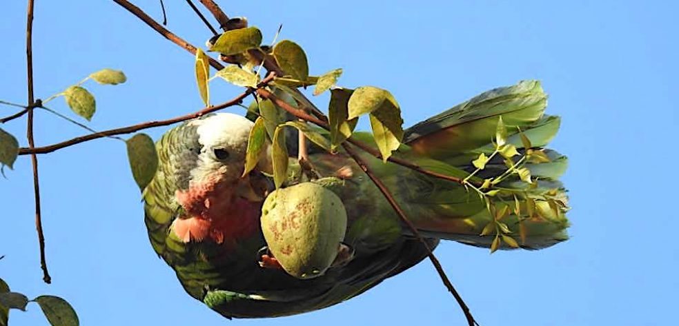
 Parrot BPS 1")
 Parrot BPS 3")
 Parrot BPS 4")
 Parrot BPS 5")
 Parrot BPS 7")
 Parrot BPS 8")


You must be logged in to post a comment.