Unknown's avatar

MANGROVE DIE-BACK IN THE ABACO MARLS: THE FACTS


Mangroves, The Marls, Abaco, Bahamas (Keith Salvesen, Rolling Harbour)

MANGROVE DIE-BACK IN THE ABACO MARLS: THE FACTS

For some time now, there has been understandable concern about the increasing evidence of mangrove die-back in the Abaco Marls and elsewhere in Abaco waters. Scientific investigations are ongoing and you will find some of the survey results so far on the excellent Abaco Scientist interactive map HERE. You’ll find other relevant and authoritative mangrove material if you check out the BLOG menu of the website.
Abaco - The Marls

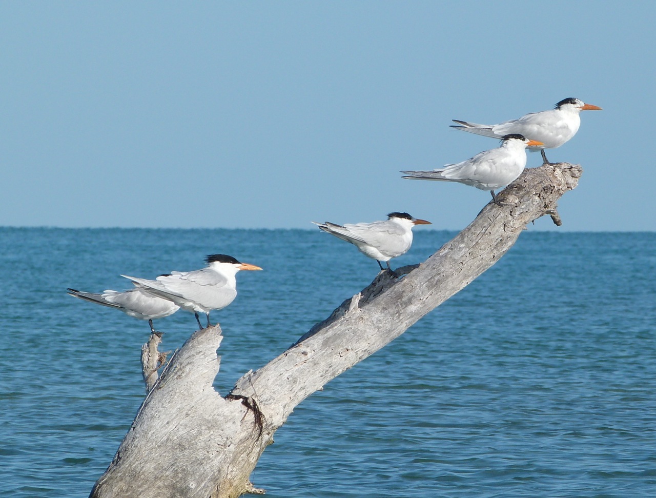
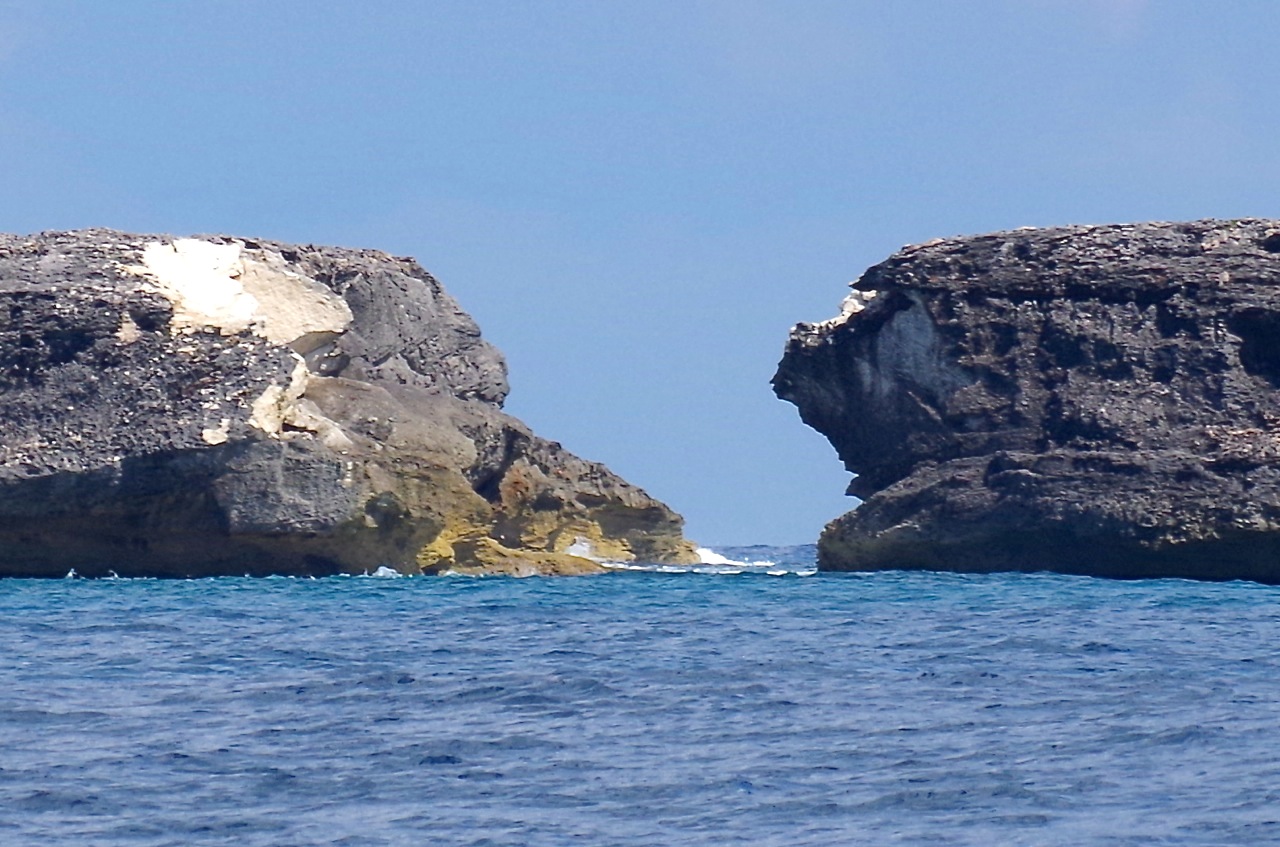
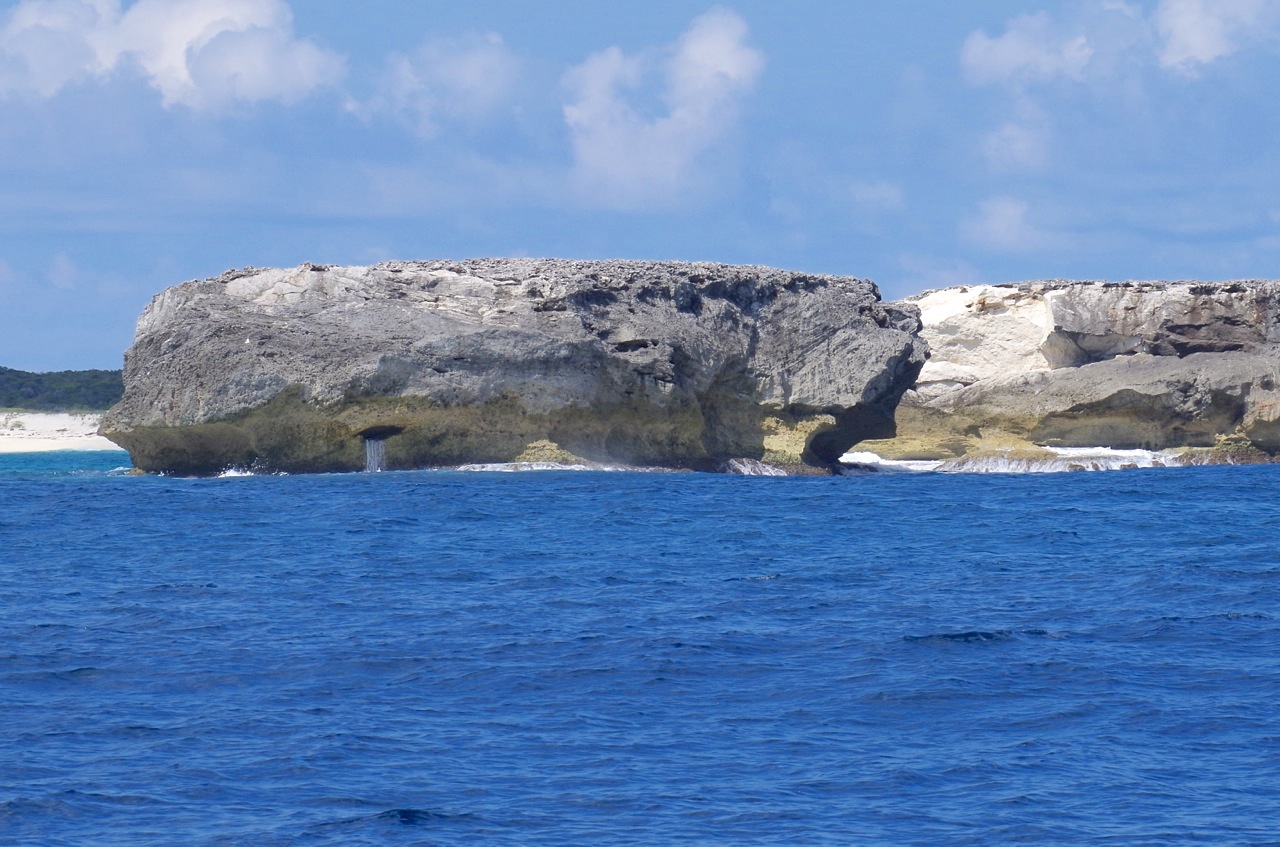
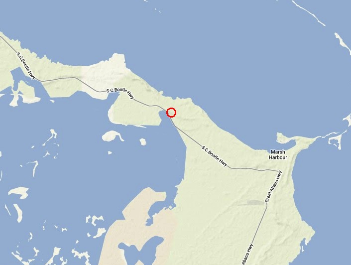
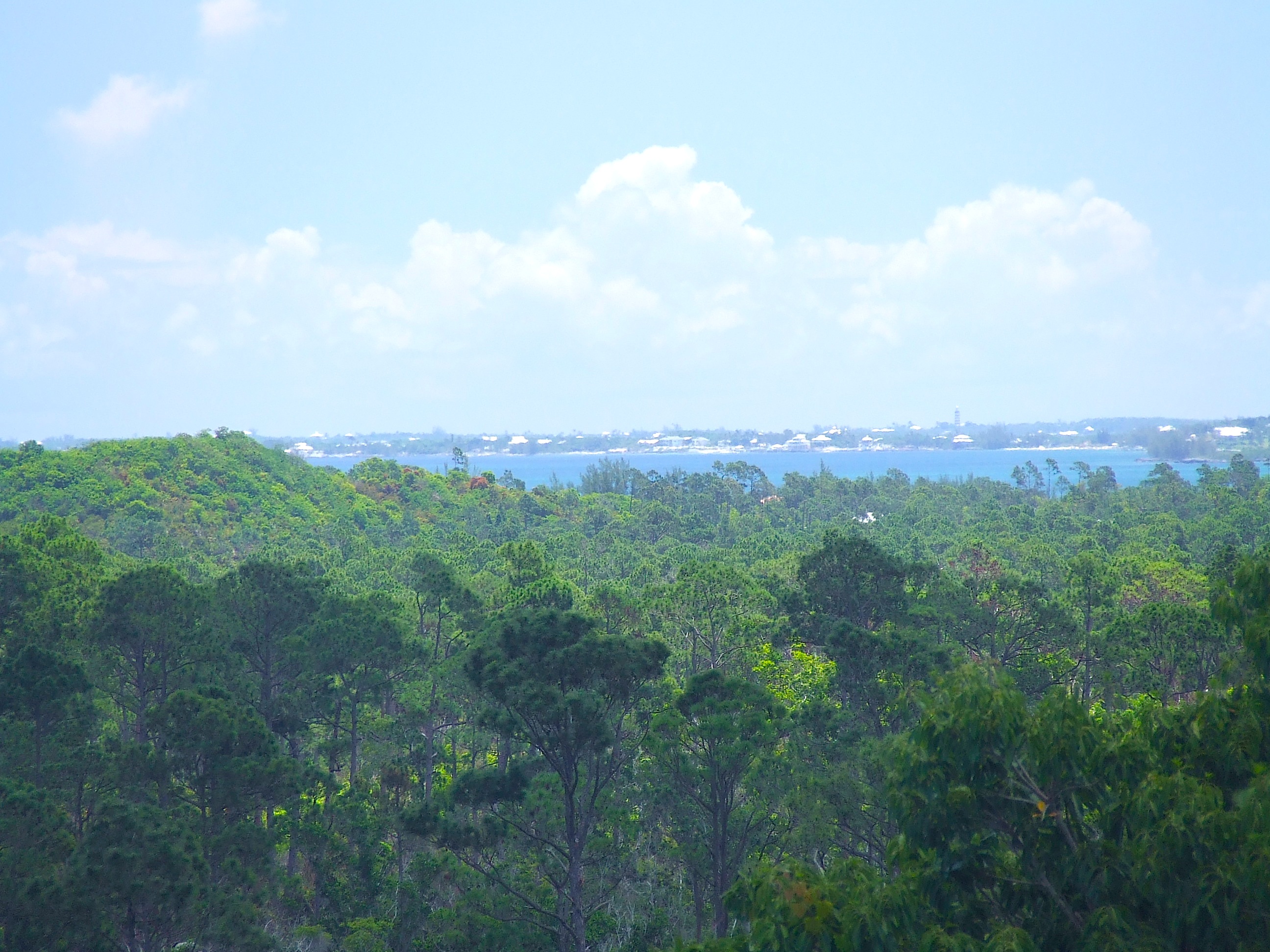
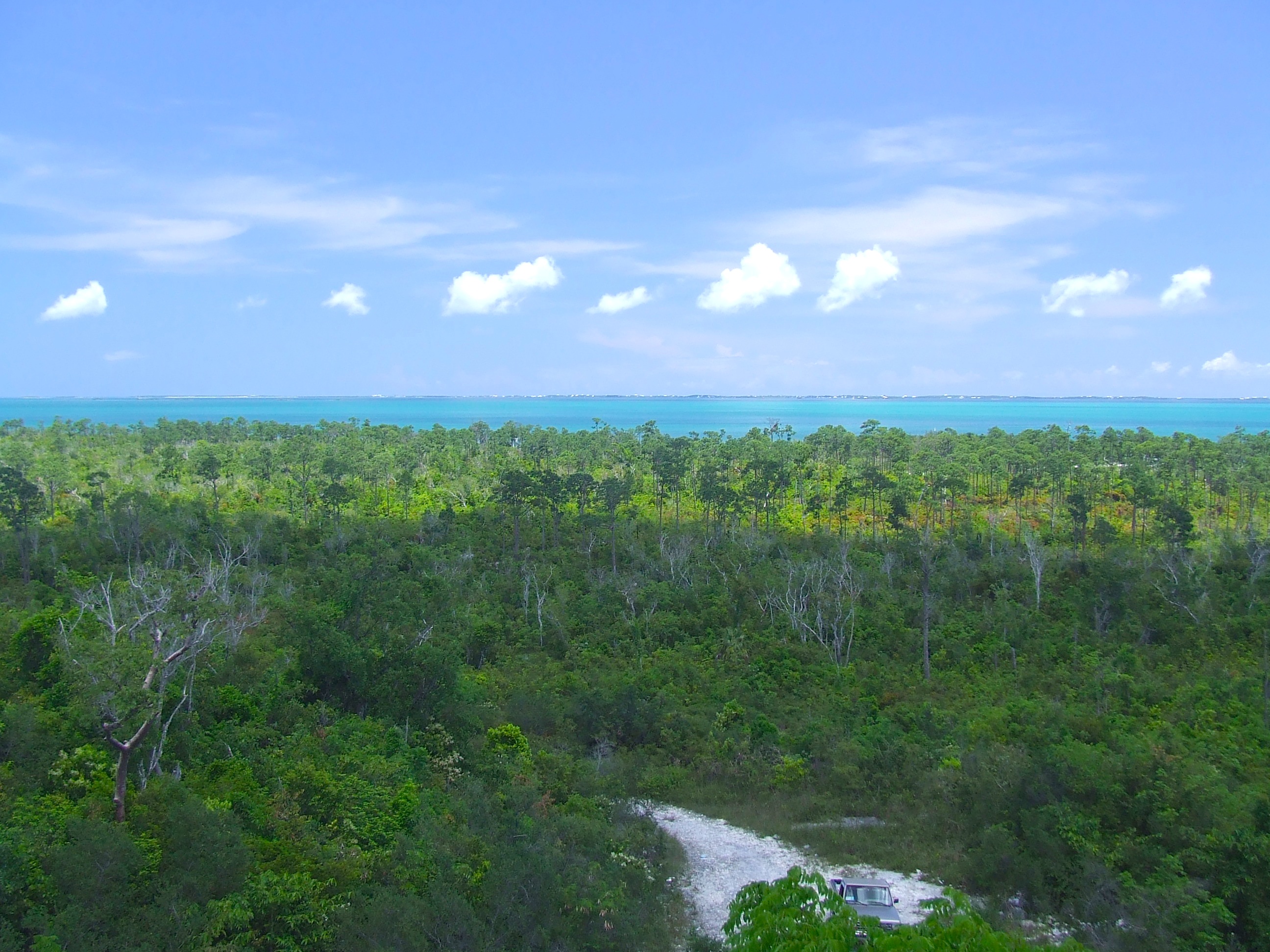
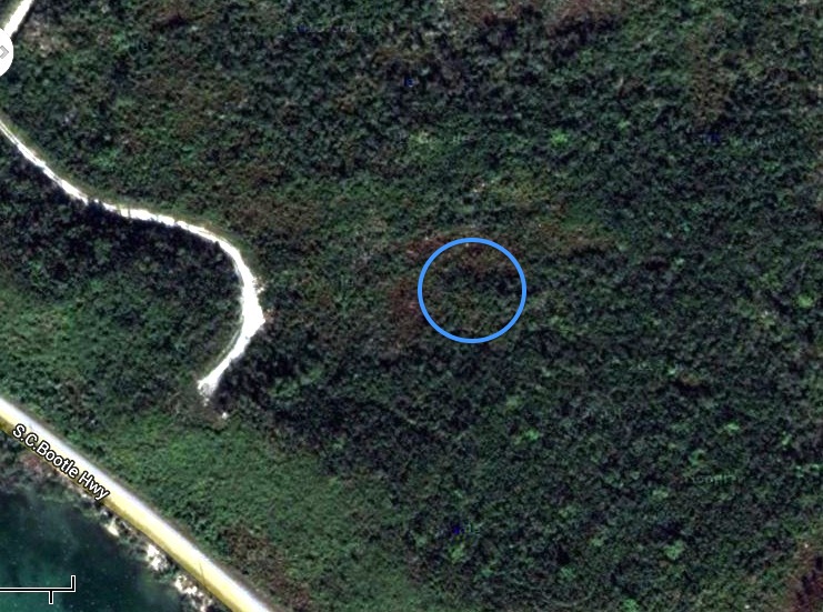
The ‘200 sq. miles’ in my map is debatable, depending what one includes. Other estimates are of 300 or even 400 sq. miles. Whichever, the Marls cover a massive area of mangroves, islets, flats, channels and wonderfully diverse wildlife. A large proportion of the many species – fish, birds, turtles etc – depend on the complex ecology of the mangroves for food, shelter and breeding. Depletion of the mangroves from whatever cause will have a direct effect on the creatures of the Marls.

Stingrays Abaco Marls 6

Ryann Rossi, a PhD student with North Carolina State University, has been researching the worrying phenomenon of mangrove die-back in the Marls this summer. She has written an interesting and informative  account (conveniently in the RH ‘Facts about…’ style) that was published in Abaco Scientist last week. The blue links will take you to the ABSCI site for further information on each topic. I’m grateful to Ryann and ABSCI for permission to use the material.

Five Things to Know About the Mangrove Die-back in The Marls (at this point, anyway)

1. This die-back appears to be the result of multiple stressors acting together. Think of it in the sense of our own body – when our immune system is down, we are often more susceptible to getting sick. The same thing is likely happening to the mangroves.Mangrove Die-back 1 (Abaco Scientist : Ryann Rossi)

2. It appears as though a fungal disease may be taking advantage of already stressed mangroves and causing die-back. We did preliminary surveys across Abaco and found fungal lesions nearly everywhere. However, the fungus was present in different densities in different areas. In the die-back area nearly all the leaves remaining on trees have lesions. We think that this pathogen capitalized on the mangroves being weakened by other stressors such as hurricanes, which cause extensive leaf drop, change in the movement of water, change in sedimentation and erosion.

Mangrove Die-back 2 (Abaco Scientist : Ryann Rossi) jpg

3. We are still working on identifying the pathogen associated with the lesions we’ve found. We are confident that it is a fungus and are currently growing fungal cultures in the lab to examine defining morphological characteristics in addition to using DNA sequencing to identify the culprit.

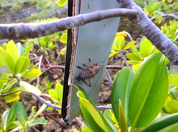
4. We have documented the presence of the Robust Bush Cricket (Tafalisca eleuthera) in the die-back areas as well as other areas with high densities of lesions. These crickets are documented to consume Red and White mangrove leaves. As such, we were concerned about their potential role in die-back. We set out a caging experiment to exclude the crickets from certain dwarf Red mangrove trees to see just how much grazing they may be doing in the die-back area. This experiment is ongoing.

Mangrove Die-back 3 (Abaco Scientist : Ryann Rossi) jpg

5. The take home: there is likely more than one causal agent of the die-back in The Marls. Many factors govern mangrove productivity and functioning: nutrient availability, salinity, sedimentation rate, herbivory, and disease are just a few of the factors that contribute to overall mangrove function making it very difficult to pin point which factors may be driving the die-off. On the bright side, we are confident that we have a lead on the causes and we are working hard in the field and laboratory to fully understand what is going on in The Marls.

By Ryann Rossi|August 26th, 2015|Disease, fungus, Insects, Mangroves and Creeks, The Marls
All pics below taken while fishing on the Marls except Melinda’s shark (I’ve never got a good one)
Hawksbill Turtle, Abaco Marls (Keith Salvesen)Bonefish Abaco Marls 4Shark 4 ©Melinda Riger @ G B Scuba copyOsprey - Abaco Marls 1 Reddish Egret (White Morph), Abaco MarlsRoyal Tern, Abaco, Bahamas (Marls) 3Willet, The Marls, AbacoSouthern Stingray, Abaco Marls (Keith Salvesen 4)
FRIENDS OF THE ENVIRONMENT has also included an article on die-back by Ryann in its latest Newsletter:

Mangrove Die Off on Abaco by Ryann Rossi, NCSU

This summer Stephanie Archer and I continued research efforts focused on determining the cause of the mangrove die-off in The Marls (work funded by the National Science Foundation). Our efforts were predominantly focused on the fungal pathogen we found associated with the die-off site. We created a small citizen science and outreach project to document the presence or absence of the pathogen across Abaco. This project consisted of short surveys and leaf collections. In total, 92 areas were surveyed including locations from Abaco and San Salvador. We also took this outreach project to the annual Bahamas Reef Environment Education Foundation (BREEF) teacher training conference.  There we disseminated survey packets to teachers from islands throughout The Bahamas who will help us collect more data on the presence (or absence) of this pathogen on other Islands.

3 men on a skiff, Abaco Marls (Keith Salvesen : Rolling Harbour)

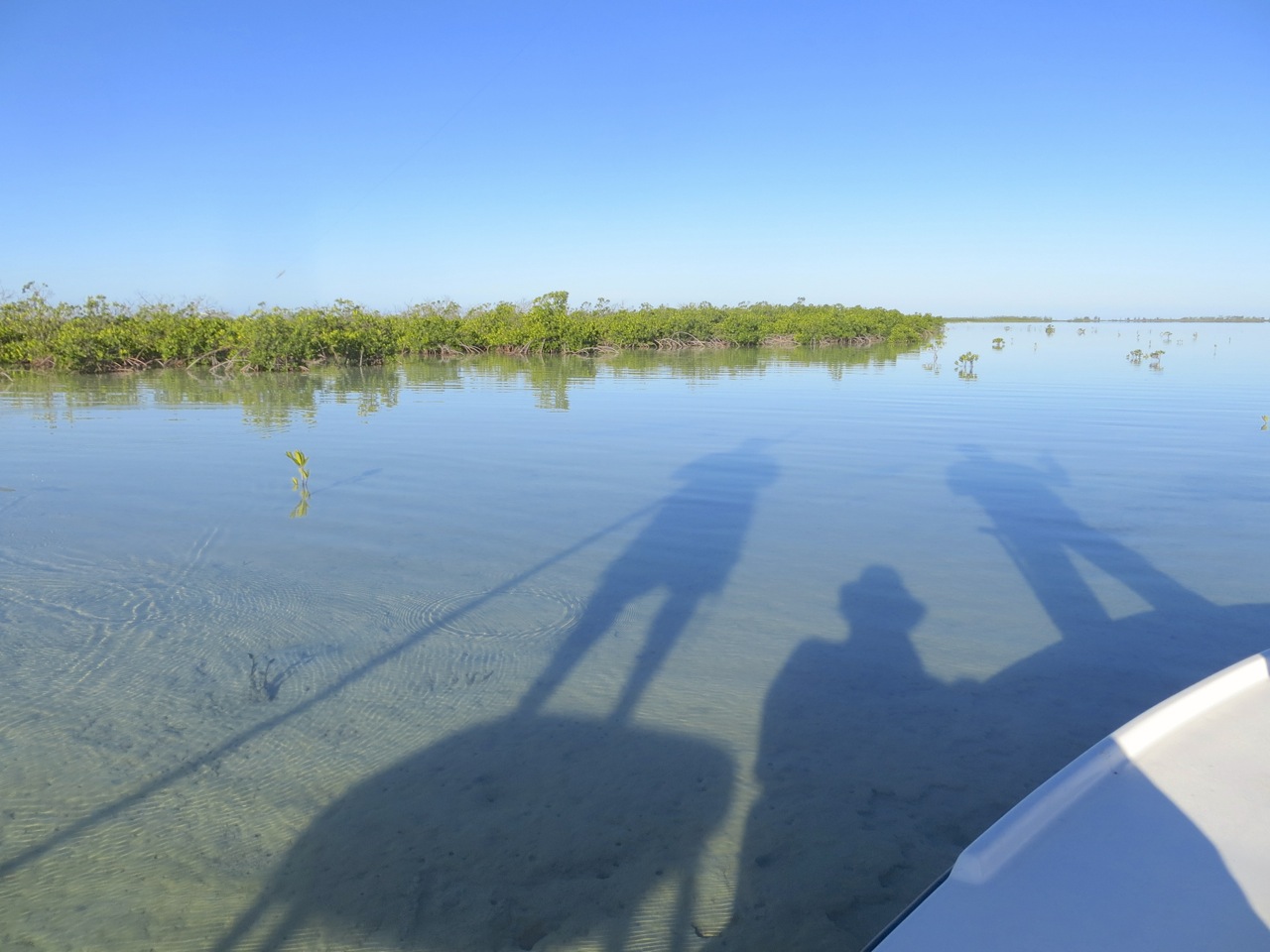
Three men on a skiff – Abaco Marls

On Abaco, we constructed an experiment to investigate the role of grazing and the presence of fungal lesions on Red mangroves. We simulated grazing using crafting scissors to cut small sections on 600 leaves in 4 different mangrove creeks. We observed the leaves for 28 days to determine if cutting leaves predisposed leaves to fungal infection. At these sites we also trapped for insects to gain an idea of what kind of grazers may be chewing on the leaves. We also did a series of disease incidence surveys that will be routinely monitored for disease progress over the next 2 years. These surveys will allow us to systematically track the progress of the disease. In addition to our field work, we spent many hours in the laboratory isolating fungi from leaves to grow in culture. These cultures were brought back to North Carolina State University and will be sequenced in order to help us identify the fungal pathogen responsible for making the lesions on the mangrove leaves.

Mangroves, Abaco Marls (Keith Salvesen)

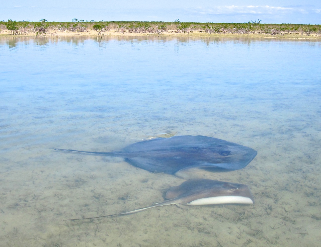
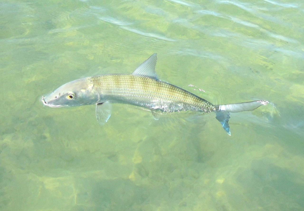
Credits: Source material Ryann Rossi; Abaco Scientist; all photos © Keith Salvesen @ Rolling Harbour except those by Ryann / ABSCI in the main article and Melinda Riger’s cool shark

Unknown's avatar

HOLE-IN-THE-WALL, ABACO: A UNIQUE PERSPECTIVE (2) PRESENT & FUTURE


Winslow Homer G W Original Brooklyn

HOLE-IN-THE-WALL, ABACO: A UNIQUE PERSPECTIVE (2) PRESENT & FUTURE

Following on from my post last month HOLE-IN-THE WALL: THE PAST, it’s time to take a closer look at the ‘Gap-in-the-Wall’ as it is today, viewed from the sea. I’ve called this a ‘unique perspective’, but I’m sure many people have taken photos of HITW from the sea. It just that apart from a few kayaking ones from before the collapse of the arch, I haven’t found them. So I took some, thanks to the BMMRO and their research RHIB. 

Hole-in-the-Wall Abaco (2015-2) 01 Location photo map

The view above is taken from some way to the west of HITW, and I have marked the main features that will be shown in this post. As one approaches the promontory, the lighthouse and its outbuildings are the only sign of human intervention to be seen in the landscape. Historically there were small settlements in this remote place, and some traces of these remain.

Hole-in-the-Wall Lighthouse Abaco (sea view)

Closing in on the former ‘Hole’, fresh damage from Hurricane Sandy’s destruction of the arch is still visible. It is more conspicuous on the other side.Hole-in-the-Wall Abaco (2015-2) 03 Collapsed arch (Hurricane Sandy)

In this photo, you can follow the features from the lighthouse to the foreshortened promontory, the new gap, the small islet that now exists, and finally a small eroded outcrop of rock – the remains of an extension of the mainland, and probably evidencing the southern tip of another arch that collapsed centuries ago.Hole-in-the-Wall Abaco (2015-2) 04 Light, hole and outcrop

Passing the outcrop and round to the east side of the promontory, further evidence of fresh damage can be seen, with the main shear being on the north side of the arch.Hole-in-the-Wall Abaco (2015-2) 05 Hole-in-the-Wall Abaco (2015-2) 09Hole-in-the-Wall Abaco (2015-2) 07Hole-in-the-Wall Abaco (2015-2) 10

There’s a fine view of the lighthouse from the east Hole-in-the-Wall Abaco (2015-2) 11

As we started the return journey to Sandy Point via groups of whales and dolphins, we went close to the outcrop, land’s end (next stop, Nassau). Even on a calm day, it is still thrashed by waves, as the second photo shows: no wonder it has eroded so quickly…  See how it looked in the 1803 aquatint below, from which one can see how there must have once been an even larger ‘hole in the wall’ way back in history and long since collapsed even by then. Hole-in-the-Wall Abaco (2015-2) 12 Hole-in-the-Wall Abaco (2015-2) 13Hole in the Wall Print 1803

Then it was time to move on, having been fortunate enough to see the location from an entirely new angleHole-in-the-Wall Abaco (2015-2) 14Hole-in-the-Wall Abaco (2015-2) 15

THE FUTURE

The geological future of the Hole-in the-Wall landscape is presumably that erosion and rising sea levels will sink the outcrop below the waves; the islet left after the collapse of the arch will similarly erode over the centuries, as in time will the whole promontory. Maybe as it gets thinner, another hole will be worn through by the waves. The restoration of the lighthouse, long promised, may perhaps take place. The nautical importance of the area suggests that the historic need for a light as both landmark and warning will continue. And who knows: even now, plans for wholesale redevelopment of the area could be on a drawing board somewhere…

Hole-in-the-Wall Lighthouse Abaco (Notice) hitw9

WINSLOW HOMER

The header image is the well-known watercolour by Winslow Homer (1836 – 1910), the original of which is in the Brooklyn Museum. It was painted in 1885 and is entitled ‘Glass Windows’. This is commonly claimed to be the famous ‘Glass Window’ feature on Eleuthera. However my own theory is that it in fact depicts Hole-in-the-Wall, Abaco. There are a number of good reasons for this, but the most immediately striking is the title Homer himself gave to an engraving of the identical view, published in The Century magazine (Feb 1887). This engraving pre-dates, and was clearly the template for, the watercolour. The rock structure and even the cloud formations are identical. And the title “On Abaco Island” seems conclusive of the location.

Hole-in-the-Wall Picture

Credits: All photos, RH; Winslow Homer painting, Brooklyn Museum online archive

Unknown's avatar

HOLE-IN-THE-WALL, ABACO: A UNIQUE PERSPECTIVE (1) THE PAST


Map of Abaco (part) - van Keulen 1728

HOLE-IN-THE-WALL, ABACO: A UNIQUE PERSPECTIVE (1) THE PAST

I’ve posted several times about the desolate, unpopulated area on the southern tip of Abaco known as Hole-in-the-Wall. It’s a place of history and mystery – indeed arguably the most historically, geographically and nautically important location on the entire island. The material in this post has to an extent been combined from earlier posts a couple of years back, since when a great many more people have been showing an interest in the wildlife and history of Abaco (thanks!) and may be new to the history and significance of HITW…

Although Abaco is identifiably – though not geographically reliably – mapped from as early as 1550 (only 58 years post-Columbus), the earliest map of Abaco showing any actual named place is the van Keulen map of 1728 in the header picture. The importance of HITW (‘Hole Rok’ marked on the east side) is clear. Indeed it is the only settlement shown. Thereafter, the place is mapped variously as Hole-in-the-Rock, Trou dans la Roche and Hole-in-the-Wall, before finally settling on the last name. HITW was clearly a significant nautical landmark from at least the c16. You can read more on this topic at HITW – A SHORT HISTORY IN MAPS

Incidentally, note the early spellings including of the word ‘Cay’ as ‘Kee’ in the bottom right corner – doubtless an explanation for the pronunciation today, when one might otherwise rhyme the word with ‘Bay’.

hole-in-the-wall-print-1803

The print above, dated 1803, is the earliest depiction of HITW that I have traced. For now, note the familiar ‘Hole’ between the two ships; and the outcrop to the right showing that another, larger ‘Hole’ had, by the early c19, collapsed. Remains of the outcrop, now badly eroded, can still be seen. Read more about pictures of HITW in SHIPS, MAPS & HITW , or in HOLE TO GAP, including a more recent print by Winslow Homer (below) which I contend is the proof that his famous painting ‘Glass Window’ in the Brooklyn Museum is of Abaco and not (as claimed elsewhere) the famous Glass Window on Eleuthera. Of which more another time…

Hole-in-the-Wall Picture

The sad fact is that although the name lives on and probably always will, in October 2012 Hurricane Sandy smashed the Hole in the Wall to smithereens, leaving what one can best describe as GAP IN THE WALL.

Here is the position of the Hole, shown before Sandy struck. Note the outcrop at the tip (bottom right corner), as seen in the old print above hole-in-the-wall-rock-abaco-location

One of very few photos taken from the sea that I have come across. There’ll be more, and much closer, in the next post Hole-in-the-Wall distance shot

The view from the lighthouse down to the ‘Land’s End’ promontory (RH)Hole-in-the-Wall Lighthouse Abaco (Keith Salvesen)

An aerial view of ‘Land’s End’ (with thanks to marinas.com for free use permission)Hole-in-the-Wall Lighthouse, Abaco annotated

The Hole, very shortly before Hurricane Sandy blasted away the bridge – the perfect place for a picnic…Hole-in-the-Wall Abaco ©Jessica Arrington

Or, as the storm approaches, maybe not…. Jack Bowers took this wonderful (and dangerous to acquire) sea-level shot – possibly the last photo ever of the intact arch427937_4820129308023_1041770732_n

Photos of the ‘Ex-Hole Now Gap’ taken within a very few days of the storm. Note the pale fresh stone HOLE-IN-THE-WALL ABACO post Sandy 1 Luc LavalleeHOLE-IN-THE-WALL ABACO post Sandy 2 Luc LavalleeHOLE-IN-THE-WALL ABACO post Sandy 3 Tara Lavallee

This post covers the history of Hole-in-the-Wall over the last 400 years or so, with links to earlier posts from a couple of years back. Then there’s a bit of a gap, I’m afraid, back to the LATE PLEISTOCENE EPOCH roughly 125,000 years ago when the landmass was formed… 

PART 2 will show how the ‘Hole’, the promontory and the lighthouse now look in 2015 from the ocean. During a recent highly successful whale-watching expedition with Charlotte & Diane from the BMMRO, we took the RHIB close to the point and took a seaward look at it from both sides, the first time I had done so. A few days before we’d been to Hole-in-the-Wall for birdwatching purposes by conventional means – the thirty mile round trip by truck along the track from the ‘Y’ of the Highway (NB no hire cars allowed). You can read an early post about this perilous adventure in TO THE LIGHTHOUSE…

HOLE-IN-THE-WALL LIGHTHOUSE: THE LANTERN ROOMHole-in-the-Wall, Abaco - Lantern Room (Keith Salvesen)

Credits: S. Wright, RH, marinas.com, Jessica Arrington, Jack Bowers, Luc Lavallee, Tara Lavallee, open source images

Unknown's avatar

“THE ABACO BACKCOUNTRY – AN APPRECIATION” by JIM TODD


Click to preview The Abaco Backcountry photo book

Jim Todd has produced an attractive self-published book, available in 3 formats, showcasing some of the outstanding features of the less-frequented areas of Abaco and its waters. It contains many excellent photographs, with interesting notes and observations. There are places and facts in the book that may not be known even to locals! Below are some sample pages. 

Abaco Backcountry Grab 2 Abaco Backcountry Grab 3 Abaco Backcountry Grab 4 Abaco Backcountry Grab 5Abaco Backcountry Grab 7 Abaco Backcountry Grab 6Abaco Backcountry Grab 1

Anyone who loves Abaco, its natural surroundings, its ecology and its wildlife will love this book. If this post has whetted your appetite, here are some further details:

Available exclusively on BLURB (this is the direct link)

“The Abaco Backcountry draws on the author’s extensive exploration of the area to describe a hypothetical traverse of its length in words and pictures. It is not a guidebook but an appreciation of a unique Bahamian marine ecosystem”

56 pp, available softcover ($35), Hardcover, Dustjacket ($38.99) and Hardcover, Image Wrap ($40.99)

STOP PRESS In answer to a UK query, the Blurb price is shown in $$$. When you go to the checkout, the shipping is added e.g. $10.99 to ship the PB version to the UK. You can pay by CC or Paypal. The conversion to sterling (or presumably euros) happens… by magic

Unknown's avatar

MAPPING ABACO: READ A NOVEL, TALK RUBBISH OR DISAPPEAR


Bahamas van Keulen Map 1728

Bahamas Map – Van Keulen – 1728

MAPPING ABACO: READ A NOVEL, TALK RUBBISH OR DISAPPEAR

I am probably the last person to twig the topological significance of Abaco’s location in the world. An email tipping me off about a TV programme led me to investigate further. There turn out to be 3 ways in which Abaco’s position in the Atlantic Ocean is of special interest. Two are geographic fact; and one is located in the grey area between myth and putative evidence-based supposition (if such a nebulous concept exists…). If everyone knew this already, sorry for being so late into the game. But you get some nice maps to look at, gratis, like the wonderful van Keulen map of 1728 above. About the only marked location on Abaco is ‘Hole Rok’ (now ‘GAP ROK’). For a history of Hole-in-the-Wall in historic maps, click HERE

1. THE DISAPPEARING TRICK?

Until the recent email, I hadn’t taken on board that Abaco is within the Bermuda Triangle. The island and its cays are contained snugly into the 60º tip of the western angle of an equilateral triangle based on Bermuda, Miami and Puerto Rico. The NOAA map below could not be clearer: Abaco is squarely within the triangle, if that is geometrically possible.

Bermuda triangle map NOAA / Google

I wrestled with whether to write an earnest discourse along the lines “Towards a Greater Understanding of Triangle Phenomenology”. Then I thought, Nah! If it’s a myth, what’s the point in examining its credibility. If it’s all true, I would’t want to worry you more than I already have by mentioning it… So you can do the hard graft if you wish by checking out the links below. Or you can just move on to section 2. Or relax in the sun, go fishing, find some nice birds, or have a Kalik or 3. 

THE WIKI ANGLE Excellent potted overview dealing with supposed position, the main ‘unexplained disappearances’, and the possible causes of these – both natural and supernatural. Frankly, this should do it for all but the most persistent, who probably are more widely informed already. 

SCIENCE CHANNEL The top ten Bermuda Triangle theories. Note: may not include your own pet theory of aliens from Planet Tharkron with their Pukotic Missile Rays

HISTORY.COM Comes complete with spooky-music video presentation. NB blurb nails its colours to the mast by using words like ‘Mythical’ and ‘Fanciful’ so if you are a believer you won’t want to go here, I suspect.

TEN WEIRD FACTS An informative video for those who want a bit more sensation.

2. WHAT A LOAD OF RUBBISH

great+atlantic sandiego.surfrider

Rowing through the Great Atlantic Garbage Patch (sandiego.surfrider)

Abaco also finds itself at the western edge of the Northern Atlantic Gyre. Strictly speaking the Gyre comprises a combination of  four main currents: the Gulf Stream in the west, the North Atlantic Current in the north, the Canary Current in the east, and the Atlantic North Equatorial Current in the south. It is not synonymous with the infamous North Atlantic Garbage Patch, which is contained within the geographical boundaries of the Gyre. The top image gives a broad-brush idea of  the central area of concentration of the Garbage Patch within the Gyre. Abaco looks to be well clear of trouble. But don’t be too optimistic.

North-Atlantic-Garbage-Patch-12Degreesoffreedom-300x204

North Atlantic Garbage Patch (12Degreesoffreedom)

Looking at various sources, there is some variation in the precise boundaries of the Gyre, though Abaco is plainly within it. Q: is it safely beyond the edges of the plastic peril? A: as any resident will know, the naturally pristine beaches tell a tale of constant plastic and other debris brought in on the high tide almost daily. The incidence depends to an extent on weather and wind direction, but the overall picture is of a relentless intrusion of rubbish on golden and white sand expanses. There is an extent to which what the tide giveth, the tide taketh away; and of course many beaches are scrupulously kept clean. NB I’m not trying to propagate anti-visitor publicity – many people will have experienced the same situation elsewhere. 

North Atlantic Gyre Garbage Patch wired_com

North Atlantic Gyre Garbage Patch (wired.com)

The research map above shows that, although the garbage hotspots and warmspots are well away from Abaco, the ever-widening circulating soup of plastic, rubber and metal has reached the island. Abaco is in the pale blue zone. Yellow is not that far off. Imagine what the orange or red areas must be like. This sort of thing:

garbage patch mail.colonial.nte

In some places the junk stacks up to form islands with hills

rubbish_telgraph.co.uk

Texas has become a standard ‘unit’ for large area comparisons. I notice that several sources describe the main area of the NA Garbage Patch in terms of Texas. But how big is that (BIG!)? To get an idea, I created a map overlaying Texas on an area centred on the Bahamas. So, Texas is this big… 

Texas / Bahamas size comparison

I’ve got more about some very specific rubbish to discuss another time, so I’ll leave you with the most interesting piece of marine debris to wash up on the Delphi Beach, a 12 ft ROCKET FAIRING from the Mars ‘Curiosity’ launch! Click link for more details. Rocket Fairing - Mars -Curiosity Launch - Beach Debris - Delphi Club Abaco

 3. A NOVEL PLACE TO BE?

The Sargasso Sea is named for the SARGASSUM seaweed found in large concentrations in the area. Columbus was the first person to sail right across the Sea, in 1492 (well, he and the crews of his 3 ships Niña, Pinta, and Santa Maria). He noted the large areas of seaweed that his expedition’s ships had to plough through. Eventually he made landfall on San Salvador, Bahamas.

This fine Krümmel map from 1891 shows the extent of the sea, and you’ll see that its western fringes reach the ocean side of Abaco. Have you seen the seaweed pictured below the map? That’s Sargassum.

1891 Sargasso See - Krummel

Sargasso See Map – Krummel -1891

 A close-up of Sargassum – maybe it washes up on a beach near you…Sargassum_on_the_beach,_Cuba Bogdan Giușcă
EIGHT FACTS ABOUT THE SARGASSO SEA TO IMPRESS YOUR FRIENDS
  • Jean Rhys’s famous 1966 novel ‘The Wide Sargasso Sea’ is actually set in Jamaica (nb the Sea is mentioned!)
  • The Sargasso is the only ‘Sea’ to have no land boundary, being entirely in the Atlantic Ocean
  • It is vital to mass migrations of eels, where they lay their eggs
  • Young loggerhead turtles are believed to head for the Sea for seaweed protection while they grow
  • Much of the debris trapped in the NA Garbage Patch is in the Sargasso, and is non-biodegradable plastic
  • The Sea is protected by Commission established in 2014 involving at present 5 countries, including (unbelievably) Monaco, the second smallest country in the world at 0.75 sq miles. Green Turtle Cay is about twice the area!
  • Cultural references include the track “Wide Sargasso Sea” on Stevie Nick’s “In Your Dreams” (2011)
  • There are loads of other literary & musical references but I lost the will to pursue them when I saw the inclusion of ‘Dungeons & Dragons’

If you want to find out more about Jean Rhys’s novel, read it or click HERE

JeanRhys_WideSargassoSea

 MUSICAL DIGRESSION

While writing this post I have had a song thrumming annoyingly inside my head. It’s ‘Bermuda Triangle’, with its coyly rhyming ‘look at it from my angle’. Now it’ll be inside your head too! I couldn’t remember who it sang it. Rupert Holmes? No, that was the egregious “Escape (The Piña Colada Song)” (1979). Ah yes. Barry Manilow. Bazza Mazza. The Bazzman. As you’ve finished with the maps etc, here’s a musical memory with a counterbalance of the Stevie Nicks song mentioned earlier…

Those cover the Triangle and the Sargasso; what of the Garbage? Try some Fresh Garbage from Spirit…

OPTIONAL MUSICAL NOTES Randy California’s fingerpicked intro to ‘TAURUS‘ is remarkably similar to the later, far more famous guitar work of Jimmy Page’s intro to ‘STAIRWAY TO HEAVEN‘. And Spirit happened to tour with the early Led Zep. Legal action was commenced last year for copyright infringement, as yet unresolved… You be the Judge!

Credits: As credited above; open source; NOAA; mail.colonial; telegraph.co.uk; Sandy Walker; Bogdan Giușcă, Youtube self-credited; Wiki; Random Researches and Magpie Map & Fact pickings

Unknown's avatar

ABACO’S FOUR PROTECTED AREAS: THE PROPOSALS


ABACO (CUBAN) PARROT (Caroline Stahala)

ABACO’S FOUR PROTECTED AREAS: THE PROPOSALS

The latest version of the 40TH ANNIVERSARY OF THE BAHAMAS PROPOSAL FOR THE EXPANSION OF THE PROTECTED AREA SYSTEM OF THE COMMONWEALTH OF THE BAHAMAS has been published. It is a joint proposal by the Bahamas Government, The Nature Conservancy and the Bahamas National Trust. The breadth of the scheme is very ambitious, affecting all the principal Bahama Islands. To understand the objectives and scope of the project, you can see the whole 34-page project by clicking BAHAMAS PROPOSED PROTECTED AREAS 2014 It is in pdf format, so you should be able to save it if you wish to.

Many people will be familiar with the proposals as they affect Abaco. However since the latest version appears to be a final draft, I thought it might be helpful to show the 4 proposed areas of protection and conservation in their present form. These are, in summary:

  1. THE ABACO MARLS NATIONAL RESERVE A vast area of nearly 200,000 acres (300 square miles) of mangrove flats, sandbanks, creeks and wetland habitat
  2. EAST ABACO CREEKS NATIONAL PARK 13,000 acres (20 square miles) of wetland habitat that provides a vital wildlife nursery, and includes blue holes, creeks and a significant area for recreational activities (though Pete’s Pub at Little Harbour may be just outside the zone…)
  3. CROSS HARBOUR PROTECTED AREA 14,000 acres (21 square miles) in South West Abaco, a crucial breeding area for a number of species,including bonefish
  4. SOUTH ABACO BLUE HOLES CONSERVATION AREA  A huge 34,000 acre (53 square miles) swathe of South Abaco to the west of the E D Highway, incorporating 4 inland blue holes and important cave systems, and 13 offshore blue holes. This is an area of mainly pine forest on land and low waters at sea, with an anticipated value for eco-tourism

Here are the BNT maps showing the extent of each area. Far more information will be found via the link to the report given above. 

THE ABACO PROPOSALS

Abaco Preserves 1 copy

Abaco Preserves 2 copyjpg Abaco Preserves 3 copyjpg Abaco Preserves 4 copyjpg

Credits: Parrot, (ex-)parrot protector Caroline Stahala; Maps, BNT; acres to sq m conversion, Gizmo!

Unknown's avatar

ABACO ROAD TRIP: CHEROKEE SOUND


ABACO ROAD TRIP: CHEROKEE SOUND

A Guest Post by Amanda Diedrick of GTC – check out 

“Several years back, on a family road trip to the south end of the Abaco mainland, we took a quick swing through the settlement of Cherokee Sound. Though our stop was brief, I was enchanted by the beauty of the tiny town and its breathtaking beach.

bahamas, abaco, cherokee sound, marsh harbour

Earlier this year, I finally got the chance to get back to Cherokee. I spent an afternoon wandering through this small fishing village that, by comparison, makes sedate Green Turtle Cay seem like a lively metropolis.

Similar to Green Turtle, Cherokee was originally settled by Loyalist descendants who supported their families by fishing or building boats. Today, fewer than 200 residents — most of whom commute to other parts of Abaco for work — call Cherokee Sound home.

Though Cherokee’s streets were virtually deserted on the hot June afternoon I visited, I did spot a group of primary school students enjoying recess, and I met a few locals while photographing their quaint, colourful homes.

bahamas, abaco, cherokee sound

And then there’s that beach. That stunning, unspoiled beach. And jutting 700 feet out into the clear water, a beautiful old dock which, according to the sign posted nearby, is the longest wooden pier in the Bahamas.

bahamas, abaco, cherokee sound, pier 
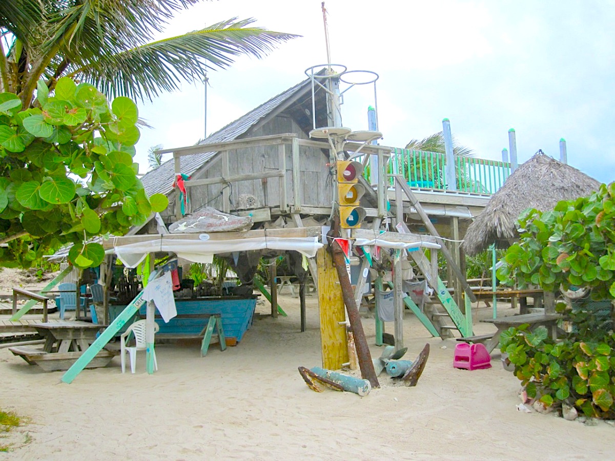
Until a few decades ago, the only way into Cherokee Sound was by sea. And given the shallow waters surrounding the settlement, an extended pier was a necessity. These days, with a paved road connecting Cherokee to the rest of the Abaco mainland, the dock functions primarily as a tourist attraction.
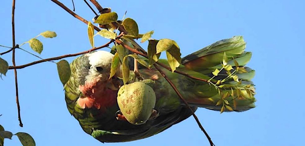
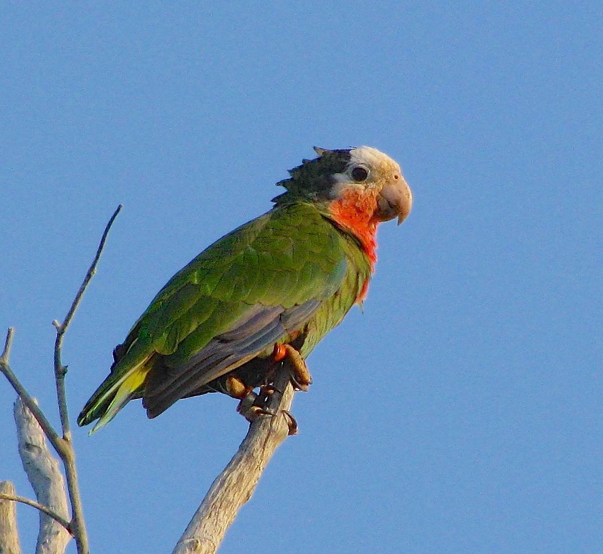
Casuarina Old Jetty

The Old Jetty at Casuarina, Abaco – the pre-road shortcut to Cherokee (RH)

To get to Cherokee Sound from Marsh Harbour, head south on the main highway and turn left when you reach the sign below:

bahamas, abaco, cherokee sound, pete's pub

Follow the winding road until it ends at Cherokee Sound. The drive from Marsh Harbour takes 30-45 minutes or so.

Cherokee Sound jpg

Between the highway and Cherokee, there are two key points of interest and they could not be more different. Pete’s Pub and Gallery is a rustic, off-the-grid, on-the-sand restaurant that serves up local seafood and stunning ocean views, while the Abaco Club at Winding Bay is a manicured beachfront resort with a spa and fitness center, full-size golf course and pro shop.

If it’s meal time or you’re in need of refreshments, I’d suggest stopping at Pete’s or the Abaco Club, as there are no restaurants in Cherokee Sound. Nor are there any hotels, though a quick online search reveals nearly a dozen vacation homes for rent in or near the village.

bahamas, abaco, cherokee sound

Below are a few of the photos I shot that afternoon. And if you’d like to know more about Cherokee Sound and its history, here’s a great article by Abaco Life editor, Jim Kerr.

Unknown's avatar

HURRICANE UPDATE: GONZALO TRACKS AWAY FROM ABACO, BAHAMAS


Hurricane Irene 2011 - the eye right on course for central Abaco

Hurricane Irene 2011 – the eye right on course for central Abaco

HURRICANE UPDATE: GONZALO TRACKS AWAY FROM ABACO, BAHAMAS

STOP PRESS – UPDATE Following yesterday’s post (below), the hurricane’s tendency to track further away from the Bahamas is confirmed by later models, for examples this one from Wunderground. So I think we are officially ‘off-risk’. But Bermuda is definitely not… Anyway, read on a bit and you will find out how hurricanes get their names! 

1901289_599770936795166_5297826701188883150_n

Yesterday I posted on my FB page an NOAA hurricane tracking map update for Hurricane Gonzalo, currently rated Cat. 2 on the SAFFIR-SIMPSON SCALE. It is making its way north through the Caribbean right now, and at one stage the storm cone looked on a possible course for the Bahamas. Abaco has been spared a major cyclone for a couple of years. However memories are very recent of Hurricane Irene (2011) which passed directly over Abaco as a Cat. 3 storm; and Hurricane Sandy (2012) that passed marginally to the east with (at that stage) an intensity of a Cat. 1 before going on to wreak havoc further north. During those ‘extreme weather events’ I posted regularly about them, with tracking maps and photos. At the time of Irene there was remarkable little information around online and I got a huge number of hits – 5000+ in a day, 15,000+ in a week. I also replied to lots of inquiries from the Bahamas, US and Canada, both general (“How are things at Cherokee?”) to very specific (“Do you happen to know if my boat ‘Blowdakidzinheritanz’ moored in Little Harbour is Okay?”).

Hurricane Sandy Earth from Space 2

Hurricane Sandy over Abaco from the International Space Station

I  have been surprised at the response the map generated by way of ‘Likes’ and comments expressing relief… So from my current safe distance of precisely 4250.00 miles from Marsh Harbour, I am posting an update with helpful maps and a bit of general hurricane info. The agencies all agree that Gonzalo will hook east as it progresses northwards. The Bahamas outlook is promising, though for example Bermuda looks to be at risk.  There’s more on hurricanes on the page ABACO WEATHER. I always think that Wunderground produce the clearest maps for general purposes, though there’s a great deal more information to be had from the NOAA site, to which there’s a direct link in the Sidebar (I’ve moved it to near the top for the time being).

CURRENT TRACKING FORECASTS OCT 14 2014 

WUNDERGROUND 3-DAY TRACKING & WIND MAP at201408at201408_satat201408_radar

NOAA TRACKERS & FORECASTS

085519203828W_NL_sm

ACCUWEATHER SATELLITE VIEW & TRACKERHurricane Gonzalo Tracking Map  - clip jpg

THE SAFFIR-SIMPSON SCALE

Here is a reminder of how tropical storms and hurricanes are measured for intensity, as decreed by the S-SS, followed by the National Hurricane Center’s explanation of the gradations of relative intensities.

Saffir-Simpson Scale (Wiki) jpgT

The Saffir-Simpson Hurricane Wind Scale is a 1 to 5 rating based on a hurricane’s sustained wind speed. This scale estimates potential property damage. Hurricanes reaching Category 3 and higher are considered major hurricanes because of their potential for significant loss of life and damage. Category 1 and 2 storms are still dangerous, however, and require preventative measures. In the western North Pacific, the term “super typhoon” is used for tropical cyclones with sustained winds exceeding 150 mph.

Category   Sustained Winds Types of Damage Due to Hurricane Winds
1 74-95 mph
64-82 kt
119-153 km/h
Very dangerous winds will produce some damage: Well-constructed frame homes could have damage to roof, shingles, vinyl siding and gutters. Large branches of trees will snap and shallowly rooted trees may be toppled. Extensive damage to power lines and poles likely will result in power outages that could last a few to several days.
2 96-110 mph
83-95 kt
154-177 km/h
Extremely dangerous winds will cause extensive damage:Well-constructed frame homes could sustain major roof and siding damage. Many shallowly rooted trees will be snapped or uprooted and block numerous roads. Near-total power loss is expected with outages that could last from several days to weeks.
3
(major)
111-129 mph
96-112 kt
178-208 km/h
Devastating damage will occur: Well-built framed homes may incur major damage or removal of roof decking and gable ends. Many trees will be snapped or uprooted, blocking numerous roads. Electricity and water will be unavailable for several days to weeks after the storm passes.
4
(major)
130-156 mph
113-136 kt
209-251 km/h
Catastrophic damage will occur: Well-built framed homes can sustain severe damage with loss of most of the roof structure and/or some exterior walls. Most trees will be snapped or uprooted and power poles downed. Fallen trees and power poles will isolate residential areas. Power outages will last weeks to possibly months. Most of the area will be uninhabitable for weeks or months.
5
(major)
157 mph or higher
137 kt or higher
252 km/h or higher
Catastrophic damage will occur: A high percentage of framed homes will be destroyed, with total roof failure and wall collapse. Fallen trees and power poles will isolate residential areas. Power outages will last for weeks to possibly months. Most of the area will be uninhabitable for weeks or months.

HOW DO HURRICANES GET THEIR NAMES?

Check out the page ABACO WEATHER

BACKTRACKING

Hurricane Irene 2011 Bahamas Map Accu jpg Hurricane Sandy Map Bahamas 2012 jpg

Unknown's avatar

BIRDS OF SAN SALVADOR, BAHAMAS: BOOK REVIEW


Birds of San Salvador (cover) JPG

THE BIRDS OF SAN SALVADOR, BAHAMAS

  • Authors: R. Hays Cummins, Mark R. Boardman, Mark L. McPhail
  • Published 1 Jan 2013, 132pp with 400+ images covering 54 species
  • Available spiral bound for $29.95 on Am@zon; and a steal at $3.16 for Kindle (£5.99 in the UK)
  • STOP PRESS Also available on iTunes for iPhone / iPad, where I imagine it looks great. Once downloaded, author Hays says it can be viewed on a Mac, certainly if you have the latest OS X Mavericks. UK price: a very modest £1.99 (= $3.30)

Within a couple of weeks of the decision to use Tom Sheley’s wonderful Bahama Woodstar as the ‘cover bird’ for “THE BIRDS OF ABACO”, another Bahamas bird book was announced. The same colourful and enchanting endemic bird had also commended itself to the authors for their cover. I wrote to Hays Cummins at once to check whether he would mind another Bahamas bird book encroaching on the territory, especially one using the same cover bird into the bargain. He very charmingly said it would be fine and declared his support for our (luckily) rather different project.

It’s been a while since I added to the section BOOKS, but I thought I’d mention this one for two reasons. First, it is described as ‘A Photo Essay of Common Birds’, which in practical terms means that most if not all of the species featured will be common to the northern Bahamas and therefore familiar on Abaco. Secondly, I very much like the format of the book: there are clear photos; and all necessary general information including notes on individual characteristics and similar species is presented in an easily assimilable way. Were the Delphi book not designed to be the 2 kg bird-showcasing non-field guide doorstop it is, the San Salvador book is one I should liked to have produced! Birds of San Salvador (sample page 1) Birds of San Salvador (sample page 2) DESCRIPTION “This enchanting book addresses a need for an important audience, the budding naturalist, which many of our students are. Without fanfare and pomposity, the book presents beautiful and inspiring photos and lively discussion, but does not indulge in the details of the accomplished birder. The authors present information about the natural history of birds on San Salvador, Bahamas, not through the eyes of a professional or advanced birder, but through the eyes and photographic lenses of inquiring educators and naturalists. This book will help capture and catalyze the interests of aspiring birders and will be an asset for introductions to the birds of the Bahamas and neighboring Caribbean. Over 400 images, representing 54 species, are all original and include a variety of behaviors and highlight recognition characteristics. The authors’ aesthetic photography, printed on high quality paper, will help reinforce identification and enjoyment. Birds are organized by habitat (Coastal, Interior, and Lakes & Ponds), not by taxonomic affinities. A taxonomic index is included.” 

I’m pleased to see the decision to depart from the usual taxonomic ordering of species, though I recognise that for a serious field guide that tradition is pretty much sacrosanct. We played around with categories and sub-categories a bit (sea birds, water birds, land birds; big, medium, small; cute, splendid, dull, plug-ugly) before settling on Peter Mantle’s excellent idea of straight alphabetical organisation. For a mainly photographic book this gives an element of surprise to turning the pages, and avoids  e.g. 37 pages of warblers species, mostly yellow, all huddled together.  Birds of San Salvador (sample page 4) Birds of San Salvador (sample page 5) I notice that there is a single Amazon review, a good one, that says “This guide to one of the lesser known islands in the Bahamas is a nice one. While not exhaustive, it covers most of the species likely to be seen on San Salvador. The style is unorthodox for a field guide (elements of humor, gives brief description of species, but no real key field marks), the descriptions, locations on the island, and behaviors make this guide useful for those visiting San Salvador. The photographs are excellent.” Birds of San Salvador (sample page 3)For anyone interested in a useful reference guide to the common birds of Abaco, and in possession of a Kindle, this book is easily worth getting electronically.  ‘To be brutally honest’ (™ Sandy Walker), I’d like in due course to produce a small book very like this for Abaco, but it would obviously be naked plagiarism to do that, so of course I won’t. Still, all the same…

Unknown's avatar

ABACO: COLOURFUL EVEN DURING TROPICAL STORM ARTHUR


-tropical-storm-arthur

Storm Tracker 13

ABACO: COLOURFUL EVEN DURING TROPICAL STORM ARTHUR

As Tropical Storm Arthur blows northwards increasing in strength, Abaco has begun to get its sunshine back. TS Arthur, then defined as a Tropical Depression, hung around over the Northern Bahamas for four days or so before finally clearing. In the past I wrote daily posts about Hurricane Irene and Hurricane Sandy at a time when information was surprisingly hard to come by. Now everyone is on Facebook and it’s easy to post (or find) cyclone reports, maps, path projections and so on. I’m always struck by the contrast between the bleak, dark-clouded snaps that people put up on their FB pages and the cheerfully coloured weather maps that mark the passage of the storm. Here are a few for Tropical Depression Arthur when over Abaco and moving north, taken from the most useful mainstream sites. My favourite is the National Hurricane Center NOAA where the graphic information is presented in a number of formats. However MIKE’S WEATHER PAGE is a good first resort for information – ‘Like’ it and you’ll get the reports you need. For a plethora of graphics on every hurricane aspect, move on to his website http://www.spaghettimodels.com 

Tropical Storm Arthur Weatherbug 2Tropical Storm Arthur Weatherbug 1 Tropical Storm Arthur Weather Underground (props to MOWMuseum Abaco)Props to Man-o-War Museum which posted the image above on FB. The purple pin is Abaco

Tropical Storm Arthur Accuweather GIFThere’s nothing like a GIF to show which way the wind is blowing…

Tropical Storm Arthur NOAA 2Tropical Storm Arthur NOAA 1

IMG_2787IMG_2789 - Version 2

Whenever there’s a bad storm or a hurricane, it’s worth visiting the NASA ISS site for dramatic images from the Space Station. The following link will take you to a dramatic photo of Hurricane Irene in 2011 HERE There’s a search facility on the site. This is a fine image of TS Arthur, illustrating the characteristic swirl pattern of a tropical storm.

Tropical.Storm Arthur NASA_ISS Props Reid Wiseman & Chris ChadwickJPG

Compare the bright graphics above with the reality for those under the massed clouds in strong wind and scything rain… Cheers for these vividly gloomy images to Julias Sawyer, Cindy James Pinder and Albury’s Ferries (who post almost daily images of Abaco weather as the ‘Donnies’ ply the seas between the main island and the outlying Cays with their passengers and cargo…)

TD Arthur, over Abaco Julias Sawyer Tropical Storm BPS Cindy James Pinder TS Arthur Albury's Ferry Service

I can’t resist adding an ‘Abaco summer weather’ photograph taken by Amanda Diedrick on Green Turtle Cay. There was a passing bout of bad weather was a couple of weeks back, and Amanda managed to take this extraordinary photo of a bolt of forked lightning apparently burning straight through a small cloud. It’s difficult to get a good lightning shot without special cameras, compartic lenses, Fitzallan filters, aperture reticulators and the like. She did it!*

Lightning Bolt GTC Amanada Diedrick

The start of the summer season is a good time to roll out the Saffir-Simpson Scale, from which you will see how the various intensities of storm are graded. It’s colourful as well.

Saffir-Simpson Hurricane Scale

Credit: ‘Watts Up With That” – an excellent weather & climate site

 *All camera terminology is invented to make it seem as if i know what I am talking about. Beyond ‘Point and  Shoot’, I’m lost…

Unknown's avatar

ROLLING HARBOUR, ABACO – THE GEOGRAPHICAL FEATURE


DCB for Vista

ROLLING HARBOUR, ABACO – THE GEOGRAPHICAL FEATURE

Rolling Harbour, location of the Delphi Club, is a mile-long curving sandy bay on the east side of South Abaco, half an hour’s drive south of Marsh Harbour. It is marked on a handful of old maps and a couple of more recent ones. Other than that, it keeps itself pretty much to itself. Here’s a 30-second, 180º panoramic movie from the beach. Blue skies. Blue water. Turquoise water. White sand. 4250 miles from where I am right now…

Abaco Map showing Rolling HabourAbaco Map showing Rolling Habour ('The Johnson Map')


Unknown's avatar

MARSH HARBOUR ONLINE MUSEUM: A NEW RESOURCE FOR OLD ABACO


Marsh Harbour, Abaco - Old Photo

MARSH HARBOUR ONLINE MUSEUM: A NEW RESOURCE FOR OLD ABACO

There’s a new arrival on Facebook, and the word is already out. Within 12 hours the page has gained 119 followers*. Already there are some wonderful old photos of family groups and MH residents. Some are named; some may be waiting for someone to recognise them. The header image (thanks for use permission, MHOM) is both instantly recognisable yet puzzling. Is that Snappas over there… no, look, there…? To get straight to the page, click HERE. I guess they’ll want to hear from anyone who has old photos or postcards of MH; or who can help with ID of people and places.

cropped-option-7-copy

There is a similar resource for GREEN TURTLE CAY, where Amanda has a great blog LITTLE HOUSE BY THE FERRY. In part it records the restoration of her family home. However, it is also packed with old photos (with people invited to name the unknowns) and details of a fascinating genealogy project through DNA samples. MAN-O-WAR CAY has a Facebook Group called Man-o-War Cay and Abaco Family History with similar aims. HOPE TOWN has a very active Facebook page fronted by the iconic LIGHTHOUSE. And so on. Not forgetting the museums such as the WYANNIE MALONE MUSEUM, Hope Town and the MAN-O-WAR CAY HERITAGE MUSEUM.

‘Elbow Reef’ – antique engraving Hope Town Abaco - historic print

I am neither Abaconian nor even a second-homer, so I tread lightly in these matters for obvious reasons. However, I have posted a few items about Abaco’s history from time to time so I’ll add a few links below in case anyone is tempted to investigate further. Meanwhile, I notice that in the time I have put this post together, the followers for MHOM have risen to 139…

ABACO HISTORY: SHIPS, MAPS & HOLE-IN-THE-WALL

CHARLES CORY’S C19 BIRDING EXPEDITIONS TO ABACO

“GLIMPSES OF LIFE ALONG A CORAL REEF” A c19 NATURALIST VISITS ABACO

MAN-O-WAR CAY, ABACO: THE HIDDEN BOAT-BUILDING VILLAGE

HOPE TOWN LIGHTHOUSE, ELBOW CAY, ABACO – A BEACON ICON

I’ll end with what I believe to be the oldest known depiction of Hole-in-the-Wall in all its glory, before Hurricane Sandy did for it. It’s an aquatint published in the Naval Review in 1803. If you want to know what the ships are, you’ll have to click the top link. This will also offer you a number of other posts about Hole-in-the-Wall and Abaco more generally, traced through historic maps. Or just open a Kalik, why not. hole-in-the-wall-print-1803

*In the same time, poor Miley Cyrus has lost 2314. Wrecking Ball indeed. Whoops! There go another 249…

Unknown's avatar

ABACO: AN IMPORTANT BIRDING AREA IN THE BAHAMAS


Abaco (Cuban) Parrot 2013 11

Abaco (Cuban) Parrot

ABACO: AN IMPORTANT BIRDING AREA IN THE BAHAMAS

The Bahamas National Trust BNT is one of several organisations in the Bahamas responsible for conservation across the widely scattered islands of the Bahamas. One of its tasks is to look after the birds and their habitat, and from time to time the Trust publishes articles about their work. The Abaco-related material below is taken from a much longer article by Predensa Moore and Lynn Gape that covers the whole area, and concerns the importance of Abaco as a prime Bird Area. This applies in particular to Little Abaco and the Northern Cays; and to the large area of South Abaco that incorporates the National Park. The bird images used show some Abaco speciality birds mentioned by the BNT in their material. 

BNT BIRD ARTICLE 2 JPG copy

BAHAMA MOCKINGBIRD Mimus gundlachiiBahama Mockingbird, Abaco 3BNT BIRD ARTICLE 3 JPGBAHAMA WOODSTAR Calliphlox evelynae              Bahama Woodstar BPS BNT BIRD ARTICLE 4 JPGBAHAMA YELLOWTHROAT Geothlypsis rostrataBahama Yellowthroat Abaco 8 BNT BIRD ARTICLE 5 JPG

CUBAN EMERALD Chlorostilbon ricordiiCuban Emerald Hummingbird, Delphi, Abaco 1Credits: BNT; Bahama Woodstar, Ann Capling with thanks; the rest, RH

Unknown's avatar

PHOTOGENIC ENDEMICS: BAHAMA YELLOWTHROATS ON ABACO


Bahama Yellowthroat Abaco 7

PHOTOGENIC ENDEMICS: BAHAMA YELLOWTHROATS ON ABACO

I’ve been keeping this little bird up my capacious avian-friendly sleeve for a while. In June we took a truck and headed for deep backcountry to the edge of the pine forests and beyond to see what we could find in the way of birdlife. Good choice – the answer was ‘plenty’.Bahama Yellowthroat Abaco 5

Among the birds we encountered were the endemic Bahama swallows, hairy woodpeckers, red-tailed hawks, kingbirds, red-legged thrushes, red-winged blackbirds, western spindalises, tobacco doves, La Sagra’s flycatchers, crescent-eyed pewees with a nest and eggs, a wonderful ‘booming display’ by antillean nighthawks courting during an early evening fly hatch**… and Bahama yellowthroats Geothlypis rostrata.Bahama Yellowthroat Abaco 1

The illustrative photos are of poor quality, but rather than blame my camera (as I am only too ready to do), I plead ‘overexcitement’ in mitigation. Of the 4 endemic species on Abaco, this was the only one I’d never seen. There was a tweeting noise on the edge of an abandoned sugar cane field (above), followed by  some rustling… and out fluttered this bird, crossing the track right by us and landing quite close to inspect us. Bahama Yellowthroat Abaco 2

This striking bird, with its Zorro mask and bright yellow body, is an endearing mix of shy and inquisitive. Only the males have the mask – the females are less colourful, though naturally equally interesting… Bahama Yellowthroat Abaco 8

Yellowthroats are responsive to pishing, and once lured from cover they may happily remain on low-to-medium height branches or on a shrub, watching you watching them.Bahama Yellowthroat Abaco 3

Their song is quite easily imitated, and that may also bring them into the open – a source of immense satisfaction to the amateur (me) if it works. Here’s an example, courtesy of my iPH@NE METHOD for bird recording. It’s the call at the start and the end.

The one we watched had plenty to sing about – it’s just a shame that my images are so poor, because in some you can see its tiny tongue. A bit too blurry, though, even by my own moderate standards for inclusion.Bahama Yellowthroat Abaco 4

At a formative stage of this blog, I did a short post about the endemic Bahama Yellowthroat and its comparisons with the similar and better-known Common Yellowthroat, which is also found in the Bahamas. You can read it HERE. There’s a female shown, a video, and an unacknowledged debt to Wiki or similar source, I can’t help but notice…Bahama Yellowthroat Abaco 6

**ANTILLEAN NIGHTHAWKS AND THE ‘BOOMING DISPLAY’

Common Nighthawk Photo “On summer evenings, keep an eye and an ear out for the male Nighthawk’s dramatic “booming” display flight. Flying at a height slightly above the treetops, he abruptly dives for the ground. As he peels out of his dive (sometimes just a few meters from the ground) he flexes his wings downward, and the air rushing across his wingtips makes a deep booming or whooshing sound, as if a racecar has just passed by. The dives may be directed at females, territorial intruders, and even people.” We found ourselves right in the middle of one of these astounding displays, with maybe 100 birds behaving exactly as described, often whooshing within inches of our heads. I’ll post some more about it in due course. Credits: Philip Simmons; All About Birds (Cornell Lab)

Toyota Truck, Abaco Backcountrygeothlypis_rostrata RANGE MAP

Unknown's avatar

PHILATELY WILL GET YOU… NICE BAHAMAS WILDLIFE STAMPS


Parrot

WILDLIFE STAMPS OF THE BAHAMAS

with guest expert PHIL LATTERLY

The Bahamas ‘does’ extremely nice stamps, in particular ones featuring the rich and varied wildlife of the islands. The islands spread from the subtropical climates of the north, on a level with Florida, to the near-tropical islands of the south. This ensures plenty of scope for designing pretty sticky bits of paper to stick onto other bits of paper. One of the small pleasures in life, near-lost to the tyranny of the email…

The sets of wildlife stamps are issued by the Bahamas Post Office. I’ll add to this collection piecemeal (including some from my own modest collection). The very latest commemorative issue heads the display.

1. SEA CREATURES

BREEF 20th Anniversary Issue – November 2013IMG_2918

REEF FISHESBahamas Reef Fish StampsBahamas Bonefish Stamp (old-style)Bahamas Marine Life Stamps 2012

2. BIRDS

February 2012: WWF Flamingo Issue

Best seen on Inagua, the island where they breed. Less often found elsewhere, and sadly now only as occasional ‘vagrants’ on Abaco. Flamingo post with wonderful pictures of adults, babies and nests HEREBahamas Wildlife Stamps Flamingos

PARROT POST

Found mainly on Abaco (the resident underground nesting variety) and Inagua (conventional nesters), where they breed. Small groups are now found elsewhere, e.g. Nassau, where there is a local monitoring programme, but I’m not sure that there is evidence of breeding there. Any info welcome… One (of several) lavishly illustrated parrot posts HERE

 Impressive commemorative issues for the BAHAMAS NATIONAL TRUST

OTHER BIRD SPECIES

Bahamas Wildlife Stamp Osprey

The KIRTLAND’S WARBLER is one of the rarest birds of the Bahamas, a winter resident that breeds only in a small area of Michigan. The entire population is numbers only a few thousand birds. The number of sightings annually on Abaco is very small – fewer than a dozen, and in some years none at all. Increasing knowledge about their favourite haunts is now improving the recording rate. I know of two seen this year, on the same day… a birder’s lifetime achievement.

Bahamas Stamps Kirtland's Warbler (eBay)

This swallow is endemic to the Bahamas

Found on Abaco only as an occasional visitor.

stock-photo-a-bahamas-stamp-featuring-a-burrowing-owl-on-the-face-10479643 copy

WATERFOWL                Credit as shown

3. ANIMALS

Bahamas Wildlife Stamp Set

Bahamas Wildlife Stamps Sept 1984Bahamas Wildlife Stamp Set - Bat, Hutia, Raccoon, DolphinBahamas Potcake Stamps (First Day Cover)

4 BUTTERFLIES & INSECTSBahamas Butterfly Stamps

Credits: A compendious credit to sundry online sources including Bahamas PO, Bahamas Weekly, eBay and other sales / promotional sources, ads and the like, and unknown sources. I rarely find myself having to use this broad sweep approach: if your pic is here and you are upset, apologies, contact me to express your displeasure &co and I’ll take it down of course. But these are only non-rare small bits of paper; and this is a humble non-profit making info site of limited appeal in a Big Wide World. OK with that?

Unknown's avatar

ABACO KAYAK CHALLENGE 2013 ON NOVEMBER 9: BE IN IT TO WIN IT!


ABACO KAYAK CHALLENGE 2013

kayak logo 2013

FRIENDS OF THE ENVIRONMENT, ABACO

Friends of the Environment (Abaco) logo

Join Friends in support of the Abaco Cancer Society and Friends of the Environment for Abaco’s third annual Kayak Challenge on November 9th at Pete’s Pub in Little Harbour.

Pete's Pub

“Any craft you can paddle will be welcome, from kayaks, paddle boards and canoes – just no engines!  There will be 3 courses to choose from: 5 miles, 8 miles, or 13 miles that will take paddlers into and through the scenic Bight of Old Robinson, part of the proposed East Abaco Creeks National Park. Paddlers will be welcomed back with a Beach party at Pete’s Pub.” 

Pete’s Pub: “Thirst come, thirst served…”Pete's Pub, Little Harbour, Abaco Bahamas

THE THREE COURSES

5 Mile Course

5 mile paddle2013

8 Mile Course

8 mile2013

13 Mile Course

13 mile paddle2013

SUPPORT FRIENDS & BMMRO INTERN OSCAR WARD AS HE NEGOTIATES THE PERILS OF THE “BIG ONE”; AND FOLLOW HIS INTERN’S BLOG HERE 

“Support boats will be available to assist, but paddlers should plan to bring adequate water and snacks for the trip. Remember, the sun in The Bahamas is hot, so pack your sunscreen, sunglasses, hat and if you burn easily, clothing to cover yourself up with along the way. Kayaking is a water activity, so be aware that anything that goes in the kayak with you will get wet whether it be from a splash from passing boat wake, drops from paddles, or a quick rain storm. Kayaking is a physical activity, remember the further you venture, the further the paddle to return.”

There will be a beach barbeque & party for spectators to cheer the paddlers on as they come in from their journey.

For more information call the FRIENDS office at 367-2721 or email info@friendsoftheenvironment.org

Bring your own Tee…Pete's Pub, Little Harbour, Abaco Bahamas

 Registration form, sponsorship form and waiver 

 Sponsorship donations can be made on-line

 Kayak Challenge event page on Facebook

Kayak Challenge Sponsors Cherokee AirHope Town Harbour LodgeThe Paint PlaceLightbourne MarinePete’s Pub and GalleryShirley Enterprises, Bon Secours Medical Group, Sands Marine Surveying & Consulting, Marsh Exporters and Importers, Ltd, Abaco Petroleum Company Ltd, Abaco Family Medicine, Abaco Tourist Office

Non-participatory support from a respectful distance (4250 miles) from

Delphi Bonefish LogoHighly competitive and vigorous kayak practice off the Delphi Club beach, Rolling HarbourKayak, Delphi Club, Abaco Bahamas

Unknown's avatar

MOUNT ABACO: THE ISLAND’S MAJESTIC SUMMIT (134 feet)


Matterhorn from Domhütte - 2.jpg

MOUNT ABACO: THE ISLAND’S MAJESTIC SUMMIT (134 feet)

The header photograph is not in fact anything to do with Abaco. Apologies for any confusion. It’s the Matterhorn, towering over the border of Switzerland and Italy, complete with high altitude, year-round snow and sub-zero temperatures. Abaco has its own excellent skiing, of course, but solely of the watery sort. However, recently the question arose as to exactly where the highest point on Abaco is situated. All sources agree that the altitude is a dizzying 134 feet, with some equating that with 40 meters and others with 41. It would be nit-picking to use the straight conversion of 40.8432 meters.

I once did a post comparing the altitude of Abaco with Mount Everest – if you have the patience, you’ll find it HERE. A check on G@@gle throws up a fascinating site called PEAKBAGGER. Click on the link and it takes you to the Abaco entry; but elsewhere on the site there is a mass of remarkable worldwide altitude information that you could easily spend an hour or 2 investigating. The essential info for Abaco is this:

  • Elevation: 41 meters, 134 feet
  • Name: “Unnamed High Point”
  • Latitude/Longitude: 26° 34′ 6” N; 77° 8′ 14” W 26.568399, -77.137319
  • 3rd highest point in the Bahamas
  • 54th highest point in the Caribbean
  • 1014th highest island point in the world (which seems very unlikely, somehow)
  • Nearest high point is on Eleuthera
  • No ‘ascents’ by registered ‘Peakbaggers’ (this is now on my bucket-list for easy personal achievements)

Peakbagger’s map places the high point close to the Highway north of Marsh Harbour. This puzzled me, partly because I remember Ricky Johnson showing us a significant rocky outcrop deep in the pine forest of south Abaco. Also, the land relief shown on the Peakbagger map suggests a higher ridge to the north-west of the red circle.Abaco High Point Map 1

So I did what any Abaco researcher would do – I contacted Sandy Estabrook, éminence grise behind the wonderful ABACO ESCAPE website. Within a very short time he got back to me with a clipping from a nautical map, confirming the high point’s location as the one given by Peakbagger. Abaco Nautical Chart

Far more importantly, it turned out that Sandy actually ascended the summit in 2009 with a friend and without oxygen. His expedition journal states simply “Heading South along Queens Hwy, Frank pointed out a hill on the Sea of Abaco side of the road. It had quite some elevation of over a hundred feet or more it seemed. (I have not seen a higher place in all of Abaco). And atop the hill was a tower that I was told was built by real estate interests some years ago for prospective clients to view the surroundings. We climbed the tower and I took a couple picts”

The tower will be familiar to travellers passing by on the Highway. I had read that this was a good place to look out for birds, and had assumed it was some sort of fire-watching tower. The use of a tower to scope out land for development is an ingenious one, but the landscape is mercifully still undeveloped. Here are some photos from the vantage point.

View roughly south-east from the tower to Hope Town. The lighthouse is just visible to the right.Frank View from Tower 84 copy

Looking north-east, with Great Guana Cay just visible on the horizonFrank View from Tower 82 copy

The view north(ish) along the ridge, with the Highway snaking up to Treasure CayFrank View from Tower 83 copy

AERIAL VIEWSMount Abaco 5 copyMount Abaco 3 copy

Normally, high points acquire a name at some time. Even quite low ones. Perhaps Abaco’s high point deserves one. In which case, Parrot Peak? (But the parrots, while symbolic of the island, don’t frequent the area). Hummingbird Hill? (Tiny and perfectly formed). A134? (Uninspiring). All suggestions welcome…

STOP PRESS Within 24 hours, John Bethel has kindly to say “I have always known this hill to be called Pidgeon Hill”. So, it has a name already. I’ll try to find out some more about this – for example whether the name is historic or recent. Can anyone add anything to this?

Thanks to Sandy Estabrook and to Peakbagger

 Abaco Escape logoPeakbagger Logo

Unknown's avatar

WHITE SOUND, ABACO: MANGROVES, MUD & (REALLY) GREAT EGRETS


Great Egret Abaco 7

WHITE SOUND, ABACO: MANGROVES, MUD & (REALLY) GREAT EGRETS

The piratically named Treasure Cay (aaarrrrrr…) is north of Marsh Harbour, and home to one of the larger communities on Abaco. It has a wonderfully long white sand beach, a golf course, condos and villas, a marina and a cheerful atmosphere. It is also one of the best areas in North Abaco for birding. There are the shorebirds, of course, and all the usual ‘settlement’ species. In addition, the golf course has freshwater ponds where you will find a wide variety of duck and other water species. NB Check in at the Club House and get permission first – amiably given if politely requested (see map below).

Treasure Cay also has a large area of bays, brackish inlets and lagoons, including – to continue the pirate theme – Galleon Bay, Brigantine Bay, Cannon Bay and Gun Powder Creek. And also White Sound. This can be reached by luck (which may run out) or good management (ask for directions; wait for me to get back the map I have lent to someone and post a grab from it). Drive (with care) along the uneven track beside the lagoon and there is a good chance you will see Great Egrets in the mangrove islands dotted around the middle of the water. This is what to look out for…Great Egret, White Sound, Abaco

Zoom in a bit, and you’ll see two more egrets on the far side of the clump of mangroves. It’s a colony… in the end we were able to count 9 birds on this one mangrove island.Great Egret Abaco 1

One of the loveliest features of these fine birds in breeding season is the way that even a slight breeze will blow their long plumes away from their bodies like streamersGreat Egret Abaco 2Great Egret Abaco 3

We were some way from the birds, as these rather indifferent photos suggest, so we decided to try and get closer. The water was fairly low, leaving expanses of firm-looking marly mud around the edge. There was an apparent causeway to an overgrown rocky outcrop that would enable us to get closer to a vantage point without being spotted. As it turned out, the mud was only… ankle deep. It could have been messier. And we had a chance to see at close quarters the remarkable way in which mangrove entanglements develop.

Great Egret Abaco 4 Great Egret Abaco 5

We reached the outcrop muddier and slightly wiser, and clambered up through the scrubby and scratchy bushes to the top, nothing if not intrepid. My wading stick came in handy for beating a rough path. And by adopting strange stances in the manner of someone trying to pick up a faint cellphone signal, we could peer through the foliage to establish whether we were indeed a bit closer to the egrets.Great Egret Abaco 6

The answer was yes. But there was another obstacle, familiar to all fellow ‘focus fail’ offenders. Shooting a bird through a hole in a bush straight in front of you is complicated. You get a vivid detailed  frame of greenery, with a blurry centre of unintentional and unwanted BOKEH instead of the intended subject. A lens entension (the poor man’s zoom that I use) tends to make it worse. So you’ll have to make do with these pictures for now, until you can visit White Sound and get your own with your natty Nikon. Great Egret Abaco 11Great Egret Abaco 9Great Egret Abaco 8

My favourite ‘stance’ shotGreat Egret Abaco 10

That wasn’t the end of the adventure. After we had squidged our way back through the slightly smelly mud, we moved further along the sound, to find a further egret colony on the far shore just in time to watch them from afar as they took flight.Great Egret Abaco 12 Great Egret Abaco 13 Great Egret Abaco 14

TREASURE CAY, LOCATIONS OF WHITE SOUND & THE GOLF CLUB, &  SOME PIRATICAL NAMESTreasure Cay Map

TREASURE CAY IN RELATION TO OTHER ABACO PLACESAbaco Egret Map 1 jpg

When leaving Treasure Cay, visitors receive a friendly reminder to return, in terms reminiscent of, yet far nicer than, a Scottish Tourist Board brochure. Maybe this reflects the historic significance of the Scots in the history of the Bahamas, to the extent that there is even a Bahamas tartan. 

Bahamas TartanHaste Ye Back...

TC Map credit: Abaco Estate Services. They send me emails, so I guess they won’t mind publicity here

Unknown's avatar

‘FAMILIAR FECES’: CETACEAN POOP-SCOOPING BY SPECIES


1238860_644550912230805_1918179367_n

‘FAMILIAR FECES’: CETACEAN POOP-SCOOPING BY SPECIES

UPDATE I name-checked BMMRO intern Oscar Ward’s blog below. Now he’s been out on the ocean on ‘poop patrol’. You can read Oscar’s account of his experiences HERE

Among the many pleasures for cetacean research scientists must be the joy of whale poop collection. Followed by close inspection and analysis. The Bahamas  Marine Mammal Research Organisation BMMRO conducts research expeditions, in conjunction with such organisations as the New England Aquarium NEAQ and Friends of the Environment FOTE, in Abaco waters and further afield in the Bahamas. The attention this year has been on beaked whale feces, though available sperm whale feces are not to be sniffed at. Images and info below are courtesy of the organisations mentioned above, with thanks for use permission

TopHead_070815o_01_Md_DEC_035

A researcher working with BMMRO demonstrates feces collection using coffee grounds. She collects the coffee granules in her net and places the entire sample into a ziplock bag, ready to hand to the boat for processing 269

The purpose of feces collection is to look at the stress and reproductive hormones of the whales and to gather a baseline for these animals with which to compare other populations that are under threat3

An alternative method of collectionpoop15

Blainville’s Beaked Whales (suppliers of raw research material)Blainville's Beaked Whale AbacoBeaked whale - supplier of poop BMMRO

There are some conditions – dare I say windy ones – when Blainville’s beaked whales may be hard to locate. At such times, collection of pieces of other species feces rarely ceases… Here is a sperm whale in the act of producing laboratory samplesTail_18Jun10_01_Pm_CAD_123

Weather of the sort that makes the day’s collection more complicated. Indeed, it looks and uphill task…GOPR0109

That’s enough on the topic for now. Later in the month there will be some great dolphin pictures to enjoy. Below is the BMMRO sightings chart for July, which I forgot to publish sooner.

Finally, a young UK friend of ours, Oscar Ward, has recently won his place to study marine biology at university next Autumn. He has just arrived on Abaco to start an internship with the BMMRO at Sandy Point. He will then be moving to Friends of the Environment in MH. He has set up an excellent blog to record his experiences, with his first Abaco post going up today, I notice. You can follow Oscar at SEVENTYPERCENT.COM And if you see him around, do say hi! to him.

BMMRO SIGHTINGS JULY 2013

Unknown's avatar

SAWMILL SINK, ABACO: INDUSTRIAL ARCHAEOLOGY IN A POST-APOCALYPTIC LANDSCAPE


Sawmill Sink (adventureactivist youtube)

SAWMILL SINK, ABACO: INDUSTRIAL ARCHAEOLOGY IN A POST-APOCALYPTIC LANDSCAPE

1. BLUE HOLES

The Blue Holes of Abaco are geological wonders about which much has been written – much of it in the NATIONAL GEOGRAPHIC MAGAZINE. Sawmill Sink is one of the best-known inland ones; and there are other holes in the shallow seas on both sides of the island. They are deep chasms in the limestone rock, many leading to extensive and complex cave systems under the island. Divers exploring Sawmill Sink have found many prehistoric fossils, including those of an extinct giant tortoise, and land crocodiles. Most conveniently, this fascinating blue hole is close to Delphi, hidden deep in the pine forest and accessible only by historic logging tracks.

LOGGING TRACK TO SAWMILL SINKSawmill Sink Abaco 19

AERIAL VIEW OF SAWMILL SINK DEEP IN THE PINE FORESTSawmill Sink Map copy

This article is not about Blues Holes in general, nor Sawmill Sink  specifically. I have such a post planned, but for the moment I’ll put some relevant links at the end of this one. Feel free to scroll straight there if the cumbersome heading has already put you off… but in an effort to hold your interest, here’s an image of the Sink to give you an idea of what it looks like. There are wooden steps down and a platform to enable you to swim in it (there are no crocodiles these days. So they say…).

SAWMILL SINK, ABACOSawmill Sink Abaco 8

2. A LOGGING HISTORY

South Abaco – defined loosely as the area south of Marsh Harbour – is dominated by pine forest. There are a few settlements and individual residences, all by the coast. The forested swathes are criss-crossed by an extensive system of logging tracks, many now all but impassable. They are reminders of Abaco’s historic importance as a source of wood deriving from the ubiquitous tall, slim pines. One use to which they were put was as mine pit props in the collieries of Wales.

 1996.2039.db

Last June when we went to Sawmill Sink, we saw a rusty rail sticking up from the undergrowth. We were with Ricky Johnson, the man who could invariably answer any question about Abaco; he explained that there had at one time been a light railway through the forest to carry the felled timber to the highway, where it was transported to the coast for loading onto ships.Sawmill Sink Abaco 17

Last month we returned to Sawmill Sink. The south part of the island was enduring the annual outbreak of forest fires, most (if not all) believed to be set by hunters wanting to clear to undergrowth to make hog-hunting easier. While the occasional natural fire is actually good for the forest (cf burning moorland), the set fires do great damage over a vast area. On some days there were 6 or more separate seats of fire appearing in one day – highly unlikely to be the work of nature. Thick palls of smoke drifted across the island, and out to sea. Even far out on the Marls, the fires were visible, with the smell of burning carried on the wind. This year, the fires came uncomfortably close to some of the settlements. Night-long community action was needed in some places to protect property. At Delphi, the fires came within 300 feet or so before finally fizzling out in the coppice… Two years ago, they  came nearly as close. For a post-fire wander round the Delphi drive circuit click FOREST FIRES (it was one of the first, tentative posts on this blog – and boy, does it show… it needs a rethink)

DELPHI GUEST DRIVE: A WARM WELCOMEForest Fire, Delphi, Abaco

The photos that follow show the track to Sawmill Sink immediately after a fire had swept through the area. Trees were still smouldering and in places the ground was still hot to the touch. Along the way the evidence of the former usage had been laid bare. Some images show the paved path that leads from the logging track to the Sink. I have no idea if these are the first images of so many visible remains of the logging trade, revealed by the burnt-off undergrowth. I haven’t tracked down any others at all so far. I write as a non-resident of the island, so if anyone can add any information, please do so via the COMMENT box. Sawmill Sink Abaco 1 Sawmill Sink Abaco 2 Sawmill Sink Abaco 3 Sawmill Sink Abaco 5 Sawmill Sink Abaco 6 Sawmill Sink Abaco 7 Sawmill Sink Abaco 9 Sawmill Sink Abaco 10 Sawmill Sink Abaco 11 Sawmill Sink Abaco 12 Sawmill Sink Abaco 13 Sawmill Sink Abaco 14

Finally, we found this rock close to the Sink. Are those plant fossils? Bearing in mind that sea probably covered this area entirely (the highest point on Abaco is a mere 134 feet ASL), might these be anemones or sponge fossils of some sort? Comments from fossilologists welcome.

STOP PRESS thanks to FOSSIL LADY (aka Kathi) for the following: “Those don’t look like plant fossils to me, they remind me of stromatolites, a sponge like creature that first dominated the earth billions of years ago. Some varieties still survive today. It would be worth it to have a geologist have a look see. ps the sinkhole is awesome!”Sawmill Sink Abaco 15

SOME BLUE HOLE LINKS TO EXPLORE 

BAHAMAS CAVES RESEARCH FOUNDATION

FRIENDS OF THE ENVIRONMENT, ABACO

NATIONAL GEOGRAPHIC

ADVANCED DIVER MAGAZINE ARTICLE

As a reward for having waded through the smoke and ash above, here’s a short video of what you can see if you dive in a blue hole. It’s worth saying (1) that you need to check you are allowed dive – some holes are subject to ongoing research and (2) blue hole diving and caving is an inherently unsafe activity unless you have the right equipment and know exactly (by which I don’t mean “hey, I can wing it”) what you are doing… 

[vimeo http://vimeo.com/37838009]

Photo credits: all RH except header (adventureactivist, youTube); pit props (Scottish Mining Museum); aerial view (Gmaps)