Unknown's avatar

WORLD SHOREBIRDS DAY, PIPING PLOVERS & IRMA


Piping Plover (Danny Sauvageau)

WORLD SHOREBIRDS DAY, PIPING PLOVERS & IRMA

Sept 6 2017. World Shorebirds Day dawns, even as the huge Cat 5 Hurricane Irma makes landfall over the small islands of the eastern Caribbean. Irma’s path has been relentlessly westwards, for sure – but the path has been unnervingly variable. The tracking reports showed Abaco successively as being in line for a direct hit; then taking a sideswipe from the south; then completely clear of the cone prediction; then within the northern edge… and today, a right hook to the east suggests again that Abaco will take a hit from irma (though as a predicted Cat 4 or maybe 3).

Hurricane Irma Tracking Path Sept 6th 2017 Wunderground

Far down the list of concerns in such a situation come shorebirds. Most if not all the islands that Irma will affect have wonderful shorebirds, both permanent and migratory. On Abaco my personal preoccupation is for the tiny Piping Plovers and our citizen scientist annual 6-month WATCH. Generally, the birds manage to find some cover at the back of the beaches to hunker down until the worst is past. But generally the beach populations are rather different after the storm, as birds scatter and take cover. 

Well, except this little guy who decided to take a windy bath on the Long Dock at Cherokee during Hurricane Matthew as it passed over Abaco last October (and props to Keith Kemp for braving the elements to get this shot!)

Birds are resilient and resourceful. Humans too. But nature unleashed with full force is a terrifying prospect. From a safe distance of 4250 miles from Marsh Harbour, thoughts and best wishes from Rolling Harbour will be with all those in the path of Irma over the next few days. 

Piping plovers on the Delphi Beach, at a more peaceful timePiping Plover, Delphi, Abaco (Keith Salvesen)

Photos: Danny Sauvageau, Keith Kemp, Keith Salvesen / Rolling Harbour; Graphic by Wunderground

Unknown's avatar

HURRICANE MATTHEW & THE TRUE MEANING OF “AWESOME”


hurricane-matthew-nasa

Hurricane Matthew, NASA aerial view

HURRICANE MATTHEW & THE TRUE MEANING OF “AWESOME”

As Hurricane Matthew sweeps northwards, with Abaco in its path for the hit tomorrow, it’s an opportunity to take a look at the power and might of extreme weather, and maybe to recalibrate the word ‘awesome’ from its current diluted usage. The images used all relate to the state of play in the last 24 hours.

Hurricane Matthew_satellite view (NASA)

Satellite view at 14.00 EDThurricane-matthew-satellite-clip-wunderground

The concept of ‘awe’, historically and Biblically, comprised emotions such as wonderment, astonishment, terror and dread. Biblical translations use ‘awe’ and ‘awesome’ almost exclusively to refer to God or to His Works. In many Biblical instances of people being awed, they not only experience extremes of emotion but also exhibit palpable signs of fear – shaking, cowering, falling down, prostrating themselves.

Aerial view of Hurricane Matthew from the International Space Station, October 4hurricane-matthew- aerial view (ISS/ NASA)

The perfect example of the ‘proper’ meaning of awesome can be found in Genesis: ‘He (Jacob) was afraid and said, “How awesome is this place! This is none other than the house of God, and this is the gate of heaven.”‘ Some translations use the word ‘dreadful’ in place of ‘awesome’ for this passage – in its old meaning of ‘full of dread’, not its watered down modern meaning as in ‘dreadful headache’ or ‘dreadful nuisance’ (the same dilution that has happened to ‘terrible’).

Hurricane Matthew Tracking Path (Wunderground)

WHAT KIND OF EMOTION IS AWE?

In 1980 a man called Dr Robert Plutchik designed a ‘diagram of emotions’ in a floral wheel format. This device visualised eight basic emotions, with eight derivative emotions each composed of two basic ones. Awe is at 4.00 o’clock, showing the extreme of the Biblical meaning as a mixture of terror and amazement (think of the reaction of the shepherds while watching of their flocks, when unexpectedly interrupted by an angel…). There’s no place in the wheel for ‘awesome’ to mean ‘I really like that photo you took’. Or, ‘your soup is delicious’. Or, ‘I am so pleased to have made a plan to meet you at Pete’s Pub’.
plutchik-wheel-svg

Language is a living thing, and the hyperbolic application of powerful words to mundane emotions or objects is widespread and unsurprising. But a Cat. 4 hurricane really is awesome stricto sensu: it is both an amazing ‘extreme weather event’, and a terrifying one, as the header image and the many images of Matthew’s progress posted online amply  illustrate. The recent practice of  giving hurricanes comfortable names does nothing to dispel their power or the awe they inspire.  On present tracking, Matthew will reach Abaco some time tomorrow. From a safe distance, I wish everyone on Abaco and elsewhere in the target zone all the very best and a safe passage through the storm.

hurricane-matthew-wunderground-clip

HOW ARE HURRICANES CATEGORISED?

Credit: 'Watts Up With That" - Click image for Hurricane Irene page of this excellent weather & climate site

 FROM ASTOUNDING TO BADASS: AWESOME SYNONYMS ANCIENT & MODERN

Astounding, breathtaking, amazing, stunning, astonishing, awe-inspiring, stupendous, staggering, extraordinary, incredible, unbelievable, magnificent, wonderful, spectacular, remarkable, phenomenal, prodigious, miraculous, sublime, formidable, imposing, impressive, mind-boggling, mind-blowing, out of this world, supercalifragilisticexpialidocious, amazeballs, badass

hurricane-matthew-tracking-clip-craig-setzer-jpg-copy

Credits: Nasa / Goes, NASA / ISS, Wunderground, Craig Setzer

Unknown's avatar

SEEING THE BACK OF HURRICANE JOAQUIN: LATEST UPDATE OCT 3


Hurricane Joaquin at dawn from International Space Station, Oct 2 (Scott Kelly / ISS / NASA)

Hurricane Joaquin at dawn from International Space Station, Oct 2 (Scott Kelly / ISS / NASA)

SEEING THE BACK OF HURRICANE JOAQUIN: LATEST UPDATE OCT 3

Since my post yesterday HERE confirming evidence that Joaquin was hooking out into the Atlantic and away from northern Bahamas, the storm has picked up speed as it now heads for Bermuda. It is also on a direct route to Ireland and the UK, but is already weakening. With the storm now reduced to a Cat. 3, a continuing lessening of intensity is predicted.

In this second – and, I hope, final – post of the hurricane season, the images below show the current state of play early today. I’ll repeat the weather watch links at the end.

Joaquin clears the Bahamas & heads out into the Atlantic towards Bermuda as a Cat. 3 stormHurricane Joaquin Storm path October 3

Forecast eye-path early on Oct 3Hurricane Joaquin Storm path October 3

The remarkable storm path, hooking round over Central Bahamas & going back on itseslfHurricane Joaquin Storm path October 3

The strange beauty of a hurricane captured from spaceHurricane Joaquin over central Bahamas, seen from space

USEFUL DIRECT LINKS FOR HURRICANE INFORMATION

NOAA / NHC

WUNDERGROUND

WEATHER CHANNEL

ACCUWEATHER

NASA

and for local Bahamas news

TRIBUNE 242

Credit: 'Watts Up With That

Sources: NASA, NOAA, ISS / Scott Kelly, Wunderground, Accuweather

Unknown's avatar

HURRICANE JOAQUIN: LATEST TRACKING UPDATE OCTOBER 2


Hurricane Joaquin Oct 2nd 6

HURRICANE JOAQUIN: LATEST TRACKING UPDATE OCTOBER 2

There’s a great deal of information about Hurricane Joaquin flying around the internet right now, which is completely understandable. How quickly things have progressed since Irene in 2011 in the very early days of this blog, when there was little public information and an almost complete absence of information on social media. I posted daily (or more) updates as the hurricane swept up over the Bahamas. In 4 days, and despite communications being largely blanked, I had over 15,000 hits and a mass of questions along the lines ‘Any news of Treasure Cay’; ‘Can you find out how my boat is – Saucy Sue in Little Harbour’; and ‘Hi I’m on Elbow Cay, can you tell my mom in Maine that I’m ok’ [+ email]…

Here is the position today, at 05.00 EDT, according to the various resources that people turn to. Central Bahamas has taken – is taking – a battering and we have the people there very much in mind. But for the northern Bahamas the picture has improved, with the veer of Joaquin’s predicted path to the northeast increasing overnight. This does not mean an absence of strong winds and big waves – these are already being felt. But the most serious area of this Cat 4 hurricane is not expected to pass over Abaco – the direct concern of most readers of this blog. How different from Irene which wrought its havoc right over the island; and Sandy, which took much the same route.

USEFUL DIRECT LINKS FOR HURRICANE JOAQUIN INFORMATION

NOAA / NHC

WUNDERGROUND

WEATHER CHANNEL

ACCUWEATHER

NASA

and for local Bahamas news

TRIBUNE 242

Anyway, all the best to everyone affected by this fierce storm directly or indirectly, and good luck.

Credit: 'Watts Up With That

Hurricane Joaquin Oct 2nd 1Hurricane Joaquin Oct 2nd 3Hurricane Joaquin Oct 2nd 4Hurricane Joaquin Oct 2nd 7Hurricane Joaquin Oct 2nd 5Hurricane Joaquin Oct 2nd 2Sources: NASA, NOAA, Wunderground, Weather Channel, NYT, Accuweather

Unknown's avatar

HOLE-IN-THE-WALL, ABACO: A UNIQUE PERSPECTIVE (1) THE PAST


Map of Abaco (part) - van Keulen 1728

HOLE-IN-THE-WALL, ABACO: A UNIQUE PERSPECTIVE (1) THE PAST

I’ve posted several times about the desolate, unpopulated area on the southern tip of Abaco known as Hole-in-the-Wall. It’s a place of history and mystery – indeed arguably the most historically, geographically and nautically important location on the entire island. The material in this post has to an extent been combined from earlier posts a couple of years back, since when a great many more people have been showing an interest in the wildlife and history of Abaco (thanks!) and may be new to the history and significance of HITW…

Although Abaco is identifiably – though not geographically reliably – mapped from as early as 1550 (only 58 years post-Columbus), the earliest map of Abaco showing any actual named place is the van Keulen map of 1728 in the header picture. The importance of HITW (‘Hole Rok’ marked on the east side) is clear. Indeed it is the only settlement shown. Thereafter, the place is mapped variously as Hole-in-the-Rock, Trou dans la Roche and Hole-in-the-Wall, before finally settling on the last name. HITW was clearly a significant nautical landmark from at least the c16. You can read more on this topic at HITW – A SHORT HISTORY IN MAPS

Incidentally, note the early spellings including of the word ‘Cay’ as ‘Kee’ in the bottom right corner – doubtless an explanation for the pronunciation today, when one might otherwise rhyme the word with ‘Bay’.

hole-in-the-wall-print-1803

The print above, dated 1803, is the earliest depiction of HITW that I have traced. For now, note the familiar ‘Hole’ between the two ships; and the outcrop to the right showing that another, larger ‘Hole’ had, by the early c19, collapsed. Remains of the outcrop, now badly eroded, can still be seen. Read more about pictures of HITW in SHIPS, MAPS & HITW , or in HOLE TO GAP, including a more recent print by Winslow Homer (below) which I contend is the proof that his famous painting ‘Glass Window’ in the Brooklyn Museum is of Abaco and not (as claimed elsewhere) the famous Glass Window on Eleuthera. Of which more another time…

Hole-in-the-Wall Picture

The sad fact is that although the name lives on and probably always will, in October 2012 Hurricane Sandy smashed the Hole in the Wall to smithereens, leaving what one can best describe as GAP IN THE WALL.

Here is the position of the Hole, shown before Sandy struck. Note the outcrop at the tip (bottom right corner), as seen in the old print above hole-in-the-wall-rock-abaco-location

One of very few photos taken from the sea that I have come across. There’ll be more, and much closer, in the next post Hole-in-the-Wall distance shot

The view from the lighthouse down to the ‘Land’s End’ promontory (RH)Hole-in-the-Wall Lighthouse Abaco (Keith Salvesen)

An aerial view of ‘Land’s End’ (with thanks to marinas.com for free use permission)Hole-in-the-Wall Lighthouse, Abaco annotated

The Hole, very shortly before Hurricane Sandy blasted away the bridge – the perfect place for a picnic…Hole-in-the-Wall Abaco ©Jessica Arrington

Or, as the storm approaches, maybe not…. Jack Bowers took this wonderful (and dangerous to acquire) sea-level shot – possibly the last photo ever of the intact arch427937_4820129308023_1041770732_n

Photos of the ‘Ex-Hole Now Gap’ taken within a very few days of the storm. Note the pale fresh stone HOLE-IN-THE-WALL ABACO post Sandy 1 Luc LavalleeHOLE-IN-THE-WALL ABACO post Sandy 2 Luc LavalleeHOLE-IN-THE-WALL ABACO post Sandy 3 Tara Lavallee

This post covers the history of Hole-in-the-Wall over the last 400 years or so, with links to earlier posts from a couple of years back. Then there’s a bit of a gap, I’m afraid, back to the LATE PLEISTOCENE EPOCH roughly 125,000 years ago when the landmass was formed… 

PART 2 will show how the ‘Hole’, the promontory and the lighthouse now look in 2015 from the ocean. During a recent highly successful whale-watching expedition with Charlotte & Diane from the BMMRO, we took the RHIB close to the point and took a seaward look at it from both sides, the first time I had done so. A few days before we’d been to Hole-in-the-Wall for birdwatching purposes by conventional means – the thirty mile round trip by truck along the track from the ‘Y’ of the Highway (NB no hire cars allowed). You can read an early post about this perilous adventure in TO THE LIGHTHOUSE…

HOLE-IN-THE-WALL LIGHTHOUSE: THE LANTERN ROOMHole-in-the-Wall, Abaco - Lantern Room (Keith Salvesen)

Credits: S. Wright, RH, marinas.com, Jessica Arrington, Jack Bowers, Luc Lavallee, Tara Lavallee, open source images

Unknown's avatar

ABACO DAWN: WHERE NATURE MEETS ART…


Delphi Sunrise, Abaco 3

DELPHI DAWN: WHERE NATURE MEETS ART…

There’s a moment when certain photos suddenly look as if they are paintings. This may be especially true of skyscapes or seascapes – or both together. Here are some recent daybreak views from Abaco which could as easily have been painted from a bright palette. And in case you think the effects have been produced or enhanced by some photoshop-style jiggery-pokery, all these images are exactly as I downloaded them, and no ‘special effect’ settings were used to take them. I just pointed and shot… J.M.W.Turner, what could you have done with a Pentax?

Delphi Sunrise, Abaco 1Delphi Sunrise, Abaco 5Delphi Sunrise, Abaco 2Delphi Sunrise, Abaco 6Delphi Sunrise 4

Unknown's avatar

HURRICANE UPDATE: GONZALO TRACKS AWAY FROM ABACO, BAHAMAS


Hurricane Irene 2011 - the eye right on course for central Abaco

Hurricane Irene 2011 – the eye right on course for central Abaco

HURRICANE UPDATE: GONZALO TRACKS AWAY FROM ABACO, BAHAMAS

STOP PRESS – UPDATE Following yesterday’s post (below), the hurricane’s tendency to track further away from the Bahamas is confirmed by later models, for examples this one from Wunderground. So I think we are officially ‘off-risk’. But Bermuda is definitely not… Anyway, read on a bit and you will find out how hurricanes get their names! 

1901289_599770936795166_5297826701188883150_n

Yesterday I posted on my FB page an NOAA hurricane tracking map update for Hurricane Gonzalo, currently rated Cat. 2 on the SAFFIR-SIMPSON SCALE. It is making its way north through the Caribbean right now, and at one stage the storm cone looked on a possible course for the Bahamas. Abaco has been spared a major cyclone for a couple of years. However memories are very recent of Hurricane Irene (2011) which passed directly over Abaco as a Cat. 3 storm; and Hurricane Sandy (2012) that passed marginally to the east with (at that stage) an intensity of a Cat. 1 before going on to wreak havoc further north. During those ‘extreme weather events’ I posted regularly about them, with tracking maps and photos. At the time of Irene there was remarkable little information around online and I got a huge number of hits – 5000+ in a day, 15,000+ in a week. I also replied to lots of inquiries from the Bahamas, US and Canada, both general (“How are things at Cherokee?”) to very specific (“Do you happen to know if my boat ‘Blowdakidzinheritanz’ moored in Little Harbour is Okay?”).

Hurricane Sandy Earth from Space 2

Hurricane Sandy over Abaco from the International Space Station

I  have been surprised at the response the map generated by way of ‘Likes’ and comments expressing relief… So from my current safe distance of precisely 4250.00 miles from Marsh Harbour, I am posting an update with helpful maps and a bit of general hurricane info. The agencies all agree that Gonzalo will hook east as it progresses northwards. The Bahamas outlook is promising, though for example Bermuda looks to be at risk.  There’s more on hurricanes on the page ABACO WEATHER. I always think that Wunderground produce the clearest maps for general purposes, though there’s a great deal more information to be had from the NOAA site, to which there’s a direct link in the Sidebar (I’ve moved it to near the top for the time being).

CURRENT TRACKING FORECASTS OCT 14 2014 

WUNDERGROUND 3-DAY TRACKING & WIND MAP at201408at201408_satat201408_radar

NOAA TRACKERS & FORECASTS

085519203828W_NL_sm

ACCUWEATHER SATELLITE VIEW & TRACKERHurricane Gonzalo Tracking Map  - clip jpg

THE SAFFIR-SIMPSON SCALE

Here is a reminder of how tropical storms and hurricanes are measured for intensity, as decreed by the S-SS, followed by the National Hurricane Center’s explanation of the gradations of relative intensities.

Saffir-Simpson Scale (Wiki) jpgT

The Saffir-Simpson Hurricane Wind Scale is a 1 to 5 rating based on a hurricane’s sustained wind speed. This scale estimates potential property damage. Hurricanes reaching Category 3 and higher are considered major hurricanes because of their potential for significant loss of life and damage. Category 1 and 2 storms are still dangerous, however, and require preventative measures. In the western North Pacific, the term “super typhoon” is used for tropical cyclones with sustained winds exceeding 150 mph.

Category   Sustained Winds Types of Damage Due to Hurricane Winds
1 74-95 mph
64-82 kt
119-153 km/h
Very dangerous winds will produce some damage: Well-constructed frame homes could have damage to roof, shingles, vinyl siding and gutters. Large branches of trees will snap and shallowly rooted trees may be toppled. Extensive damage to power lines and poles likely will result in power outages that could last a few to several days.
2 96-110 mph
83-95 kt
154-177 km/h
Extremely dangerous winds will cause extensive damage:Well-constructed frame homes could sustain major roof and siding damage. Many shallowly rooted trees will be snapped or uprooted and block numerous roads. Near-total power loss is expected with outages that could last from several days to weeks.
3
(major)
111-129 mph
96-112 kt
178-208 km/h
Devastating damage will occur: Well-built framed homes may incur major damage or removal of roof decking and gable ends. Many trees will be snapped or uprooted, blocking numerous roads. Electricity and water will be unavailable for several days to weeks after the storm passes.
4
(major)
130-156 mph
113-136 kt
209-251 km/h
Catastrophic damage will occur: Well-built framed homes can sustain severe damage with loss of most of the roof structure and/or some exterior walls. Most trees will be snapped or uprooted and power poles downed. Fallen trees and power poles will isolate residential areas. Power outages will last weeks to possibly months. Most of the area will be uninhabitable for weeks or months.
5
(major)
157 mph or higher
137 kt or higher
252 km/h or higher
Catastrophic damage will occur: A high percentage of framed homes will be destroyed, with total roof failure and wall collapse. Fallen trees and power poles will isolate residential areas. Power outages will last for weeks to possibly months. Most of the area will be uninhabitable for weeks or months.

HOW DO HURRICANES GET THEIR NAMES?

Check out the page ABACO WEATHER

BACKTRACKING

Hurricane Irene 2011 Bahamas Map Accu jpg Hurricane Sandy Map Bahamas 2012 jpg

Unknown's avatar

ABACO: COLOURFUL EVEN DURING TROPICAL STORM ARTHUR


-tropical-storm-arthur

Storm Tracker 13

ABACO: COLOURFUL EVEN DURING TROPICAL STORM ARTHUR

As Tropical Storm Arthur blows northwards increasing in strength, Abaco has begun to get its sunshine back. TS Arthur, then defined as a Tropical Depression, hung around over the Northern Bahamas for four days or so before finally clearing. In the past I wrote daily posts about Hurricane Irene and Hurricane Sandy at a time when information was surprisingly hard to come by. Now everyone is on Facebook and it’s easy to post (or find) cyclone reports, maps, path projections and so on. I’m always struck by the contrast between the bleak, dark-clouded snaps that people put up on their FB pages and the cheerfully coloured weather maps that mark the passage of the storm. Here are a few for Tropical Depression Arthur when over Abaco and moving north, taken from the most useful mainstream sites. My favourite is the National Hurricane Center NOAA where the graphic information is presented in a number of formats. However MIKE’S WEATHER PAGE is a good first resort for information – ‘Like’ it and you’ll get the reports you need. For a plethora of graphics on every hurricane aspect, move on to his website http://www.spaghettimodels.com 

Tropical Storm Arthur Weatherbug 2Tropical Storm Arthur Weatherbug 1 Tropical Storm Arthur Weather Underground (props to MOWMuseum Abaco)Props to Man-o-War Museum which posted the image above on FB. The purple pin is Abaco

Tropical Storm Arthur Accuweather GIFThere’s nothing like a GIF to show which way the wind is blowing…

Tropical Storm Arthur NOAA 2Tropical Storm Arthur NOAA 1

IMG_2787IMG_2789 - Version 2

Whenever there’s a bad storm or a hurricane, it’s worth visiting the NASA ISS site for dramatic images from the Space Station. The following link will take you to a dramatic photo of Hurricane Irene in 2011 HERE There’s a search facility on the site. This is a fine image of TS Arthur, illustrating the characteristic swirl pattern of a tropical storm.

Tropical.Storm Arthur NASA_ISS Props Reid Wiseman & Chris ChadwickJPG

Compare the bright graphics above with the reality for those under the massed clouds in strong wind and scything rain… Cheers for these vividly gloomy images to Julias Sawyer, Cindy James Pinder and Albury’s Ferries (who post almost daily images of Abaco weather as the ‘Donnies’ ply the seas between the main island and the outlying Cays with their passengers and cargo…)

TD Arthur, over Abaco Julias Sawyer Tropical Storm BPS Cindy James Pinder TS Arthur Albury's Ferry Service

I can’t resist adding an ‘Abaco summer weather’ photograph taken by Amanda Diedrick on Green Turtle Cay. There was a passing bout of bad weather was a couple of weeks back, and Amanda managed to take this extraordinary photo of a bolt of forked lightning apparently burning straight through a small cloud. It’s difficult to get a good lightning shot without special cameras, compartic lenses, Fitzallan filters, aperture reticulators and the like. She did it!*

Lightning Bolt GTC Amanada Diedrick

The start of the summer season is a good time to roll out the Saffir-Simpson Scale, from which you will see how the various intensities of storm are graded. It’s colourful as well.

Saffir-Simpson Hurricane Scale

Credit: ‘Watts Up With That” – an excellent weather & climate site

 *All camera terminology is invented to make it seem as if i know what I am talking about. Beyond ‘Point and  Shoot’, I’m lost…

Unknown's avatar

‘HEY JUDE! DON’T MAKE IT BAD…’ A HURRICANE HITS THE UK


Storm Jude Newhaven Lighthouse

‘HEY JUDE! DON’T MAKE IT BAD…’ A HURRICANE HITS THE UK

Today is the Feast of St Jude. Patron Saint of lost causes and (more modernly) depression… and, some suggest, IBISES.

It is also the day of the most violent storm to hit the UK since 1987, with hurricane force winds recorded on the south coast (Force 12 on the BEAUFORT SCALE) and plenty of Force 11 ‘violent storm’ readings. There has been widespread damage to trees, cars and property, with 2 deaths so far reported, and one person missing at sea. Public transport is returning to normal, after the wholesale cancelation of flights, trains and other public transport services. 300,000 homes have had power outages. I fully realise that Abaconians have far more frequent and far worse hurricanes visited on them, the latest being Sandy last year and Irene the previous year. This is in no way a competition, but I thought some images from the UK over the last 24 hours or so might be of interest and dispel the notion that Britain is a country of benign 365/24/7 soft drizzle and gentle rain…

Brighton Pier, Sussexbrighton_2715167k

In 1987 a popular BBC weatherman had the misfortune to say on air “Earlier on today, apparently, a woman rang the BBC and said she heard there was a hurricane on the way… well, if you’re watching, don’t worry, there isn’t!”. That evening, the worst storm to hit South East England for three centuries caused record damage and killed 19 people. In contrast, the weather agencies were ahead of the game on this occasion, so Britain was well-prepared for the onslaught…

131025jet              131025winds2

The storm looms over the Dorset and Sussex coasts…Storm Jude massing off Dorset coastStorm Jude

The whole length of the south coast takes a hit, from Cornwall to KentImage 1Britain Stormstorm-weather-mari_2715597kstorm-boat-weather_2715542kNew England Makes Preparations For Hurricane Sandy ImpactStorm Jude Newhaven Lighthouse 2readers-storm-port_2715656k

And the coast of WalesStorm Jude Wales

Inland, there is damage to building and property. This crane fell onto a Government building in LondonStorm Jude collapsed crane, London_70749840_786671a0-9df9-45da-9066-6f73bb46e830 readers-storm-11_2715776k

A large number of trees have fallen, many onto cars in residential areasstorm-weather-tree_2715589k ad_119148649 readers-storm-tree_2715620k

Schools have not been closed, but some pupils needed to take an unorthodox route_70748775_81e1d53b-f22c-4738-9929-6389dac477e7 readers-storm-10_2715781k

More minor incidents involved some garden trashing – dammit, that’s our garden…Image 2

These 2 photos were taken on the Chesil Beach in Dorset, where Mrs Harbour and I were a couple of weeks ago, and which I posted about on my companion non-Abaco blog HERE. Below them is a photo of the same location I took then, for comparison.

Storm Jude Chesil BeachStorm Jude Chesil Beach 2chesil-bank-6

The highest wind velocity, around 100 MPH, was recorded at the Needles, a well-known geographical landmark on  the west side of the Isle of Wight in the English Channel. Here is a photo I took there a year ago, when things were calmer. The Needles, Isle of Wight

NEW PHOTOGRAPHS FROM CORNWALL CAN BE FOUND AT STORMY MONDAY (to continue the musical theme)

Saint Jude, St Peter’s Rome

CREDITS Many & various: news agencies; BBC; folk who have uploaded their pics onto news sites, both national & local, for wider viewing; anyone not covered by the aforementioned...

Unknown's avatar

TROPICAL STORM CHANTAL HEADS FOR BAHAMAS & ABACO: REGULAR UPDATES


TS Chantal small

TROPICAL STORM CHANTAL HEADS FOR BAHAMAS & ABACO…

EX-CHANTAL ACTIVE AFTER-EFFECTS FOR BAHAMAS JULY 12

WUNIDS_map

… AND DISSIPATES AS AT 17.00 EDT July 10

TD Chantal dissipated NOAA

UPDATE NOAA 11.00 EDT July 10

The storm path seems to be drifting gradually westwards. Abaco is now clear of the currently predicted path, rather than slap bang in the middle…

Chantal NOAA 10.7 11.00

UPDATE NOAA 6.00 EDT July 10

084552W5_NL_sm

084552

UPDATE INTELLICAST 17.00 July 9  Intellicast 9.07.13 17.00

ORIGINAL POST

The 9th July, the season of storms starts to loom, and Chantal is first off the meteorological starting blocks. The reason I am posting this now is because the present 5-day predictions (see NOAA charts below) has Chantal heading directly for the Bahamas in general, and Abaco in particular. So this may be one to keep a weather eye on over the next few days…

NOAA GraphicNOAA imageTS Chantal 9.7 1 NOAA Image

Unknown's avatar

NEWFOUNDLAND & LABRADOR: RH GOING TO THE DOGS?


20130211-094810.jpg

NEWFOUNDLAND & LABRADOR: RH GOING TO THE DOGS?

En route from London to New York yesterday we had to take a northerly route over Greenland (we were in a plane, obviously) to avoid Nemo. I took the pics below from 36k feet from the galley window. The landscape was simply a vast wilderness of mountain, forest, snow and frozen lakes & rivers. No idea how they will look in Blogland. I’ll tidy this up – or bin it – next week when I can use something bigger than an iPhone to post with.

Thanks to people who have commented / asked Qs (including the person from Newfoundland who wants to know about flamingos). Replies shelved until next week. It’s raining heavily in NYC today, which should see off the remains of quite a heavy snow dump (later note: it didn’t!).Newfoundland : Labrador aerial view 2Newfoundland : Labrador aerial view 1Newfoundland : Labrador aerial view 3  Newfoundland : Labrador aerial view 6Newfoundland : Labrador aerial view 4Newfoundland : Labrador aerial view 7This last close-up image looks almost surreal, with a frozen river appearing to cross over itself…

Unknown's avatar

HOLE-IN-THE WALL ABACO: “MIND THE GAP” – A NEW ISLET IS BORN


HOLE-IN-THE WALL ABACO: “MIND THE GAP” – A NEW ISLET IS BORN

17th October 2012

Jack Bowers and friends visited Hole-in-the-Wall and took what are probably the last photos of Hole-in-the-Wall before Hurricane Sandy struck, and the central arch was smashed into the sea – this one below, and others HERE

6th November 2012

Less than 3 weeks later, John Haestad made the same trip towards the end of the promontory. This time, it was different. The arch was gone. Beyond the breach, a new islet, separated from the mainland by a foaming channel. John has kindly given use permission, and you are now looking at what may be the first image of Abaco’s new geography. A feature that had appeared on maps since at least the early c18, been a landmark for marine navigation for centuries, and lent its name to the lighthouse station, has gone forever. A very small island at the southeastern tip of Abaco has been born…

HOLE-IN-THE-WALL PROMONTORY, ABACO
(Since posting this, Jack Bowers has come up with ‘Holy Isle’, which has a certain ring to it…)

ADDITION I have now found a photo by Jennifer Arrington (to whom thanks for use permission) which shows from a helpful angle both the intact Hole and the small tip of land beyond, now an island. Many photographers are understandably drawn to the Hole itself by the time they have trekked across the sharp uneven rocks to get to it. This is one of the few I have found that gives a wider perspective.

HOLE-IN-THE-WALL: THE ‘ISLAND’ BEFORE IT BECAME ONE…

AFTERWORD FROM ROLLING HARBOUR

For an interesting philosophical and metaphysical discussion on whether the collapse of the arch made any sound if there was no one (and / or no living creature) there to hear it, check out IF A TREE FALLS IN A FOREST… but please don’t if that sort of arcane  and /or pointless argument drives you mad with irritation 

Unknown's avatar

ABACO’S ‘HOLE-IN-THE-WALL’ BEFORE SANDY DEMOLITION: FIRST & LAST EVER IMAGES


ABACO’S HOLE-IN-THE-WALL BEFORE HURRICANE SANDY DESTRUCTION

THE FIRST & LAST EVER IMAGES OF A GEOGRAPHICAL LANDMARK

This post follows on directly from my PREVIOUS POST about Hurricane Sandy’s destruction of Abaco’s Hole-in-the -Wall rock ‘bridge’. Thanks to Abaco resident Jack Bowers, his camera and his kind permission, I am able to show what are almost certainly the very first and the very last pictures of Abaco’s Hole in the Wall aka ‘Hole in the Rock’, the landmark rock formation at the southeastern tip of the island.

THE EARLIEST KNOWN PICTURE OF HOLE-IN-THE-WALL

The earliest picture that I have been able to trace is a fine nautical aquatint dated 1803 by J.Wells based on a shipman’s sketch. There’s more detail about it in the previous post, but for the full details of this picture, its origin, and a very early description of  one of Abaco’s best-known features CLICK HOLE-IN-THE-WALL AQUATINT 

THE LAST PICTURES EVER TAKEN OF THE HOLE IN THE WALL, ABACO

Jack Bowers and some friends visited Hole-in-the-Wall a week before Hurricane Sandy swept in from the south. He writes “I hiked all around (and foolishly IN) the Hole on 10/17/12, a week before its demise. I may have the last photos taken of various aspects of it, if needed. I noticed some serious cracks (mostly on the proximal side of the arch) and placed my feet carefully away from them, but the collapse did not seem this imminent. I also shot some nice shots of the lighthouse from the distal point of the rocks (a shot not easily obtainable now). Trying to find a positive, the new “Window” should provide some spectacular new splashes that the arch used to largely contain”. Please note that the very fine photos below are all ©Jack Bowers

The ‘Land’s End’ promontory of Abaco, taken from the lighthouse station. The Hole is (was) near the tip.

Looking back to the lighthouse on the hike south

Rough seas ahead…  foreshadowing the later rock destruction                

A last view of ‘Hole in the Wall’ as it used to look….     

The dramatic view from below the arch – it will never be seen like this again…

ABACO’S CHANGED GEOGRAPHY AS FROM 10.24.12 FOR ALL ETERNITY

HOLE-IN-THE-WALL: LATE PLEISTOCENE EPOCH to LATE OCTOBER 2012

Very soon after these photos were taken, the history of the Hole and the geography of Abaco abruptly changed. The weather worsened, Tropical Storm Sandy gathered strength north of Cuba to reach hurricane force, and a week later the rock arch had been simply smashed into the boiling sea by the combined power of wind and the water. It seems unlikely that in the intervening week, with a major storm approaching, anyone else will have made the long rough drive 15 miles along the track to the lighthouse, traversed the difficult terrain of the promontory, risked the increasing winds and swelling seas, and calmly toted a camera at the underside of the arch. So unless and until I hear otherwise, I shall consider Jack’s pictures to be the final record of an Abaco landmark known to sailors for many centuries, mapped by name since 1738 (or earlier), first depicted in 1803 and probably in existence since the last ice-age. R.I.P. (Rest in Pieces)

AFTERWORD: DOES THIS SORT OF THING HAPPEN OFTEN ON ABACO?

Yes. As elsewhere in the Bahamas or indeed any hurricane zone. Here’s an example from last year demonstrating the power of Hurricane Irene, which also scored a direct hit on Abaco. The top photo is a shot of the Delphi Club beach at Rolling Harbour looking south, taken by me in early 2011. I have cropped it to enlarge the view of the large rock in the sea beyond the small bay on the middle left. It’s a substantial, solid, slab visible at all tides.

Hurricane Irene passed directly overhead on August 26 / 27 2011. Here’s my photo taken this year, showing the rock with the centre blasted out during the storm. Impressive damage! (That little piece of foreshore needs a clean-up… most of that stuff looks like plastic junk / nylon rope etc, the sort of detritus that takes a mere century or three to degrade…)

Unknown's avatar

HURRICANE SANDY: VIEWS FROM SPACE, STORM SURGES & THE THREAT TO NEW YORK…


INTERACTIVE HURRICANE SANDY STORM TRACKER

Type in your location for current path prediction

Click Pic!

<<<<<<<<<<<<<<<<>>>>>>>>>>>>>>>>>>

1. SCARY BEAUTY

HURRICANE SANDY: VIEWS FROM SPACE

LATEST NASA-GOES IMAGE 29 OCTOBER


Photo credits NASA-GOES, NOAA, BBC & honourable tips of the hat to sundry Sandy magpies

2. STORM SURGE

HURRICANE SANDY’S THREAT TO NEW YORK

US EAST COAST FLOOD PROJECTION MAP

“12 FEET” The biggest fear from this storm in the New York City area is the storm surge. Right now anything from 6 to 12 feet seems quite possible. The greatest storm surge in modern history at Battery Park was 10.5 feet in 1960. Irene’s storm surge was a little over four feet in New York. That’s why you’re seeing evacuations in New York (extract, Guardian UK)

sandy storm surge

Photo credit: Noaa.gov

FOR 9 MORE REASONS THAT MAKE SANDY AN EXCEPTIONAL STORM, CLICK HERE

Unknown's avatar

HURRICANE SANDY AFTERMATH: ABACO PICTURES, NEWS FROM DELPHI CLUB, BAHAMAS & MANATEE UPDATE


DAMAGE FROM HURRICANE SANDY AT THE DELPHI CLUB, ABACO

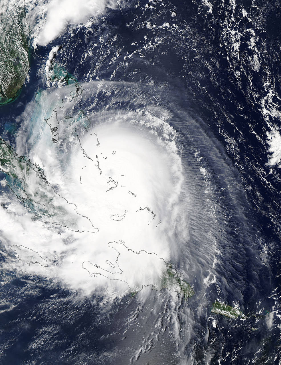
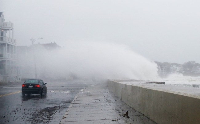
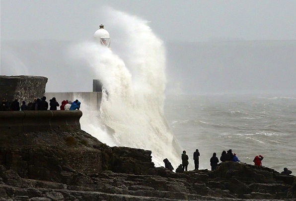
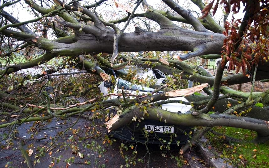
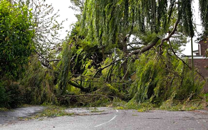
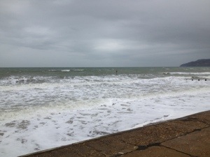
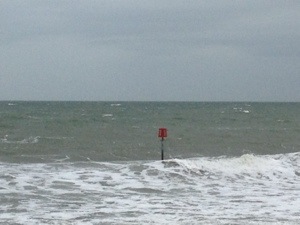
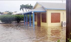
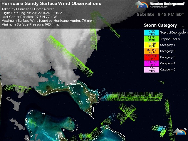
The storm has passed from the Bahamas and the clear-up is underway – but further north communities are bracing themselves for the onslaught. The news today  from contacts, from Facebook and the web generally, is of thankfully little lasting damage, with power and comms restored in many places. There’s been plenty of flooding – eg Sandy Point – and tree / plant mayhem.

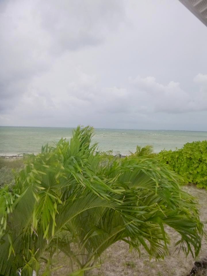
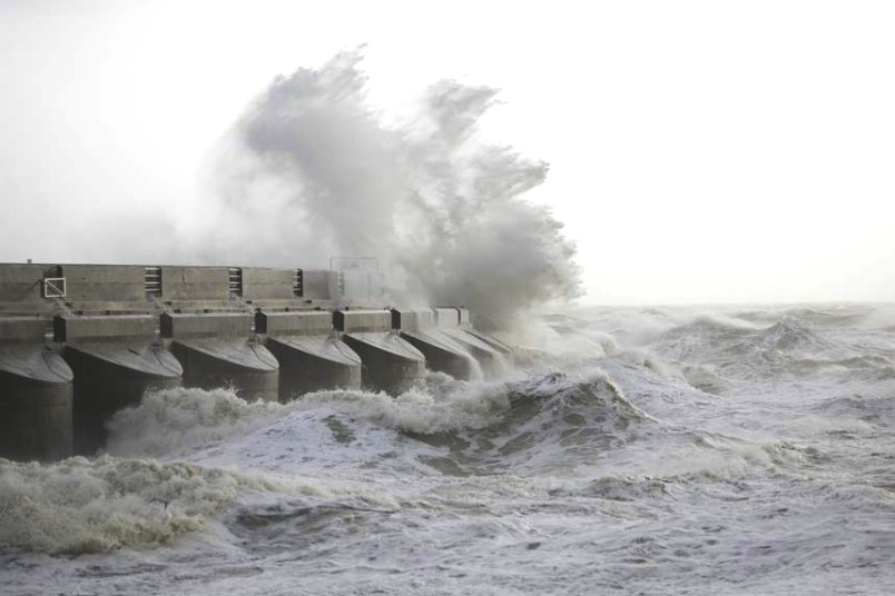
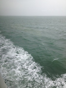
The Delphi Club was again, as with Irene last year, almost directly beneath the eye of the storm. Then, a couple of leaves were lost from the pineapple crown (above), a few fittings were smashed, and the gardens were unceremoniously rearranged. Peter Mantle, Delphi Club supremo, has posted his record of the last few days at the club – the approach of Sandy, the storm, and the aftermath. I am posting extracts below, to be read (chronologically) from the bottom entry to the top of the page. For those who haven’t experienced a storm of this violence, Peter’s account gives a vivid picture of the before, the during and the after…

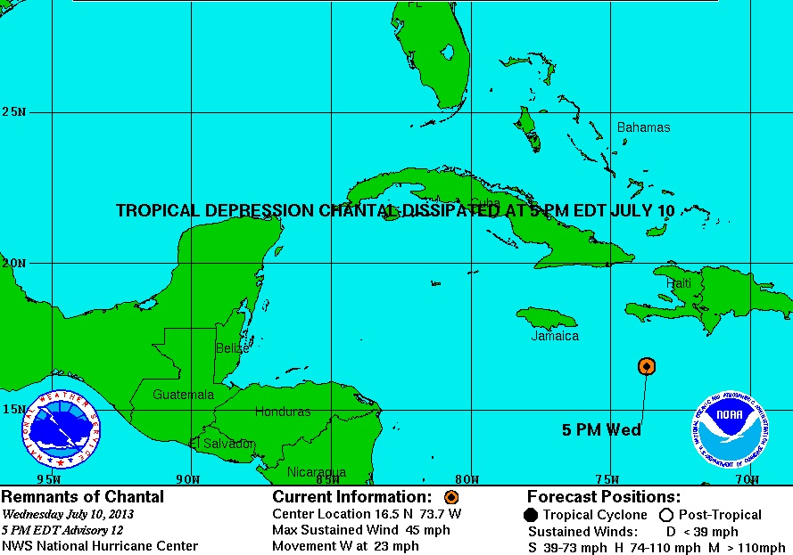
Apologies for having posted about Sandy in detail with maps etc, and at the crucial time tailing off  while I was away and had only an iPhone™  and a sporadic connection…

STOP PRESS: AMERICAN OYSTERCATCHERS – BRAVE OR FOOLISH? 29 October

Peter Mantle has just sent me a ‘Sandy’ photo from the Delphi Club beach, showing a group of oystercatchers on the rocks at one end of Rolling Harbour. Storm detritus already festoons the rocks. Have the birds seen what’s about to hit them? Are they waterproof? 

STOP PRESS: BMMRO MANATEE UPDATE 29 October

The BMMRO has posted news from Sandy Point and for those who have been asking after manatee Georgie’s welfare, an update:

“Hi Everyone, everything is ok here at the research center! We are working on getting information on Georgie’s whereabouts and we will happily update everyone as soon as we hear anything. There’s still a bit of damage here in Abaco that is preventing travel but hopefully we will be able to get up to Georgie soon”.

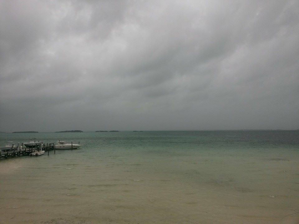
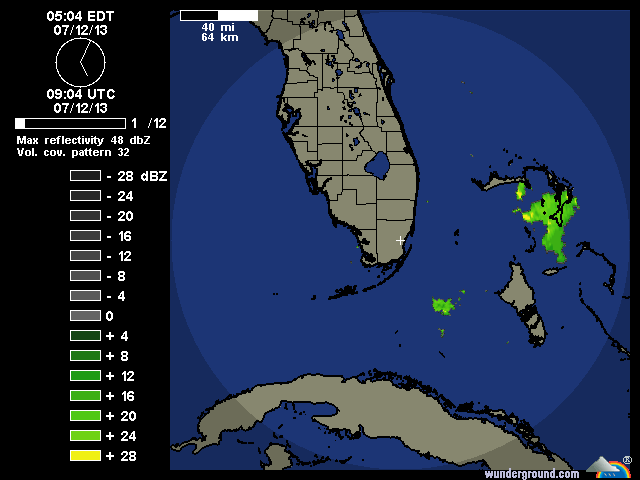
STOP PRESS: SOME ABACO IMAGES 28 October

(credits to Timothy Roberts & Cindy James Pinder and their facebook posts)

SANDY TAKES BONEFISH; DARK HUMOUR ON DARK DAYS

OCTOBER 27th Among the many bits of minor damage caused by Hurricane Sandy was the destruction of our bonefish weather vane. This had been hand-made by the other Sandy, our general manager, and stood atop his lodgings. Snapped off, the copper creation was found nearby, bruised and dented, rather like ourselves.

Yet again, we have been very fortunate – staff and guests are all well. And most of the damage caused by the 100mph winds was minor. The storm had its moments, but the worst bits were at nighttime when many people were huddled safe in bed. Lots of bumps and bangs provided a spooky soundtrack, but it was more of a B movie than a full-blown Hollywood epic. That said, I hate to think what a really big Category 3, 4 or 5 hurricane would be like.

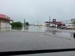
We still have no mains electricity; thank God for the gennie. We have no phones or mobile connection, so we have little idea of what is going on elsewhere on the island. We hope for the best but fear not all will have escaped as lightly as we did. Some of the staff from Crossing Rocks are stranded here by flooding. But the wireless internet is back so all will soon be revealed.

Yet again, the gardens have been shredded. The banana trees have been snapped off mid-fruiting. My favorite banyan tree has broken in half again, having nearly bounced back from Irene. The big Bismark ferns are banjaxed, the bougainvillea is blasted leafless and the pool is a mess. But who cares. We are fine. Dunkirk spirit? Well, very black humour and spirits of a different kind have seen us through.

“I survived Sandy” T-shirts are now in preparation, but that’s a staff joke about their hyperactive and heroic boss…..

A BAD HAIR DAY…

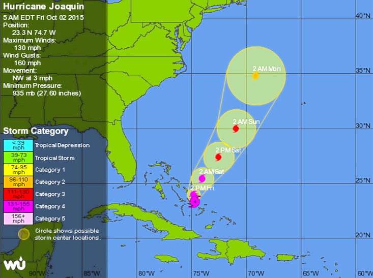
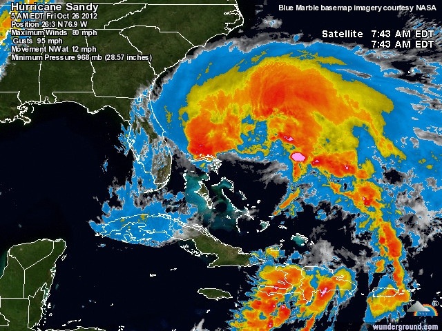
OCTOBER 25th It is getting distinctly breezy here, with winds as bad as any Irish gale. But Hurricane Sandy, now upgraded to a Category 2 hurricane, is still some 18 hours away and currently features average winds of 105mph with higher gusts. It may get even worse, they say. So no fishing today. More guests have made it in. Bahamasair even ran a plane out of Nassau at first light this morning.

While we still have power and phones, the lines are buzzing and we are glued to the internet. It seems odd to see that Sandy is the lead news story on the BBC. Non-technical guests have adjourned to the library (where “A Perfect Storm” and “Winnie the Poo and the Blustery Day” are current favourites). The air of gloom is more attributable to the fact that Arsenal lost at home last night than to any fears for personal safety.

We may go quiet for a while.

NOTHING VERY FEMININE ABOUT THIS SANDY

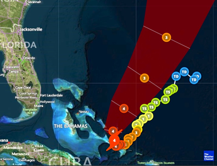
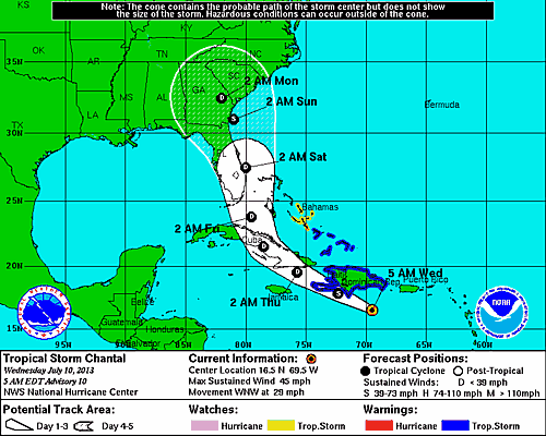
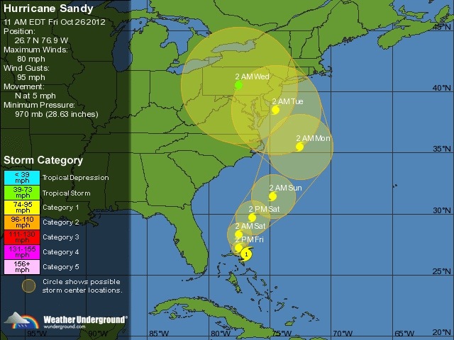
OCTOBER 24th, noon Tropical storms are now given boys’ and girls’ names alternately; in the old days they were all girls. The one that currently threatens us is Sandy, a name that is more commonly applied to females in this part of the world. But there is nothing too feminine about this storm; as the forecast deteriorates and Sandy intensifies into a hurricane over Jamaica, we are becoming more and more concerned by its macho capabilities.

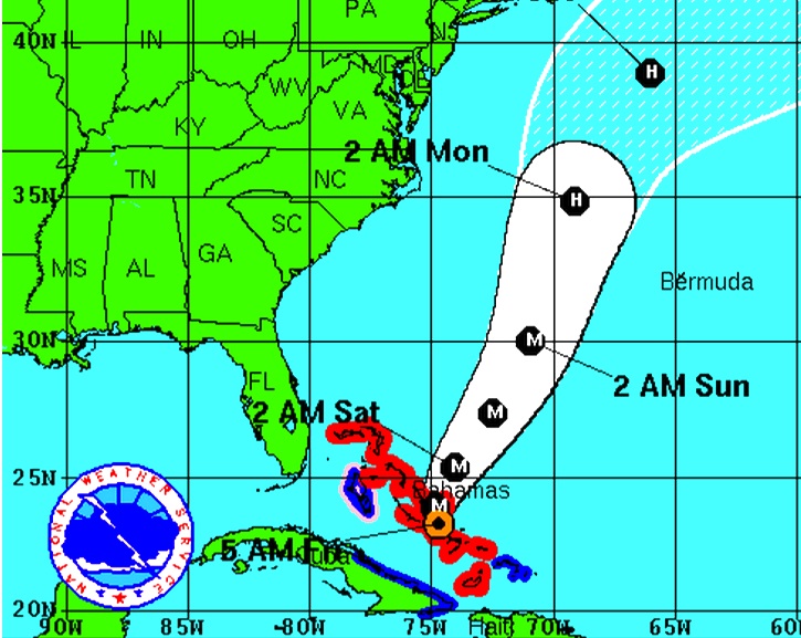
The National Hurricane Centre now predicts that Sandy will pass very close to Abaco – the predicted path having shifted overnight. As it now looks, the eye may pass just 25 miles from us, which would basically be a direct hit since damaging winds spread far out from the centre. We are going to have to keep a very close on on this little girl over the next 48 hours.

ALL EYES ON SANDY

OCTOBER 23rd No sooner has the Club reopened for the new season than a tropical storm appears on the horizon. And, in a twist of divine humour, it’s been christened after our general manager, Sandy.

Sandy (the mostly human version) is tracking Sandy (the swirling tempest) on an hourly basis. As it now stands, we are in the “cone” of the likely track of the storm over coming days. Currently south of Jamaica, TS Sandy is turning north and could yet morph into a hurricane. It’s expected to be over or near us by Friday night, with “average” winds of nearly 60mph and gusts of up to 90mph.

Hatches will therefore be battened, outdoor furniture put back indoors and supplies of grog reinforced. The lucky fishers in residence will have to take a breather, while the new chef, John, will receive a special form of baptism.

Tropical storms this late in the year are a great rarity. Somehow that is not very reassuring just now. But the forecast for the following week is rather better… 

Click image to visit the Delphi Club

Unknown's avatar

HURRICANE SANDY AFTERMATH: ABACO, BAHAMAS (+ TRACKING / RADAR MAPS 14.00 EDT 27 OCTOBER)


HURRICANE SANDY AFTERMATH: UPDATE FOR ABACO 27 0CTOBER 1400 EDT

There’s little to add to the earlier comment today. Messages I have received are of the brief “it’s all ok” sort. I’ve heard that some have got power back – but I have also seen warnings that in some places it will take longer to rectify. Here are some images from Marsh Harbour yesterday.
20121027-192723.jpg

20121027-192240.jpg

20121027-192213.jpg

HURRICANE SANDY AFTERMATH: UPDATE FOR ABACO 27 OCTOBER 0400 EDT

A quick scan of emails and online reports for Abaco & the Cays indicates widespread flooding and tree damage, a few boat problems, outages and comms loss – 20 out of 22 cellphone towers are down. I’ve seen no reports of significant injury or property damage. More later.

SANDY NOW CLEAR OF ABACO 1900 EDT
20121027-005719.jpg

20121027-005700.jpg

SANDY STORMS NORTH
20121026-174649.jpg

20121026-174543.jpg

HURRICANE SANDY LATEST UPDATES 26 OCTOBER 11.00 EDT ABACO BAHAMAS via iPhone and a dodgy network link…

Back to Cat 1 but right on target… Dune at White Sound holds, but plenty of water…! HT & Seaspray report 10″ water above docks… beach erosions reported elsewhere… Flooding & tree damage but no reports yet of injury or heavy damage to houses

NEW IMAGES including hurricane hunter cloudscape – eye of the storm passing over east Abaco… GOOD LUCK TODAY

20121026-142603.jpg

20121026-142613.jpg20121026-010616.jpg

HURRICANE SANDY HEADING NORTH FOR BAHAMAS

INTERACTIVE STORM TRACKER

Type in your location for current path predictionClick Pic!

UPDATE 25 OCT 05.00 EDT HURRICANE SANDY CLEARING CUBA AS CAT. 2

Three hours passing has made a further difference, and not for the better. The landmass of Cuba, far from slowing the storm, has seen it intensify to Cat 2 – though so far that is predicted only as far as the south Bahamas… (Map 1). However the eastward drift into the Atlantic is still detectable – see Abaco detail, Map 2

UPDATE 25 OCT 02.00 EDT HURRICANE SANDY MAKES CUBA LANDFALL

As Sandy reaches the south coast of Cuba, two things have become clear overnight. First, the storm’s strength is now predicted at Cat 1 until it clears into the Atlantic north of the Bahamas – there will be no reduction to TS status in the south Bahamas (Map 1) Secondly, the news for Abaco is that a slight drift of the spine of the storm to the east can be detected (see Abaco Detail, Map 2). Yesterday, the eye was due to pass pretty much directly over MH and indeed (like Irene last year) the Delphi Club and Rolling Harbour. The shift may of course have no significant effect on the storm’s power, but if the eye’s path could continue to drift further east… Map 3 is the ‘hot’ map from 04.00 EDT today

FLIGHT ADVISORY As many on Abaco may already have found, there are flight disruptions from Nassau – I know of one person who couldn’t get to MH last night. So visitors following this blog and planning an imminent flight need to keep a careful eye on the situation, which given the path of the storm is likely to worsen.

I will not be in a position to post much in the way of updates between now and Monday – by which time Sandy should have cleared to the north of the Bahamas. The interactive tracker link at the top of this page is an excellent resource, especially as you can input a precise location. There is luckily a wealth of information out there on the internet – far more than for Irene last year. I notice too that Abaco residents are busy exchanging information on Facebook. While we are away, we’ll be thinking of all those in the path of the storm…

UPDATE 24 OCT 18.00 EDT HURRICANE SANDY CROSSING JAMAICA

Sandy is now a Cat 1 hurricane as it crosses Jamaica and heads for eastern Cuba. As the latest projections show, the prospects for the Bahamas have worsened: hurricane force is expected over central and northern islands (see map below for Abaco detail)

DETAILED TRACKING PATH FOR THE BAHAMAS 24 OCTOBER 18.00 EDT

NATIONAL HURRICANE CENTER UPDATE EXTRACT 24 OCT 16.00 EDT

THE EYE OF HURRICANE SANDY MADE LANDFALL ON THE SOUTHEASTERN COAST
OF JAMAICA NEAR KINGSTON AT APPROXIMATELY 3.00 PM EDT / 19.00 UTC
MAXIMUM SUSTAINED WINDS AT LANDFALL WERE ESTIMATED TO BE 80 MPH / 130 KM/H
======================================
HURRICANE SANDY ADVISORY NUMBER 9 NWS NATIONAL HURRICANE CENTER MIAMI FL 1100 AM EDT WED OCT 24 2012 
SANDY REACHES HURRICANE STRENGTH... CONDITIONS DETERIORATING IN JAMAICA... 

CHANGES WITH THIS ADVISORY 
THE GOVERNMENT OF THE BAHAMAS HAS ISSUED A HURRICANE WATCH FOR CENTRAL AND NORTHWESTERN BAHAMAS 

SUMMARY OF WATCHES AND WARNINGS IN EFFECT

A HURRICANE WARNING IS IN EFFECT FOR JAMAICA and [SPECIFIED] REGIONS OF CUBA 
A TROPICAL STORM WARNING IS IN EFFECT FOR HAITI, THE CENTRAL BAHAMAS, THE NORTHWESTERN BAHAMAS 
A HURRICANE WATCH IS IN EFFECT FOR THE CENTRAL BAHAMAS, THE NORTHWESTERN BAHAMAS 
A TROPICAL STORM WATCH IS IN EFFECT FOR THE SOUTHEASTERN BAHAMAS, FLORIDA EAST COAST FROM THE VOLUSIA/BREVARD
COUNTY LINE TO OCEAN REEF, FLORIDA UPPER KEYS FROM OCEAN REEF TO CRAIG KEY, FLORIDA BAY

UPDATE 24 OCT 05.00 EDT TS SANDY MARCHES NORTH OVER JAMAICA

The latest maps below show TS / Hurricane Sandy at 5 am EDT today. Map 3 is the most useful for the current detailed Abaco prediction. Meanwhile, the US news indicates increasing concerns further north (much as happened with Irene last year)

TS SANDY POSITION & PROJECTED PATH 24 OCT 5.00 am EDTTS SANDY 5-DAY FORECAST 24 OCT 05.00 am EDT

TS SANDY DETAILED TRACKER 24 OCT 5.00 am EDT

TS SANDY POSITION & PROJECTED PATH 24 OCT 5.00 am EDT

CONCERN IS INCREASING FOR TS SANDY’S PATH UP THE US EAST COAST…

UPDATE 23 OCT 23.00 EDT TS Sandy is now approaching Jamaica.

Continue reading

Unknown's avatar

HURRICANE SANDY: CUBA, BAHAMAS (TRACKING / PATH MAPS, LATEST ABACO UPDATES 25 OCTOBER)


20121027-192522.jpg

HURRICANE SANDY HEADING NORTH FOR BAHAMAS

INTERACTIVE STORM TRACKER

Type in your location for current path predictionClick Pic!

UPDATE 25 OCT 05.00 EDT HURRICANE SANDY CLEARING CUBA AS CAT. 2

Three hours passing has made a further difference, and not for the better. The landmass of Cuba, far from slowing the storm, has seen it intensify to Cat 2 – though so far that is predicted only as far as the south Bahamas… (Map 1). However the eastward drift into the Atlantic is still detectable – see Abaco detail, Map 2

UPDATE 25 OCT 02.00 EDT HURRICANE SANDY MAKES CUBA LANDFALL

As Sandy reaches the south coast of Cuba, two things have become clear overnight. First, the storm’s strength is now predicted at Cat 1 until it clears into the Atlantic north of the Bahamas – there will be no reduction to TS status in the south Bahamas (Map 1) Secondly, the news for Abaco is that a slight drift of the spine of the storm to the east can be detected (see Abaco Detail, Map 2). Yesterday, the eye was due to pass pretty much directly over MH and indeed (like Irene last year) the Delphi Club and Rolling Harbour. The shift may of course have no significant effect on the storm’s power, but if the eye’s path could continue to drift further east… Map 3 is the ‘hot’ map from 04.00 EDT today

FLIGHT ADVISORY As many on Abaco may already have found, there are flight disruptions from Nassau – I know of one person who couldn’t get to MH last night. So visitors following this blog and planning an imminent flight need to keep a careful eye on the situation, which given the path of the storm is likely to worsen.

I will not be in a position to post much in the way of updates between now and Monday – by which time Sandy should have cleared to the north of the Bahamas. The interactive tracker link at the top of this page is an excellent resource, especially as you can input a precise location. There is luckily a wealth of information out there on the internet – far more than for Irene last year. I notice too that Abaco residents are busy exchanging information on Facebook. While we are away, we’ll be thinking of all those in the path of the storm…

UPDATE 24 OCT 18.00 EDT HURRICANE SANDY CROSSING JAMAICA

Sandy is now a Cat 1 hurricane as it crosses Jamaica and heads for eastern Cuba. As the latest projections show, the prospects for the Bahamas have worsened: hurricane force is expected over central and northern islands (see map below for Abaco detail)

DETAILED TRACKING PATH FOR THE BAHAMAS 24 OCTOBER 18.00 EDT

NATIONAL HURRICANE CENTER UPDATE EXTRACT 24 OCT 16.00 EDT

THE EYE OF HURRICANE SANDY MADE LANDFALL ON THE SOUTHEASTERN COAST
OF JAMAICA NEAR KINGSTON AT APPROXIMATELY 3.00 PM EDT / 19.00 UTC
MAXIMUM SUSTAINED WINDS AT LANDFALL WERE ESTIMATED TO BE 80 MPH / 130 KM/H
======================================
HURRICANE SANDY ADVISORY NUMBER 9 NWS NATIONAL HURRICANE CENTER MIAMI FL 1100 AM EDT WED OCT 24 2012 
SANDY REACHES HURRICANE STRENGTH... CONDITIONS DETERIORATING IN JAMAICA... 

CHANGES WITH THIS ADVISORY 
THE GOVERNMENT OF THE BAHAMAS HAS ISSUED A HURRICANE WATCH FOR CENTRAL AND NORTHWESTERN BAHAMAS 

SUMMARY OF WATCHES AND WARNINGS IN EFFECT

A HURRICANE WARNING IS IN EFFECT FOR JAMAICA and [SPECIFIED] REGIONS OF CUBA 
A TROPICAL STORM WARNING IS IN EFFECT FOR HAITI, THE CENTRAL BAHAMAS, THE NORTHWESTERN BAHAMAS 
A HURRICANE WATCH IS IN EFFECT FOR THE CENTRAL BAHAMAS, THE NORTHWESTERN BAHAMAS 
A TROPICAL STORM WATCH IS IN EFFECT FOR THE SOUTHEASTERN BAHAMAS, FLORIDA EAST COAST FROM THE VOLUSIA/BREVARD
COUNTY LINE TO OCEAN REEF, FLORIDA UPPER KEYS FROM OCEAN REEF TO CRAIG KEY, FLORIDA BAY

UPDATE 24 OCT 05.00 EDT TS SANDY MARCHES NORTH OVER JAMAICA

The latest maps below show TS / Hurricane Sandy at 5 am EDT today. Map 3 is the most useful for the current detailed Abaco prediction. Meanwhile, the US news indicates increasing concerns further north (much as happened with Irene last year)

TS SANDY POSITION & PROJECTED PATH 24 OCT 5.00 am EDTTS SANDY 5-DAY FORECAST 24 OCT 05.00 am EDT

TS SANDY DETAILED TRACKER 24 OCT 5.00 am EDT

TS SANDY POSITION & PROJECTED PATH 24 OCT 5.00 am EDT

CONCERN IS INCREASING FOR TS SANDY’S PATH UP THE US EAST COAST…

UPDATE 23 OCT 23.00 EDT TS Sandy is now approaching Jamaica.

Continue reading

Unknown's avatar

TROPICAL STORM SANDY: HEADING FOR BAHAMAS (TRACKING / PATH MAPS, LATEST ABACO UPDATES 24 OCTOBER)


HURRICANE SANDY HEADING NORTH FOR BAHAMAS

INTERACTIVE REAL-TIME STORM TRACKER

Type in your location for current path predictionClick Pic!

UPDATE 24 OCT 18.00 EDT HURRICANE SANDY CROSSING JAMAICA

Sandy is now a Cat 1 hurricane as it crosses Jamaica and heads for eastern Cuba. As the latest projections show, the prospects for the Bahamas have worsened: hurricane force is expected over central and northern islands (see map below for Abaco detail).

I will not be in a position to post much in the way of updates between now and Monday – by which time Sandy should have cleared to the north of the Bahamas. The interactive tracker link at the top of this page is an excellent resource, especially as you can input a precise location. There is luckily a wealth of information out there on the internet – far more than for Irene last year. I notice too that Abaco residents are busy exchanging information on Facebook. While we are away, we’ll be thinking of all those in the path of the storm… 

DETAILED TRACKING PATH FOR THE BAHAMAS 24 OCTOBER 18.00 EDT

NATIONAL HURRICANE CENTER UPDATE EXTRACT 24 OCT 16.00 EDT

THE EYE OF HURRICANE SANDY MADE LANDFALL ON THE SOUTHEASTERN COAST
OF JAMAICA NEAR KINGSTON AT APPROXIMATELY 3.00 PM EDT / 19.00 UTC
MAXIMUM SUSTAINED WINDS AT LANDFALL WERE ESTIMATED TO BE 80 MPH / 130 KM/H
======================================
HURRICANE SANDY ADVISORY NUMBER 9 NWS NATIONAL HURRICANE CENTER MIAMI FL 1100 AM EDT WED OCT 24 2012 
SANDY REACHES HURRICANE STRENGTH... CONDITIONS DETERIORATING IN JAMAICA... 

CHANGES WITH THIS ADVISORY 
THE GOVERNMENT OF THE BAHAMAS HAS ISSUED A HURRICANE WATCH FOR CENTRAL AND NORTHWESTERN BAHAMAS 

SUMMARY OF WATCHES AND WARNINGS IN EFFECT

A HURRICANE WARNING IS IN EFFECT FOR JAMAICA and [SPECIFIED] REGIONS OF CUBA 
A TROPICAL STORM WARNING IS IN EFFECT FOR HAITI, THE CENTRAL BAHAMAS, THE NORTHWESTERN BAHAMAS 
A HURRICANE WATCH IS IN EFFECT FOR THE CENTRAL BAHAMAS, THE NORTHWESTERN BAHAMAS 
A TROPICAL STORM WATCH IS IN EFFECT FOR THE SOUTHEASTERN BAHAMAS, FLORIDA EAST COAST FROM THE VOLUSIA/BREVARD
COUNTY LINE TO OCEAN REEF, FLORIDA UPPER KEYS FROM OCEAN REEF TO CRAIG KEY, FLORIDA BAY

UPDATE 24 OCT 05.00 EDT TS SANDY MARCHES NORTH OVER JAMAICA 

The latest maps below show TS / Hurricane Sandy at 5 am EDT today. Map 3 is the most useful for the current detailed Abaco prediction. Meanwhile, the US news indicates increasing concerns further north (much as happened with Irene last year) Continue reading

Unknown's avatar

CHILLIN’ ON ABACO VS CHILLY IN ENGLAND


CHILLIN’ ON ABACO VS CHILLY IN ENGLAND

“Life’s a beach”, it is said. On Abaco, a new season is starting at the Delphi Club, and the first guests will be sorting out their fishing tackle, reaching for the sun cream and abandoning pre-Delphi diet boot-camp. If they have been eating Marmite™ sandwiches for a week before their arrival, they won’t need  to waste energy slapping no-see-ums. The day-dreaming becomes reality, perhaps involving his ‘n’ hers rods near the rocks at one end of the beach

That’s all well and good. But in more northern latitudes the slide from summer via autumn to winter is accelerating. The trout fishing season has just ended, with my final efforts washed away by heavy rain and flooding – this photo is the road leading to one of the beats, a sure meteorological sign that a visit to the local pub would be sensible… 

A pint of beer in front of a log fire soon puts things into perspective, and the mind can wander to warmer climates, the bonefishing prospects for the season, and the calm beauty of Rolling Harbour…

Two days ago, the UK temperature dropped sharply, the skies began to clear and the sun came back. Ah! Autumn – season of tum-ti-tum and mellow wotsit… 

At one moment there was a wonderful double rainbow across the fields

This was followed by a bright starry night & the thermometer dropping abruptly to -6˚F. And then this – the first frost of the year…

  These photos are of patterns on the car roof & windscreen, before the sun thawed the ice


Brrrrrrrrr. Best not to end on a freezing note. Back to Rolling Harbour for some warmth